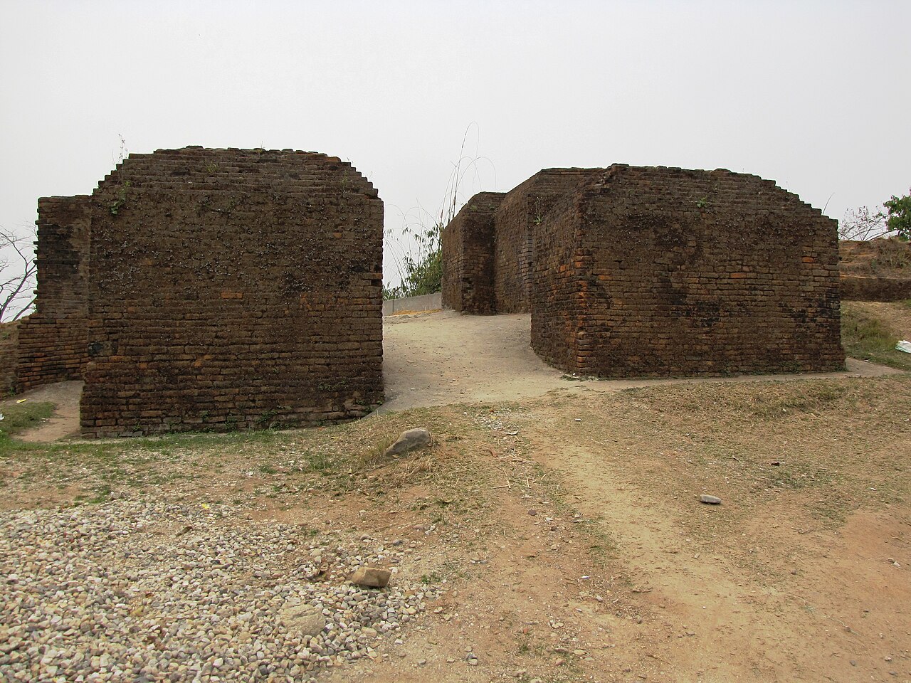
Yangzuomie City Ruins — China castle

Yangzuomie City Ruins

Yangzuomie city ruins
Ruins
The Yangzuomie city ruins represent a significant archaeological site in China, offering valuable insights into ancient urban development and fortification techniques. Although the precise city and region remain unidentified, the ruins stand as a testament to the architectural and historical legacy of early Chinese settlements.

Historical context and significance

The site dates back to an early period of Chinese history, likely associated with the development of fortified urban centers during the early to middle historical periods. While exact dating remains uncertain, the ruins suggest a settlement that played a role in regional defense and administration. The fortifications would have been crucial for protection against invasions and local conflicts, reflecting the strategic importance of the location.

Architectural features of the ruins

The Yangzuomie city ruins are primarily characterized by remnants of defensive walls and foundations of buildings that once formed part of the city's infrastructure. The walls, constructed from local materials, reveal the use of early masonry techniques adapted to the region's environment. Although much of the superstructure has been lost over time, the layout indicates a planned urban design with fortified enclosures.

Defensive structures

The surviving wall fragments suggest a robust defensive system, possibly including ramparts and watchtowers, which were common in ancient Chinese city fortifications. These structures would have enabled surveillance and defense against potential attackers, demonstrating the military architectural knowledge of the era.

Urban layout

Archaeological studies indicate that the city was organized with a central area likely serving administrative or ceremonial functions, surrounded by residential and possibly commercial zones. The spatial arrangement reflects typical urban planning principles observed in ancient Chinese cities, emphasizing both functionality and defense.

Archaeological research and discoveries

Excavations at the Yangzuomie city ruins have uncovered artifacts such as pottery shards, tools, and remnants of daily life that provide a glimpse into the culture and economy of its inhabitants. These findings contribute to understanding the technological and social aspects of the settlement.

Ongoing research aims to clarify the chronological framework and cultural affiliations of the site, which remains a subject of scholarly interest due to its potential to illuminate aspects of early Chinese urbanism and fortification strategies.

Preservation status and visitor information

The site is currently classified as ruins, with much of the original structures no longer intact but still offering valuable archaeological evidence. Preservation efforts focus on protecting the remaining features from natural decay and human impact.

Access to the site may be limited due to its archaeological nature and the unknown precise location. Visitors interested in ancient Chinese fortifications and archaeology should seek guidance from local heritage authorities for information on visiting opportunities and regulations.

Frequently asked questions (FAQ)

How do I get to Yangzuomie City Ruins?
You can reach Yangzuomie City Ruins by taking public transportation or driving from nearby cities. The closest major city is Xi'an, which is well-connected by train and bus services. Local taxis and ride-sharing options are also available for convenience.
What is the historical significance of Yangzuomie City Ruins?
Yangzuomie City Ruins are remnants of an ancient city that dates back to the Han dynasty, showcasing the rich cultural heritage of the region. The site provides valuable insights into the architectural styles and urban planning of ancient China. It is a crucial location for understanding the historical trade routes and interactions during that era.
When was Yangzuomie City Ruins discovered?
The ruins were first discovered in the early 20th century, with significant excavations occurring in the 1950s. Ongoing archaeological work continues to uncover more about the site's history and its importance in Chinese heritage. The discoveries have helped to piece together the life and times of the people who lived there.
Can I visit Yangzuomie City Ruins year-round?
Yes, Yangzuomie City Ruins are open to visitors year-round, with no seasonal closures. However, it is advisable to check local weather conditions before planning your visit, as heavy rains can affect accessibility. The site is best enjoyed during the spring and autumn months when the weather is mild.
Why is visiting Yangzuomie City Ruins important for understanding Chinese history?
Visiting Yangzuomie City Ruins is important as it allows you to engage with the physical remnants of a significant historical site. It offers a unique opportunity to explore ancient architecture and learn about the lives of people from centuries ago. The ruins serve as a testament to the region's historical narrative and cultural evolution.
Is it possible to take guided tours at Yangzuomie City Ruins?
Yes, guided tours are available for visitors who wish to gain deeper insights into the history and significance of the ruins. These tours are typically led by knowledgeable guides who can provide context and answer questions. You can book a tour in advance or inquire about availability upon arrival.
What are the opening hours for Yangzuomie City Ruins?
Yangzuomie City Ruins are generally open from 8:00 AM to 6:00 PM daily. During peak tourist seasons, the hours may be extended. It is advisable to check the official website or local information for any updates on opening hours before your visit.
Are there any ticket prices for visiting Yangzuomie City Ruins?
Entry to Yangzuomie City Ruins typically requires a small entrance fee, which helps support the preservation of the site. Ticket prices may vary for adults, children, and seniors, so it's best to check the latest information before your visit. Some guided tours may include the ticket fee in their package.
What nearby attractions should I visit after exploring Yangzuomie City Ruins?
After visiting Yangzuomie City Ruins, you can explore nearby attractions such as the Terracotta Army and the ancient city walls of Xi'an. Additionally, the Huaqing Hot Springs and Mount Li are popular destinations in the area. Each of these sites offers a unique glimpse into China's rich history and stunning landscapes.

Photo gallery

Yangzuomie City Ruins
Click to view

Photo by Xin•CC BY-SA 4.0

1 photo • Click any image to view in full screen

Information

Archaeological Site / Ruins

Loading map...

Visitor reviews

No reviews yet. Been here? Write the first review and help other travelers!

Write the first review

Visited this castle? Share your experience

Your review helps other travelers and adds first-hand knowledge to our encyclopedia.
Write a review

(5/5)

0/2000 characters

Your review will be visible after admin approval

Nearby castles

631.9 km
Kangla Fort — India castle

Kangla Fort

Imphal, India

Kangla Fort, located in Imphal, the capital city of Manipur in northeastern India, is a historically significant fortified palace complex that served as the traditional seat of the Meetei rulers. The name "Kangla" translates to "the prominent part of the dry land" in the old Meetei language, reflecting its strategic and cultural importance. Situated along the banks of the Imphal River, the fort originally extended on both the western and eastern sides of the river, though today only the western portion remains, largely in a state of ruins.The Kangla Fort holds immense cultural and historical value for the people of Manipur. It was the ancient capital of the kingdom of Manipur before modern times and is deeply revered as a symbol of the region's sovereignty and heritage. The site is considered sacred by the Meitei community, who view it as a spiritual and cultural heartland. This reverence is reflected in the ongoing efforts to preserve and restore the fort, as well as proposals to declare it a UNESCO World Heritage Site, a recognition that would acknowledge its global cultural significance.Historical significance of kangla fortThe origins of Kangla Fort trace back to ancient times, with its foundations linked to the early history of the Manipur kingdom. It served as the royal palace and administrative center for the Meetei dynasty, which governed the region for centuries. The fort was not only a seat of political power but also a cultural hub where traditional rituals, ceremonies, and governance took place. Over time, it witnessed numerous historical events, including battles, regime changes, and colonial encounters.During the British colonial period, Kangla Fort experienced significant changes. The British forces occupied the fort in the 19th century, altering its structure and using it as a military garrison. This period marked a shift from its original role as a royal palace to a strategic military outpost. Despite these changes, the fort retained its symbolic importance for the local population, who continued to regard it as a representation of their identity and history.Architectural features and layoutKangla Fort was originally a sprawling complex featuring fortified walls, gates, palatial buildings, courtyards, and religious structures. The fortifications included thick walls constructed from stone and earth, designed to protect against invasions. The layout was carefully planned to accommodate the needs of the royal family, administrative officials, and the military.Key architectural elements included the main entrance gates, which were often elaborately decorated and served as ceremonial thresholds. Inside the fort, there were royal halls used for court assemblies and state functions. The complex also housed temples and sacred spaces, underscoring the fort's dual role as a political and spiritual center.Though much of the fort is now in ruins, archaeological excavations and preservation efforts have revealed the foundations and remnants of these structures, providing valuable insights into the construction techniques and cultural practices of the Meetei civilization.The fort's strategic locationThe fort's position on the banks of the Imphal River was a strategic choice, offering natural defense advantages and access to water resources. The river acted as a natural moat on one side, making it difficult for enemies to mount a direct assault. The surrounding terrain provided elevated ground, enhancing visibility and defense capabilities.Cultural and spiritual importanceKangla Fort is more than a historical monument; it is a living symbol of the Meitei people's identity and their connection to their ancestral past. The site hosts traditional festivals, rituals, and cultural events that celebrate the heritage of Manipur. It is considered a sacred place where the spiritual and temporal worlds intersect.The fort's significance extends to its role in contemporary Manipur society, where it serves as a reminder of the region's independence before colonial rule and as a focal point for cultural revival and education.Conservation and current statusToday, Kangla Fort exists primarily as archaeological ruins, with ongoing efforts to preserve and restore its remaining structures. The Government of Manipur, along with various cultural organizations, is actively involved in conservation projects aimed at safeguarding the fort's heritage. These projects include archaeological excavations, structural stabilization, and the development of visitor facilities.The proposal to designate Kangla Fort as a UNESCO World Heritage Site reflects its outstanding universal value and the commitment to protect it for future generations. Visitors to the site can explore the ruins, learn about the history of the Meetei dynasty, and experience the cultural richness of Manipur through guided tours and interpretive displays.

Details
666.9 km
Ita Fort — India castle

Ita Fort

Itanagar, India

Ita Fort is a significant historical bastioned fortress located in Itanagar, the capital city of Arunachal Pradesh, India. The fort's name translates to "Fort of Bricks," with "Ita" meaning brick in the Assamese language, reflecting the extensive use of brick masonry in its construction. Dating back to the 15th century, Ita Fort is generally attributed to the Chutia kingdom, which ruled the region during the late medieval period. This fortification is an important example of the military architecture of the time and stands as a testament to the strategic and cultural developments under the Chutia rulers. Historical background and significance The Ita Fort is closely linked to the reign of the Chutia kings, particularly associated with King Gauri Narayan, who is credited with consolidating the kingdom in the region. According to historical chronicles, Gauri Narayan undertook the construction of a series of hill forts along the foothills, designed to protect and control the territory. Ita Fort was part of this strategic network, serving both as a military bastion and a symbol of the kingdom's power. The fort's location in Itanagar, which later became the capital of Arunachal Pradesh, underscores its importance in regional history. Chutia kingdom and fortifications The Chutia kingdom flourished between the 13th and 16th centuries in what is now northeastern India. They developed a distinctive architectural style, notable for its use of brick and stone in fort construction. Ita Fort's extensive brickwork, totaling approximately 16,200 cubic metres, exemplifies the advanced masonry skills of the Chutia builders. The fortifications included defensive walls, bastions, and possibly moats, designed to withstand attacks and control access to the region. Architectural features and construction details Ita Fort is classified as a bastioned fortress, a style characterized by strong defensive walls and projecting bastions for artillery or archery defense. The fort's construction prominently features brick as the primary material, which was a distinctive choice in this region during the late medieval period. The walls were likely thick and robust, designed to resist siege warfare common in the 15th century. Brickwork and layout The fort's massive brickwork is a key architectural highlight, with the volume of bricks used estimated at over 16,000 cubic metres. This extensive use of brickwork not only provided structural strength but also allowed for intricate designs and durable construction. The layout of the fort would have included multiple bastions along the perimeter walls, providing vantage points for defense and surveillance. Defensive structures The bastions of Ita Fort would have served as platforms for archers and later for gunpowder weapons, reflecting the military advancements of the late medieval period. The fort likely featured gates with defensive mechanisms such as heavy doors and possibly barbicans to control entry. While detailed plans of the fort's internal structures are limited, it is probable that the fort contained residential quarters, storage facilities, and water tanks, consistent with other contemporaneous forts. Archaeological discoveries and preservation Excavations and studies at Ita Fort have uncovered valuable archaeological materials that shed light on the region's history and the Chutia kingdom's cultural practices. Artifacts from the site include pottery, tools, and remnants of the fort's brick structures. Many of these finds are preserved and displayed at the Jawaharlal Nehru Museum in Itanagar, offering insights into the fort's construction techniques and the daily life of its inhabitants. Preservation status Currently, Ita Fort remains a partially preserved monument, with significant portions of its brick walls still standing. The site is recognized for its historical and architectural value, attracting researchers and visitors interested in the medieval history of northeastern India. Efforts to maintain and protect the fort continue, ensuring its legacy endures for future generations. Impact on regional identity and tourism Ita Fort holds a prominent place in the cultural heritage of Arunachal Pradesh. The fort's historical association with the Chutia kingdom and its architectural uniqueness contribute to regional pride. Itanagar's name itself derives from the fort, highlighting its lasting influence on local identity. The site is an important destination for tourists and history enthusiasts, providing a tangible connection to the area's medieval past. Visiting Ita Fort Visitors to Ita Fort can explore the remains of the brick walls and bastions, gaining an appreciation for the fort's scale and construction. The nearby Jawaharlal Nehru Museum complements the visit with exhibits of artifacts recovered from the site. While the fort is not extensively developed for tourism, it offers a valuable educational experience for those interested in India's northeastern history and medieval fort architecture.

Late Medieval (14th–15th c.)
Details
672.5 km
Citadel of Tuyen Quang — Vietnam castle

Citadel of Tuyen Quang

Tuyen Quang, Vietnam

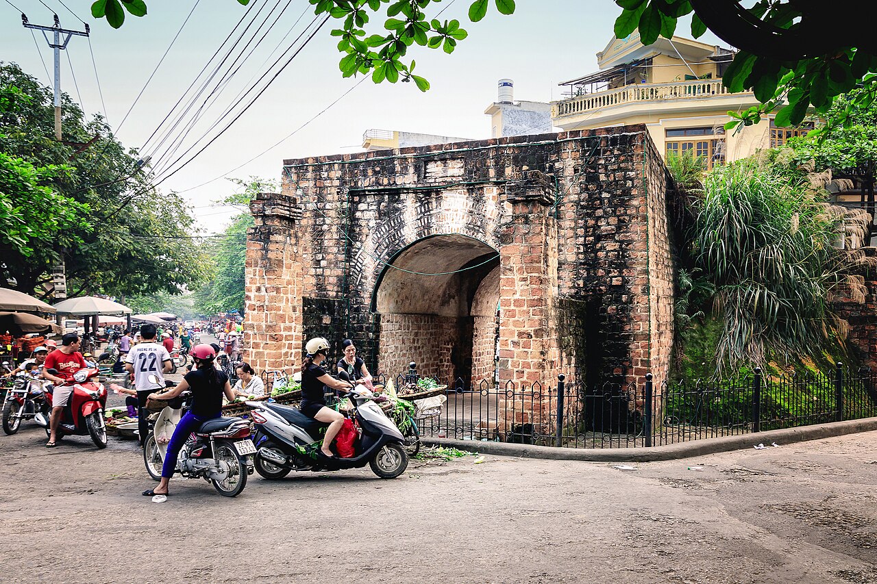
The Citadel of Tuyen Quang is a significant historic bastioned fortress located in northern Vietnam. This fortress played a crucial role during the French colonial period, particularly in the late 19th century, serving as a key defensive stronghold against French forces during the Tonkin Campaign. The citadel is renowned for its robust bastion fortifications, which reflect European military architectural influences adapted to local conditions. Historical significance and military role The Citadel of Tuyen Quang was constructed as part of a network of fortifications to defend northern Vietnam from colonial incursions. Its strategic location allowed control over important routes and provided a defensive advantage against invading forces. The fortress is most famous for its role in the 1884-1885 Siege of Tuyen Quang, where Vietnamese and Black Flag forces resisted a prolonged French siege. This event marked a significant episode in the resistance against French colonial expansion in Indochina. Architectural features and design The citadel’s design is characterized by bastioned walls arranged in a polygonal layout, typical of European star forts developed in the early modern period. These bastions allowed defenders to cover all approaches with overlapping fields of fire, minimizing blind spots. The walls were constructed with thick masonry and earthworks to absorb artillery fire. The fortress included moats and ramparts enhancing its defensive capabilities. Defensive structures The bastions are connected by curtain walls featuring firing positions for infantry and artillery. The design incorporated angled bastions to deflect incoming cannonballs. Inside, the citadel contained barracks, armories, and command posts necessary for sustaining a garrison during siege conditions. Adaptation to local environment While based on European bastion fort concepts, the citadel’s construction utilized local materials and techniques suited to the tropical climate. The thick walls and earthen embankments helped mitigate the impact of heavy rains and humidity. Current condition and cultural importance Today, the Citadel of Tuyen Quang remains a partially preserved historical site. Some sections of the bastioned walls and defensive earthworks survive, though much of the structure has suffered from time and neglect. The site is recognized for its cultural and historical importance in Vietnam’s colonial resistance history and serves as a reminder of the military architecture of the period. Visiting information The citadel is accessible to visitors interested in Vietnam’s military history and colonial heritage. While facilities may be limited, the site offers an opportunity to explore the remains of a bastioned fortress that played a key role in 19th-century conflicts. Visitors should check local sources for opening hours and any guided tour availability.

Post-Renaissance (17th–18th c.)
Details