Pukará de Quitor — Chile castle

Pukará de Quitor

Pukará de Quitor: pre-Columbian stone fortress in Chile
San Pedro de Atacama, Antofagasta, Chile
High Medieval (11th–13th c.)
Ruins

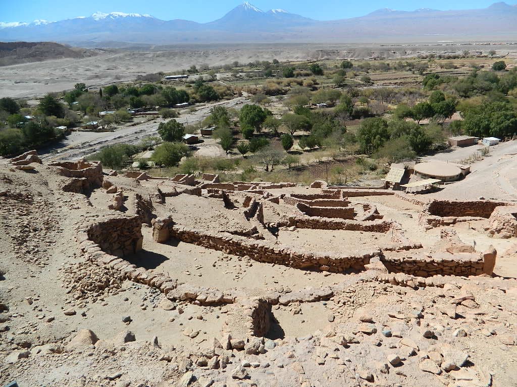
Pukará de Quitor, also spelled Pucará de Quitor, is a significant pre-Columbian archaeological site located in northern Chile. This ancient stone fortress stands approximately 3 kilometers northwest of the town of San Pedro de Atacama, strategically positioned overlooking the valley of the San Pedro River. Its name derives from the Quechua word "pukara," meaning "fortress," reflecting its original defensive purpose.

Historical context and construction

Constructed in the 13th century, Pukará de Quitor served as a fortified stronghold for the indigenous peoples of the Atacama Desert region. The fortress was built during a period of increasing conflict and territorial defense among local groups prior to the arrival of the Spanish conquistadors. Its robust stone walls and elevated position provided both protection and surveillance over the surrounding landscape, including vital water sources and trade routes.

Architectural features and layout

The fortress comprises multiple stone enclosures arranged on a rocky hill, utilizing the natural topography to enhance its defensive capabilities. The walls, constructed from local stone, are thick and designed to withstand attacks, with remnants still visible today. The complex includes several terraces, gates, and defensive bastions that allowed defenders to monitor and repel invaders effectively. Its design reflects the military architecture typical of Andean cultures in the Late Intermediate Period.

Significance and preservation

Pukará de Quitor holds great cultural and historical importance as one of the few surviving examples of indigenous military architecture in the Atacama region. It was declared a national monument in 1982 by the Chilean government, recognizing its value for understanding pre-Columbian societies and their adaptation to harsh desert environments. Today, the site is classified as archaeological ruins, with ongoing efforts to preserve its structure and promote archaeological research.

Visitor experience and accessibility

The fortress is accessible to visitors interested in exploring the ancient history of northern Chile. Its location near San Pedro de Atacama makes it a popular destination for tourists seeking to learn about indigenous cultures and the region's archaeological heritage. Visitors can walk the trails around the fortress ruins, enjoy panoramic views of the valley, and appreciate the ingenuity of its builders in adapting to the challenging desert terrain.

Archaeological research and findings

Extensive archaeological studies at Pukará de Quitor have uncovered artifacts and structural details that shed light on the social organization, defensive strategies, and daily life of its inhabitants. Excavations have revealed pottery, tools, and other cultural materials that provide insight into the Atacameño people who constructed and occupied the fortress. These findings contribute to a broader understanding of pre-Hispanic civilizations in the Andean region.

Impact of Spanish conquest

The fortress played a role during the early encounters with Spanish forces in the 16th century. It was reportedly a site of resistance before eventually falling under Spanish control. The military architecture and strategic location of Pukará de Quitor exemplify the indigenous efforts to defend their territories against colonial incursions.

Frequently asked questions (FAQ)

What is Pukará de Quitor?
Pukará de Quitor is a historic fortress located near San Pedro de Atacama, Chile. It was built by the Atacameño people in the 12th century and served as a defensive structure against invaders. Today, it is a popular archaeological site that showcases the rich cultural heritage of the region.
When was Pukará de Quitor built?
Pukará de Quitor was constructed around the 12th century, during a time when the Atacameño civilization thrived in the harsh desert environment. The fortress played a crucial role in protecting the local population and their resources from potential attacks. Its strategic location offers stunning views of the surrounding landscape.
Can I visit Pukará de Quitor?
Yes, Pukará de Quitor is open to visitors throughout the year. The site is accessible with a short hike that allows you to explore the ruins and enjoy panoramic views of the Atacama Desert. It is advisable to wear comfortable shoes and bring water, especially during hot weather.
What are the opening hours for Pukará de Quitor?
Pukará de Quitor typically opens daily from 9:00 AM to 5:30 PM. However, it is recommended to check for any seasonal changes in hours or special closures before your visit. Arriving earlier in the day can help you avoid crowds and enjoy a more peaceful experience.
Is it possible to learn about the history of Pukará de Quitor during my visit?
Yes, visitors can gain insights into the history of Pukará de Quitor through informational panels located throughout the site. Additionally, guided tours are available, offering a more in-depth understanding of the fortress's significance and the culture of the Atacameño people. Engaging with knowledgeable guides can enhance your experience.
What is the best time to visit Pukará de Quitor?
The best time to visit Pukará de Quitor is during the cooler months of April to October when temperatures are more moderate. Early morning or late afternoon visits can also provide a more comfortable experience and stunning lighting for photography. The desert landscape is particularly beautiful during these times.
Are there any nearby attractions to explore after visiting Pukará de Quitor?
Yes, there are several nearby attractions worth exploring after your visit to Pukará de Quitor, including the Valle de la Luna (Valley of the Moon) and the historic town of San Pedro de Atacama. Both locations offer unique landscapes and cultural experiences, making it easy to fill your day with adventure.
What are the ticket prices for Pukará de Quitor?
The entrance fee for Pukará de Quitor is relatively affordable, usually around 3,000 Chilean Pesos for adults, with discounts for children and seniors. Tickets can be purchased on-site, and the fee contributes to the maintenance and preservation of this important cultural site. Always check for any updates on pricing or special promotions before your visit.
Is Pukará de Quitor accessible for people with mobility issues?
Pukará de Quitor has some accessibility challenges due to its rugged terrain and steep paths. While some areas may be reachable, the site is primarily designed for visitors who can navigate uneven surfaces. It is recommended to contact local tour operators for options that cater specifically to those with mobility limitations.

Photo gallery

Pukará de Quitor
Click to view

Photo by Vessna•CC BY-SA 3.0

1 photo • Click any image to view in full screen

Information

Archaeological Site / Ruins

Loading map...

Visitor reviews

No reviews yet. Been here? Write the first review and help other travelers!

Write the first review

Visited this castle? Share your experience

Your review helps other travelers and adds first-hand knowledge to our encyclopedia.
Write a review

(5/5)

0/2000 characters

Your review will be visible after admin approval

Nearby castles

297.6 km
Pucará de Tilcara — Argentina castle

Pucará de Tilcara

Tilcara, Argentina

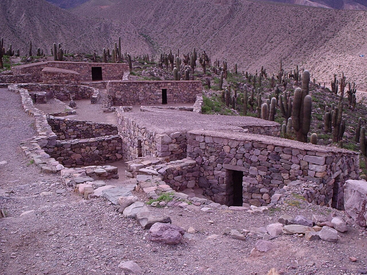
The Pucará de Tilcara is an impressive pre-Inca archaeological fortress located on a hill just outside the small town of Tilcara in the province of Jujuy, Argentina. This ancient pukara, meaning fortress in the local Quechua language, was strategically constructed to oversee and defend the surrounding area, particularly the long stretch of the Quebrada de Humahuaca valley. Its elevated position provided extensive views for monitoring movement through this important trade and travel route in the Andes.Historical context and cultural significanceThe Pucará de Tilcara dates back to approximately the 11th century, during a period preceding the rise of the Inca Empire. It served as a defensive stronghold for the local indigenous communities, including the Omaguaca people, who inhabited the region before the Inca expansion. The site reflects the complex social and military organization of these pre-Inca cultures, demonstrating their ability to engineer fortified settlements adapted to the challenging Andean environment.The fortress was built primarily to protect against rival groups and to control the vital corridor of the Quebrada de Humahuaca, which was a key route connecting different ecological zones and facilitating trade and cultural exchange across the Andes. The Pucará is one of the few surviving examples of such defensive architecture in northern Argentina, highlighting its importance in regional history.Architectural features and layoutThe site consists of extensive stone walls arranged in a series of terraces that follow the natural contours of the hill. These walls formed defensive barriers and enclosures for the inhabitants. The construction technique involved dry stone masonry, using locally sourced stones carefully fitted without mortar, a common method among Andean cultures.The fortress complex includes remains of residential structures, storage facilities, and communal spaces, indicating a self-sustaining settlement. The layout is characterized by its adaptation to the steep terrain, with narrow pathways and stairways connecting different levels. The design reflects both practical defensive considerations and the need to maximize arable land on the terraced slopes.Defensive elementsThe defensive walls are the most prominent feature, built to withstand attacks and to provide vantage points for surveillance. The walls vary in thickness and height, with some sections reaching over two meters tall. The fortress also had limited access points, which could be easily defended against intruders.Natural features of the hill, such as steep cliffs and rugged terrain, were incorporated into the defense strategy, making direct assault difficult. The positioning of the fortress allowed early warning of approaching enemies and control over the surrounding landscape.Archaeological research and restorationThe Pucará de Tilcara has been the subject of archaeological study since the mid-20th century. Excavations have uncovered artifacts including pottery, tools, and remains of domestic life, providing insight into the daily activities and culture of its inhabitants.Declared a National Monument in 2000, the site has undergone partial reconstruction to stabilize the ruins and enhance visitor understanding. These efforts aim to preserve the original structures while making the fortress accessible to the public. It remains the only publicly accessible archaeological site within the Quebrada de Humahuaca, attracting tourists interested in Andean history and pre-Columbian architecture.Visiting the pucará de tilcaraVisitors to the site can explore the fortress ruins via marked trails that wind up the hill, offering panoramic views of the valley below. Interpretive signage provides context about the site's history, architecture, and cultural significance. The nearby town of Tilcara offers amenities and further cultural experiences related to the indigenous heritage of the region.The site is open year-round, with the best visiting conditions in the dry season from May to October. Access involves a moderate uphill walk, making it suitable for visitors with reasonable mobility.

High Medieval (11th–13th c.)
Details
762.4 km
Castillo Forga — Peru castle

Castillo Forga

Mollendo, Peru

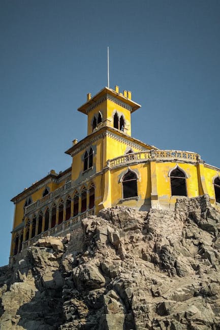
Perched dramatically on a cliff overlooking the southern Peruvian coast, Castillo Forga is a striking example of early 20th-century neo-Gothic architecture blended with Neoclassical and Baroque influences. This abandoned mansion stands as a testament to the ambitions and tastes of José Miguel Forga, a prominent landowner and textile magnate from Arequipa, who commissioned its construction between 1908 and 1910. Castillo Forga dominates the coastal landscape of Mollendo, a small but historically significant port town in southern Peru, offering panoramic views of the Pacific Ocean. Originally named "Casa Blanca" (White House), the mansion was a social hub for the elite of Arequipa during its heyday. Its location atop a cliff made it a unique architectural feat, accessible only by an iron bridge that connected the residence to the town below. This bridge not only served a practical function but also added to the mansion's imposing and exclusive character. The design reflects Forga's admiration for European styles, particularly the romanticized medieval revival that neo-Gothic architecture represents, combined with decorative elements from Neoclassical and Baroque traditions. Architectural design and features Castillo Forga exemplifies the neo-Gothic architectural style popular in the late 19th and early 20th centuries, characterized by pointed arches, intricate stonework, and vertical lines that evoke medieval Gothic cathedrals. The mansion incorporates ornate windows with tracery, steeply pitched roofs, and decorative battlements that enhance its castle-like appearance. The inclusion of Neoclassical and Baroque elements is evident in the mansion's symmetrical layout, elegant columns, and elaborate interior moldings, which soften the otherwise austere Gothic forms. The mansion's construction utilized local materials adapted to the coastal environment. Its cliffside position required careful engineering to ensure stability and durability against the ocean's corrosive effects and seismic activity common in the region. The iron bridge, a rare feature for private residences of the era, was an engineering marvel that symbolized the connection between the natural landscape and human craftsmanship. Historical context and ownership José Miguel Forga, the original owner, was a wealthy figure in Arequipa's early 20th-century society, with significant interests in land and the textile industry. His decision to build such an elaborate mansion in Mollendo reflected both his economic power and his desire to bring European architectural sophistication to Peru's southern coast. The mansion served as a venue for social gatherings, parties, and meetings among the region's elite, reinforcing Mollendo's status as a cultural and economic hub during that period. However, the global economic crisis of 1929 severely impacted Forga's fortunes. Mounting tax debts led to the mansion's confiscation during President Manuel Prado's administration, after which it was handed over to the archbishop of Arequipa. Over the following decades, the mansion changed hands multiple times, with each owner struggling to maintain the property. Its remote location and the high costs of upkeep contributed to its gradual abandonment and deterioration. Current condition and cultural significance Today, Castillo Forga stands as a partially preserved relic of early 20th-century architecture and Peruvian social history. Although it has suffered from neglect and exposure to the elements, the mansion's core structure and many of its defining features remain intact. Its imposing silhouette continues to draw interest from historians, architects, and tourists intrigued by its unique blend of styles and its dramatic coastal setting. The mansion's cultural significance extends beyond its architectural value. It embodies the aspirations of a bygone era in Peruvian history when European influences shaped the tastes and ambitions of the local elite. Castillo Forga also highlights the economic fluctuations that affected the region, illustrating how global events like the Great Depression had local repercussions. Visiting Castillo Forga While Castillo Forga is not currently a fully restored tourist site, it remains accessible to visitors interested in exploring Mollendo's historical landmarks. The mansion's cliffside location offers breathtaking views of the Pacific Ocean and the surrounding landscape, making it a compelling destination for photographers and history enthusiasts alike. Visitors should exercise caution due to the building's partial preservation state and the challenging terrain around the cliff. Efforts to preserve and restore Castillo Forga could enhance its role as a cultural and historical attraction, contributing to the appreciation of Peru's architectural heritage. Meanwhile, the mansion stands as a poignant reminder of the region's rich history and the enduring legacy of early 20th-century architectural ambition on the Peruvian coast.

Post-Renaissance (17th–18th c.)
Details
1052.3 km
Waqrapukara — Peru castle

Waqrapukara

, Peru

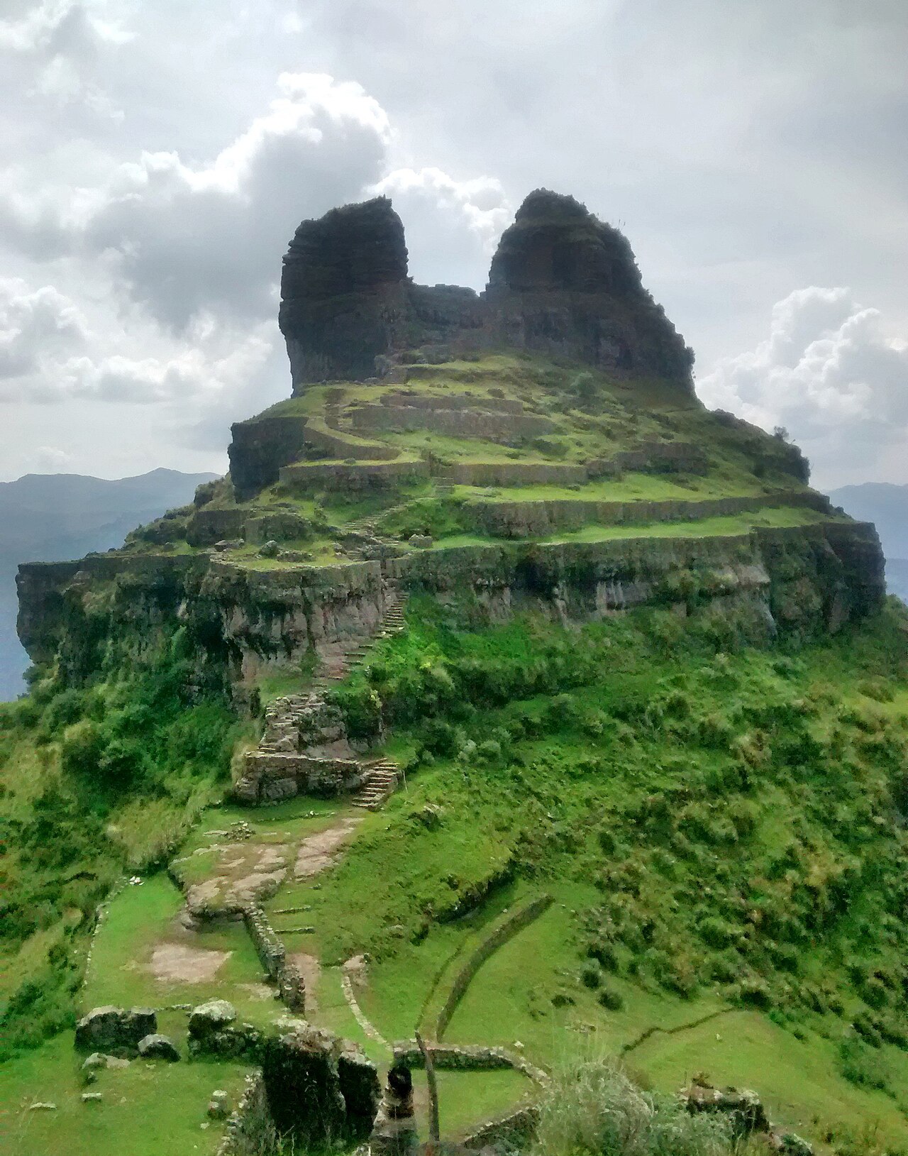
Waqrapukara, also spelled Waqra Pukara, is a remarkable archaeological site located in the Cusco Region of Peru, within the Acomayo Province, Acos District. Situated near the Apurímac River at an altitude of approximately 4,300 metres (14,100 feet) above sea level, this site stands out for its strategic location and unique architectural features. The name Waqrapukara likely derives from the Quechua language, combining waqra meaning "horn" and pukara meaning "fortress," thus often translated as the "horn fortress." Historical context and cultural significance The site was originally constructed by the Canchis people, an indigenous group who built distinctive circular stone buildings that characterize the complex. These structures reflect the architectural ingenuity and cultural practices of the Canchis prior to Inca domination. Later, the site was conquered and integrated into the expansive Inca Empire, which repurposed it as a sanctuary or ceremonial center. This transition highlights the site's importance in the regional power dynamics and religious landscape during the Late Medieval period. Architectural features and layout Waqrapukara's architecture is notable for its combination of defensive and ceremonial elements. The fortress-like design includes massive stone walls that form enclosures with a distinctive horn-shaped outline, which may have served both symbolic and practical functions. The complex contains numerous circular buildings, which are relatively rare in Andean architecture and suggest specialized uses, possibly for ritual activities or elite residences. The stonework demonstrates advanced masonry techniques typical of Andean cultures, with carefully fitted stones that have withstood centuries of weathering at high altitude. The site also features terraces, stairways, and platforms that integrate with the rugged mountainous terrain, enhancing its defensive capabilities and ceremonial prominence. Location and environmental setting Perched high in the Andes, Waqrapukara overlooks the Apurímac River valley, providing commanding views that were likely advantageous for surveillance and defense. The altitude and remote location contribute to the site's preservation but also present challenges for modern visitors. The surrounding landscape is characterized by steep cliffs and mountainous terrain, which adds to the fortress-like impression and the site's strategic importance. Cultural heritage and modern recognition In July 2017, Waqrapukara was declared a National Cultural Heritage Site by the Peruvian Ministry of Culture, recognizing its historical, architectural, and cultural value. This designation has helped promote conservation efforts and increased awareness of the site's significance within Peru's rich pre-Columbian history. Today, Waqrapukara attracts archaeologists, historians, and tourists interested in Andean civilizations and Inca heritage. Although the site remains in a state of ruins, ongoing research and preservation initiatives aim to protect its structures and interpret its complex past for future generations. Visiting waqrapukara Visitors to Waqrapukara should be prepared for high-altitude conditions and rugged terrain. The site is accessible by trekking routes from nearby towns in the Cusco Region, offering an immersive experience of Andean culture and history. Due to its remote location, facilities are limited, so travelers are advised to plan accordingly and respect the site's cultural and natural environment.

Late Medieval (14th–15th c.)
Details