Arish castle — Egypt castle

Arish castle

Arish castle in Egypt
High Medieval (11th–13th c.)
Partially Preserved

Arish castle is a notable historic fortress located in Egypt, recognized primarily as a hill castle due to its elevated strategic position. This castle played a significant role in the military and political history of the region, serving as a defensive stronghold against various invasions and conflicts throughout the medieval period.

Historical context and significance

Arish castle's origins trace back to the medieval era, where it was constructed to oversee and protect the surrounding region. Although the exact date of its construction remains uncertain, its architectural features and strategic placement align with fortifications built during the High Medieval period. The castle's location in the Sinai Peninsula made it a vital point of control for trade routes and military campaigns connecting Egypt with the Levant and the broader Middle East.

Architectural features and layout

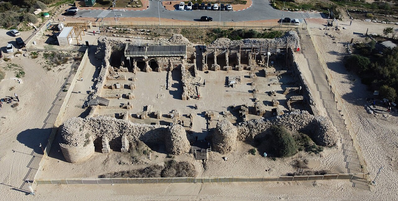
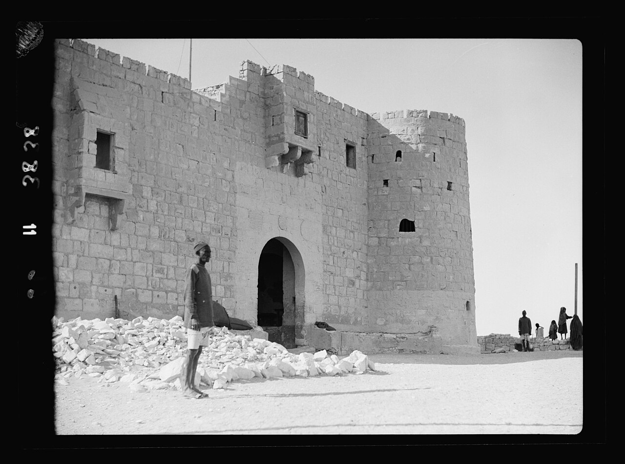
The castle is characterized by its elevated position on a hill, which provided natural defense advantages and extensive visibility over the surrounding landscape. Its design includes robust stone walls and defensive structures typical of medieval fortifications. The castle likely featured towers and battlements that allowed defenders to monitor and repel attackers effectively. The use of local stone materials contributed to its durability and integration into the natural terrain.

Defensive structures

Key defensive elements of Arish castle would have included thick curtain walls, a fortified gatehouse, and possibly a moat or ditch to hinder enemy approach. The elevated position itself served as a formidable barrier, enhancing the castle's defensive capabilities. These features reflect common medieval military architectural practices aimed at maximizing protection and control.

Role in regional conflicts

Throughout its history, Arish castle was involved in various military engagements due to its strategic importance. It served as a defensive bastion during periods of conflict between regional powers vying for control of the Sinai and surrounding areas. The castle's presence helped secure trade routes and served as a military outpost for controlling movement across the region.

Current condition and preservation

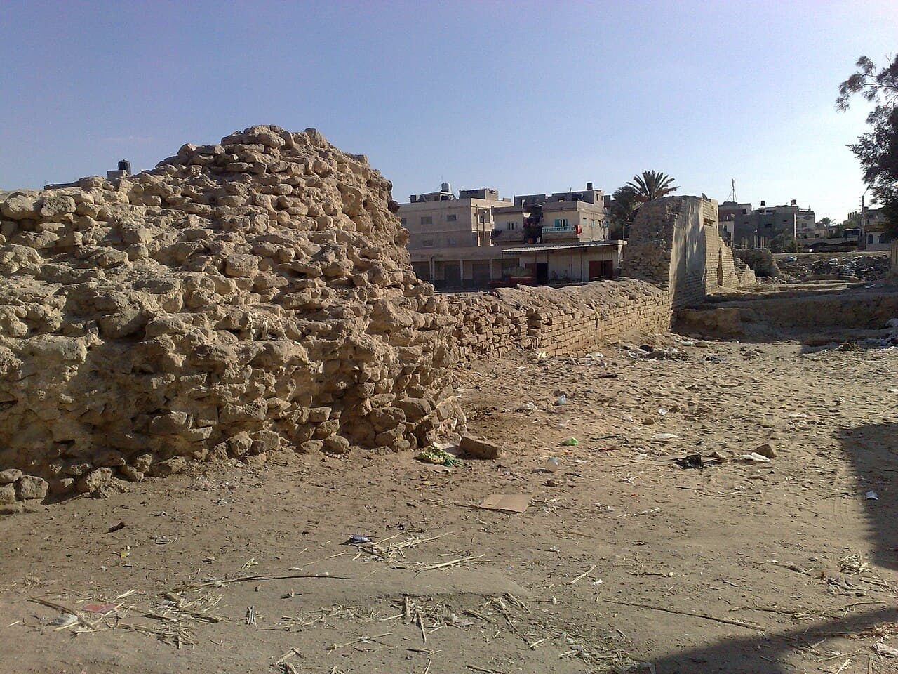
Today, Arish castle stands as a partially preserved historical site. While some sections of the original structure remain intact, others have suffered from the passage of time and environmental factors. Efforts to preserve and study the castle contribute to understanding its historical significance and architectural characteristics. Visitors to the site can observe the remnants of its defensive walls and appreciate its commanding location.

Visiting Arish castle

Though not widely known as a major tourist destination, Arish castle offers valuable insights into medieval military architecture in Egypt. Its hilltop setting provides panoramic views of the surrounding landscape, making it an interesting site for history enthusiasts and researchers. Accessibility may be limited due to its location, but the castle remains an important cultural heritage site within the region.

Frequently asked questions about Arish castle

  • When was Arish castle built? The exact construction date is uncertain, but it likely dates back to the High Medieval period, reflecting typical medieval military architecture.
  • What is the architectural style of Arish castle? The castle features medieval fortification elements common in hill castles, including thick stone walls and defensive towers.
  • Is Arish castle open to visitors? The castle is accessible, though it is not a major tourist site. Visitors interested in medieval architecture and history can explore the partially preserved ruins.
  • Where is Arish castle located? It is situated in the Sinai region of Egypt, strategically placed on a hill overlooking key trade and military routes.
  • What is the current condition of the castle? Arish castle is partially preserved, with some original structures intact while others are in ruins.

Frequently asked questions (FAQ)

How do I get to Arish Castle?
Arish Castle is located in the city of Arish in Egypt's North Sinai Governorate. You can reach the castle by taking a bus or taxi from major cities like Cairo or Ismailia. Once in Arish, local transport options will guide you to the castle site.
What is the historical significance of Arish Castle?
Arish Castle dates back to the Ottoman period and served as an important military fortification in the region. It played a strategic role in controlling trade routes and protecting the area from invasions. The castle is a testament to the architectural styles and military strategies of its time.
When was Arish Castle built?
Arish Castle was constructed in the late 16th century during the reign of the Ottoman Empire. Its design reflects the military architecture prevalent during that period. Today, it stands as a historical monument showcasing the rich history of the region.
Can I enter Arish Castle?
Yes, visitors are generally allowed to enter Arish Castle, but it's advisable to check in advance for any specific regulations or guided tour availability. Inside, you can explore the castle's architecture and enjoy panoramic views of the surrounding area. Always respect the historical site by following the guidelines provided.
Why is Arish Castle an important tourist destination?
Arish Castle is important for its historical and architectural value, making it a fascinating destination for history enthusiasts. It offers insights into the military history of Egypt and the Ottoman Empire. Additionally, its picturesque location attracts visitors who appreciate both history and scenic views.
Is it possible to take guided tours of Arish Castle?
Yes, guided tours are often available for visitors wanting to learn more about the history and architecture of Arish Castle. These tours are led by knowledgeable guides who can provide in-depth information and answer questions. It's recommended to book in advance to ensure availability.
What are the opening hours for Arish Castle?
Arish Castle typically opens to visitors from 9 AM to 5 PM, but hours may vary during holidays or special events. It's best to check the local tourism website or contact the castle authorities for the most current information. Arriving early can help you avoid crowds and enjoy a more relaxed visit.
What is the best time to visit Arish Castle?
The best time to visit Arish Castle is during the cooler months, from October to April. During this period, temperatures are more comfortable for exploring outdoor sites. Additionally, visiting during weekdays can help you avoid larger crowds often seen on weekends.
Are there any nearby attractions to Arish Castle?
Yes, there are several nearby attractions, including beautiful beaches along the Mediterranean coast and historical sites like the ancient city of Pelusium. Visitors can also explore local markets and experience the culture of Arish. Combining your visit to the castle with these attractions can make for a richer travel experience.
What are the ticket prices for Arish Castle?
Ticket prices for Arish Castle are generally affordable, with discounts often available for students and children. Prices may vary depending on the season and any guided tours you choose. It's a good idea to check the official website or local information sources for the latest pricing details before your visit.

Photo gallery

Arish castle
Click to view

Photo by Zeadanany•CC BY-SA 4.0

1 photo • Click any image to view in full screen

Information

Hill Castle

Loading map...

Visitor reviews

No reviews yet. Been here? Write the first review and help other travelers!

Write the first review

Visited this castle? Share your experience

Your review helps other travelers and adds first-hand knowledge to our encyclopedia.
Write a review

(5/5)

0/2000 characters

Your review will be visible after admin approval

Nearby castles

76.4 km
Qasr al-Basha — Palestine castle

Qasr al-Basha

, Palestine

Qasr al-Basha, also known as Pasha's Palace Museum, Radwan Castle, and Napoleon's Fort, was a prominent historic fortress located in the Old City of Gaza, Palestine. This castle played a significant role as a seat of power during both the Mamluk and Ottoman periods, reflecting the strategic importance of Gaza throughout the centuries. The fortress was originally constructed in the 13th century, during the high medieval period, and stood as a symbol of military and administrative authority in the region. Historical significance and strategic role Qasr al-Basha's location in Gaza made it a vital stronghold controlling important trade routes and coastal access. Throughout the Mamluk era, the fortress served as a military garrison and administrative center, overseeing the security of the city and its surroundings. Under the Ottoman Empire, the castle continued to function as a seat of local power and governance, adapting to the changing political landscape of the region. During the British Mandate period, the fortress was repurposed as a police station, demonstrating its continued strategic and administrative utility. The castle's layered history reflects the complex succession of rulers and the evolving military architecture of the eastern Mediterranean. Architectural features and construction Qasr al-Basha was built primarily as a fortified palace, combining residential and defensive functions. The castle's architecture was characterized by robust stone walls, towers, and designed to withstand sieges and attacks. Its layout included a central courtyard surrounded by chambers and halls used for administrative and residential purposes. The fortress showcased elements typical of Mamluk military architecture, including thick curtain walls and narrow windows for archers. Ottoman modifications introduced additional features suited to the needs of the time, possibly including reinforced gates and internal divisions for administrative offices and barracks. Materials and construction techniques The castle was constructed using locally sourced stone, carefully cut and fitted to form the defensive walls. The masonry techniques reflected the skilled craftsmanship of the medieval period, with an emphasis on durability and defense. The structure's design balanced the need for a secure fortress with the requirements of a palace residence. Destruction and current status Qasr al-Basha remained a notable landmark in Gaza until its destruction during the Israeli invasion of Gaza in 2024. Prior to its destruction, the castle housed a museum that preserved artifacts and exhibits related to Gaza's history, underscoring its cultural significance. The loss of Qasr al-Basha represents a significant blow to the architectural heritage and historical record of the region. Today, the site is classified as archaeological ruins, with remnants of its walls and foundations still visible. Efforts to document and preserve the remains have been challenged by ongoing conflict and instability in the area. Legacy and cultural importance Qasr al-Basha stood as a testament to the rich history of Gaza, reflecting the city's role as a crossroads of civilizations. Its multiple names, including Napoleon's Fort, hint at its involvement in broader historical events, such as the campaigns of Napoleon Bonaparte in the region. The castle's architectural and historical layers provide valuable insights into the military and administrative strategies of the Mamluk and Ottoman empires. It also served as a symbol of local authority and resilience through centuries of change. Despite its destruction, Qasr al-Basha remains a subject of study and remembrance among historians, archaeologists, and the people of Gaza, highlighting the enduring significance of medieval fortifications in the cultural heritage of Palestine.

High Medieval (11th–13th c.)
Details
107.1 km
Ashdod-Sea Fortress — Israel castle

Ashdod-Sea Fortress

Ashdod, Israel

Ashdod-Sea Fortress stands as a remarkable testament to the region's dynamic history, showcasing layers of occupation and architectural evolution from the 7th century CE through the Crusader period. Located in the municipality of Ashdod, Israel, this fortress was strategically constructed under the Umayyad Caliph Abd al-Malik to serve as a vital coastal defense installation. Its primary role was to protect the southern stretch of the coastal plain and to function as an early warning system for the nearby provincial capital of Ramla against naval threats, particularly from the Byzantine Empire. Historical context and strategic importance The fortress's origins in the early Islamic period highlight its significance in the Umayyad military network. Built during a time of expanding Islamic control, Ashdod-Sea Fortress was part of a broader system of fortifications designed to secure maritime routes and coastal settlements. Its location enabled surveillance over the Mediterranean Sea, providing critical intelligence and defense against potential Byzantine incursions. By the 10th century, under the rule of the Fatimid Caliphate, the fortress experienced substantial expansion and reinforcement. Renamed Qal’at al-Mina or "Port Fortress," it became a fortified maritime outpost crucial for monitoring sea traffic and defending the coastline. This period saw the integration of Islamic architectural and military innovations, enhancing the fortress's defensive capabilities. The fortress's resilience was tested in 1033 when a powerful earthquake inflicted severe damage, particularly to its entrance towers. Despite this setback, the site remained operational and was later adapted by the Crusaders following their successful campaigns in the region. By 1099, the Crusaders had fortified the structure further, renaming it Castellum Beroart or Beroartum, in honor of Nicholas de Beroart, a knight linked to the Lordship of Ramla. The fortress continued to serve as a key military stronghold throughout the 12th and 13th centuries during the Crusader presence in the Levant. Following the 1260 Mamluk conquest and the collapse of the Crusader Kingdom, the fortress was abandoned as a military installation. Over subsequent centuries, it transitioned into a refuge for nomadic groups, its ruins silently narrating the region's turbulent history of conquest and cultural exchange. Architectural features and layout The fortress occupies an area approximately 60 meters by 45 meters, enclosed by robust walls constructed from kurkar, a calcareous sandstone native to the coastal region. These walls originally supported six round towers about eight meters tall, strategically positioned to protect vital access points. The western side, facing the sea, was guarded by four towers, including two flanking the main sea gate, while the eastern side featured two round towers and two additional square towers at the eastern corners, reinforcing the fortress's landward defenses. A distinctive moat surrounds the fortress on the landward side, crossed by a bridge leading to the eastern gate. This defensive feature underscores the fortress's dual role in guarding against threats from both sea and land. Despite centuries of exposure to harsh sea winds and the seismic impact of the 1033 earthquake, significant portions of the walls and towers remain visible, offering insight into the fortress's original imposing presence. Internal structures and facilities Within the fortress, the layout centers around a central courtyard, which was surrounded by various chambers serving multiple functions. These included residential quarters, stables for horses, and a mosque, reflecting the fortress's Islamic heritage during the Umayyad and Fatimid periods. Archaeological excavations have revealed two wells to the north and south of the courtyard, emphasizing the critical importance of a reliable water supply in sustaining the garrison and inhabitants. To the north of the courtyard lies a well-preserved bathhouse featuring plaster-coated pools and an advanced water heating system. This facility aligns with the Islamic tradition of bathhouses (hammams) common in military and urban centers, highlighting the cultural and practical aspects of life within the fortress. Preservation and modern significance Modern conservation efforts have focused on stabilizing the remaining structures by reinforcing walls and clearing accumulated sands that had obscured parts of the site. Renovations include renewed flooring to facilitate visitor access and the construction of an elevated wooden observation platform, offering panoramic views of the fortress ruins and the surrounding coastal landscape. The fortress is part of a broader historical and ecological complex that includes a nearby signaling tower located in present-day Ashdod's Quarter 15. Together, these sites formed an ancient communication network essential for coastal defense. Adjacent to the fortress lies an ecological park that preserves both natural habitats and remnants of the ancient Ashdod-Sea city, linking the fortress to its wider historical and environmental context. Cultural heritage and tourism Ashdod-Sea Fortress today is recognized not only for its military and architectural significance but also as a cultural heritage site that embodies the layered history of the southern Levant. It attracts scholars, archaeologists, and tourists interested in the intersection of Islamic, Crusader, and local histories. The site offers a tangible connection to the past, illustrating the strategic importance of coastal fortifications in medieval geopolitical struggles. Visitors can explore the fortress ruins, learn about its historical phases, and appreciate the sophisticated defensive and residential features that sustained its occupants over centuries. The integration of natural and historical elements in the surrounding ecological park enhances the visitor experience, providing a serene environment that complements the fortress's historical narrative.

Early Medieval (5th–10th c.)
Details
134.6 km
An-Nekhel Fortress — Egypt castle

An-Nekhel Fortress

Nekhel Municipality, Egypt

The Fortress of an-Nekhel stands prominently in the Sinai Peninsula of Egypt, marking the strategic heart of the peninsula. This bastioned fortress was constructed in the 16th century during the Renaissance period, reflecting military architectural advances of the time. It occupies a commanding position along historic caravan routes that connected Egypt with the Arabian Peninsula, serving as a critical waypoint and defensive stronghold. Historical significance and strategic location Located in what is now the Nekhel Municipality, the fortress's site has been of importance since Ancient Egyptian times, as archaeological excavations have uncovered remains dating back to that era. Its position at the exact center of the Sinai Peninsula made it a natural hub for controlling movement across the desert, especially for caravans and military expeditions. During the Islamic era, an-Nekhel fortress gained additional prominence as a vital staging ground for Muslim pilgrims undertaking the Hajj or Umra. Pilgrims traveling from Egypt and North Africa to the holy cities of Mecca and Medina often stopped here to rest and resupply. The fortress thus played a dual role as both a military bastion and a crucial support point for religious journeys. Architectural features and construction The fortress is classified as a bastioned fortress, a style that emerged in the Renaissance with the advent of gunpowder artillery. Its design includes thick defensive walls and angular bastions that allowed defenders to cover all approaches with crossfire, reducing blind spots and improving protection against cannon fire. Constructed primarily from local stone, an-Nekhel fortress features a roughly rectangular layout with bastions projecting from the corners and midpoints of the walls. The walls are punctuated by narrow gunports and embrasures for artillery. The main gate is fortified, often with additional defensive elements such as a barbican or a drawbridge, though specific details about these features at an-Nekhel are limited. Inside, the fortress likely contained barracks, storage rooms for food and ammunition, and water cisterns to sustain occupants during sieges or long periods of isolation. The presence of a central courtyard would have facilitated movement and organization within the fortress. Role in regional defense and trade Throughout its history, an-Nekhel fortress served as a key military outpost guarding the desert approaches to Egypt. It was part of a network of fortifications that protected trade routes and pilgrimage paths from raids by hostile tribes or foreign invaders. Its bastioned design reflects the evolving military technology of the Renaissance, adapted to the challenges of desert warfare. The fortress also functioned as a customs and control point, regulating the flow of goods and people across the Sinai. This role was essential for maintaining the security and economic stability of the region. Archaeological findings and preservation Excavations at the site have revealed layers of occupation, including artifacts and structural remains from Ancient Egypt through the Islamic period. These findings highlight the continuous strategic importance of the location over millennia. Today, an-Nekhel fortress remains a partially preserved historic site. Its ruins provide valuable insights into the military architecture of the Renaissance adapted for desert conditions and the cultural exchanges along the pilgrimage routes. Visiting an-Nekhel fortress While the fortress is not as widely known or visited as other Egyptian monuments, it attracts historians, archaeologists, and adventurous travelers interested in the intersection of military history and Islamic pilgrimage traditions. Visitors should prepare for desert conditions and limited facilities. The site offers a unique glimpse into the Renaissance-era bastioned fortress architecture in a desert environment and its role in safeguarding one of the world's oldest pilgrimage routes.

Renaissance (15th–17th c.)
Details