Şanlıurfa Castle — Turkey castle

Şanlıurfa Castle

Şanlıurfa Castle: historic hilltop fortress of Edessa
Şanlıurfa, Turkey
Late Medieval (14th–15th c.)
Partially Preserved

Şanlıurfa Castle stands as a monumental testament to the rich and complex history of the ancient city of Edessa, located in modern-day Turkey. Perched atop a natural hill known as Top Dağı or Nemrud Dağı, this hill castle commands a strategic vantage point overlooking the surrounding landscape and the contemporary city below. Its origins trace back to the 3rd century AD, making it a significant site that reflects the architectural and military evolution from antiquity through the medieval period.

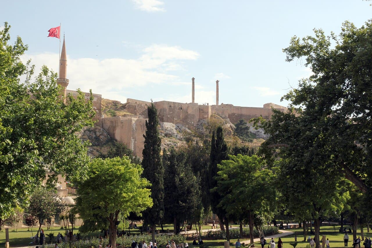
The castle's earliest fortifications were constructed by the ancient kingdom of Osroene, which recognized the importance of controlling this elevated position. Around 201 AD, King Abgar VIII responded to the challenges posed by flooding in the lower city by erecting a grand Syro-Roman winter palace on the hilltop. This palace featured imposing architectural elements, most notably the two towering Corinthian columns approximately 15 meters high, which have endured as iconic symbols of the site and are locally referred to as the "Throne of Nimrod." These columns rise above the fortress's outer terrace walls and remain in their original placement, offering a striking visual link to the ancient past.

Architectural features and defensive design

The fortress occupies a roughly rectangular area measuring about 300 meters east to west and 80 meters north to south, situated on a hill rising some 30 meters above the surrounding terrain. Its design reflects a series of adaptations and expansions made over centuries to meet evolving military needs. The castle's outer defenses include a well-preserved moat on the southern, mountain-facing side, which reaches depths of at least 12 meters. This moat originated as part of the defensive trenches constructed during the reign of Emperor Justinian in the 6th century and was later expanded by the Byzantine general Georgios Maniakes in the early 11th century. The Crusaders further enhanced these defenses by enlarging the moat and reinforcing the walls to withstand sieges.

Within the castle's interior, archaeological investigations have uncovered traces of a medieval mosque, indicating the site's continued religious and cultural significance during Islamic rule. The main medieval gate likely corresponds to the current northern entrance, suggesting a continuity of access points through the centuries. Historical sources imply the existence of additional gates oriented towards both the city and the surrounding countryside, enhancing the fortress's control over key routes.

South of the two Corinthian columns lie the remains of the Crusader donjon, a fortified tower that served as a stronghold within the castle complex. This donjon was destroyed by the Seljuk Sultan Ala ad-Din Kai Kobad I after the Seljuk conquest in the 12th century, leaving behind fragments that provide valuable insight into Crusader military architecture and defensive strategies.

Historical significance and shifting control

Şanlıurfa Castle's history is marked by its control under various empires and rulers, reflecting the turbulent geopolitical landscape of the region. Initially fortified by the Osroene kingdom, the castle later became a focal point for Roman and Byzantine authorities. During the 6th century, Emperor Justinian's administration undertook significant hydraulic engineering projects, including redirecting the nearby Skirtos River, to protect the city from flooding and reinforce its defenses.

In the early medieval period, the fortress changed hands multiple times. The Persians, Byzantines, and various Muslim forces each held the castle at different times, underscoring its strategic value. In 1031, the Byzantine general Georgios Maniakes recaptured Şanlıurfa and strengthened its fortifications, enabling it to resist attacks such as those by Ibn Waṯṯāb in 1036 and the Seljuk leader Alp Arslan in 1071.

The castle briefly came under the control of Philaretos Brachamios in 1083 before passing to the Armenian ruler Thoros, who expanded the fortress until his assassination in 1098. Subsequently, Baldwin of Boulogne, a prominent Crusader leader, assumed control. The Crusaders held the castle for several decades, enhancing its defenses further until the Seljuk conquest in 1147, which resulted in the destruction of much of Edessa.

The Seljuk Sultan Ala ad-Din Kai Kobad I notably demolished the Crusader donjon, symbolizing the shift in power. Later, the castle may have seen modifications under the Seljuks, Artuqids, and Mamluks, though archaeological evidence is still being studied to clarify these phases.

Preservation and restoration efforts

Today, Şanlıurfa Castle remains a prominent historical landmark, with ongoing restoration and archaeological work aimed at preserving its remaining structures and uncovering further details about its layered past. In April 2013, a significant partial collapse of an outer fortification wall occurred due to heavy rains, highlighting the challenges of conserving such ancient sites. Fortunately, no injuries were reported, and restoration efforts have continued to stabilize and protect the fortress.

The surviving elements, including the Corinthian columns, outer terrace walls, and the deep moat, offer visitors a tangible connection to the castle's multifaceted history. While many inner buildings have not survived, the site remains invaluable for understanding the architectural and military developments from the Roman era through the Crusader period and beyond.

Geographical and cultural context

Situated just south of the ancient sacred pond complex of Balıklıgöl, Şanlıurfa Castle's location underscores its cultural and spiritual significance in addition to its military role. The castle's elevated position on the hill provided not only defensive advantages but also a commanding view of the city and its environs, essential for controlling trade routes and regional power dynamics.

The castle's enduring presence reflects the rich tapestry of civilizations that have influenced Şanlıurfa and the broader region over millennia. It stands as a symbol of resilience and continuity, bridging the ancient world with the medieval and early modern periods.

Visitor experience and accessibility

Visitors to Şanlıurfa Castle can explore the imposing Corinthian columns and walk along sections of the fortress walls and moat, gaining insight into the site's defensive architecture. The castle's hilltop location offers panoramic views of the modern city and the surrounding landscape, making it a popular destination for history enthusiasts and tourists alike.

While some areas of the castle are under restoration, the site is accessible to the public, providing educational opportunities about the complex history of Edessa and the various cultures that have shaped it. Informational signage and guided tours help contextualize the architectural features and historical events associated with the fortress.

Frequently asked questions (FAQ)

What is the historical significance of Şanlıurfa Castle?
Şanlıurfa Castle is historically significant as a strategic fortress that has witnessed control by the Osroene kingdom, Romans, Byzantines, Crusaders, Seljuks, and others, reflecting the region's complex history.
Can visitors see the ancient Corinthian columns at Şanlıurfa Castle?
Yes, visitors can view the two towering Corinthian columns known as the "Throne of Nimrod," which date back to the Syro-Roman winter palace built around 201 AD.
Is Şanlıurfa Castle accessible to the public?
The castle is accessible to the public, allowing visitors to explore the fortress walls, moat, and columns, although some areas may be under restoration.
When was the castle originally built?
The earliest fortifications of Şanlıurfa Castle date back to the 3rd century AD, constructed by the ancient kingdom of Osroene.
What defensive features does Şanlıurfa Castle have?
Key defensive features include a deep moat on the southern side, outer terrace walls, and remnants of a Crusader donjon, reflecting multiple phases of fortification.

Photo gallery

Şanlıurfa Castle
Click to view

Photo by Klaus-Peter Simon•CC BY-SA 3.0

1 photo • Click any image to view in full screen

Information

Hill Castle

Sources & official resources

Verify the information above using these authoritative references.

Loading map...

Visitor reviews

No reviews yet. Been here? Write the first review and help other travelers!

Write the first review

Visited this castle? Share your experience

Your review helps other travelers and adds first-hand knowledge to our encyclopedia.
Write a review

(5/5)

0/2000 characters

Your review will be visible after admin approval

Nearby castles

72.4 km
Birecik Castle — Turkey castle

Birecik Castle

Birecik, Turkey

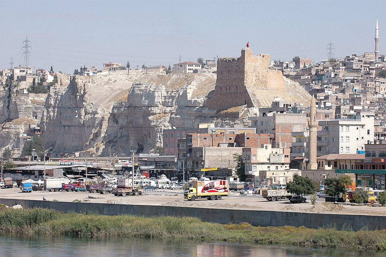
Birecik Castle, locally known as Birecik Kalesi, is a historic hill castle located in the city of Birecik within the Şanlıurfa province of Turkey. It occupies a strategic position on an elongated limestone ridge overlooking the left bank of the Euphrates River. The castle's commanding location provided natural defensive advantages and control over river traffic, making it a significant fortification through various historical periods. The castle complex originally consisted of two main parts: the inner castle atop the ridge and an outer castle situated between the ridge and the riverbank. The outer castle is believed to have been constructed by the Seleucid Empire between 298 and 236 BC, marking the earliest phase of fortification at the site. This outer defensive structure underwent several repairs and modifications over the centuries, including during the Roman period (30 BC–395 AD), the era of the Frankish Crusaders (1098–1150), and later the Mamluk Sultanate (1277–1484). The inner castle on the ridge is generally dated to the 13th century, corresponding to the High Medieval period. Some sources attribute its construction to the Muslim rulers of Aleppo between 1128 and 1260, highlighting the castle's role in the regional power struggles of the time. The castle was known locally as Beyaz Kale or "White Castle," a name derived from the pale color of the limestone ridge on which it stands. Architectural features and layout The original fortress was extensive, with the entire summit of the ridge fortified as the inner castle. This included high defensive walls and multiple towers, reportedly numbering twelve, reaching heights of 30 to 40 meters. These towers and walls provided formidable protection and vantage points for surveillance and defense against attackers. The outer castle below complemented the inner defenses, acting as a first line of fortification along the riverbank. The complex reportedly featured four gates, which controlled access between the river, the outer castle, and the inner stronghold. Unfortunately, much of this extensive structure has been lost over time due to natural erosion, landslides, earthquakes, and possibly deliberate demolition. One surviving element is the Alaburç tower, a corner tower that has been consolidated in the early 20th century and remains the main visible landmark of the castle today. This tower exemplifies the castle's medieval military architecture and its adaptation to the limestone ridge's topography. Historical significance and ownership Birecik Castle has witnessed numerous historical phases reflecting the turbulent history of southeastern Anatolia. After its initial construction and modifications by the Seleucids, Romans, Crusaders, and Mamluks, the castle eventually became part of the Ottoman Empire in 1517. Under Ottoman rule, the castle lost much of its strategic importance, likely leading to its gradual decline and ruin. Up to the early 19th century, more substantial remains of the castle were still visible, including the walls and towers. However, the passage of time and natural disasters have significantly diminished the castle's physical presence. Recent condition and accessibility In recent years, the castle's accessibility has been compromised. A walkway on the west side of the ridge, which allowed visitors to reach the inner castle, was destroyed by a landslide. This has made the castle largely inaccessible to the public. There have been discussions about constructing a cable car to improve access, though no definitive developments have been reported. The region suffered severe damage during the 2023 Turkey-Syria earthquake, and it is suspected that Birecik Castle sustained further damage, though detailed assessments are not yet available. Near the castle, remnants of the old city walls remain, including two gates and a tower, offering additional insight into the medieval fortifications that protected Birecik. Cultural and heritage importance Birecik Castle is an important cultural landmark that reflects the layered history of the region, from Hellenistic times through the medieval Islamic period to the Ottoman era. Its commanding position on the Euphrates River underscores its historical role in controlling trade and military movements along this vital waterway. Despite the loss of much of its structure, the castle remains a symbol of the area's rich past and architectural heritage. Efforts to preserve and possibly restore parts of the castle could enhance understanding of the region's medieval fortifications and attract cultural tourism. Visitors to the area can explore the nearby city walls and enjoy views of the Euphrates, appreciating the strategic significance that led to the castle's original construction.

High Medieval (11th–13th c.)
Details
80.4 km
Najim Castle — Syria castle

Najim Castle

Manbidj, Syria

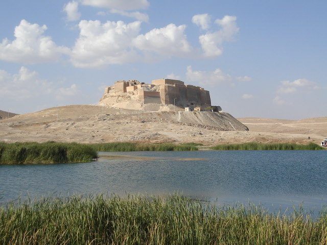
Najim Castle, locally known as Qalaat Najim or Kalat Nejem, is a prominent hill castle situated approximately 20 km east of the town of Manbij on the west bank of the Euphrates River in northern Syria. It holds the distinction of being the northernmost fortification along the Euphrates within Syrian territory. This castle commands a strategic position overseeing a historic crossing point on the river, once a vital link on an ancient trade route connecting Aleppo to Harran. The site of Najim Castle has a long history of human settlement dating back to ancient Greco-Roman times. Archaeological and textual evidence suggest the presence of a fortified settlement known as Caeciliana during the Roman period, though this identification is not definitively confirmed. The location's importance is underscored by its proximity to a river crossing and its role in regional commerce and military control. The earliest recorded mention of a fortification at Najim dates to the 9th century, with the castle first documented in 912 AD under the name Qalaat Najim. Over subsequent centuries, the castle underwent significant developments, reflecting the turbulent political and military history of northern Syria. During the 12th century, the fortress was strengthened under the rule of Nur ad-Din Zengi, a powerful leader of the Zengid dynasty, who stationed a garrison there to secure this strategic outpost. In the early 13th century, the castle was extensively renovated and expanded by Az-Zahir Ghazi, the son of the famed Muslim leader Saladin and the lord of Aleppo. The surviving remains of Najim Castle primarily date from this period, showcasing the architectural and military advancements of the Ayyubid dynasty. Az-Zahir Ghazi’s renovations included the construction of robust defensive walls, polygonal towers, and a sophisticated entrance gateway designed to impede attackers. Architectural features and defensive design Najim Castle is built atop a natural hill, utilizing the elevated terrain to maximize its defensive capabilities. The fortress is characterized by a truncated cone-shaped layout, with thick ashlar masonry walls rising from a carefully constructed glacis—a sloping stone base that reinforces the walls and deflects projectiles. This glacis is a hallmark of medieval military architecture in the region and links Najim stylistically to other major citadels such as those in Aleppo, Hama, and Homs. The castle’s perimeter is fortified with multiple polygonal towers, providing overlapping fields of fire and observation points. The main entrance is particularly notable for its complex defensive layout: a ramp leads to a large gatehouse featuring a series of four angled turns within a narrow passage. This design created a formidable obstacle for any attacking force, forcing them into a confined space vulnerable to defenders’ countermeasures. The entrance bears architectural resemblance to the gate of the Aleppo Citadel, reflecting shared military engineering principles of the era. Inside, the castle is organized around a small rectangular courtyard, which is surrounded by residential wings and functional chambers. These include living quarters for the garrison and commanding officers, storerooms, and administrative spaces. The castle’s internal layout balances military utility with the requirements of a self-sustaining fortress. Notable internal structures and inscriptions Among the surviving structures within Najim Castle is a palace-bath complex, arranged around a central courtyard with a fountain. This complex highlights the dual military and residential nature of the fortress, providing comfort and luxury alongside defense. The bathhouse reflects advanced water management techniques and an emphasis on hygiene and social life within the castle walls. The castle also houses a mosque distinguished by a rare architectural feature: an exterior double arcade overlooking the Euphrates River. This element, where two rows of arches face outward, is unusual in Islamic military architecture and is otherwise known only from the mosque at the Alhambra palace in Spain. This unique feature underscores the cultural and artistic sophistication present at Najim during its peak. Archaeologists have uncovered at least three or four inscriptions dating from the reign of Az-Zahir Ghazi. These inscriptions confirm the Ayyubid ruler’s direct involvement in the castle’s construction and maintenance, providing valuable historical context and dating for the fortress’s key phases of development. Historical significance and military role Najim Castle’s strategic importance stems from its control over a key crossing on the Euphrates River, where two islands allowed the construction of a pontoon bridge. This bridge was a vital link on the trade route from Aleppo to Harran, facilitating commerce and military movement. Control of Najim meant dominance over this critical artery in northern Syria’s economic and military landscape. Throughout its history, Najim Castle passed through the hands of various ruling dynasties. Following the Umayyad conquest, it was controlled by the Hamdanids, then the Mirdasids, and later the Banu Numayr, a nomadic Arab tribe that maintained possession into the early 12th century. The Zengids, under Nur ad-Din Zengi, restored the castle in the 12th century, and the Ayyubids further fortified it in the early 13th century. In the 19th century, Najim Castle played a role in regional conflicts when it was damaged during a siege in 1820 by Ottoman forces. The castle was used as a refuge by a local Arab leader resisting Ottoman control, highlighting its continued military relevance even in the modern era. More recently, during the Syrian Civil War, Najim Castle was the site of military action when the Syrian Democratic Forces captured it from the Islamic State group (ISIS) in 2016. This event underscores the fortress’s enduring strategic value over more than a millennium. Archaeological remains and current condition Today, Najim Castle stands as a partially preserved ruin, with many of its defensive walls, towers, and internal structures still visible. The ashlar glacis and polygonal towers remain prominent features, providing insight into medieval military architecture in Syria. The castle’s location in a desert-like environment on the Euphrates riverbank enhances its dramatic presence and historical ambiance. The castle is freely accessible to visitors, though it remains off the main tourist paths. Its remote setting offers a unique opportunity to explore a significant historical site that reflects the complex layers of Syrian history, from ancient times through the medieval Islamic period to the present day. While the nearby settlement that once supported Najim Castle has vanished, the fortress itself stands as a testament to the region’s rich cultural heritage and the enduring legacy of military architecture in the Middle East.

Early Medieval (5th–10th c.)
Details
84.9 km
Rumkale Castle — Turkey castle

Rumkale Castle

Kasaba Köyü Yolu, Turkey

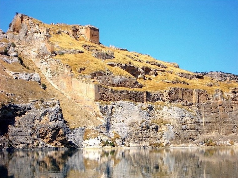
Rumkale Castle, also known locally as simply Rumkale, is a striking example of a strategic hill castle located on a commanding rocky peninsula formed by the Euphrates River and the Merziman Creek in the Gaziantep province of southeastern Turkey. Its name translates to "Castle of the Romans," reflecting its deep historical roots tied to the Roman and Byzantine periods. This fortress has played a significant role throughout history as a military stronghold, religious center, and cultural hub. Situated on a natural rock formation rising approximately 50 meters above the river, Rumkale's location was chosen for its natural defensibility and control over the surrounding region. The rock is almost vertically cut beneath the castle walls, enhancing its impregnability. Although often called a castle, Rumkale functioned more as a fortified settlement or citadel with multiple defensive features including massive stone walls, rectangular towers, and a deep dry moat carved by hand to protect its southern landward approach. Ancient origins and early history The site of Rumkale has a history extending back to antiquity, with early records identifying it as the fortress of Shitamrat, conquered by the Assyrian king Shalmaneser III in 855 BCE. The strategic importance of this location was recognized by successive civilizations, including the Hellenistic and Roman empires, who contributed to the development of the fortress structures visible today. The castle guarded an important Roman road along the Euphrates, underscoring its military significance. Byzantine and armenian period: religious and cultural significance By the 5th and 6th centuries, Rumkale had become a religious center, serving as the seat of a Syriac Orthodox bishopric. In the 11th century, the fortress saw the growth of an Armenian community. Control shifted from Byzantine hands to Armenian lords in the late 11th and early 12th centuries. The fortress was briefly captured by Crusader forces under Baldwin II of Edessa in 1116. Between approximately 1148 and 1150, Rumkale, then known as Hromgla, was acquired by Armenian Catholicos Grigor III Pahlavuni and became the seat of the Armenian Apostolic Church. This status lasted until 1292. The fortress hosted important religious synods, including those held in 1178 and 1179, which focused on church union efforts. It was also the residence of notable Armenian Catholicoi such as Nerses IV Schnorhali. The site became a center for manuscript illumination and Armenian religious art, attracting artists like Toros Roslin in the mid-13th century. Religious buildings and ecclesiastical architecture Within the fortress walls, several churches were constructed, including those dedicated to St. Gregory the Illuminator (Surb Grigor Lusavorich), the Holy Mother of God (Surb Astvatsatsin), and the Holy Savior (Surb Prkich). The largest church, built in the mid-12th century, was later converted into a mosque in the 13th century but collapsed in the 18th century. The fortress also housed the Syriac Orthodox monastery of Barshavma, reflecting the religious diversity of the settlement. Military history and later periods Rumkale endured numerous military challenges. It withstood a Mamluk siege in 1280 but ultimately fell after a prolonged siege in 1292 to the Mamluks, who renamed it Qal'at al-Muslimin (Castle of the Muslims). The Mamluks reinforced its role as a border fortress guarding against the Ilkhanate. Although later called Kale-i Zerrin (Golden Citadel), Rumkale never regained its former prominence. The fortress suffered damage during the invasions of Timur's forces around 1400–1401 but was restored by the Mamluks. It peacefully surrendered to the Ottoman Empire in 1516 following their victory over the Mamluks at Marj Dabiq and became an administrative center known as a sanjak, later downgraded to a district (kaza). By the 19th century, Rumkale's strategic importance declined, especially after a local rebellion in 1831 led to its depopulation by Ottoman authorities. The fortress was bombarded in 1832 by Egyptian forces under Ibrahim Pasha, causing severe damage and eventual abandonment. Architectural features and fortifications The fortress is enclosed by massive stone walls made of white chalk or limestone blocks, reaching heights of about 18 meters. These walls are reinforced by rectangular towers topped with battlements. Access was strictly controlled by a winding path carved into the rock, passing through six successive gates before reaching the interior. Defensive features include a deep artificial ditch approximately 24 meters deep and 12 meters wide, carved from the rock to isolate the fortress from an adjacent plateau. A remarkable engineering feature is a deep well about 60 meters in depth, with a spiral staircase carved into the rock allowing access to water from the river below. This well was partly filled and dry by the late 19th century. Within the walls, remnants of around forty houses indicate a once-thriving settlement. Several water cisterns and a historic cemetery have been identified, highlighting the complex social and religious life within the fortress. Ottoman-period structures include a palace built on the northern slope, replacing an earlier church, and multiple mosques mentioned in 16th-century records. Connectivity and infrastructure Connectivity from the fortress to the west was facilitated by a Roman bridge crossing the Euphrates, leading to a guarded path. On the eastern side, access was provided by a stairway. The fortress also hosted a madrasa complex named Rammahiya Madrasa, which included a primary school and a masjid, likely situated near a water source within the castle. Modern history and preservation In the 18th and 19th centuries, Rumkale was documented by European explorers and scholars such as Richard Pococke, Helmut von Moltke, Carl Ritter, Karl Humann, and Otto Puchstein, who provided valuable descriptions of its ruins. During the Ottoman period, the fortress served as a prison for political exiles, contributing to its depopulation. The construction of the Birecik Dam in 2000 flooded the lower parts of the fortress and nearby settlements, leaving only the upper ruins visible above the reservoir. Since 2017, Rumkale has been closed to visitors due to ongoing consolidation and partial reconstruction efforts to preserve its remaining structures. In 2021, a modern glass viewing terrace was inaugurated on the cliffs opposite Rumkale, offering panoramic views of the fortress and the Euphrates River. The site remains an important cultural and historical landmark, symbolizing the region's layered history from antiquity through medieval Christian and Islamic periods to the modern era. Rumkale Castle's rich history, impressive architecture, and commanding location make it a significant monument for understanding the military, religious, and cultural developments in southeastern Turkey over several millennia.

High Medieval (11th–13th c.)
Details