Rock of Dunamase
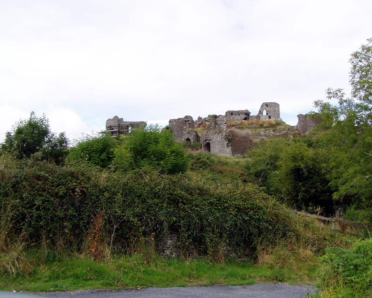
Rock of Dunamase, known in Irish as Dún Másc meaning "fort of Másc," is a prominent hill castle ruin located in County Laois, Ireland. This historic site sits atop a rocky outcrop rising approximately 46 metres (151 feet) above the surrounding plain, providing commanding views across the landscape towards the Slieve Bloom Mountains. The castle's strategic position made it a key defensive stronghold during the early Hiberno-Norman period.
Historical background and early significance
The site of the Rock of Dunamase has been of military and strategic importance since ancient times. Before the Norman conquest, it was an important Gaelic fortification. The name "Dún Másc" reflects its origins as a Gaelic stronghold, likely dating back to the early medieval period. The rocky promontory provided natural defenses, making it an ideal location for a fort.
Following the arrival of the Normans in Ireland in the late 12th century, the site was developed into a Norman castle. The castle was constructed to consolidate Norman control over the region, serving both as a military fortress and a symbol of Norman authority. The castle's elevated position allowed for surveillance of the surrounding plains and control over local routes.
Architectural features and castle layout
The Rock of Dunamase castle exhibits typical features of a hill castle built during the early Norman period. The castle ruins include remnants of stone curtain walls, defensive battlements, and the remains of a keep or donjon that once served as the main fortified residence and last line of defense.
The castle's layout took advantage of the natural rocky outcrop, with walls following the contours of the rock to maximize defensive capabilities. The steep cliffs on several sides acted as natural barriers, reducing the need for extensive fortifications in those areas. Access to the castle was likely limited to a narrow approach, enhancing its defensibility.
Within the castle walls, there would have been courtyards and service buildings necessary to support the garrison and residents. Although much of the structure is now in ruins, archaeological studies have identified foundations and wall fragments that indicate the castle's former complexity and size.
Historical events and ownership
The Rock of Dunamase played a role in various historical conflicts and power struggles in medieval Ireland. It was a significant stronghold during the turbulent period of Norman expansion and Irish resistance. Control of the castle changed hands multiple times, reflecting the shifting political landscape.
Over the centuries, the castle fell into decline and was eventually abandoned. Its ruins today stand as a testament to its former military importance. The site is now a protected archaeological monument and a popular destination for visitors interested in Irish history and medieval architecture.
Location and visitor information
The Rock of Dunamase is situated near the N80 road between the towns of Portlaoise and Stradbally in County Laois. Its accessible location makes it a favored spot for tourists and history enthusiasts exploring the Irish midlands.
Visitors to the site can explore the ruins and enjoy panoramic views of the surrounding countryside, including the distant Slieve Bloom Mountains. The site offers a tangible connection to Ireland's Norman past and the early medieval period.
Cultural and heritage significance
The Rock of Dunamase holds cultural importance as a symbol of the Norman influence on Irish history and architecture. Its ruins provide valuable insights into early castle construction techniques and defensive strategies in Ireland.
Preservation efforts ensure that the site remains accessible for educational and heritage purposes, allowing visitors to appreciate the blend of natural landscape and medieval fortification that defines the castle's character.
Frequently asked questions (FAQ)
- How do I get to the Rock of Dunamase castle?
- The Rock of Dunamase is located near the N80 road between Portlaoise and Stradbally in County Laois, Ireland. It is accessible by car and local roads, with parking available nearby.
- What is the historical significance of the Rock of Dunamase?
- The Rock of Dunamase was a strategic Norman fortress built in the 12th century on a rocky outcrop. It played a key role in controlling the surrounding region during the early Hiberno-Norman period.
- Can visitors explore the ruins of the castle?
- Yes, visitors can explore the ruins of the Rock of Dunamase castle. While much of the structure is in ruins, the site offers panoramic views and a glimpse into medieval castle architecture.
- When is the best time to visit the Rock of Dunamase?
- The best time to visit is during the warmer months from late spring to early autumn when the weather is favorable for outdoor exploration and enjoying the scenic views.
- Is there an entry fee to visit the castle?
- There is no entry fee to visit the Rock of Dunamase, making it an accessible historical site for all visitors.
Photo gallery

Public domain
Information
Loading map...
Visitor reviews
No reviews yet. Been here? Write the first review and help other travelers!
Write the first reviewVisited this castle? Share your experience
Your review helps other travelers and adds first-hand knowledge to our encyclopedia.