Mahim Fort — India castle

Mahim Fort

Mahim Fort in Mumbai, India
Mumbai, Maharashtra, India
Late Medieval (14th–15th c.)
Ruins

Mahim Fort is a historic coastal fortification located in the Mahim area of Mumbai, Maharashtra, India. Positioned strategically on the shores of Mahim Bay, the fort commands views over Worli to the south, Bandra to the north, and the Mahim locality to the east. Its location made it a significant military and maritime vantage point, controlling access to the bay and nearby coastal routes.

Historical background and strategic importance

The precise origins of Mahim Fort are not well documented, but it is believed to have been constructed during the period of the Bahamani Sultanate or the subsequent Adil Shahi dynasty of Bijapur in the late medieval era. The fort later came under the control of the Mughal Empire and then the Portuguese in the 16th century, reflecting its importance in the contest for dominance over the western coast of India. Eventually, the fort was taken by the British East India Company, who used it to protect their growing interests in the region.

Due to its location on the western coast, the fort played a key role in maritime defense and trade protection. It guarded the entrance to the Mahim Creek and served as a lookout point to monitor naval movements along the Arabian Sea coast. The fort's position allowed it to oversee and potentially control the important trade routes connecting the hinterlands with the Arabian Sea.

Architectural features and layout

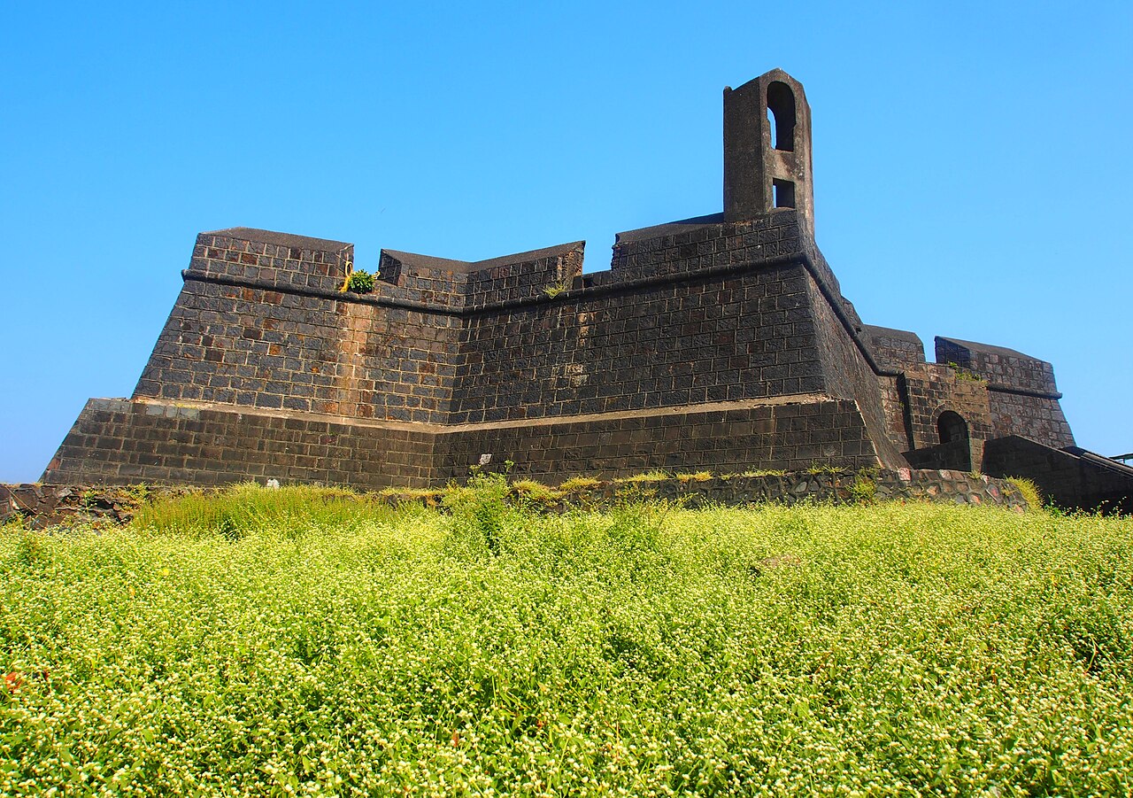
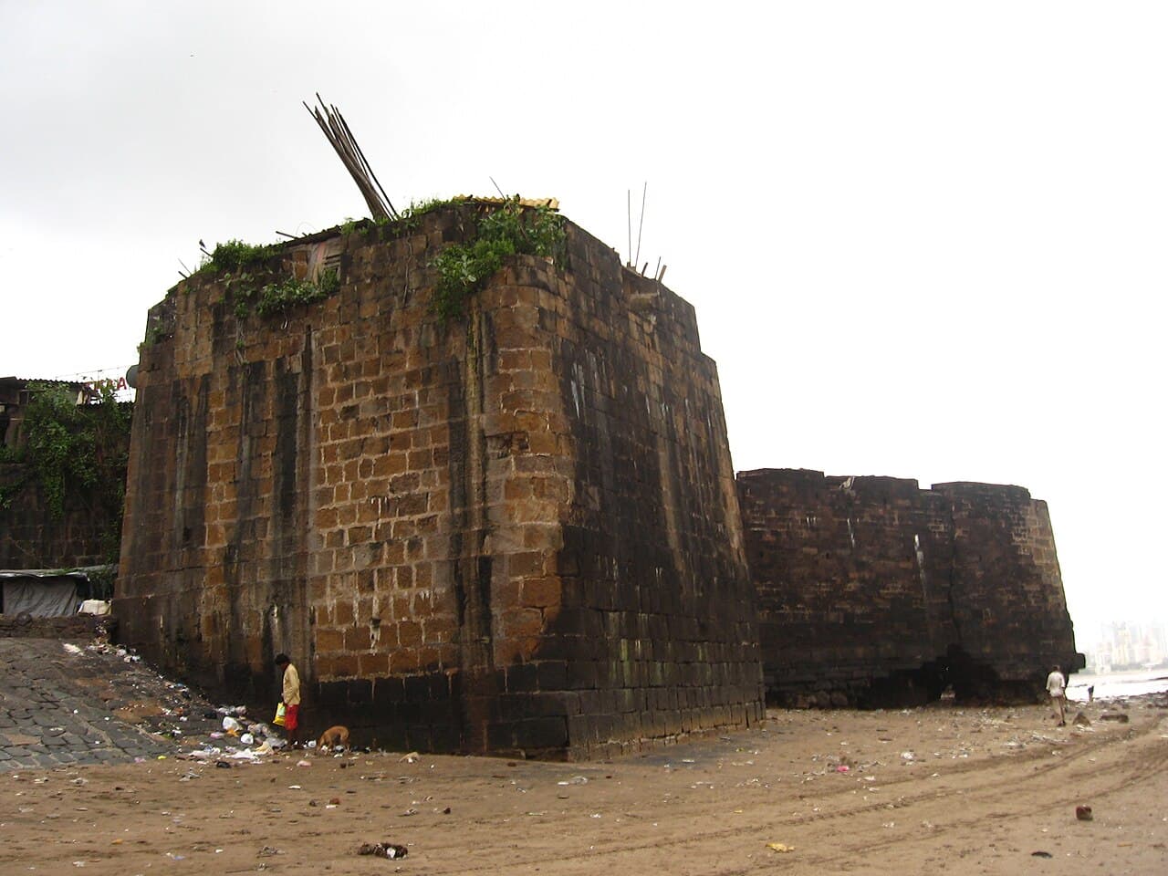
Mahim Fort is classified as a coastal fortress, built primarily for defense against naval threats. The fort's remains show a simple but effective design typical of coastal forts in the region, with thick stone walls constructed to withstand cannon fire and tidal forces. The walls were built using local basalt stone, a common building material in the Mumbai region.

The fort's layout was oriented to maximize visibility of the bay and surrounding waters. It included bastions at key points for mounting artillery and providing overlapping fields of fire. There was likely a main gate facing the landward side, with smaller entrances or sally ports to allow defenders to launch sorties or control access.

Within the fort, there would have been barracks, storage facilities for ammunition and provisions, and possibly a cistern or well to supply fresh water during sieges. However, much of the internal structure has been lost to time, and only the outer walls and some bastions remain visible today.

Current condition and preservation challenges

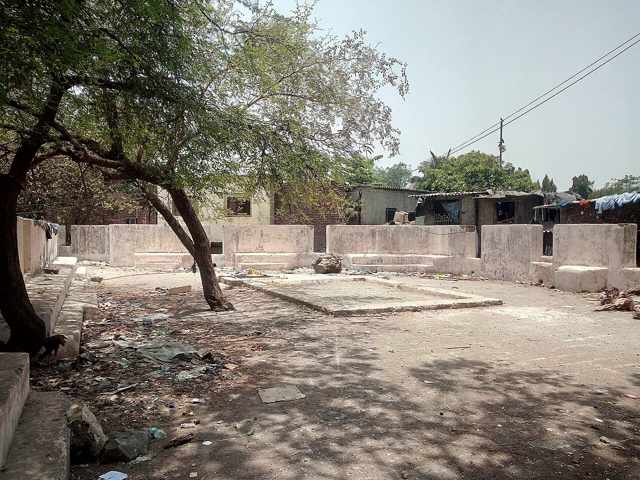
Today, Mahim Fort exists mostly as ruins, suffering from significant deterioration due to natural and human factors. The fort faces ongoing threats from tidal erosion, which gradually wears away the stone foundations and walls exposed to the sea. Additionally, the site has been affected by encroachment from nearby informal settlements, complicating conservation efforts.

Administrative neglect has also contributed to the fort's decline. Despite its historical significance, Mahim Fort has not received adequate protection or restoration by local authorities. The lack of maintenance and public awareness has left the fort vulnerable to further decay and loss.

Significance and cultural heritage

Although largely in ruins, Mahim Fort remains an important cultural and historical landmark in Mumbai. It represents the layered history of the region, reflecting the various powers that controlled the western coast of India over several centuries. The fort's position on Mahim Bay connects it to the maritime heritage of Mumbai, once a collection of islands and a key port city.

Efforts to raise awareness about the fort's condition have been made by heritage activists and local communities. Preservation of the fort would contribute to safeguarding Mumbai's coastal history and provide educational opportunities about the region's medieval and colonial past.

Visiting Mahim Fort

Visitors to Mahim Fort can explore the remains of the fort walls and enjoy views of Mahim Bay and the surrounding neighborhoods. However, due to its ruined condition and lack of formal facilities, caution is advised when visiting. The site is accessible from the Mahim area of Mumbai, but there are no established visitor services or guided tours.

Exploring the fort offers a glimpse into the strategic military architecture of coastal forts in India and a tangible connection to Mumbai's historical landscape.

Frequently asked questions (FAQ)

How do I get to Mahim Fort?
Mahim Fort is located in Mumbai, India, and can be easily accessed via public transport. The closest railway station is Mahim, and local buses and rickshaws also connect to the area, making it convenient for visitors.
What is the historical significance of Mahim Fort?
Mahim Fort was built in the 18th century by the Portuguese to defend their territory against invaders. It later served as a strategic military outpost for the British, reflecting the colonial history of Mumbai and the fort's importance in maritime defense.
When was Mahim Fort constructed?
Mahim Fort was constructed in 1534 by the Portuguese, with later modifications by the British. Its construction marks a significant period in Indian history as it coincides with European colonial expansion in the region.
Can I visit Mahim Fort any time of the year?
Yes, Mahim Fort is open to visitors year-round, but the best time to visit is during the cooler months from November to February. During this period, the weather is pleasant, making it ideal for exploration.
Why is Mahim Fort considered an architectural gem?
Mahim Fort showcases a unique blend of Portuguese and British architectural styles, featuring impressive stone walls and bastions. Its design reflects the military engineering of the time and provides a glimpse into the historical significance of fortifications in Mumbai.
Is it possible to access the fort's interiors?
While the exterior of Mahim Fort is accessible to visitors, the interiors may not always be open to the public due to safety and preservation concerns. However, you can still enjoy the panoramic views and surrounding area.
What are the opening hours for Mahim Fort?
Mahim Fort does not have specific opening hours as it is an open-site fort. Visitors can explore the fort at any time, but it's advisable to visit during daylight for safety and better visibility of the surroundings.
Are there any nearby attractions to visit after Mahim Fort?
Yes, nearby attractions include the beautiful Mahim Beach and the historic Mahim Dargah. These sites provide additional cultural experiences and scenic views, making it easy to plan a full day of exploration in the area.
What are the ticket prices for visiting Mahim Fort?
There is no entrance fee to visit Mahim Fort, making it a budget-friendly option for travelers. This allows visitors to enjoy the historical site without any financial constraints.

Photo gallery

Mahim Fort
Click to view

Photo by Nicholas (Nichalp)•CC BY-SA 3.0

1 photo • Click any image to view in full screen

Information

Coastal Castle / Fortress

Current owner

Municipality

Loading map...

Visitor reviews

No reviews yet. Been here? Write the first review and help other travelers!

Write the first review

Visited this castle? Share your experience

Your review helps other travelers and adds first-hand knowledge to our encyclopedia.
Write a review

(5/5)

0/2000 characters

Your review will be visible after admin approval

Nearby castles

2 km
Castella de Aguada — India castle

Castella de Aguada

Mumbai, India

Castella de Aguada, also known as Bandra Fort, is a 17th-century bastioned fortress located at Land's End in Bandra, Mumbai, India. Constructed by the Portuguese in 1640, the fort was strategically positioned as a watchtower overseeing Mahim Bay, the Arabian Sea, and the southern island of Mahim. Its location allowed the Portuguese to monitor maritime activity and protect their interests along the western coast of India during the Renaissance period. Origins and strategic importance The fort's name, Castella de Aguada, is a corruption of the Portuguese term Castelo da Aguada, meaning "Fort of the Waterpoint." This name reflects the fort's crucial role as a freshwater source for Portuguese ships navigating the Arabian Sea. The fort was originally called Forte de Bandorá or Bandra Fort by its builders. The availability of a reliable freshwater spring made it an essential stopover for replenishing water supplies during long voyages. Its strategic significance increased notably after 1661, when the Portuguese ceded the seven islands of Bombay to the English. Castella de Aguada then became a key lookout point to monitor naval movements near the newly acquired English territories, enhancing its military value. Architectural features and layout The fort is built over multiple levels, rising from sea level to an altitude of approximately 24 metres (79 feet). It features bastioned walls typical of Portuguese military architecture designed to withstand cannon fire and provide overlapping fields of fire against attackers. The fort's bastions allowed defenders to cover the surrounding coastline and the approaches from the sea effectively. Constructed primarily of local basalt stone, the fort incorporates thick ramparts, parapets, and embrasures for artillery. Its design reflects the Renaissance-era military architectural principles introduced by the Portuguese, emphasizing both defense and the fort's role as a water supply station. Within the fort's precincts, there are remnants of watchtowers and a freshwater spring, which was the source of the fort's name. The fort's walls enclose a courtyard area that would have housed soldiers and stored supplies necessary for maintaining a garrison and supporting naval operations. Historical context and later use During its operational period, Castella de Aguada served as a vital maritime outpost for the Portuguese empire in western India. It functioned as a lookout post to guard against rival European powers and local threats, ensuring Portuguese dominance over the coastal trade routes. Following the transfer of Bombay to the British, the fort's military importance declined, and it eventually fell into disuse. Despite this, the fort remains an important heritage site reflecting the colonial history of Mumbai and the broader region. Preservation and cultural significance Today, Castella de Aguada stands as a partially preserved monument open to the public. Its ruins attract visitors interested in colonial history and coastal fortifications. The fort has also gained popularity as a filming location for several Hindi films, including "Dil Chahta Hai" and "Buddha Mil Gaya." Efforts to maintain and preserve the fort focus on stabilizing its structures and promoting awareness of its historical value. The fort's scenic location overlooking the Arabian Sea and its connection to Mumbai's colonial past make it a notable cultural landmark. Visiting Castella de Aguada Visitors can explore the fort's walls, bastions, and the freshwater spring area while enjoying panoramic views of the sea and the Mumbai skyline. The site offers insight into Portuguese military architecture and the maritime history of the region.

Renaissance (15th–17th c.)
Details
2.6 km
Riwa Fort — India castle

Riwa Fort

Mumbai, India

Riwa Fort, locally called Kala Qilla or Black Fort, is a historic fortress located on the banks of the Mithi River in central Mumbai (formerly Bombay), India. Though now in a state of ruins, the fort holds significant historic importance due to its strategic location and role in the maritime defense of the region during the early 18th century. Situated in the midst of the Dharavi slums, the fort's remains offer a glimpse into the colonial and regional conflicts that shaped Mumbai's development.The site originally consisted of marshy land that served as a natural boundary dividing territories controlled by the British East India Company and the Portuguese. This strategic position on the Mithi River made it a crucial point for controlling access to the island of Bombay and protecting it from naval incursions.Historical context and constructionThe fort was commissioned during the tenure of John Horne, the Governor of Bombay, as part of a defensive strategy against the aggressive maritime activities of the Maratha naval leader Kanhoji Angre. Kanhoji Angre was a prominent admiral of the Maratha Empire who controlled significant portions of the western coast of India and was known for his naval raids against European colonial powers.Construction of the fort likely took place in the early 18th century, although precise dates are not well documented. The fort's primary purpose was to serve as a coastal defense installation to monitor and repel attacks by Maratha forces, particularly those led by Angre, who was a formidable adversary to British interests in the region.Architectural features and layoutWhile much of Riwa Fort lies in ruins today, historical records and remaining structures indicate it was a modest defensive fortification typical of early colonial coastal forts in India. The fort's walls were constructed from locally available stone and mortar, designed to withstand naval bombardment and provide vantage points for artillery placement.The fort's location on the riverbank allowed for control over river access and facilitated surveillance of maritime traffic. It likely featured battlements, watchtowers, and a fortified gatehouse to regulate entry. Its compact size suggests it was intended more as a military outpost than a large garrison or administrative center.Military significance and conflictsRiwa Fort played a role in the ongoing conflicts between the British colonial authorities and the Maratha Empire during the 18th century. The Marathas, under Kanhoji Angre, frequently challenged British naval dominance along the western coast, and the fort was part of the British effort to secure Bombay against these threats.Despite British efforts, the fort was eventually captured by the Marathas, reflecting the shifting control of the region during this turbulent period. This capture underscored the strategic importance of the fort and the contested nature of coastal defenses in western India.Decline and present conditionFollowing the decline of Maratha naval power and the consolidation of British control over Bombay, Riwa Fort lost its military relevance. Over time, it fell into disrepair and was largely abandoned. Today, the fort remains in a dilapidated state amid the dense urban sprawl of Dharavi, one of Asia's largest slums.The fort is under the care of the Maharashtra Directorate of Archaeology and Museums, which recognizes its heritage value. However, the site faces challenges from urban encroachment and environmental degradation, limiting preservation efforts.Significance and heritage valueDespite its ruined condition, Riwa Fort stands as a testament to the complex colonial and regional power struggles that shaped Mumbai's history. It reflects the military architecture and strategic thinking of early 18th-century coastal defenses in India.The fort's location near the Mithi River and within a rapidly urbanizing area highlights issues of heritage conservation amid modern development pressures. It remains a subject of interest for historians, archaeologists, and those studying the maritime history of the western Indian coast.

Details
2.9 km
Worli Fort — India castle

Worli Fort

Mumbai, India

Worli Fort is a historic 17th-century bastioned fortress located on Worli Hill in Mumbai, India. Constructed by the British East India Company around 1675, the fort played a crucial role in monitoring and defending the waters of Mahim Bay during a period when Mumbai was composed of seven separate islands. Contrary to common misconceptions attributing its construction to the Portuguese, the fort was established to serve as a strategic lookout for enemy ships approaching the area.The fort's location on Worli Hill provided a commanding vantage point over the surrounding sea and land routes, enabling early warnings against naval threats. Its design reflects typical bastioned fortress features of the period, including thick defensive walls and bastions intended to mount cannons, which were essential for coastal defense in the Renaissance era.Historical context and strategic importanceDuring the late 17th century, the region that is now Mumbai was a fragmented archipelago of seven islands. The British, having acquired the islands from the Portuguese as part of the dowry of Catherine of Braganza in 1661, sought to fortify their new possession against rival colonial powers and local threats. Worli Fort was part of a network of fortifications designed to secure the harbor and protect the growing British settlement.The fort was primarily used as a lookout post to monitor enemy ship movements and to provide early warnings to the British authorities in Bombay (now Mumbai). Its position overlooking Mahim Bay was critical for controlling access to the harbor and safeguarding the maritime trade routes that were vital to the British East India Company's commercial interests.Architectural features and designThe fort exhibits characteristics typical of a bastioned fortress, a style that evolved to meet the demands of artillery warfare. The thick stone walls and bastions were designed to withstand cannon fire and to allow defenders to mount their own artillery pieces for effective coastal defense.Although the fort is relatively small compared to other contemporary fortifications, its robust construction and strategic placement made it an effective military installation. The walls enclose a compact area with limited internal structures, primarily serving as a lookout and defensive position rather than a large garrison.Defensive structuresThe fort's bastions provided platforms for cannons that could cover the approaches from the sea. The walls are built from local stone, and the fort's elevated position enhanced its defensive capabilities by providing clear lines of sight over the bay and surrounding areas.Access and layoutAccess to the fort is gained via a narrow pathway winding up Worli Hill. The interior contains remnants of small buildings that may have served as quarters or storage for ammunition and supplies. The overall layout is simple, reflecting its primary function as a lookout rather than a fully developed military base.Worli and its cultural heritageThe area surrounding Worli Fort is home to one of Mumbai's oldest fishing communities, which has persisted for centuries despite the city's rapid urbanization. The village near the fort maintains traditional fishing practices, contributing to the cultural fabric of the region.In addition to its historical and military significance, the Worli Hill area is notable for its geological features and fossil discoveries. The hill's sedimentary rock formations have attracted interest from geologists and paleontologists, adding a scientific dimension to the site's importance.Current condition and visitor informationToday, Worli Fort stands as a well-preserved monument open to the public. Visitors can explore the fort's walls and enjoy panoramic views of Mahim Bay and the surrounding cityscape. The site offers a glimpse into Mumbai's colonial past and its maritime defense history.The fort is accessible by foot from the surrounding neighborhoods, and its elevated position makes it a popular spot for photography and sightseeing. While the internal structures are mostly ruins, the fort's walls and bastions remain intact, providing a tangible connection to the city's 17th-century military architecture.

Renaissance (15th–17th c.)
Details