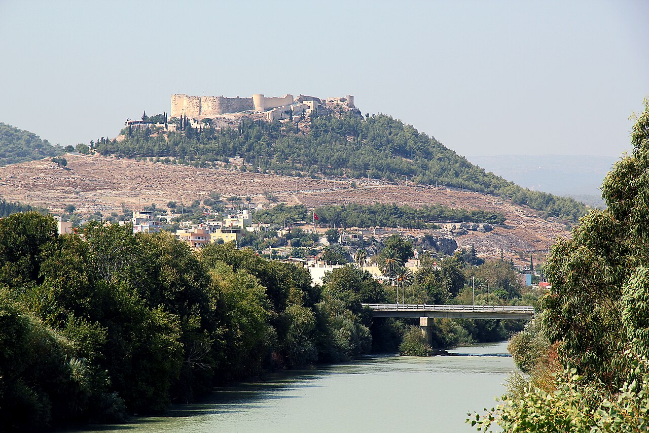
Liman Castle — Turkey castle

Liman Castle

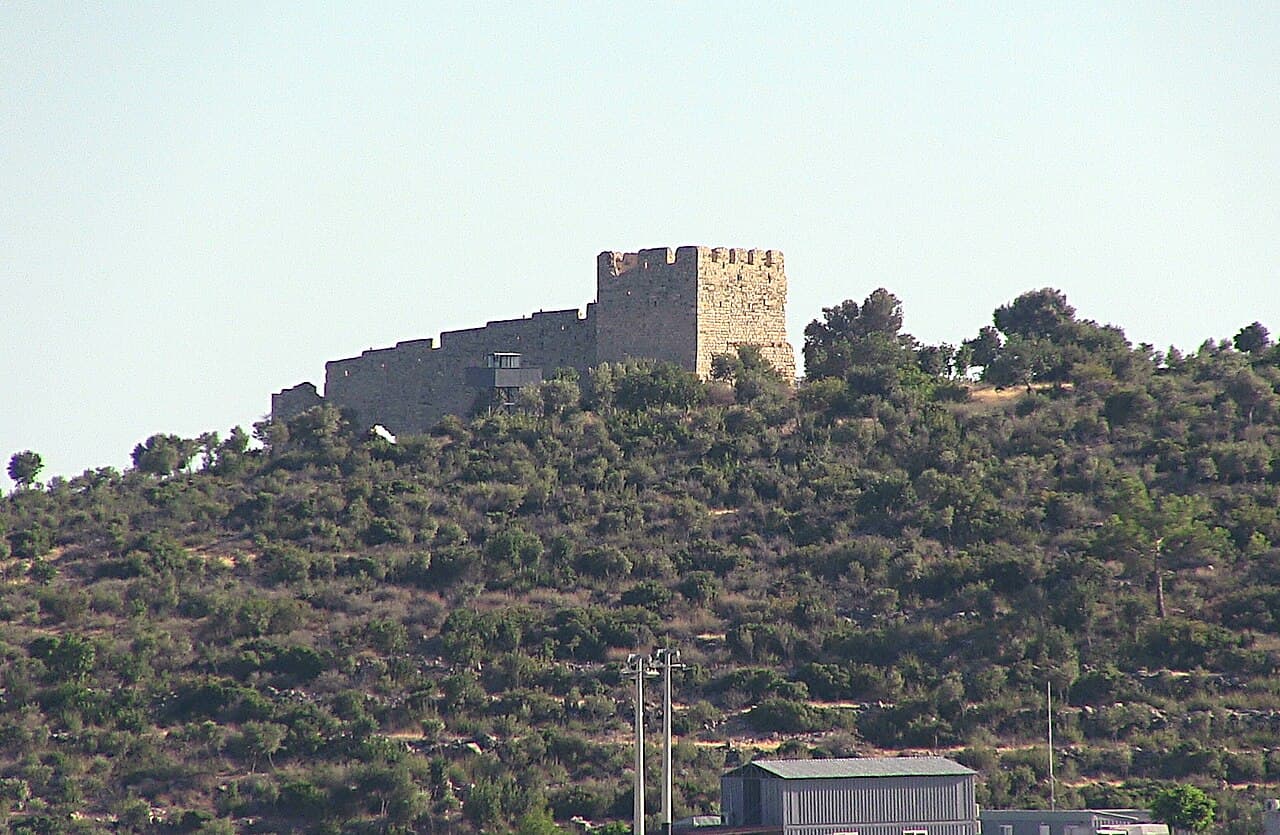
Liman castle ruins in turkey
Ruins

Liman Castle is an ancient fortress located in Turkey, known today primarily for its archaeological ruins. Though the exact city location remains uncertain, the castle’s remnants provide valuable insights into the region’s historical defensive strategies and architectural practices.

The castle’s origins likely date back to the medieval period, serving as a coastal fortification. Its strategic position would have been crucial for controlling maritime routes and protecting the surrounding area from naval threats. Despite its current ruined condition, the site offers a glimpse into the construction techniques and military architecture of its time.

Historical context and significance

Liman Castle played a role in the defense network along the Turkish coast, which has been a crossroads of civilizations for centuries. The castle’s location suggests it was part of a broader system of fortifications designed to monitor and secure important sea lanes. This region witnessed various empires and cultures, including Byzantine and Ottoman influences, which may have impacted the castle’s development and use.

Architectural features and layout

The surviving ruins indicate a typical medieval fortification style, with remnants of stone walls and defensive structures. Although much of the castle has succumbed to time and natural forces, traces of battlements and possible watchtowers can be discerned, hinting at its original defensive purpose. The layout likely included a courtyard and living quarters for garrison troops, though these remain largely unexcavated.

Construction materials and techniques

The castle was primarily constructed using locally sourced stone, a common practice in the region for durability and defense. The masonry work reflects the skills of medieval builders who balanced fortification needs with available resources. The use of thick walls and strategic positioning on elevated ground would have enhanced its defensive capabilities.

Archaeological research and preservation

As an archaeological site, Liman Castle has attracted interest from historians and archaeologists aiming to uncover more about its origins and role in regional history. Excavations and studies continue to reveal artifacts and structural details that contribute to understanding the castle’s past. Preservation efforts focus on stabilizing the ruins to prevent further deterioration while allowing public access for educational purposes.

Visitor experience and accessibility

Visitors to Liman Castle can explore the ruins and appreciate the historical ambiance of the site. The castle’s remote location and partial preservation mean that access may be limited, and facilities are minimal. It is advisable for visitors to prepare accordingly and consider guided tours if available to gain deeper insights into the site’s significance.

Cultural and heritage importance

Liman Castle represents a tangible connection to Turkey’s medieval coastal defenses and maritime history. The ruins serve as a reminder of the region’s strategic importance and the complex interactions between different empires over centuries. Efforts to preserve and study the site contribute to safeguarding this heritage for future generations.

Frequently asked questions (FAQ)

What is the historical significance of Liman Castle?
Liman Castle, located in Turkey, dates back to the Byzantine period and played a crucial role in the region's defense against invasions. Its strategic position allowed it to control trade routes and protect the surrounding area, making it an important landmark throughout history.
When was Liman Castle built?
Liman Castle was constructed in the 10th century during the Byzantine Empire's reign. Over the centuries, it has undergone various renovations and expansions, reflecting the architectural styles of different periods.
What are the opening hours for Liman Castle?
Liman Castle is open to visitors daily from 9 AM to 7 PM. However, it is advisable to check for seasonal changes in hours, especially during the winter months.
Is it possible to access Liman Castle by public transport?
Yes, visitors can easily access Liman Castle via local buses or taxis from nearby towns. The castle is well-signposted, making it straightforward to find for tourists.
Can I buy tickets in advance for Liman Castle?
Tickets for Liman Castle can be purchased on-site at the entrance. Unfortunately, advance ticket purchases are not available, so it's best to arrive early to avoid long lines.
What is the best time to visit Liman Castle?
The ideal time to visit Liman Castle is during the spring and fall months when the weather is mild and comfortable for exploring. Summer can be quite hot, while winter may bring chilly temperatures.
Are there any nearby attractions to visit after Liman Castle?
Yes, nearby attractions include the ancient ruins of Ephesus and the picturesque town of Selçuk. Both locations offer rich historical experiences and beautiful landscapes, making them perfect additions to your visit.
How do I get the most out of my visit to Liman Castle?
To enhance your visit, consider hiring a local guide who can provide in-depth historical insights and stories about the castle. Additionally, exploring the surrounding areas and taking in the views from the castle's towers can greatly enrich your experience.

Photo gallery

Liman Castle
Click to view

Photo by Kpisimon•CC BY-SA 3.0

1 photo • Click any image to view in full screen

Information

Archaeological Site / Ruins

Loading map...

Visitor reviews

No reviews yet. Been here? Write the first review and help other travelers!

Write the first review

Visited this castle? Share your experience

Your review helps other travelers and adds first-hand knowledge to our encyclopedia.
Write a review

(5/5)

0/2000 characters

Your review will be visible after admin approval

Nearby castles

6.3 km
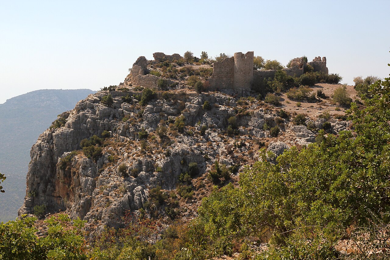
Tokmar Castle — Turkey castle

Tokmar Castle

North of the D400-road, Turkey

Tokmar Castle, locally known as Tokmar Kalesi, is a striking medieval fortress perched on a rocky cliff overlooking the village of Akdere in the Mersin province of Turkey. Situated in the historic region of Cilicia, this castle offers a remarkable glimpse into the military and residential architecture of the Armenian Kingdom of Cilicia during the High Medieval period. Its strategic location on a mountain spur, approximately 400 meters above the valley below, provided commanding views over the surrounding landscape and the ancient harbor of Palaiai, located about 4 kilometers to the east. The castle's origins date back to the late 12th century, when it was constructed by skilled Armenian masons who modeled it after nearby fortresses such as Yılankale. Although the castle's original medieval name remains uncertain, architectural and historical evidence suggests that Tokmar Castle may correspond to the fortress known in contemporary sources as Castellum Novum in Latin or Norpert in Armenian, both meaning "new castle." This identification is supported by records indicating that the castle was held by the Armenian noble Sebastos Heri around 1198-1210. Historical significance and political context During the early 13th century, the castle played a pivotal role in the complex political and military alliances of the region. In 1210, King Leo I of the Armenian Kingdom of Cilicia transferred control of Castellum Novum (likely Tokmar Castle) along with Silifke Castle to the Knights Hospitaller. This transfer was part of a strategic agreement in which the Knights provided a military force of 400 knights to support the Armenian kingdom's defense against the Seljuk Turks, along with annual payments. While Silifke Castle was returned to Armenian control in 1226, Tokmar Castle disappears from the historical record after this period, leaving its subsequent fate somewhat obscure. Later historical phases saw the castle come under the control of the Karamanid dynasty, a powerful Anatolian beylik, before ultimately being absorbed into the expanding Ottoman Empire in the late 15th century. The castle is referenced in several historical maps from this era, including the 1490 Rizo-Portolan map as "lo chastel chamandrachi" and Richard Kiepert's map as "Burg Palaea," names associated with the nearby ancient port of Palaiai. These cartographic records underscore the castle's continued strategic importance along the Mediterranean coast. Architectural features and layout Tokmar Castle is classified as a hill castle, uniquely adapted to its rugged terrain on the rocky plateau known as Kale Tepesi. The fortress occupies an irregular polygonal enclosure approximately 50 by 70 meters, with walls that closely follow the natural contours of the site. The southern side benefits from steep natural cliffs that provide formidable defense, while the northern side, more accessible and vulnerable, is reinforced by four semicircular bastions. These bastions originally rose to multiple stories and featured narrow arrow slits designed to allow defenders to repel attackers while remaining protected. The curtain walls are constructed from finely cut limestone blocks arranged in two layers. The outer faces are composed of bossed ashlar masonry, characterized by roughened stone surfaces that enhance structural strength and grip. These walls are about 1.5 meters thick, reflecting the military engineering expertise of the Armenian masons. Although much of the battlements and parapets have collapsed over time, fragments of the wall walkways remain visible, hinting at the castle's former defensive capabilities. Defensive structures On the eastern side of the castle, the foundations of a zwinger—a narrow outer ward designed to trap and expose attackers—are still discernible. The original main gate and its surrounding facade have not survived, but the presence of the zwinger indicates a layered defense system typical of Armenian fortifications. The northern bastions, with their multiple stories and arrow slits, emphasize the importance of protecting the more accessible approaches to the fortress. Residential and internal buildings Within the castle's courtyard, particularly in the southeastern sector, the remains of a residential building stand out. This structure suggests that Tokmar Castle served not only as a military stronghold but also as a noble residence overseeing the surrounding territory. Other internal buildings have been lost or destroyed, but the surviving ruins provide valuable insights into the castle's dual function as a fortress and a domicile. Geographical and strategic importance Located approximately three kilometers from the Mediterranean Sea, Tokmar Castle's elevated position allowed it to control key land routes and oversee maritime activities near the ancient harbor of Palaiai. The castle's vantage point on Kale Tepesi offered expansive views toward the sea and the valley below, making it an ideal site for monitoring enemy movements and securing the western borders of the Armenian Kingdom of Cilicia. The castle's proximity to other significant fortifications, such as Silifke Castle to the northeast and Yılankale nearby, formed a network of defenses that protected the region from Seljuk incursions and other threats. The strategic handover of Tokmar Castle to the Knights Hospitaller further underscores its military value during the turbulent 12th and 13th centuries. Modern condition and visiting information Today, Tokmar Castle remains a well-preserved ruin accessible to visitors free of charge. The castle's exterior walls largely stand intact, offering a clear impression of its original size and layout, while the interior spaces have mostly been lost to time. Its commanding views and historical significance make it a popular destination for tourists interested in medieval Armenian architecture and the history of Cilicia. The site was studied in the early 1980s by researchers Hansgerd Hellenkemper and Friedrich Hild, who highlighted its role as a noble residence and military fortress. Visitors can explore the rugged terrain and appreciate the blend of natural and constructed defenses that characterize this remarkable example of Armenian fortification architecture. While the castle lacks extensive visitor facilities, its scenic location and evocative ruins offer a rewarding experience for those willing to hike up the hill and delve into the rich history of the region. The combination of natural cliffs, fortified walls, and strategic bastions makes Tokmar Castle an outstanding example of High Medieval Armenian military architecture in Cilicia. Related sites and historical context Tokmar Castle is part of a broader historical landscape shaped by the Armenian Kingdom of Cilicia, which flourished from the late 11th to the late 14th centuries. This kingdom was known for its distinctive fortifications, blending Western European and Byzantine architectural influences with local traditions. Nearby castles such as Yılankale and Silifke Castle share similar construction techniques and historical trajectories, reflecting the region's strategic importance during the Crusades and the Seljuk conflicts. The castle's history also intersects with the military orders, particularly the Knights Hospitaller, who played a significant role in the defense of the Armenian kingdom and the broader Levantine frontier. The transfer of Tokmar Castle to the Hospitallers in 1210 illustrates the complex alliances and power dynamics of the period. Today, Tokmar Castle stands as a testament to the rich medieval heritage of Cilicia and offers valuable insights into the military, political, and cultural history of this crossroads region between Europe and Asia.

High Medieval (11th–13th c.)
Details
13.1 km
Silifke Castle — Turkey castle

Silifke Castle

Kale Yolu, Turkey

Silifke Castle, locally known as Silifke Kalesi, is a prominent high medieval fortress perched on a strategic hilltop in the town of Silifke, within the Mersin province of southern Turkey. This imposing hill castle stands near the delta of the Göksu River (ancient Calycadnus), overseeing the vital coastal road and the entrance to the Göksu canyon. Its location has made it a key defensive stronghold throughout history, witnessing a complex succession of empires, cultures, and military powers. The castle occupies an elongated, oval-shaped outcrop rising approximately 86 meters above sea level. This natural elevation provided commanding views over the surrounding landscape, including the ancient city of Seleucia adjacent to the modern town of Silifke. The fortress's strategic position allowed control over important land and river routes connecting Cilicia to the Taurus Mountains and the Mediterranean coast. Early history and byzantine origins The earliest fortifications on this site date back to the Byzantine Empire, constructed between the 7th and 11th centuries as a defensive bastion against Arab incursions during a turbulent period of frontier warfare. The fortress was initially built atop the ruins of an ancient acropolis, integrating earlier structures into its foundations. In the late 11th century, Byzantine Emperor Alexios I Komnenos reinforced Silifke's defenses by dispatching the royal eunuch Eustathius to fortify the castle and nearby Korykos. This move was part of a broader strategy to secure the region against the advancing Crusaders, particularly the Norman leader Bohemund I de Guiscard. The fortress maintained a significant garrison under the command of a Strategus Strabo, emphasizing its military importance. Armenian kingdom and the knights hospitaller By the late 12th century, Silifke Castle had passed from Byzantine to Armenian control, specifically under Baron Leo II, who later became King Leo I of Armenia. This transfer marked a turning point, as the castle would remain outside Byzantine hands thereafter. In 1210, King Leo I granted Silifke Castle to the Knights Hospitaller as part of a military alliance to defend the Armenian kingdom against the Seljuk Turks. The Hospitallers undertook extensive rebuilding efforts, transforming Silifke into a formidable fortress between 1210 and the early 1220s. Commanders such as Guérin de Montaigu, Aimery de Pax, and Féraud de Barras oversaw the construction of massive walls, towers, and other defensive structures. The castle successfully withstood a siege in 1216/17 by the Sultan of Konya, demonstrating its enhanced fortifications and strategic resilience. This period also saw Silifke serve as a refuge for Isabella I, Queen of Armenia, during political turmoil following the poisoning of her husband Philip of Antioch in 1226. Architectural features and layout Silifke Castle is characterized by its oval-shaped hilltop layout, measuring approximately 250 meters from west to east and 75 meters in width. The fortress is surrounded by a dry moat and once featured a crenellated curtain wall punctuated by twenty-three towers, of which ten still survive today. Many of these towers retain their original vaulted ceilings, a testament to the medieval stone masonry techniques employed. The outer walls are constructed from finely cut ashlar masonry, featuring large, well-drafted stone blocks that provide both strength and aesthetic appeal. The fortress's design includes a central courtyard around which residential and service buildings were arranged, creating a self-sufficient community within the walls. Significant ruins inside the castle include a palace complex, storage chambers, a cistern for water collection, and a dungeon likely used for confinement or storage. A mosque dating from the emirate period reflects the Islamic architectural influence during later Ottoman control. Archaeological excavations have uncovered numerous Armenian inscriptions, providing evidence of the castle's historical connection to the Armenian Kingdom of Cilicia and their construction activities. The main gate, located on the northern side, served as the primary entrance and defensive choke point. Later history and cultural significance Following the Armenian period, Silifke Castle became part of the Karamanid Beylik in the 14th century, a Turkish principality that succeeded Armenian rule in the region. In 1471, the fortress was conquered by Gedik Ahmet Pasha and incorporated into the Ottoman Empire. The large breach in the eastern wall is attributed to this conquest, marking the end of its medieval military role. Historical travelers and scholars have documented the castle's features over centuries. The 15th-century Italian traveler Giosafat Barbaro described its ancient sarcophagi, rock-cut tombs, and formidable iron gates. Ottoman traveler Evliya Çelebi in the 17th century noted the presence of twenty-three towers and a mosque built during Sultan Bayezid II's reign. British naval officer Francis Beaufort and French orientalist Victor Langlois recorded Armenian inscriptions and other details in the early 19th century. Modern archaeological surveys and excavations, particularly those conducted between 2010 and 2020, have revealed extensive information about the castle's layered history, architectural evolution, and cultural importance. Today, Silifke Castle stands as a significant monument reflecting the diverse historical influences of the Mediterranean and Anatolian regions. Visiting silifke castle today Currently, Silifke Castle is freely accessible to visitors. The outer walls and many towers remain standing, providing a glimpse into its former grandeur. While much of the interior structures have fallen to ruin, the site offers a fascinating exploration of medieval military architecture and the historical narratives embedded within its stones. Visitors can observe the castle's dry moat, the surviving towers with their vaulted ceilings, and the remains of the palace and mosque. The panoramic views from the hilltop are particularly striking, overlooking the Göksu River valley and the surrounding landscape. Silifke Castle remains a valuable cultural heritage site, attracting historians, archaeologists, and tourists interested in the rich medieval history of Cilicia and the broader eastern Mediterranean region.

High Medieval (11th–13th c.)
Details
27.2 km

Meydan Castle

East of Silifke Yolu, Turkey

Meydan Castle, also known locally as Meydankale or Meydan Kalesi, is a historic fortress located on a spur north of the village of İmamlı in the province of Mersin, Turkey. This castle should not be confused with another similarly named Armenian castle located in the Taurus Mountains to the northeast. Meydan Castle stands as a significant example of ancient military architecture in the region, primarily dating back to the Seleucid Empire period (312 BC–63 BC). The castle was likely more of a fortified settlement or fortress rather than a traditional residential castle. Its strategic position on the corner of a gently sloping plateau, bordered by a canyon to the north and northeast and a slope to the west, allowed it to control an important ancient road. This road connected the Mediterranean Sea with the ancient sister cities of Dioceasarea and Olba (modern-day Uzuncaburç), making Meydan Castle a critical military and trade vantage point. Architecture and layout The castle's construction is notable for its use of polygonal masonry, a technique characteristic of Seleucid architecture. This style involves carefully fitted stone blocks with irregular shapes that interlock without the use of mortar. Later repairs and additions to the castle employed bossage masonry, which features stones with a roughened surface projecting beyond the wall face. The site features several important architectural elements, including the ruins of an observation tower at the highest point of the spur, which would have provided extensive views over the surrounding landscape and the vital road beneath. Defensive bastions reinforce the corners and vulnerable points along the walls, while numerous rooms and cisterns indicate the castle's capacity to support a garrison and inhabitants during sieges or extended occupation. Additionally, a necropolis on the site suggests the presence of a settled community or a military garrison with burial grounds nearby. The castle's layout is stretched out along the plateau, adapting to the natural topography to maximize defensive advantages. Historical context and significance While the exact historical records and original names of Meydan Castle during the Hellenistic and Roman periods remain unknown, its architectural style and strategic location provide clues to its importance. The castle's control over a key route between the Mediterranean and inland cities would have made it a valuable military asset during the turbulent times of the Seleucid Empire and subsequent eras. Its continued use and rebuilding in later periods indicate that Meydan Castle retained its strategic value well beyond its initial construction. However, the lack of detailed historical documentation means much of its story remains a mystery, inviting further archaeological investigation. Visiting meydan castle The castle is freely accessible to visitors, though reaching it requires some effort. Visitors must travel along a small unpaved road to reach the barnyard entrance of a local farm. It is customary and respectful to ask the farmer for permission to cross the yard to access a small gate adjacent to the property. From this gate, the ruins are just a few minutes' walk away, although no formal paths or signage guide the way. The site is heavily overgrown with small trees and prickly bushes, which can obscure many features, including the numerous cistern openings. Caution is advised when exploring the area to avoid injury. Despite the challenges, the well-preserved polygonal masonry and the castle's commanding position offer a rewarding experience for visitors interested in ancient military architecture and history. Natural setting and strategic location Meydan Castle's location on a plateau corner with natural defenses provided by a canyon and slopes made it a formidable fortress. The adjacent ancient road was a vital artery for trade and military movements, linking coastal and inland regions. This setting highlights the castle's role in controlling movement and protecting regional interests during the Seleucid and later periods. Architectural features and construction techniques The use of polygonal masonry is a hallmark of Hellenistic fortifications, allowing for strong, durable walls capable of withstanding attacks and natural erosion. The later incorporation of bossage stones suggests ongoing maintenance and adaptation of the fortress to evolving defensive needs. The presence of cisterns reflects the importance of water storage for sustaining inhabitants during sieges. These cisterns, often hidden by vegetation, demonstrate advanced engineering to ensure survival in a potentially hostile environment. Archaeological potential and preservation Meydan Castle remains partially preserved, with much of its structure still identifiable despite overgrowth and the passage of time. The site offers significant archaeological potential to uncover more about the region's military history and settlement patterns during the Hellenistic and Roman periods. Visitors and researchers alike benefit from the castle's relatively undisturbed condition, though care must be taken due to the natural hazards posed by dense vegetation and uneven terrain.

Details