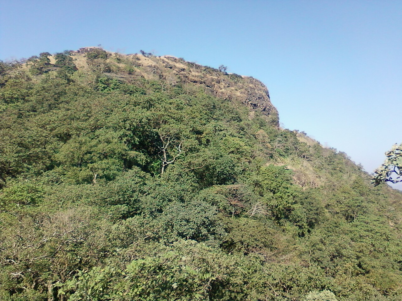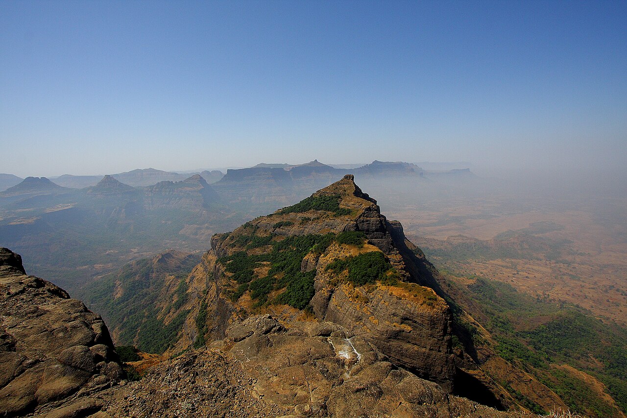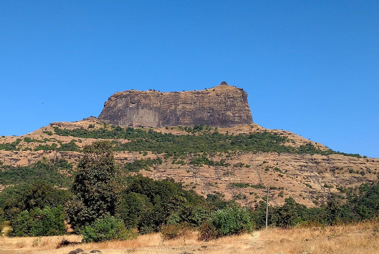
Harihar Fort — India castle

Harihar Fort

Harihar Fort: ancient hillfort with rock-cut steps near Nashik
Maharashtra, India
Ruins

Harihar Fort, also known as Harshagad, is a historic hillfort situated in the Nashik district of Maharashtra, India. Located approximately 40 kilometres from Nashik, 48 kilometres from Igatpuri, and 40 kilometres from Ghoti Budruk, this fort is perched atop a steep hill and is renowned for its distinctive rock-cut steps that attract numerous visitors and trekkers each year.

Geographical setting and strategic importance

The fort occupies a commanding position on a hill, providing extensive views over the surrounding landscape of the Western Ghats. Its elevated location was strategically chosen to monitor and control the trade routes and movements through the region. The rugged terrain and natural defenses made it a formidable stronghold in its time.

Architectural features and construction

Harihar Fort is classified as a hillfort and is primarily constructed from local stone. One of its most remarkable features is the series of rock-cut steps carved directly into the hillside, which are both a practical means of ascent and a unique architectural element. These steps are steep and uneven, reflecting the fort's ancient origins and the challenges of its terrain.

The fort's remains include sections of stone walls, gateways, and bastions, though much of the structure is in ruins today. The fortifications were designed to exploit the natural topography, enhancing defense capabilities against invaders.

Historical context and significance

While detailed historical records about Harihar Fort are limited, it is known to have been an important military outpost in the region. The fort likely dates back to the medieval period, serving various rulers who controlled the Nashik area. Its strategic location made it a valuable asset in controlling local territories and trade routes.

Over time, the fort fell into disuse and was abandoned, leading to its current state as archaeological ruins. Despite this, Harihar Fort remains a significant cultural and historical landmark, reflecting the martial architecture and defensive strategies of its era.

Visiting Harihar Fort

Today, Harihar Fort is a popular destination for hikers and history enthusiasts. The trek to the summit via the rock-cut steps offers both a physical challenge and scenic views of the surrounding hills and valleys. Visitors can explore the remnants of the fort's walls and bastions while enjoying the natural beauty of the Western Ghats.

Due to its rugged terrain and partial preservation, visitors are advised to wear appropriate footwear and exercise caution. The fort is accessible year-round, with the cooler months being the most comfortable for trekking.

Preservation and cultural importance

As a site of archaeological ruins, Harihar Fort is part of the region's cultural heritage. Efforts to preserve the fort focus on maintaining its structural remains and promoting awareness of its historical value. The fort contributes to the understanding of medieval military architecture in Maharashtra and serves as a tangible link to the area's past.

Frequently asked questions (FAQ)

How do I reach Harihar Fort from Nashik?
Harihar Fort is located about 40 kilometres from Nashik. Visitors can reach the base village by road via local buses or private vehicles, followed by a trek to the fort summit.
What is unique about the architecture of Harihar Fort?
The fort is notable for its steep rock-cut steps carved directly into the hillside, which serve as the main access route and are a distinctive architectural feature.
When is the best time to visit Harihar Fort?
The best time to visit Harihar Fort is during the cooler months from October to February, when the weather is pleasant for trekking and exploring the ruins.
Is Harihar Fort suitable for beginner trekkers?
The trek involves steep and uneven rock-cut steps, so it is recommended for visitors with a moderate level of fitness and some trekking experience.
Are there any facilities available at Harihar Fort?
Facilities at the fort are minimal due to its status as ruins. Visitors should carry water, snacks, and wear appropriate footwear for the trek.

Photo gallery

Harihar Fort
Click to view

Photo by Ccmarathe•CC BY-SA 4.0

1 photo • Click any image to view in full screen

Information

Hill Castle

Loading map...

Visitor reviews

No reviews yet. Been here? Write the first review and help other travelers!

Write the first review

Visited this castle? Share your experience

Your review helps other travelers and adds first-hand knowledge to our encyclopedia.
Write a review

(5/5)

0/2000 characters

Your review will be visible after admin approval

Nearby castles

40.9 km
Alang Fort — India castle

Alang Fort

, India

Alang Fort, also known as Alangad or Alang, is a prominent bastioned fortress situated in the Kalsubai range of the Western Ghats mountains in Nashik district, Maharashtra, India. It forms part of the famous Alang-Madan-Kulang (AMK) trek, which is renowned as one of the most challenging and adventurous trekking routes in Maharashtra. This group of forts, including Madangad Fort and Kulang Fort, is linked by rugged trails that test the endurance and skills of even experienced mountaineers and trekkers. The fort stands on a large natural plateau, providing a strategic vantage point that was historically significant for defense and surveillance. Its location amidst the dense forests and steep cliffs of the Western Ghats adds to its inaccessibility and mystique. The entire region experiences heavy monsoon rains, which further complicate access and make the terrain slippery and hazardous during the rainy season. Architectural features and fort layout Alang Fort exemplifies the characteristics of a bastioned fortress, designed to withstand sieges and provide strong defense against invaders. The fort's layout includes remnants of historic buildings scattered across the plateau, indicating its past importance as a military outpost. Among the key features within the fort are two caves capable of sheltering up to 40 people, a small temple that served religious purposes for the garrison, and 11 water cisterns carved into the rock to collect and store rainwater, crucial for sustaining life during prolonged sieges or dry periods. The fort's natural plateau is surrounded by steep escarpments, which act as natural defenses, making it difficult for enemies to approach unnoticed. The bastions and walls, though now largely in ruins, would have been formidable in their prime, equipped for both defense and surveillance over the surrounding valleys and mountain passes. Historical context and significance The exact date of construction of Alang Fort is not precisely documented, but it is generally attributed to the Medieval period when many such forts were built or enhanced by regional rulers to control trade routes and defend territories. The fort's strategic location in the Western Ghats allowed control over the surrounding mountain passes and the nearby trade routes connecting the Deccan plateau to the coastal regions. Throughout history, the fort has witnessed various rulers and conflicts, particularly during the era of the Maratha Empire. It served as a military outpost and refuge, with its difficult terrain providing natural protection against invasions. The fort's challenging access and natural defenses made it less vulnerable to capture compared to other forts in the region. The challenging trek and modern-day significance The trek to Alang Fort is considered one of the most demanding in Maharashtra, attracting adventure enthusiasts and experienced trekkers. The route is characterized by dense forests, steep ascents, narrow pathways, and stretches that require careful navigation, especially during the monsoon season when the terrain becomes slippery and waterlogged. The Maharashtra Culture Government website highlights the difficulty of the Alang-Madan-Kulang trek, emphasizing the need for proper preparation, physical fitness, and experience in mountaineering techniques. Due to the fort's remote location, trekkers are advised to carry sufficient food, water, and camping equipment for a safe round trip. Besides its adventure appeal, the fort offers breathtaking views of the surrounding peaks such as Kalasubai (the highest peak in Maharashtra), Aundh Fort, Patta, Bitangad, Harihar, Trymbakgad, Anjaneri, Harishchandragad, Aajobagad, Khutta, and Ratangad. These views make the trek not only a physical challenge but also a scenic and culturally enriching experience. Natural environment and biodiversity The fort is located within the Western Ghats, a UNESCO World Heritage site known for its rich biodiversity and unique ecosystems. The dense forests around the fort are home to various species of flora and fauna, including several endemic and endangered species. The monsoon rains transform the landscape into lush greenery, enhancing the natural beauty of the trek and the fort itself. Facilities and visitor information Due to its remote and rugged nature, Alang Fort does not have extensive visitor facilities. There are no permanent accommodations or food services on the fort, so visitors must be self-sufficient. The two caves on the fort provide basic shelter for trekkers who choose to camp overnight. Visitors should plan their trek carefully, considering weather conditions and physical preparedness. The best time to visit is during the post-monsoon months when the weather is clearer and the trails are less slippery. Despite the challenges, the fort remains a popular destination for those seeking adventure, history, and natural beauty.

Details
58.4 km
Asheri Fort — India castle

Asheri Fort

, India

Asheri Fort is a significant bastioned fortress located in the Palghar district of Maharashtra, India. Situated approximately 102 km from Mumbai and 88 km from Thane, it occupies a strategic position on the hills near Mendhavan Khind along the Mumbai-Ahmedabad highway. The fort overlooks the surrounding landscape, providing a commanding view that was essential for military defense in its time. Historical background and strategic importance The fort has played an important role in the regional history of Maharashtra, especially during the Maratha period and earlier phases of Indian history. Its location on a hilltop made it a key defensive structure against invasions and local conflicts. The fort’s bastions and walls were designed to withstand artillery attacks, reflecting the military architectural advancements of the period. Asheri Fort was part of a network of forts that secured the western coast of India, controlling trade routes and offering protection to local rulers. Its proximity to major cities like Mumbai and Thane added to its strategic value. Architectural features and fortifications The fort is classified as a bastioned fortress, characterized by its robust defensive walls and bastions designed to mount cannons and other artillery. The fort’s walls are made of stone and mortar, typical of the military constructions in the region. The bastions are positioned to provide overlapping fields of fire, enhancing the fort’s defensive capabilities. The entrance to the fort is fortified with a strong gate, often featuring guard rooms and defensive loopholes. Inside, the fort contains remnants of various structures including residential quarters, storage rooms, and water cisterns essential for sustaining a garrison during sieges. The fort’s location on a hill not only provided military advantages but also required careful engineering to manage water supply and access. Several water tanks and cisterns carved into the rock helped collect and store rainwater, ensuring the fort’s occupants could survive extended periods without external supplies. Current condition and restoration efforts Today, Asheri Fort is partially preserved, with many of its original walls and bastions still standing, though some areas are in ruins. The fort has undergone restoration efforts led primarily by the local villagers of the nearby base village, Khodkona, a small tribal community. These restoration activities have helped stabilize the fort’s structure and maintain its accessibility for visitors. The fort is accessible via trekking routes from Khodkona, offering visitors a chance to explore its historic ruins and enjoy panoramic views of the surrounding landscape. The restoration work by locals reflects the cultural importance of the fort to the community and their commitment to preserving their heritage. Visiting Asheri Fort Asheri Fort is a popular destination for history enthusiasts and trekkers. The trek to the fort is moderately challenging, passing through scenic hills and forests. Visitors can explore the fort’s bastions, gates, and water tanks, gaining insight into the military architecture of the region. The best time to visit is during the cooler months from October to February, when the weather is pleasant for trekking. Visitors should carry adequate water and wear suitable footwear for the rocky terrain. Nearby attractions The fort’s location near the Mumbai-Ahmedabad highway makes it accessible for travelers interested in exploring other historical sites and natural attractions in the Palghar district. Nearby sites include other hill forts and tribal villages that offer a glimpse into the local culture and history.

Late Medieval (14th–15th c.)
Details
65.7 km
Harishchandragad — India castle

Harishchandragad

, India

Harishchandragad is a prominent hill fort located in the Ahilyanagar district of India. This ancient fortification is renowned for its strategic position atop the rugged hills of the Western Ghats, providing commanding views over the surrounding landscape. The fort’s history is closely intertwined with the nearby Malshej Ghat and Kothale village, both of which played important roles in the region's defense and administration. Historical significance and strategic location The fort of Harishchandragad has served as a critical military and administrative center over several centuries. Its elevated position allowed it to function as a natural stronghold, guarding the trade routes and controlling access through the mountain passes. The fort’s location near Malshej Ghat, a key mountain pass in the Western Ghats, made it an essential outpost for monitoring movement between the Deccan plateau and the coastal regions. Throughout its history, Harishchandragad witnessed various rulers and dynasties, including the Yadavas and later the Marathas, who utilized the fort for defense and governance. Its role in regional conflicts and as a refuge during invasions highlights its military importance. Architectural features and fortifications Harishchandragad is classified as a bastioned fortress, characterized by its robust defensive structures. The fortifications include thick stone walls reinforced with bastions at strategic points, designed to withstand sieges and attacks. The walls follow the natural contours of the hill, integrating seamlessly with the rocky terrain. The fort complex contains several notable architectural elements such as gates, watchtowers, and battlements. These features provided defenders with vantage points for surveillance and defense. The presence of multiple water tanks and reservoirs within the fort ensured a reliable water supply during prolonged sieges, a crucial aspect of its design. Temples and cultural landmarks Within the fort precincts, there are several ancient temples that reflect the religious and cultural heritage of the region. The most famous among these is the Kedareshwar cave temple, dedicated to Lord Shiva. This temple is carved into the rock and is a significant pilgrimage site, attracting devotees and tourists alike. Other smaller shrines and structures within the fort complex demonstrate the blend of military and religious functions that the site served. These temples add to the fort's historical depth and cultural significance. Natural environment and trekking significance Harishchandragad is not only important historically but also admired for its natural beauty. The fort is surrounded by dense forests, rugged cliffs, and scenic waterfalls, making it a popular destination for trekkers and nature enthusiasts. The challenging terrain and panoramic views from the fort's summit offer an immersive experience of the Western Ghats' landscape. The fort's location within a biodiversity-rich region contributes to its appeal, with various endemic flora and fauna found in the area. This combination of cultural heritage and natural environment makes Harishchandragad a unique site of interest. Preservation and current condition Today, Harishchandragad remains a well-preserved example of hill fort architecture in India. While some sections have suffered from natural erosion and the passage of time, much of the fort's structure, including its walls and temples, remains intact. Conservation efforts have helped maintain its integrity as a cultural and historical monument. The fort is accessible to visitors and continues to be a site of archaeological and tourist interest. Its preservation allows for ongoing study and appreciation of India's medieval military architecture and regional history.

Details