Freudenkoppe Castle
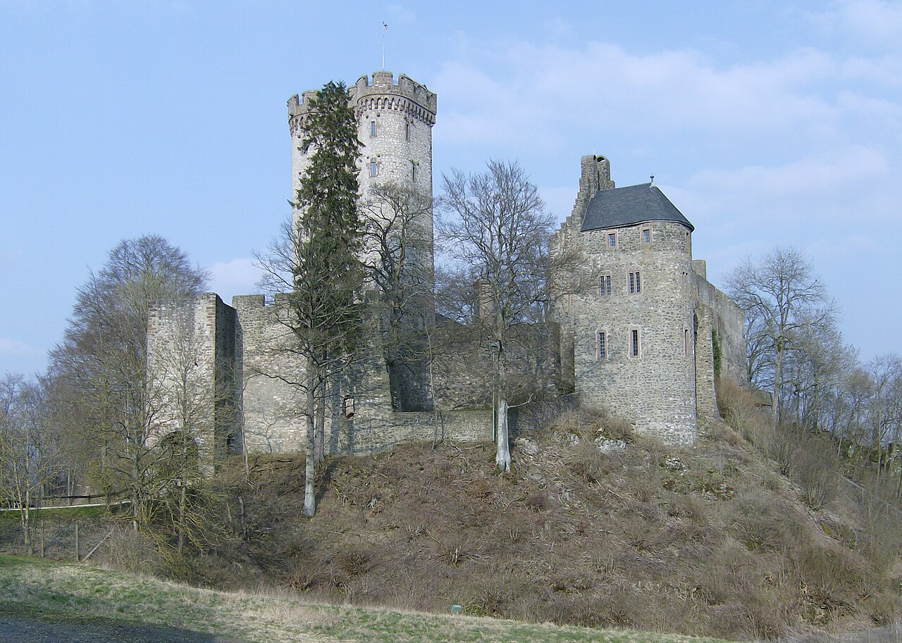
Freudenkoppe Castle, locally known as Burg Freudenkoppe, is a medieval hill castle ruin located on a basaltic cinder cone of an extinct volcano called the Nerother Kopf in the Rhineland-Palatinate region of Germany. The castle stands south of the K33 road, west of the village of Neroth, surrounded by dense forest, which adds to its secluded and atmospheric setting. This strategic location atop a volcanic hill provided natural defensive advantages and access to valuable basalt resources used historically for quarrying millstones.
The castle was likely constructed between 1337, the year it was first documented, and 1340, when it was completed under the direction of John I of Bohemia. Shortly after, in 1346, the castle was granted to Baldwin of Luxembourg, the Archbishop-Elector of Trier, by John I's son. Baldwin used Freudenkoppe Castle as a military base during his siege of Daun Castle, underscoring its strategic importance in regional conflicts of the 14th century.
Architectural design and features
The castle originally featured a trapezoidal plan, a common layout for hill castles of the period, designed to adapt to the natural contours of the volcanic summit. It was protected by a dry moat on three sides, enhancing its defensive capabilities by creating a barrier against attackers. The centerpiece was a square keep, which served as the main stronghold and residence within the castle walls. This keep would have been the last line of defense during sieges.
In 1440, a tower house was constructed just outside the main castle walls, indicating an expansion of the fortification or the addition of a residential or administrative building to support the castle's occupants. The tower house would have provided additional living space and possibly served as a lookout point.
Historical context and decline
Freudenkoppe Castle is last mentioned in historical records in 1460. After this date, it either gradually fell into ruin or was destroyed during military actions. One plausible cause of destruction is the campaigns of French troops under Louis XIV in 1689, who devastated many castles in the Rhineland during the Nine Years' War. However, the exact circumstances of the castle's decline remain uncertain.
Geological and archaeological significance
The castle's location on the basaltic cinder cone of the Nerother Kopf is notable not only for defense but also for its geological features. Prior to and during the castle's existence, the site was used for quarrying millstones from the basalt rock. This quarrying activity created several artificial caves beneath the castle walls, the largest of which is known as the Mühlsteinhöhle or Millstone Cave. Quarrying continued until 1788, long after the castle was abandoned, adding an industrial dimension to the site's history.
Visitor information and current condition
Today, Freudenkoppe Castle is a ruined hill castle freely accessible to the public. Visitors should be prepared for a steep 15-minute walk from the nearest forest road to reach the site. The castle ruins, combined with the nearby millstone cave, offer a unique and atmospheric experience amid the forested volcanic landscape. The site is valued for its historical and geological significance as well as its evocative ruins.
Despite its ruinous state, the castle's remnants of walls, moat, and keep foundations remain visible, providing insight into medieval defensive architecture adapted to a volcanic hilltop. The combination of natural and man-made features makes Freudenkoppe Castle an interesting destination for visitors interested in medieval history, geology, and hiking.
Frequently asked questions (FAQ)
- How do I reach Freudenkoppe Castle and what should I expect on the approach?
- Freudenkoppe Castle is accessible via a forest road south of the K33 road. Visitors should be prepared for a steep 15-minute walk through forested terrain to reach the castle ruins.
- What is the historical significance of Freudenkoppe Castle?
- Built between 1337 and 1340, Freudenkoppe Castle served as a strategic hilltop fortress and was used by Baldwin of Luxembourg during the siege of Daun Castle in the 14th century.
- Are there any unique geological features at Freudenkoppe Castle?
- Yes, the castle is built on a basaltic cinder cone of an extinct volcano, and quarrying for millstones created several artificial caves beneath the castle, including the notable Millstone Cave.
- Is Freudenkoppe Castle open to the public and are there any entrance fees?
- The castle ruins are freely accessible to the public with no entrance fees. Visitors can explore the site and nearby caves at their leisure.
- What remains of Freudenkoppe Castle can be seen today?
- Visitors can see the remains of the trapezoidal castle walls, the square keep foundations, dry moat, and the tower house built outside the walls in 1440, along with the adjacent millstone caves.
Information
Loading map...
Visitor reviews
No reviews yet. Been here? Write the first review and help other travelers!
Write the first reviewVisited this castle? Share your experience
Your review helps other travelers and adds first-hand knowledge to our encyclopedia.