Fort Tiracol — India castle

Fort Tiracol

Fort tiracol: portuguese bastioned fortress in goa, india
Goa, India
Post-Renaissance (17th–18th c.)
Partially Restored

Fort Tiracol, also known as Fortaleza da Santíssima Trindade, is a prominent Portuguese bastioned fortress located near the village of Tiracol in the North Goa district of Goa, India. This fort occupies a strategic position at the mouth of the Terekhol River, overseeing the Arabian Sea and marking the northern boundary of Goa. It is accessible by a short ferry ride from the village of Querim, approximately 42 kilometers north of Panaji, the capital of Goa.

Historical background and strategic importance

Constructed in the early 17th century during the period of Portuguese colonial expansion in India, Fort Tiracol was originally built as a defensive structure to protect Portuguese interests along the western coast of India. Its location at the river mouth allowed control over maritime traffic and served as a deterrent against invasions and pirate attacks. The fort played a significant role in the military history of the region, especially during conflicts with local rulers and competing colonial powers.

The fort was initially established in 1609 by the Portuguese, replacing an earlier fortification that had been destroyed. Over time, it was fortified further with bastions and thick walls to withstand artillery attacks, reflecting the evolution of military architecture in the colonial era.

Architectural features and fortifications

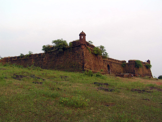
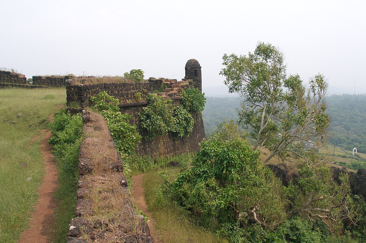
Fort Tiracol exemplifies the bastioned fortress style common to Portuguese military architecture of the 17th century. The fort is constructed with robust laterite stone walls, designed to absorb and deflect cannon fire. It features multiple bastions—angular projections that provide defensive firing positions covering all approaches to the fort.

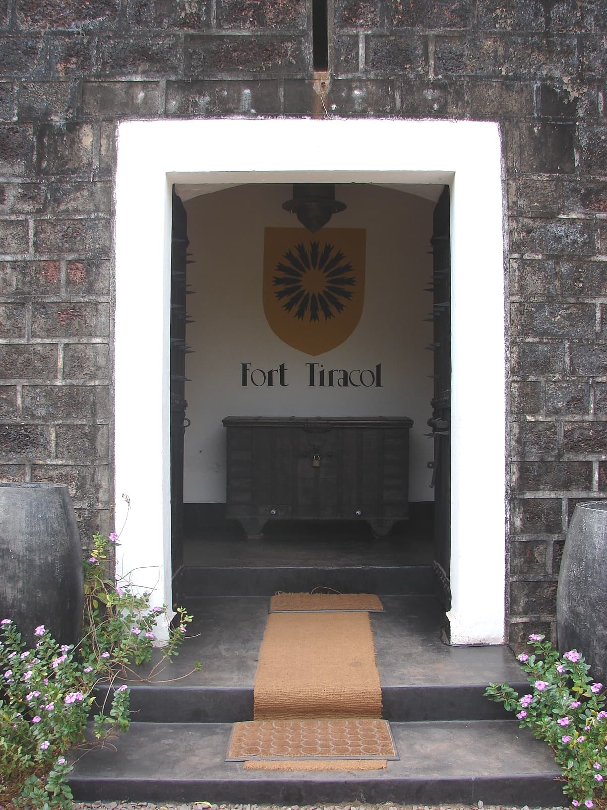
The fort's layout is roughly rectangular, with bastions placed at the corners and along the walls to maximize defensive coverage. The entrance is marked by a gatehouse, which historically served as a checkpoint and defensive barrier. Inside the fort, there are remnants of barracks, a chapel, and storage areas, indicating its role as a military garrison.

The fort's position overlooking the Terekhol River and the Arabian Sea allowed it to monitor naval movements and provided a vantage point for early warning of approaching enemies. The thick walls and bastions were designed to withstand sieges and artillery bombardment, common in the warfare of the period.

Cultural significance and current status

Fort Tiracol holds cultural and historical significance as a symbol of Portuguese colonial heritage in Goa. It reflects the military and architectural strategies employed by the Portuguese to maintain their hold over coastal territories in India.

Today, the fort is a well-preserved monument and has been partially restored to accommodate visitors. It is a popular tourist attraction, drawing visitors interested in colonial history, military architecture, and scenic views of the river and sea. The fort also houses a heritage hotel, allowing guests to experience the historic ambiance.

Visitors can explore the fort's bastions, walls, and internal structures, gaining insight into 17th-century fortification techniques and colonial life. The ferry ride from Querim adds to the experience, providing picturesque views of the surrounding landscape.

Access and visitor information

The fort is accessible primarily by ferry from Querim village, which is connected by road to Panaji and other parts of Goa. The ferry crossing is short and offers scenic views of the Terekhol River estuary and surrounding greenery.

While the fort is open to visitors, it is advisable to check local timings and access conditions, as they may vary seasonally. The presence of a heritage hotel within the fort provides accommodation options for travelers seeking an immersive historical experience.

Frequently asked questions (FAQ)

How do I reach Fort Tiracol from Panaji?
Fort Tiracol can be reached by taking a ferry from Querim village, which is about 42 km north of Panaji. Querim is accessible by road from Panaji, and the ferry ride to the fort offers scenic views of the Terekhol River.
What is the historical significance of Fort Tiracol?
Fort Tiracol was built by the Portuguese in 1609 as a bastioned fortress to defend their colonial interests on the western coast of India. It played a key role in controlling maritime traffic and defending against invasions during the colonial period.
Can visitors explore inside the fort?
Yes, visitors can explore the bastions, walls, and internal structures of Fort Tiracol. Parts of the fort have been restored, and it houses a heritage hotel, offering a unique experience of colonial military architecture.
Is Fort Tiracol open to the public year-round?
The fort is generally open to visitors, but it is recommended to check local conditions and timings before planning a visit, as they may vary seasonally or due to weather.
What architectural style is Fort Tiracol built in?
Fort Tiracol is an example of a bastioned fortress typical of Portuguese military architecture in the early 17th century, featuring robust stone walls and angular bastions designed for artillery defense.

Photo gallery

Fort Tiracol
Click to view

Photo by Mvkulkarni23•CC BY 3.0

1 photo • Click any image to view in full screen

Information

Bastioned Fortress

Loading map...

Visitor reviews

No reviews yet. Been here? Write the first review and help other travelers!

Write the first review

Visited this castle? Share your experience

Your review helps other travelers and adds first-hand knowledge to our encyclopedia.
Write a review

(5/5)

0/2000 characters

Your review will be visible after admin approval

Nearby castles

15 km
Chapora Fort — India castle

Chapora Fort

Bardez, India

Chapora Fort is a historic bastioned fortress situated in the Bardez region of Goa, India, perched strategically above the Chapora River. This fortification dates back to the 18th century and was originally constructed under the rule of the Adil Shahi dynasty, specifically by ruler Adil Shah. Its original name was Shahpoora, which later evolved into Shapora and eventually Chapora due to linguistic changes influenced by the Portuguese and local communities.Historical background and strategic importanceThe fort's location was of considerable strategic value, overseeing the confluence of the Chapora River and the Arabian Sea, which made it a critical point for controlling maritime and inland trade routes. The fort changed hands multiple times, reflecting the turbulent history of the region marked by conflicts between the Adil Shahi sultanate, the Mughal Empire, and later the Portuguese colonial powers. The fort's control was vital for dominance over northern Goa and its surrounding territories.After the decline of the Adil Shahi dynasty, the fort came under the influence of the Maratha Empire. The Malvankar naval forces, associated with Shivaji Maharaj, maintained a presence in the surrounding villages, which influenced the fort's name adaptation to Chapora. Eventually, the Portuguese took control, modifying the fort and using it as a military outpost to secure their colonial interests in Goa.Architectural features and designChapora Fort is classified as a bastioned fortress, a style characterized by angular bastions designed to withstand cannon fire and provide overlapping fields of defensive fire. The fort's walls are thick and robust, constructed primarily from laterite stone, a common building material in the region known for its durability and resistance to tropical weather.The fortress features multiple bastions positioned at strategic points along the walls, allowing defenders to cover all approaches. The design includes a main entrance gate, which historically would have been fortified with heavy wooden doors and possibly a drawbridge or moat, though these features have not survived intact. Inside, the fort contained barracks, storage rooms, and a cistern for water storage, essential for withstanding sieges.Location and surroundingsChapora Fort is located on a hillock overlooking the Chapora River estuary, providing commanding views of the surrounding landscape, including the Arabian Sea coastline and the nearby Morjim beach. This vantage point was crucial for spotting incoming ships and potential threats from the sea.Today, the fort is a popular tourist destination, known for its panoramic views and the dramatic ruins that evoke its martial past. The site is accessible by road and is frequented by visitors interested in history, architecture, and scenic photography.Current condition and preservationThe fort is in a state of ruins, with many of its original structures partially collapsed or eroded due to centuries of exposure to the coastal climate and lack of continuous maintenance. Despite this, significant portions of the bastions and walls remain standing, allowing visitors to appreciate the scale and defensive design of the fortress.Efforts have been made to preserve the site as a cultural heritage landmark, although it remains largely an open-air ruin without extensive restoration. The fort's condition offers a tangible connection to Goa's layered history of indigenous dynasties, Maratha influence, and Portuguese colonization.Visitor information and tourismChapora Fort is open to the public and does not charge an entrance fee, making it an accessible destination for tourists and locals alike. The best time to visit is during the cooler months from November to February, when the weather is more comfortable for exploring the fort's extensive grounds.Visitors can enjoy walking along the ramparts, exploring the remains of the fortifications, and taking in views of the Chapora River and the Arabian Sea. The fort's proximity to popular beaches like Morjim also makes it a convenient stop for those touring northern Goa.Frequently asked questionsWhat is the historical significance of Chapora Fort? Chapora Fort was a strategic military outpost controlling access to northern Goa and played a role in regional conflicts between the Adil Shahi dynasty, Marathas, and Portuguese.Can visitors explore the entire fort? While much of the fort is in ruins, visitors can walk along the surviving bastions and walls and explore accessible interior areas safely.Is there an entrance fee to visit Chapora Fort? No, the fort is free to enter and open year-round.When is the best time to visit Chapora Fort? The cooler months from November to February offer the most pleasant weather for visiting.How do I reach Chapora Fort? The fort is accessible by road from nearby towns in Bardez, Goa, with parking available close to the site.

Post-Renaissance (17th–18th c.)
Details
27 km
Corjuem Fort — India castle

Corjuem Fort

, India

Corjuem Fort, also known as Fort Assunção, is a small but strategically significant bastioned fortress located on the river island of Corjuem in Goa, India. Situated approximately 4 kilometres from the village of Aldona and about 12 kilometres from Panjim, the fort played a key role in the defense system of Portuguese India. Despite its modest size compared to other Goan forts, Corjuem Fort commands an excellent vantage point overlooking the surrounding river and land, which was vital for monitoring and controlling riverine and land-based approaches. Historical context and strategic importance Constructed during the period when the Portuguese established their colonial presence in Goa, Corjuem Fort was part of a network of fortifications designed to protect their territories from rival colonial powers and local adversaries. The fort's location on a river island allowed it to serve as a defensive outpost guarding the waterways, which were crucial for transportation and trade. Its bastioned design reflects the military architectural principles of the time, emphasizing angled bastions for better defense against artillery and infantry attacks. Architectural features and design The fort exemplifies typical bastioned fortress characteristics, including thick stone walls and angular bastions projecting outward to cover adjacent walls with defensive fire. The smaller scale of Corjuem Fort compared to other Goan forts does not diminish its architectural significance. Its compact layout was adapted to the island's geography, maximizing defensive capabilities while maintaining a manageable footprint. The fort's walls enclose a courtyard that would have housed essential military facilities and quarters for the garrison. The elevated position provides commanding views of the surrounding river channels and adjacent land, enabling early detection of enemy movements. Materials and construction techniques Constructed primarily from locally sourced laterite stone, a common building material in Goa, the fort's masonry exhibits the durability necessary to withstand tropical weather and military assaults. The use of lime mortar and traditional stone-cutting techniques ensured the fort's resilience over centuries. Preservation and current status Today, Corjuem Fort is a protected monument under the Goa, Daman and Diu Ancient Monuments and Archaeological Sites and Remains Act. While smaller and less well-known than other Goan forts such as Aguada or Chapora, it remains an important heritage site illustrating the Portuguese military presence in the region. The fort is partially preserved, with some walls and bastions intact, allowing visitors to appreciate its historical layout and strategic location. Visitor experience and accessibility The fort is accessible via a short boat ride or road journey from Aldona village, making it a quieter alternative to more frequented forts in Goa. Visitors can explore the ramparts and enjoy panoramic views of the surrounding river and countryside. The site offers insight into the colonial military architecture adapted to the unique river island environment. Corjuem Fort in the context of Goan fortifications Corjuem Fort complements the network of coastal and inland fortifications that the Portuguese built to secure their hold over Goa. Its role was more specialized in controlling riverine access rather than serving as a major coastal defense. This distinction highlights the varied strategic approaches employed by the Portuguese in fort design and placement. The fort's relatively modest size and remote location have contributed to its lesser prominence in popular tourism, but it remains a valuable site for understanding the military history and colonial architecture of Goa.

Details
28.3 km
Fort Aguada — India castle

Fort Aguada

, India

Fort Aguada is a prominent 17th-century Portuguese bastioned fortress located on Sinquerim Beach in Goa, India. Constructed in 1612, it was strategically built to guard the Arabian Sea coast and to serve as a crucial water source for Portuguese ships. The fort's name "Aguada" translates to "watering place," highlighting its original function as a freshwater reservoir for vessels sailing along the western coast of India. Strategic location and historical context Situated at the mouth of the Mandovi River, Fort Aguada's coastal position offered a commanding view over the Arabian Sea, enabling early detection of enemy ships and protecting the vital sea route to the Portuguese colony of Goa. This fortification was part of a broader network of Portuguese defenses established during the Renaissance period to secure their colonial interests in India. The fort played a significant role during the Portuguese colonial era, serving both military and logistical purposes. It was a key defense point against the Dutch and Maratha incursions and later functioned as a prison during British rule. Architectural features and design Fort Aguada exemplifies the bastioned fortress style, a military architectural design that emerged in Europe during the Renaissance to counter the threat posed by artillery. Its thick laterite stone walls and bastions were designed to withstand cannon fire and provide overlapping fields of fire. The fort's walls extend over 600 meters and enclose an area of approximately 12 acres. It features a large circular bastion at the seaward end, which housed cannons to fend off naval attacks. The fort's defensive structures include ramparts, parapets, and a moat, which was originally filled with water from the nearby river. One of the fort's most notable structures is the lighthouse, built in 1864 atop the fort's highest point. This lighthouse is one of the oldest of its kind in Asia and remains operational, guiding ships along the Arabian Sea coast. Inside the fort, there is a large freshwater spring and a reservoir that supplied water to the ships, a rare feature that underlines the fort's strategic importance as a replenishment station. Preservation and current status Today, Fort Aguada is a well-preserved monument protected by the Archaeological Survey of India (ASI) and is classified as a Monument of National Importance. The fort attracts numerous tourists each year who come to explore its historical ramparts, bastions, and the lighthouse. The site offers panoramic views of the Arabian Sea and the surrounding beaches, making it a popular destination for history enthusiasts and visitors interested in colonial architecture and military history. Visitor experience and accessibility The fort is accessible from the city of Panaji, the capital of Goa, and is located near the popular Sinquerim Beach. Visitors can walk along the fort's ramparts, explore the bastions, and visit the lighthouse area. Informational plaques provide historical context, enhancing the educational experience. While the fort's interior structures are limited, the expansive grounds and coastal views provide a unique experience of a Renaissance-era bastioned fortress adapted to the tropical environment of India.

Renaissance (15th–17th c.)
Details