Fort Margherita — Malaysia castle

Fort Margherita

Fort Margherita: a bastioned fortress in Kuching, Malaysia
Kuching, Sarawak, Malaysia
Modern (19th–20th c.)
Well Preserved

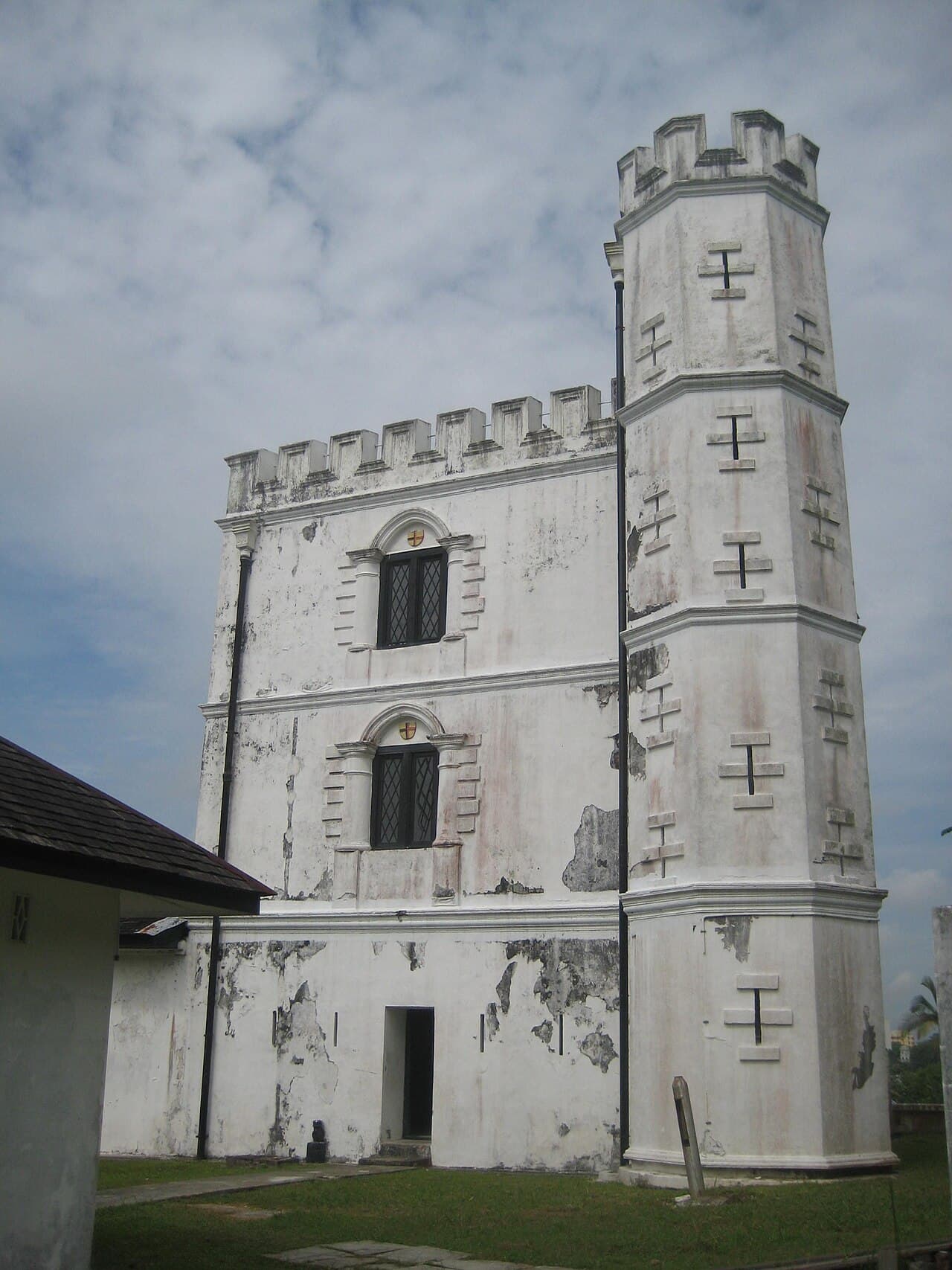
Fort Margherita stands as a prominent bastioned fortress located in Kuching, Sarawak, Malaysia. Constructed in 1879 under the direction of Charles Brooke, the second Rajah of Sarawak, this fort played a crucial role in the defense of the region during the late 19th century. Its primary purpose was to protect the city of Kuching from frequent attacks by pirates who threatened the security of the Sarawak River and its surrounding settlements.

Architectural design and strategic location

The design of Fort Margherita reflects the influence of English castle architecture, adapted to the tropical environment of Malaysia. The fortress features thick masonry walls and bastions at its corners, which allowed defenders to cover all approaches with cannon and rifle fire. The bastioned structure provided overlapping fields of fire, a common military architectural feature in the 19th century to enhance the fort's defensive capabilities.

Strategically positioned on the north bank of the Sarawak River, the fort overlooks the river and the city of Kuching. This vantage point enabled early detection of incoming threats and control over river traffic. The fort is located directly across the river from The Astana, the official residence of the Yang di-Pertua Negeri of Sarawak, and adjacent to the New Sarawak State Legislative Assembly Building. Its proximity to these important landmarks underscores its historical significance in the governance and defense of Sarawak.

Historical context and the brooke dynasty

Fort Margherita was built during the era of the Brooke dynasty, which ruled Sarawak for over a century. The Brookes, starting with James Brooke in 1841, established a unique form of governance blending local customs with British colonial administration. Charles Brooke, the second Rajah and builder of the fort, focused on strengthening the region's defenses against external threats such as piracy and internal unrest.

The fort's construction in 1879 was part of a broader effort to consolidate Brooke control and protect the economic interests in Sarawak, particularly the lucrative trade along the Sarawak River. Its presence deterred pirate raids and helped maintain order in the area, contributing to the stability and growth of Kuching as the administrative center.

Later uses and current function

After its military use declined, Fort Margherita was repurposed as the Sarawak Police Museum in 1971. This museum showcased the history and development of law enforcement in Sarawak, highlighting the challenges faced by the police force in maintaining security across the diverse and often rugged territory.

In recent years, the fort has been transformed into a significant tourist attraction and cultural site. It now houses the Brooke Gallery, an exhibition dedicated to the history of the Brooke dynasty and the colonial era in Sarawak. The gallery features artifacts, documents, and multimedia displays that provide visitors with a comprehensive understanding of the region's past under Brooke rule.

Access and visitor experience

Fort Margherita is accessible by road and river, enhancing its appeal as a heritage destination. Visitors can reach the fort by a 15-minute drive along Petra Jaya or enjoy a scenic river cruise from Pangkalan Batu, located in front of the Main Bazaar on the Kuching Waterfront. This accessibility allows tourists to experience the fort within the broader context of Kuching's historical and cultural landscape.

The fort is an integral part of the Kuching Heritage Trail, a curated route that connects various historical sites in the city. Visitors exploring the trail gain insight into Kuching's colonial history, architectural heritage, and the legacy of the Brooke family.

Frequently asked questions (FAQ)

How do I get to Fort Margherita in Kuching?
Fort Margherita is accessible by a 15-minute drive along Petra Jaya or via a short river cruise from Pangkalan Batu on Kuching Waterfront. Both options offer scenic views of the Sarawak River and city.
What historical period does Fort Margherita represent?
Fort Margherita was built in 1879 during the Brooke dynasty period, reflecting the late 19th-century colonial era in Sarawak under British influence.
Can visitors explore the interior of Fort Margherita?
Yes, the fort houses the Brooke Gallery, an exhibition showcasing the history of Sarawak under the Brooke dynasty, and visitors can tour the preserved bastioned fortress.
Why was Fort Margherita built?
The fort was constructed by Charles Brooke to protect Kuching from pirate attacks and to secure the Sarawak River, a vital trade route during the 19th century.
Is Fort Margherita part of any heritage trail?
Yes, Fort Margherita is part of the Kuching Heritage Trail, which links key historical and cultural sites in the city for visitors to explore.

Photo gallery

Fort Margherita
Click to view

Photo by Mattun0211•CC0

1 photo • Click any image to view in full screen

Information

Bastioned Fortress

Current owner

Government of Sarawak

Loading map...

Visitor reviews

No reviews yet. Been here? Write the first review and help other travelers!

Write the first review

Visited this castle? Share your experience

Your review helps other travelers and adds first-hand knowledge to our encyclopedia.
Write a review

(5/5)

0/2000 characters

Your review will be visible after admin approval

Nearby castles

718.7 km
Tatas Fort — Indonesia castle

Tatas Fort

, Indonesia

Tatas Fort is a significant example of an 18th-century bastioned fortress located in Indonesia. Constructed during the post-Renaissance period, this fortification reflects the military architectural styles and strategic defensive needs of its era, particularly under colonial influence in Southeast Asia. Historical context and strategic importance The fort was built in the 18th century during a time when European colonial powers were expanding their territories and fortifying key locations for military and trade control. Situated in Indonesia, which was under Dutch colonial rule for much of this period, Tatas Fort served as a critical defensive structure to protect coastal areas and trade routes from rival powers and local resistance. The strategic placement of the fort allowed it to oversee and control access to important maritime channels, making it a vital asset in the colonial military network. Its construction was part of broader efforts to establish strongholds that could withstand artillery attacks and provide secure bases for troops. Architectural features of Tatas Fort Bastioned design and layout Tatas Fort is characterized by its bastioned fortress design, which was a common military architectural style developed during the Renaissance and adapted in later periods. The bastions are angular projections from the main walls, designed to eliminate blind spots and allow defensive fire along the walls' faces. This design improved the fort's ability to repel attackers and defend against cannon fire. The fort's walls are constructed from durable materials suitable for withstanding both artillery bombardment and tropical weather conditions. The bastions are connected by curtain walls, forming a polygonal or star-shaped layout typical of bastioned forts, optimizing defensive coverage. Defensive elements and internal structures The fort includes several key defensive features such as thick ramparts, embrasures for cannons, and fortified gates. The presence of a moat or ditch around the fort is possible, as this was a common feature in bastioned fortresses to hinder enemy advances, although specific details about Tatas Fort's moat are limited. Inside, the fort likely contained barracks, storage rooms for ammunition and supplies, and command quarters. These internal facilities supported the garrison stationed there and ensured operational readiness during sieges or attacks. Colonial military architecture in Indonesia Tatas Fort exemplifies the adaptation of European military architectural principles in the Indonesian context. The Dutch East India Company (VOC) and later Dutch colonial authorities constructed numerous forts across the archipelago to secure their interests. These forts combined European defensive designs with local construction techniques and materials. The bastioned fortress style was favored for its effectiveness against gunpowder artillery, which had rendered earlier medieval fortifications obsolete. Forts like Tatas Fort were integral to maintaining colonial dominance and protecting valuable trade commodities such as spices. Current condition and preservation While detailed information about the current condition of Tatas Fort is limited, bastioned forts from this period in Indonesia vary in preservation status. Some remain well-preserved or restored as historical sites, while others have fallen into ruin due to tropical climate, neglect, or urban development. Efforts to preserve such forts contribute to understanding Indonesia's colonial history and architectural heritage. These sites offer insights into military engineering and the geopolitical dynamics of the 18th century in Southeast Asia. Visiting Tatas Fort Visitors interested in colonial military architecture and Indonesian history may find Tatas Fort a valuable site to explore. Its bastioned design and historical significance provide a tangible connection to the region's past conflicts and colonial administration. Information regarding visiting hours, ticket prices, and accessibility is not widely documented, so potential visitors should seek local guidance or tourism resources for up-to-date details.

Post-Renaissance (17th–18th c.)
Details
727.9 km
Fort Siloso — Singapore castle

Fort Siloso

Sentosa, Singapore

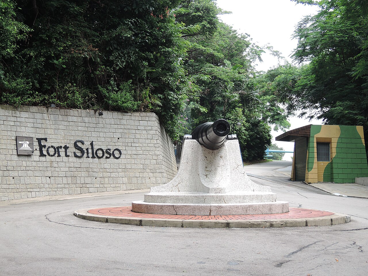
Fort Siloso is a prominent 19th-century bastioned fortress located on Sentosa Island, Singapore. It is the only preserved coastal artillery battery of the original twelve that formed part of "Fortress Singapore", a network of defenses constructed to protect the strategic port city during the British colonial period. Built primarily to defend against naval attacks, Fort Siloso played a significant role during the Battle of Singapore in World War II. Historical background and strategic importance The construction of Fort Siloso began in the late 19th century, as part of the British Empire's efforts to fortify Singapore, a key trading hub and naval base in Southeast Asia. The fort was designed to guard the western entrance to Singapore's harbor, providing artillery coverage against enemy warships attempting to enter the harbor from the Malacca Strait. Fort Siloso was equipped with coastal artillery guns mounted on bastions and gun emplacements, making it a classic example of a bastioned fortress adapted to modern artillery warfare of the time. Sentosa Island, formerly known as Pulau Blakang Mati, was selected for its strategic vantage point, allowing Fort Siloso to oversee and control maritime access. The fort was part of a larger defensive system that included other batteries and fortifications around Singapore, collectively known as Fortress Singapore. Architectural features and military design Fort Siloso's design reflects the military engineering principles of the 19th century, emphasizing strong defensive walls, bastions for mounting artillery, and underground magazines for ammunition storage. The fortress features a series of gun emplacements arranged to provide overlapping fields of fire, maximizing coverage of the sea approaches. The walls and structures were constructed using reinforced concrete and brick, materials chosen for their durability and resistance to bombardment. The fort also includes observation posts and command centers that coordinated the firing of the guns. These facilities were connected by a network of underground tunnels, allowing safe movement of personnel and supplies during combat. The layout allowed defenders to withstand prolonged attacks and maintain control of the surrounding waters. Role in World War II and the Battle of Singapore During World War II, Fort Siloso was a critical component of Singapore's coastal defense system. It saw action during the Battle of Singapore in early 1942, when Japanese forces launched a major assault to capture the island. Although the fort's artillery was primarily designed to counter naval threats, it was pressed into service against advancing ground forces as well. Despite the fortifications and determined defense, Singapore fell to the Japanese in February 1942. Fort Siloso was subsequently occupied by Japanese forces and used as a military installation throughout the occupation period. The fort's role during the war exemplifies the challenges faced by fixed coastal defenses in the face of modern combined arms warfare. Post-war history and preservation After World War II, Fort Siloso was decommissioned as a military facility, reflecting changes in defense technology and strategy. In the decades that followed, the site was preserved as a historical monument and converted into a military museum open to the public. The museum displays a collection of artifacts, photographs, and exhibits detailing the fort's history and Singapore's wartime experiences. A notable feature of the museum is the Surrender Chambers, which reopened in June 2017 with a refreshed exhibition. This exhibit focuses on the events surrounding the British surrender of Singapore to Japanese forces, providing visitors with immersive and educational insights into this pivotal moment in history. Admission to the museum is free, encouraging educational tourism and public engagement with Singapore's heritage. Visitor experience and educational value Today, Fort Siloso offers visitors a chance to explore preserved bastioned walls, gun emplacements, and underground tunnels. The site provides interpretive signage and guided tours that explain the fort's construction, military function, and historical context. Visitors can gain a deeper understanding of coastal defense strategies and the impact of World War II on Singapore. The museum's location on Sentosa Island also allows visitors to enjoy the natural surroundings and other attractions, making Fort Siloso a significant cultural and historical destination. The preservation of this modern period fortress offers valuable insights into the evolution of military architecture and the geopolitical history of Southeast Asia.

Modern (19th–20th c.)
Details
756.3 km
Oranje Nassau Coal Mine Site — Indonesia castle

Oranje Nassau Coal Mine Site

, Indonesia

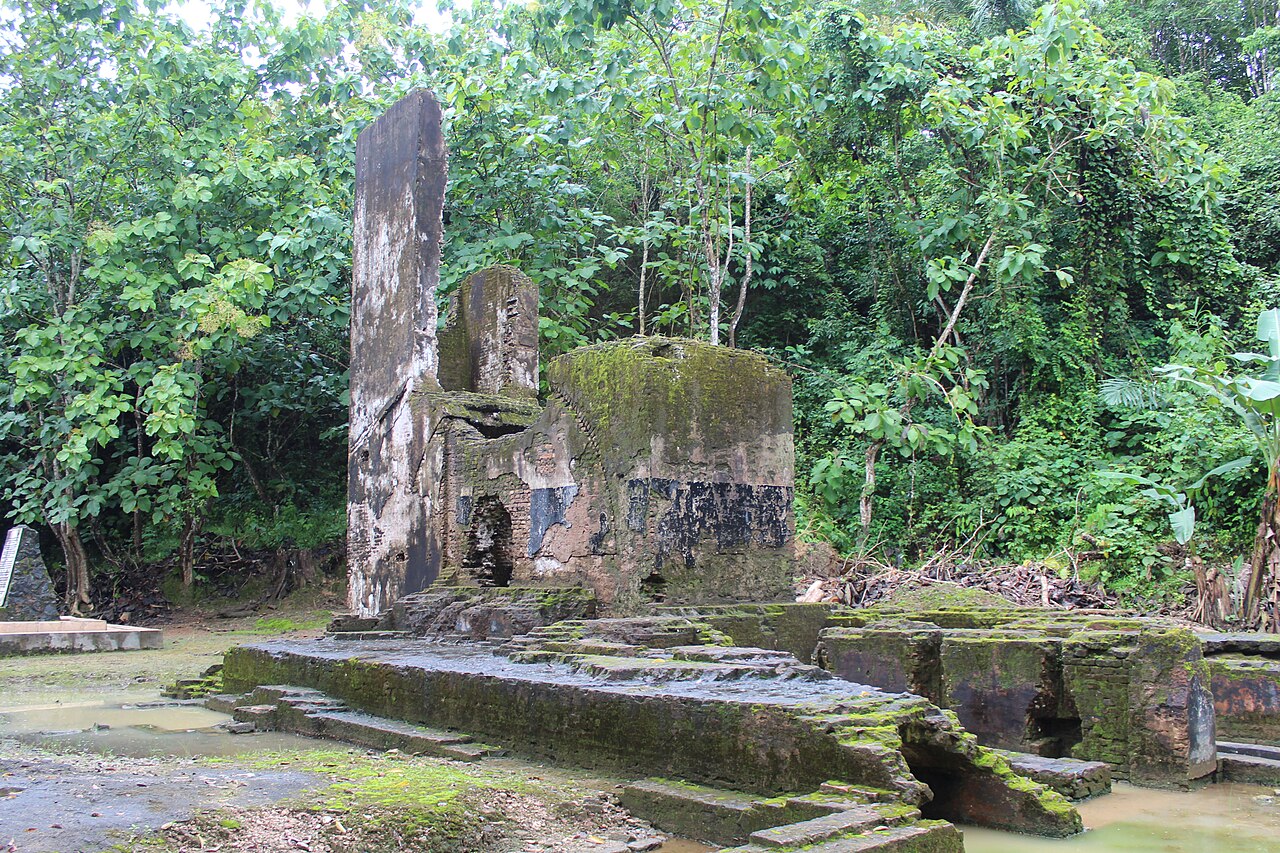
The Oranje Nassau Coal Mine Site is a significant industrial heritage location in Indonesia, representing the Dutch colonial era's mining activities. Unlike traditional castles, this site is an industrial complex rather than a fortification, reflecting the economic and technological history of the region during the early 20th century. The site is notable for its extensive mining infrastructure, including shafts, tunnels, and processing facilities that illustrate the coal extraction methods used during the colonial period.Historical context and significanceThe Oranje Nassau Coal Mine was established during the Dutch colonial administration as part of efforts to exploit Indonesia's rich natural resources. Coal mining was a critical industry, fueling both local and international markets. This site played a key role in the economic development of the area, contributing to the industrial growth of the region. The mining operations at Oranje Nassau were part of a broader network of resource extraction that supported the colonial economy.Architectural and industrial featuresThe site includes remnants of mining shafts, rail tracks, and processing buildings that demonstrate early 20th-century industrial architecture. The structures are utilitarian in design, focused on functionality rather than aesthetics, typical of industrial sites of that era. The layout reflects the operational flow from coal extraction to processing and transportation, with facilities arranged to optimize efficiency.Mining infrastructureThe mining shafts are central to the site, providing access to underground coal seams. These shafts were supported by robust structural elements to ensure safety and operational stability. Adjacent to the shafts, there are remains of coal processing plants where raw coal was sorted and prepared for shipment.Transportation elementsRail tracks and loading areas facilitated the movement of coal from the mine to distribution points. The presence of these features highlights the integration of the site into regional and global trade networks. The transportation infrastructure was crucial for the economic viability of the mining operations.Preservation and current conditionToday, the Oranje Nassau Coal Mine Site is recognized as an important industrial archaeological site. While many structures are in a state of ruins or partially preserved, efforts have been made to document and protect the site due to its cultural and historical value. The site offers insights into the technological advancements and working conditions of the mining industry during the colonial period.Visiting information and cultural importanceVisitors to the site can explore the remains of the mining infrastructure and gain an understanding of the industrial heritage of Indonesia. The site serves as a reminder of the colonial past and the impact of resource extraction on the region's development. It is an educational destination for those interested in industrial archaeology and colonial history.

Post-Renaissance (17th–18th c.)
Details