Dún Dúchathair — Ireland castle

Dún Dúchathair

Dún dúchathair: the black fort of inishmore

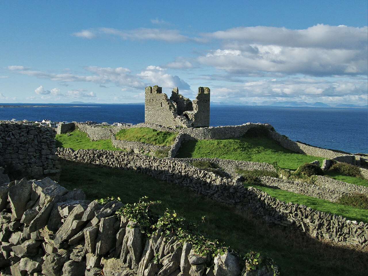
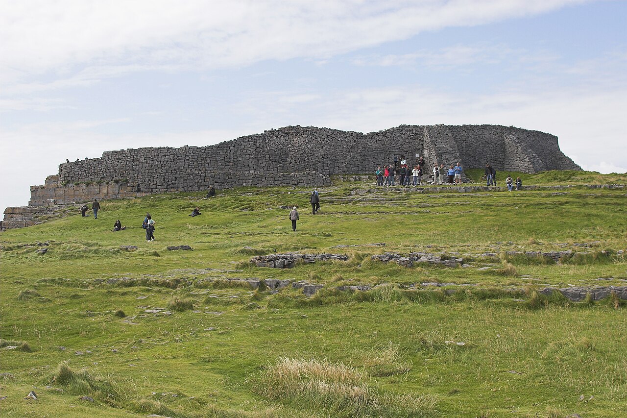
Dún Dúchathair, also known as Dúchathair or anglicized as Doocaher, is a prominent ancient stone fortification situated on the dramatic cliffs of Cill Éinne (Killeany) on Inishmore, the largest of the Aran Islands in County Galway, Ireland. The name translates to "black fort," reflecting the dark, weathered stone used in its construction, which has withstood the harsh Atlantic elements for centuries. This bastioned fortress is notable for its imposing defensive walls and strategic cliffside location, offering commanding views over the surrounding sea.

The fort's position on a rocky promontory, now jutting into the Atlantic due to extensive coastal erosion, highlights its original purpose as a stronghold designed to maximize natural defenses. The surviving outer walls of Dún Dúchathair reach approximately 6 metres in height and are about 5 metres thick, constructed from large, roughly hewn limestone blocks typical of the region. These massive walls form a roughly circular enclosure that would have provided formidable protection against invaders.

Architectural features and fortification elements

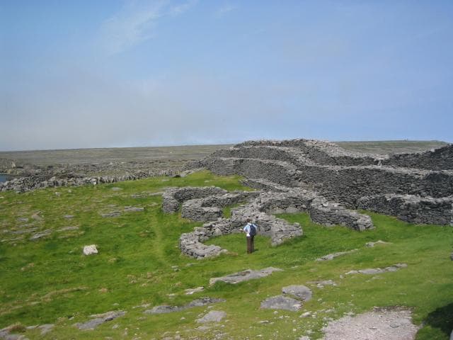
Inside the fort's enclosure lie the ruins of several clocháns, traditional beehive huts built with dry stone masonry without mortar. These small, corbelled stone structures are characteristic of early Irish dwellings and monastic cells, suggesting that the site may have had a dual purpose as both a defensive fortification and a settlement or refuge. However, there is no evidence of a reliable water source within the fort, which implies that inhabitants would have needed to rely on rainwater collection or external supplies during occupation.

One of the most intriguing defensive features at Dún Dúchathair is the presence of a cheval de frise near the entrance. This consists of an array of sharp stone spikes or upright slabs arranged to deter or injure attackers attempting to breach the gate, a sophisticated defensive tactic rarely found in Irish coastal forts. The entrance itself would have been heavily fortified, likely with thick wooden gates reinforced with iron, though no such gates survive today.

Historical context and age

The precise age of Dún Dúchathair remains uncertain, as no definitive archaeological dating has yet been published. However, the architectural style and construction techniques suggest it was built during the early medieval period, possibly between the 8th and 12th centuries. This timeframe corresponds with a period of frequent coastal raids and Viking incursions in Ireland, which prompted the construction of many similar coastal and island fortifications.

The fort's location on the Aran Islands, a region rich in prehistoric and early medieval archaeological sites, further supports this dating. The combination of defensive walls, beehive huts, and the cheval de frise indicates a community prepared for sustained defense and habitation in a challenging maritime environment.

Geographical and cultural significance

Dún Dúchathair is situated on the western edge of Inishmore, where the rugged cliffs meet the Atlantic Ocean. This location not only provided natural defense but also allowed control over maritime routes and early warning of incoming threats. The fort is part of a wider network of prehistoric and early medieval sites on the Aran Islands, which together illustrate the strategic importance of these islands in Ireland's history.

The fort is a key cultural landmark for the local community and visitors, offering insight into the defensive architecture and living conditions of early Irish coastal settlements. Its dramatic setting and well-preserved stonework make it a significant attraction for those interested in Irish heritage and ancient fortifications.

Preservation and current condition

Today, Dún Dúchathair stands as a well-preserved bastioned fortress despite centuries of exposure to harsh weather and coastal erosion. The thick stone walls remain largely intact, though some sections have suffered damage from the sea and wind. The interior clochán ruins provide valuable archaeological evidence of habitation, although no roof structures survive.

Access to the site is on foot via paths on Inishmore, and visitors can explore the fort's perimeter and interior remains. Interpretation panels and guided tours help contextualize the site's historical and architectural importance.

Architectural comparison and influence

Dún Dúchathair shares characteristics with other Irish coastal stone forts, such as Dún Aonghasa, also on Inishmore, but is distinguished by its extensive bastioned walls and the unique cheval de frise defense. The use of dry stone masonry and corbelled huts reflects a continuity of ancient building traditions in the region.

The fort's design demonstrates an adaptation to the rugged coastal environment, combining natural rock formations with man-made defenses to create a formidable stronghold. This blend of natural and constructed elements is typical of Irish promontory forts and highlights the ingenuity of early medieval builders.

Photo gallery

Dún Dúchathair
Click to view

Photo by Tom Pullman•CC BY-SA 2.0

1 photo • Click any image to view in full screen

Information

Bastioned Fortress

Loading map...

Visitor reviews

No reviews yet. Been here? Write the first review and help other travelers!

Write the first review

Visited this castle? Share your experience

Your review helps other travelers and adds first-hand knowledge to our encyclopedia.
Write a review

(5/5)

0/2000 characters

Your review will be visible after admin approval

Nearby castles

5.8 km
Dun Aengus — Ireland castle

Dun Aengus

, Ireland

Dún Aengus (also spelled Dún Aonghasa) is a remarkable prehistoric hill fort located on the largest of the Aran Islands, Inis Mór, off the coast of County Galway, Ireland. This ancient site is perched dramatically on the edge of a 100-metre-high cliff, overlooking the Atlantic Ocean, offering commanding views that once served defensive purposes. As one of the best-preserved and most iconic prehistoric forts in Ireland, it attracts visitors interested in archaeology, history, and stunning landscapes. Historical context and dating The origins of Dún Aengus trace back to the Bronze Age, with construction phases spanning from approximately the 2nd century BC through the early medieval period. Archaeological evidence suggests that the fort was built and expanded over several centuries, reflecting the evolving defensive needs and social organization of the island's inhabitants. The fort's name derives from the legendary figure Aengus, a god of love and youth in Irish mythology, although the site's actual builders predate these myths. Architectural features and layout Dún Aengus is a classic example of a prehistoric ringfort or hill fort, characterized by its concentric stone walls arranged in a roughly oval shape. The fort's outer wall, constructed from massive limestone blocks, stands up to 6 meters high in places and encloses an area approximately 100 meters long and 50 meters wide. The walls are built without mortar, relying on the careful placement and weight of the stones for stability. The fort comprises three main walls, each forming a series of defensive rings. The innermost wall surrounds a central enclosure that likely served as a protected living or ceremonial space. The middle and outer walls provided additional layers of defense, with narrow gaps and gateways designed to control access and slow attackers. One of the most striking architectural elements is the fort's position on a steep cliff edge, with sheer drops on the seaward side providing a natural defense. The landward side is protected by the stone walls and a series of terraces and ditches, enhancing the fort's defensibility. Construction techniques The builders of Dún Aengus employed dry-stone walling techniques typical of prehistoric Atlantic Europe. The careful stacking of large limestone blocks without mortar required skilled craftsmanship to ensure the walls' longevity and resistance to harsh coastal weather. The fort's walls exhibit a slight inward batter, increasing stability and preventing collapse. Archaeological significance and excavations Dún Aengus is one of the most important archaeological sites in Ireland, providing valuable insights into prehistoric life on the Aran Islands. Excavations have uncovered evidence of habitation, including pottery fragments, tools, and animal bones, indicating the fort was not only a defensive structure but also a settlement. Archaeologists have studied the site extensively to understand the social and economic organization of its builders. The fort's strategic location suggests it played a role in controlling maritime routes and local resources. Its preservation allows researchers to examine prehistoric construction methods and settlement patterns in western Ireland. Tourism and preservation Today, Dún Aengus is a popular tourist destination, drawing visitors from around the world to experience its dramatic setting and ancient history. The site is managed to balance public access with conservation efforts, ensuring the fragile stone walls and surrounding landscape are protected. The fort is accessible via walking paths from the village of Kilronan on Inis Mór. Signage and guided tours help visitors understand the site's historical context and architectural features. The cliff-top location offers breathtaking views, making it a highlight of any visit to the Aran Islands. Visitor information Visitors should wear sturdy footwear due to uneven terrain and be cautious near cliff edges. The best time to visit is during the warmer months when weather conditions are more favorable. Facilities on Inis Mór support tourism, including accommodations and transport links to the mainland.

Early Medieval (5th–10th c.)
Details
12.2 km
O'Brien's Castle — United Kingdom castle

O'Brien's Castle

Inisheer, United Kingdom

O'Brien's Castle stands as a remarkable example of a 15th-century Gaelic tower house perched atop the highest point of Inisheer, the smallest of the three Aran Islands off Ireland's west coast in Galway Bay. This fortress, known in Irish Gaelic as Caisleán Uí Bhriain, commands a strategic vantage point overlooking the surrounding Atlantic waters and the island's rugged landscape. Its imposing ruins offer a glimpse into the turbulent medieval history of the region and the architectural ingenuity of Gaelic Ireland. Upon arriving at Inisheer, visitors encounter a quaint fishing village where Irish Gaelic remains the primary language among its roughly 250 residents. From the village, the castle's silhouette dominates the skyline, symbolizing centuries of local power and heritage. Despite its ruined state, the castle's design and historical context provide rich insights into the defensive strategies and social structures of its time. Historical background and clan significance The castle was constructed in the early 15th century, around the year 1400, by the Clann Teige, a branch of the influential O'Brien family, a prominent Gaelic Irish dynasty. This period was marked by frequent clan conflicts and shifting allegiances, making fortified residences essential for defense and control. O'Brien's Castle was built on the site of an earlier ringfort known as Dún Formna, which dates back to roughly between the 5th century BCE and 1st century CE. This earlier fortification highlights the site's long-standing strategic importance, situated on a ridge or "shoulder" of land that provided natural defensive advantages. In the late 16th century, circa 1582, the castle was seized by the Ó Flaithbheartaigh (O’Flaherty) family, another powerful Gaelic clan from western Ireland. This transition reflected the ongoing power struggles among Irish clans during the Elizabethan era. Later, the castle was involved in the wider conflicts of the 17th century, including the Cromwellian conquest of Ireland. In 1652, forces loyal to Oliver Cromwell captured the castle and deliberately damaged it through a process known as slighting, aimed at rendering it militarily ineffective. Architectural features and defensive design O'Brien's Castle is a classic example of a rectangular tower house, also referred to as a donjon or keep, a common form of fortified residence in medieval Ireland. The structure's design reflects a blend of residential comfort and military defense, characteristic of Gaelic noble houses of the period. Entrance and layout The original entrance was located on the first floor, accessible via an external wooden staircase. This elevated entry point was a deliberate defensive measure, limiting direct access from the ground and making forced entry more difficult for attackers. The first floor housed a large hall, which served as the main social and administrative space. Within its thick walls, mural staircases provided access to the parapet — a low protective wall along the roofline used by defenders to survey the surroundings and repel assailants. Basement and vaulted chambers The ground floor functioned as a basement or storage area, featuring three vaulted chambers with arched ceilings designed to enhance structural strength and durability. These chambers likely stored provisions and weapons, critical for sustaining a siege. Unique masonry and artistic details One of the castle's notable architectural features is a corbel carved with a human face, which supports an overhanging bartizan — a small turret positioned at a corner of the tower. This artistic detail exemplifies the craftsmanship and symbolic expression found in Gaelic castle masonry, adding both functional and decorative value. The castle's role in regional history Throughout its history, O'Brien's Castle played a significant role in the local power dynamics of the Aran Islands and the broader region of western Ireland. Its position on Inisheer allowed control over maritime routes and offered refuge during times of conflict. The castle's capture by the O’Flahertys and later by Cromwellian forces illustrates its strategic importance across centuries. Despite its partial ruin, the castle remains a powerful symbol of Gaelic resilience and medieval fortification techniques. It provides valuable archaeological and architectural insights into the evolution of defensive structures in Ireland from the early medieval period through the late medieval era. Visiting o'brien's castle today Today, O'Brien's Castle is accessible to visitors who arrive on Inisheer by ferry from the mainland. The site is open for exploration, allowing visitors to walk among the ruins and appreciate the castle's commanding views over Galway Bay. While the castle is in a ruined state, many architectural elements remain discernible, offering a tangible connection to Ireland's medieval past. Visitors are encouraged to respect the fragile ruins and the surrounding natural environment. The castle's location on a hill provides excellent photographic opportunities and a unique perspective on the island's historical landscape. Nearby attractions The Aran Islands' unique cultural heritage, including traditional Irish language and crafts. Other historic sites on Inisheer, such as ancient churches and prehistoric forts. Natural features like the dramatic coastline, beaches, and limestone pavements. O'Brien's Castle remains a poignant reminder of Ireland's rich medieval history and the enduring legacy of Gaelic clans in shaping the country's architectural and cultural heritage.

Late Medieval (14th–15th c.)
Details
22.9 km

O'Brien's Tower

Cliffs of Moher, United Kingdom

O'Brien's Tower stands prominently at the highest point of the Cliffs of Moher, one of Ireland's most iconic natural landmarks and a major tourist attraction in County Clare. This distinctive 19th-century observation tower was constructed in 1835 by the local landlord and Member of Parliament, Sir Cornelius O'Brien, to provide Victorian visitors with panoramic views of the dramatic Atlantic coastline. Historical background and purpose The tower was built during a period when the Cliffs of Moher were becoming increasingly popular among tourists, particularly those of the Victorian era who were drawn to the natural beauty and rugged landscape. Sir Cornelius O'Brien commissioned the tower not only to enhance the visitor experience but also to promote tourism in the region, which was an innovative approach at the time. There are various accounts regarding the tower's original function. One popular story suggests that it initially served as a teahouse for visitors, featuring a large round table with ironwork seats, allowing guests to enjoy refreshments while taking in the spectacular views. Another anecdote claims that O'Brien built the tower to impress women he was courting, adding a romantic dimension to its history. Architectural features and location O'Brien's Tower is a circular stone structure, modest in scale but strategically positioned to maximize the sweeping vistas available from the Cliffs of Moher. It is constructed from local limestone, blending harmoniously with the natural cliff environment. The tower's simple yet sturdy design reflects the functional purpose of observation and hospitality rather than military defense. Perched at approximately 214 meters (702 feet) above the Atlantic Ocean, the tower offers breathtaking views extending along the coastline. On clear days, visitors can see as far as Loop Head to the south and the mountains of Kerry beyond, making it a favored spot for photography and sightseeing. Tourism and cultural significance The tower remains a key highlight for visitors exploring the Cliffs of Moher, which attract over a million tourists annually. It symbolizes the early efforts to develop tourism infrastructure in rural Ireland and represents the Victorian fascination with nature and scenic landscapes. Despite its modest size, O'Brien's Tower has become an emblematic feature of the cliffs, often appearing in promotional materials and travel literature about the region. Its presence enriches the visitor experience by providing a designated vantage point and a tangible link to the area's 19th-century cultural history. Visiting O'Brien's Tower today Today, the tower is accessible via the well-maintained pathways along the Cliffs of Moher and is part of the larger visitor center complex. While the interior is not typically open for public access, the area around the tower serves as a popular lookout point. Visitors are advised to take care near the cliff edges due to the natural hazards posed by the rugged terrain and Atlantic winds. The tower and its surroundings offer excellent opportunities for nature photography, birdwatching, and appreciating the dramatic coastal geology. Nearby attractions Doolin village – Known for traditional Irish music and access to the Aran Islands ferry. Liscannor – A small coastal town with historical sites and local crafts. Burren National Park – Featuring unique karst landscapes and diverse flora. Architectural and historical context O'Brien's Tower is an example of a 19th-century folly or ornamental building, common in the Victorian era when landowners often built such structures to enhance the landscape or provide scenic viewpoints. Unlike medieval castles or fortifications, the tower was never intended for defense but purely for leisure and observation. The tower's construction during the modern period distinguishes it from the many medieval castles scattered across Ireland and the United Kingdom. Its style is functional rather than stylistic, with a focus on durability and integration with the natural surroundings. Preservation and condition The tower remains well preserved, maintained as part of the Cliffs of Moher visitor experience. Conservation efforts ensure that the stonework and structural integrity are upheld, allowing it to continue serving as a landmark and viewing platform for future generations.

Modern (19th–20th c.)
Details