Bilevska fortress — Ukraine castle

Bilevska fortress

Bilevska fortress: a bastioned fortress in Ukraine

Bilevska fortress is a notable example of a bastioned fortress located in Ukraine, representing a significant phase in the evolution of military architecture. While specific details about its exact city location remain unclear, the fortress is recognized for its strategic design that reflects the defensive innovations of the period in which it was constructed.

Architectural design and features

The bastioned fortress typology of Bilevska fortress indicates a structure designed primarily for defense against artillery attacks, a style that became prominent in Europe from the 16th century onwards. This type of fortress typically features angled bastions projecting outward from the main walls, allowing defenders to cover adjacent walls with overlapping fields of fire, thus eliminating blind spots.

The fortress likely includes thick curtain walls reinforced with bastions at the corners, ravelins or detached triangular fortifications to protect the main walls, and possibly a dry moat or water-filled ditch surrounding the perimeter to hinder attackers. The layout would have been carefully planned to maximize defensive capabilities while accommodating garrison quarters, armories, and storage facilities within the walls.

Historical context and significance

Although precise historical records about Bilevska fortress are limited, bastioned fortresses in Ukraine typically date from the early modern period, especially between the 16th and 18th centuries, when the region was a frontier zone between various empires and powers. The fortress would have served as a military stronghold to control strategic routes and protect local populations from invasions or raids.

The architectural style reflects the influence of European military engineering principles introduced during this period, adapted to local geographic and political conditions. The fortress may have played a role in regional conflicts, border defense, and the assertion of territorial control.

Preservation and current condition

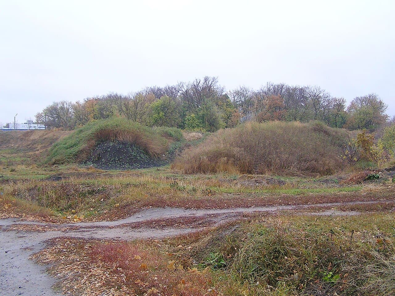
The current state of Bilevska fortress is not well documented, but bastioned fortresses in Ukraine often face challenges related to preservation due to their age and historical conflicts. Depending on the level of conservation efforts, the fortress might range from ruins to partially preserved structures, with some bastions and walls still visible to visitors and historians.

Visiting and cultural importance

For those interested in military history and architecture, Bilevska fortress offers insight into the bastioned fortress design and the strategic military thinking of the early modern period in Eastern Europe. It stands as a cultural heritage site reflecting the turbulent history of Ukraine's borderlands.

Visitors should check local resources for access information, as the fortress's location and visitor facilities are not widely publicized. Exploring such sites contributes to understanding the region's historical landscape and the evolution of fortification techniques.

Frequently asked questions (FAQ)

What is the architectural style of Bilevska fortress?
Bilevska fortress is a bastioned fortress, a style characterized by angled bastions designed to improve defense against artillery attacks, common from the 16th century onward.
When was Bilevska fortress likely built?
While the exact date is unknown, bastioned fortresses like Bilevska were typically constructed in the early modern period, between the 16th and 18th centuries.
Can I visit Bilevska fortress?
Visiting information for Bilevska fortress is limited due to its less publicized location. It is advisable to check local sources or heritage organizations for access details.
Why is Bilevska fortress historically significant?
The fortress represents the military architectural advancements of the early modern period in Ukraine, serving as a strategic defense point in a historically contested region.

Photo gallery

Bilevska fortress
Click to view

Photo by Denis Vitchenko•CC BY-SA 4.0

1 photo • Click any image to view in full screen

Information

Bastioned Fortress

Loading map...

Visitor reviews

No reviews yet. Been here? Write the first review and help other travelers!

Write the first review

Visited this castle? Share your experience

Your review helps other travelers and adds first-hand knowledge to our encyclopedia.
Write a review

(5/5)

0/2000 characters

Your review will be visible after admin approval

Nearby castles

98.8 km
Novobohorodytska Fortress — Ukraine castle

Novobohorodytska Fortress

, Ukraine

Novobohorodytska Fortress, also known as the Bohorodytska Fortress or Theotokos Fortress (Ukrainian: Богородицька фортеця), is a significant 17th-century bastioned fortress located on the right bank of the Samara River in Ukraine. This fortress served as a strategic military retrenchment during the era of the Cossack Hetmanate and played a pivotal role in the conflicts involving the Russian Empire as it sought control over access to the Black Sea and the Sea of Azov. The fortress is historically important for its military function as a frontier outpost and for its connection to the broader geopolitical struggles of Eastern Europe in the early modern period. Historical context and origins The fortress was constructed in the 17th century during a time of intense military and political activity in the region. It was built on the site of the former Cossack town of Samar, indicating that the location had long-standing strategic importance. Rather than being a completely new construction, Novobohorodytska Fortress represents a retrenched fortification that replaced or incorporated earlier defensive works associated with the Cossack settlements. The fortress's establishment coincided with the period when the Cossack Hetmanate was consolidating its power and defending its territories against incursions from neighboring states, including the Polish-Lithuanian Commonwealth and the expanding Russian Empire. As the Russian Empire advanced its ambitions to secure maritime access, fortresses like Novobohorodytska became vital military hubs. Architectural features and design Novobohorodytska Fortress is classified as a bastioned fortress, a style that became prominent in the Renaissance period due to the evolution of artillery warfare. The bastioned design features angular bastions projecting from the curtain walls, allowing defenders to cover adjacent walls with gunfire and eliminating blind spots. This architectural innovation greatly improved the fortress's defensive capabilities against cannon fire and siege tactics. The fortress likely included thick earthen ramparts reinforced with masonry, wide moats or ditches, and multiple layers of walls. The bastions were positioned at strategic points to maximize fields of fire. Inside, the fortress would have housed barracks, armories, command centers, and storage facilities necessary for sustaining a garrison during prolonged sieges. The choice of location on the Samara River provided natural defensive advantages and access to water, which was crucial for both daily life and military operations. The river also served as a transportation route, facilitating the movement of troops and supplies. Military significance and role During the 17th century and beyond, Novobohorodytska Fortress was a key outpost in the contest for control over the southern frontiers of the Cossack Hetmanate and the Russian Empire's expanding territories. It guarded approaches to the fertile lands of the region and protected strategic river crossings. The fortress's military importance was heightened during the conflicts between the Cossacks, the Polish-Lithuanian Commonwealth, and the Russian Empire. It functioned as a defensive bastion against incursions and as a staging ground for military campaigns aimed at securing dominance in the region. Its role in securing access to the Black Sea and the Sea of Azov underscored its strategic value, as control over these waterways was crucial for trade, military movement, and regional influence. Later history and current condition Over time, as military technology and political boundaries evolved, the fortress's strategic importance diminished. The site has undergone various changes, and while much of the original structure may not have survived intact, it remains a site of archaeological and historical interest. Today, Novobohorodytska Fortress is recognized for its historical significance and as a representative example of Renaissance bastioned fortifications in Ukraine. The fortress's remnants provide valuable insights into the military architecture and regional history of the 17th century. Preservation efforts focus on maintaining the site as an archaeological site and cultural heritage landmark, attracting historians, archaeologists, and visitors interested in the military and Cossack history of Eastern Europe. Legacy and cultural importance Novobohorodytska Fortress embodies the complex history of the Cossack Hetmanate and the turbulent geopolitical struggles of Eastern Europe in the early modern era. It reflects the adaptation of Renaissance military architecture to the specific needs of frontier defense in Ukraine. The fortress also serves as a reminder of the Cossack communities' resilience and their role in shaping regional identities. Its location on the site of the former Cossack town of Samar connects it to a broader narrative of settlement, conflict, and cultural exchange along the Samara River.

Renaissance (15th–17th c.)
Details
112.2 km
Kodak Fortress — Ukraine castle

Kodak Fortress

Dnipro, Ukraine

Kodak Fortress stands as a significant historical monument near the modern city of Dnipro in Ukraine. Established in 1635 by the Polish–Lithuanian Commonwealth, it served as a fortified military outpost designed to control the Zaporizhian Cossacks and restrict their access to the Black Sea. The strategic location of Kodak Fortress was chosen following the 1634 peace treaty with Muscovy, reflecting the Commonwealth's intent to assert dominance over the volatile southern frontier. The fortress was developed under the direction of Crown Hetman Stanisław Koniecpolski with the assistance of the notable French military engineer Guillaume Le Vasseur de Beauplan. Early history and military significance Shortly after its foundation, Kodak Fortress became a focal point of conflict. In August 1635, it was seized and partially demolished by Cossack forces led by Hetman Ivan Sulima, who also executed the fortress commander, Jean Marion. Despite this early setback, the Polish Sejm approved reconstruction efforts in 1636. The rebuilding was completed in 1639 by Friedrich Getkant, a German-Swedish engineer, who enlarged the fortress significantly to meet contemporary defensive standards inspired by the New Dutch fortification system. This system emphasized angular bastions and layered defenses optimized to resist artillery, marking Kodak as a modern military installation of its time. The fortress's expanded design allowed it to house a larger garrison and defend against raids and attempts to escape to the nearby Zaporizhian Sich. This strategic importance earned Kodak the nickname "the key to Zaporizhzhia". Role during the khmelnytsky uprising and later conflicts Kodak Fortress played a central role during the Khmelnytsky Uprising. After enduring a siege lasting four months, it surrendered on October 1, 1648 to the Cossack army under Colonel Maksym Nesterenko (or possibly Prokop Shumeiko). Following its capture, Kodak was transformed into a Cossack military base and eventually came under the authority of the Zaporizhian Sich around 1656. Throughout the late 17th and early 18th centuries, Kodak served as a logistical and strategic center during various Russo-Turkish conflicts. The fortress also provided refuge to the rebel leader Kondraty Bulavin during 1707–1708. Under the tenure of Hetman Ivan Mazepa, Kodak functioned as a lookout post monitoring the activities of the Zaporizhian Sich. However, the fortress was ordered destroyed in 1711 according to the terms of the Treaty of the Pruth, along with several other fortifications in the southern region. Although partially rebuilt in the early 1700s, Kodak suffered further damage in the 1720s when Tatar forces captured and burned the site and the adjacent settlement, effectively ending its function as a defensive fortress. Post-military use and decline From 1734 to 1775, the area served as a Cossack settlement and administrative center known as the Kodak palanka. After the destruction of the New Sich in 1775, many displaced Cossacks resettled there, and the locality became known as Stari Kodaky. The historical importance of Kodak Fortress was recognized in 1910 when historian Dmytro Yavornytsky advocated for a memorial plaque commemorating the site. The fortress ruins endured significant damage in the 20th century, especially beginning in 1938 when granite quarrying devastated much of the site. By the 1980s, approximately 90% of the original structure had been lost despite local efforts to protect it. Archaeological investigations have been carried out intermittently since Yavornytsky's initial work in the early 1900s. Renewed excavations since 1990, including those led by archaeologists from Dnipro National University, uncovered remains such as the St. Archangel Michael Church, which had been destroyed in 1937. These efforts have provided valuable insights into the fortress's occupation and use during the Cossack period. Architectural features and layout The original layout of Kodak Fortress reflected a quadrangular earthwork design established in 1635. It featured two half-bastions on the southern side, a defensive rampart surrounding the site, and a protective ditch. After reconstruction in 1639, the fortress expanded nearly threefold and was reshaped into a square measuring approximately 112.5 meters on each side. The design followed the New Dutch fortification system, emphasizing angular bastions and layered defenses suited to resist artillery attacks. The earthen ramparts were substantial, measuring 24 meters wide at the base and rising about 7 meters in height. On top of these ramparts sat two rows of wooden palisades, serving as fencing to provide an additional barrier. Surrounding the fortress on three sides was a broad, dry moat about 11 meters deep and 16 meters wide, designed to hinder attackers. The fourth side faced the steep cliffs of the Dnieper River, offering a natural defensive advantage. Within the fortress grounds stood religious and residential structures, including a Catholic church with an adjoining monastery and an Orthodox church. Around sixty houses formed a small settlement complete with a market near the walls. The garrison grew to around 600 mercenaries equipped with artillery, supplemented by a large watchtower located roughly three kilometers away, enhancing the site's surveillance capabilities. Some reports indicate the fortress could accommodate more than 1,000 people. Current condition and preservation efforts Today, only portions of the northern earth ramparts survive, with much of the fortress demolished due to extensive granite quarrying starting in the late 1930s. Archaeological efforts have identified cultural layers associated with the Cossack period, revealing insights into the fortress's occupation and use. Excavations have unearthed remnants of the St. Archangel Michael Church, a religious building destroyed in 1937 but confirmed to have stood within the fortress precinct. Recent conservation proposals seek to restore surviving features, including the earthworks and moats. Plans include reconstructing sections of the wooden fortifications with palisades and drawbridges along the ramparts to give a clearer sense of the original defensive system. A museum complex is being designed on stilts above the quarry lake, aligning with the reconstructed outlines of the fortress as seen from the river, thereby reviving the silhouette of this once-critical military stronghold.

Late Medieval (14th–15th c.)
Details
161.6 km
Belgorod Fortress — Russia castle

Belgorod Fortress

, Russia

Belgorod fortress is a significant example of a 16th-century bastioned fortress located in the Russian Federation. Constructed during the Renaissance period, this fortress was part of a broader strategic effort to fortify the southern borders of the Russian state against invasions and raids, particularly from the Crimean Tatars and other nomadic groups. The strategic importance and historical context Built in the 16th century, the Belgorod fortress played a crucial role in the defense system of Russia's southern frontier. During this period, the Russian state was expanding and consolidating its territories, necessitating the construction of robust fortifications. The fortress was designed to withstand artillery attacks, reflecting the military advancements of the Renaissance era. Architectural features and design The fortress is classified as a bastioned fortress, a style that emerged in response to the development of gunpowder artillery. Its design incorporates angular bastions projecting outward from the main walls, allowing defenders to cover adjacent walls with cannon and musket fire, eliminating blind spots. This design was revolutionary compared to earlier medieval castles, which typically had round towers and high walls vulnerable to cannon fire. The walls of Belgorod fortress were constructed thick and low, optimized to absorb and deflect artillery shots. The fortress likely included moats or ditches surrounding the walls, along with ravelins and curtain walls to further impede attackers. Gatehouses would have been heavily fortified, possibly with drawbridges and barbicans, enhancing the defensive capabilities. Materials and construction techniques The fortress was built primarily from local stone and brick, materials typical for Russian fortifications of the Renaissance period. The masonry techniques would have combined traditional Russian methods with influences from Western Europe, reflecting the exchange of military architectural knowledge during the Renaissance. Role in regional defense and military history Belgorod fortress served as a military stronghold and administrative center, controlling key routes and protecting the surrounding region. It was part of a network of fortresses that secured the southern borders of Russia and facilitated the expansion into the steppe regions. The fortress's presence deterred raids and provided a base for Russian troops during conflicts. Throughout its history, the fortress likely witnessed various military engagements, sieges, and changes in control, although specific battles are less documented compared to more famous Russian fortresses. Preservation and current status Today, the Belgorod fortress remains a valuable cultural and historical monument. Its condition varies, with some sections well-preserved or restored, while others may be in ruins or partially preserved. The fortress attracts visitors interested in military architecture and Russian history, offering insights into Renaissance-era fortification techniques adapted to the Russian context. Visitor experience and accessibility Visitors to Belgorod fortress can explore its defensive walls, bastions, and possibly remaining gate structures. Interpretive signage or guided tours may be available to provide historical context and explain the architectural features. The site contributes to the understanding of the evolution of fortress design in Russia and the broader European military architectural developments during the Renaissance.

Renaissance (15th–17th c.)
Details