Arabat Fortress — Ukraine castle

Arabat Fortress

Arabat Fortress: 17th-century Ottoman bastioned fortress in Ukraine
Renaissance (15th–17th c.)

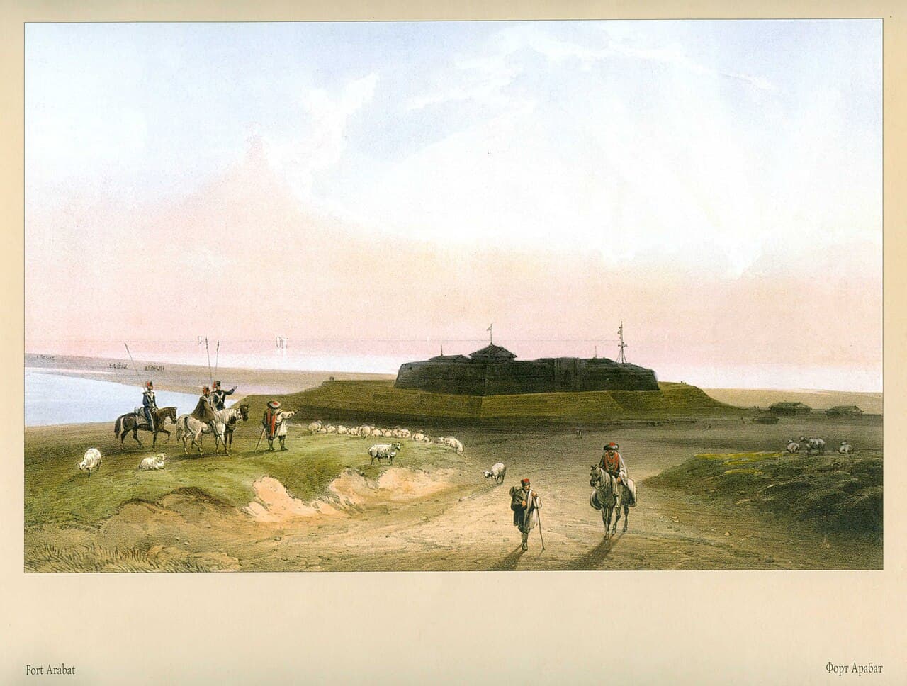
The Arabat Fortress is a 17th-century bastioned fortress constructed by the Ottoman army strategically located at the southernmost part of the Arabat Spit in present-day Ukraine. This fortress was built with the primary function of guarding the narrow spit and protecting the Crimean Peninsula from potential invasions, reflecting the military priorities of the Renaissance period when fortification design evolved to counter artillery advancements.

Historical context and strategic importance

The Arabat Fortress emerged during a period of intense military rivalry in Eastern Europe and the Black Sea region. Constructed by the Ottomans in the 17th century, it was part of a broader network of fortifications aimed at securing Ottoman territorial holdings and trade routes. The location on the Arabat Spit was crucial as it controlled access between the Sea of Azov and the Black Sea, serving as a defensive barrier against incursions from the north and west.

Throughout its operational history, the fortress witnessed various military engagements and changes in control, reflecting the turbulent regional dynamics. It remained in military use, with periods of intermittent activity, until the Crimean War (1853–1856), after which its strategic value diminished due to changing military technologies and political shifts.

Architectural features and design

The fortress is classified as a bastioned fortress, a style characteristic of the Renaissance era when fortifications adapted to the increasing effectiveness of cannon fire. This design includes angled bastions projecting from the curtain walls, allowing defenders to cover adjacent walls with flanking fire, minimizing blind spots.

The Arabat Fortress was built using local materials, with thick stone walls designed to withstand artillery bombardment. The layout includes a series of bastions connected by curtain walls enclosing a central courtyard. The bastions feature embrasures for cannons and were positioned to maximize defensive coverage of the surrounding terrain and waterways.

Additional defensive elements likely included moats or ditches, though the specific details of these features are less documented. The fortress's position on the spit also provided natural defensive advantages, with water on multiple sides limiting enemy approaches.

Military use and historical significance

During its active years, the Arabat Fortress served as a key defensive post for the Ottoman Empire against incursions from neighboring powers, including the Tsardom of Russia and the Crimean Khanate before its annexation by Russia. Its garrison was tasked with monitoring and controlling movement along the Arabat Spit, a vital corridor for military and trade activities.

The fortress's role during the Crimean War underscores its continued military relevance into the mid-19th century. Although it saw limited direct combat during this conflict, its presence contributed to the broader defensive network in the region.

Current condition and preservation

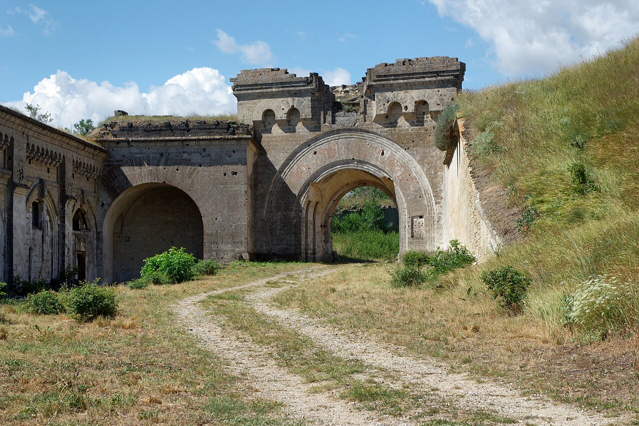
Today, the Arabat Fortress stands as a partially preserved historical site. While some of its walls and bastions remain intact, much of the structure has suffered from the ravages of time and neglect. Restoration efforts have been limited, and the fortress is not extensively developed as a tourist destination.

Despite this, it remains an important cultural and historical landmark in Ukraine, offering insight into Renaissance military architecture and the Ottoman Empire's influence in the Black Sea region. Visitors can explore the surviving fortifications and appreciate the strategic significance of its location.

Visiting information and accessibility

The fortress is accessible to visitors interested in military history and architecture, though facilities may be minimal. Its remote location on the Arabat Spit means that travel arrangements should be planned in advance. The site offers opportunities for photography and exploration of the surrounding natural landscapes.

Frequently asked questions (FAQ)

How do I get to Arabat Fortress?
You can reach Arabat Fortress by traveling to the village of Arabat in Ukraine, which is accessible by car or public transportation. The nearest major city is Genichesk, from where you can take a local bus or taxi to the fortress.
What is the historical significance of Arabat Fortress?
Arabat Fortress, built in the 17th century, played a crucial role in the defense against invasions and was strategically important for the region. It represents a key part of Ukraine's military history and showcases the architectural styles of its time.
When was Arabat Fortress constructed?
The construction of Arabat Fortress began in the late 17th century, around 1695, as part of a series of fortifications in the region. Over the years, it has been modified and restored, reflecting the architectural evolution of military structures.
Can I visit Arabat Fortress year-round?
Yes, Arabat Fortress is open to visitors throughout the year, although the best time to visit is during the warmer months from late spring to early autumn. During winter, access may be limited due to weather conditions.
Why is the architecture of Arabat Fortress unique?
The architecture of Arabat Fortress features elements typical of military fortifications from the 17th century, including thick walls and strategic towers. Its design reflects the blending of defensive needs with the local landscape, making it a fascinating study for architecture enthusiasts.
Is it possible to explore the fortress grounds?
Yes, visitors are welcome to explore the grounds of Arabat Fortress, where they can walk along the walls and enjoy panoramic views of the surrounding area. Guided tours may be available, offering insights into the history and architecture of the fortress.
What are the opening hours for Arabat Fortress?
Arabat Fortress typically opens to visitors from 9 AM to 6 PM daily, but it is advisable to check ahead for any seasonal variations. During peak tourist season, longer hours may be implemented to accommodate more visitors.
Are there any nearby attractions to visit?
Yes, in addition to Arabat Fortress, visitors can explore the beautiful beaches along the Arabat Spit, which offer recreational opportunities and scenic views. The nearby city of Genichesk also has museums and cultural sites worth visiting.
What are the ticket prices for visiting Arabat Fortress?
Entry to Arabat Fortress is usually affordable, with ticket prices varying depending on the season and whether guided tours are included. It's best to check the official website or local tourism offices for the most current pricing information.

Photo gallery

Arabat Fortress
Click to view

Photo by Carlo Bossoli•Public domain

1 photo • Click any image to view in full screen

Information

Bastioned Fortress

Loading map...

Visitor reviews

No reviews yet. Been here? Write the first review and help other travelers!

Write the first review

Visited this castle? Share your experience

Your review helps other travelers and adds first-hand knowledge to our encyclopedia.
Write a review

(5/5)

0/2000 characters

Your review will be visible after admin approval

Nearby castles

31.1 km
Kaffa genoese fortress — Ukraine castle

Kaffa genoese fortress

, Ukraine

The Kaffa Genoese fortress is a significant example of medieval military architecture located in what is now Ukraine. Constructed in the 13th century, this fortress was built by the Genoese, a maritime republic known for their extensive trade networks and fortifications along the Black Sea coast. The fortress served as a crucial stronghold for the Genoese colony of Kaffa, now known as Feodosia, which was a major trading hub in the High Medieval period.Historical context and significanceThe fortress was established during a period of intense commercial expansion by the Genoese in the Black Sea region. Kaffa was one of the most important Genoese colonies, acting as a gateway for trade between Europe and Asia. The fortress was designed to protect the colony from various threats, including rival powers and local nomadic tribes. Its role in securing the Genoese trading interests contributed to the economic prosperity of the region during the High Medieval era.Architectural features and designThe Kaffa Genoese fortress is classified as a bastioned fortress, a style that incorporates angled bastions projecting from the curtain walls. This design allowed defenders to cover adjacent walls with crossfire, enhancing the fortress's defensive capabilities. The bastioned layout was a response to the evolving nature of siege warfare and the increasing use of artillery in the late medieval period, although the fortress predates widespread gunpowder use.The fortress walls were constructed using local stone materials, thick and high enough to withstand assaults. The bastions provided platforms for archers and later for artillery placements. Inside the fortress, there would have been various structures such as barracks, storerooms, and command centers, although much of the internal layout is now lost or in ruins.Defensive structuresThe bastions were connected by curtain walls equipped with battlements and walkways for guards. The fortress likely featured a main gatehouse fortified with towers and possibly a moat or ditch surrounding the walls to hinder attackers. These features were typical of Genoese fortifications, designed to maximize defense and control access points.Role in regional historyThroughout its history, the Kaffa Genoese fortress witnessed numerous conflicts and sieges, especially during the struggles between the Genoese, the Mongols, the Crimean Khanate, and later the Ottoman Empire. The fortress's strategic location on the Crimean Peninsula made it a focal point in regional power dynamics. It was instrumental in maintaining Genoese influence in the Black Sea until the decline of their colonial presence in the 15th century.Current condition and preservationToday, the Kaffa Genoese fortress is mostly in a state of ruins. While some sections of the bastioned walls and towers remain, much of the original structure has been lost due to centuries of warfare, neglect, and natural decay. The site is an important archaeological and historical landmark, attracting researchers and visitors interested in medieval fortifications and Genoese history.Efforts have been made to preserve what remains of the fortress, although extensive restoration has not been undertaken. The ruins provide valuable insights into the military architecture of the period and the Genoese presence in Eastern Europe.Visiting the fortressVisitors to the site can explore the remnants of the bastioned walls and gain an understanding of the fortress's layout and defensive features. The location offers a glimpse into the medieval past of the region and the role of the Genoese in shaping the history of the Black Sea coast. Interpretive signage and guided tours may be available to enhance the visitor experience, depending on local management.

High Medieval (11th–13th c.)
Details
65 km
Genoese Fortress (Sudak) — Ukraine castle

Genoese Fortress (Sudak)

Sudak, Ukraine

The Genoese fortress of Sudak, also known as the Sudak fortress, is a significant medieval bastioned fortress located in the historic town of Sudak in Crimea. Constructed primarily during the 14th century, it was built by the Genoese during their period of commercial and military expansion in the Black Sea region. The fortress occupies a substantial area of approximately 27.9 hectares, making it one of the largest and best-preserved examples of Genoese military architecture in Eastern Europe. Historical context and construction The fortress was developed over a period spanning the 13th to 15th centuries, reflecting the strategic importance of Sudak as a trading hub on the Crimean coast. The Genoese established the fortress to protect their valuable trading colony and to secure maritime routes against rival powers such as the Golden Horde and the Ottoman Empire. The construction involved extensive use of thick defensive walls and bastions, designed to withstand artillery attacks that were becoming more common during the Late Medieval period. Architectural features and design The fortress is characterized by its bastioned walls, which are a hallmark of military architecture from the Late Medieval period, designed to provide overlapping fields of fire and enhanced defense against siege warfare. The walls are punctuated by multiple towers and gatehouses, which served both defensive and administrative functions. The complex includes a citadel area, which housed the command center and living quarters for the fortress garrison. Defensive structures The bastions are strategically placed to cover all approaches to the fortress, allowing defenders to repel attackers effectively. The fortress walls incorporate arrow slits and machicolations for archers and defenders to launch projectiles while remaining protected. The moat surrounding parts of the fortress added an additional layer of defense against siege engines and infantry assaults. Internal layout Inside the fortress, there are remains of various residential buildings, warehouses, and chapels, indicating the fortress was not only a military installation but also a self-sustaining community. The courtyards provided space for mustering troops and storing supplies, while the cisterns ensured a reliable water supply during sieges. Strategic importance and historical events During its active use, the fortress played a crucial role in controlling trade routes along the Black Sea and defending the Genoese colony from various attacks. It was involved in conflicts with the Golden Horde and later faced threats from the expanding Ottoman Empire. The fortress changed hands several times before falling under Ottoman control in the late 15th century. Preservation and current status Today, the Genoese fortress of Sudak stands as a well-preserved monument and is a popular tourist attraction in Crimea. Its extensive walls and bastions remain largely intact, offering visitors a glimpse into medieval military architecture and the complex history of the Black Sea region. Archaeological efforts have helped uncover details about the fortress's construction phases and daily life within its walls. Visiting the fortress Visitors to the fortress can explore its extensive ramparts, towers, and internal buildings. The site provides panoramic views of the surrounding landscape and the Black Sea. Informational displays and guided tours help contextualize the fortress's historical significance and architectural features.

Late Medieval (14th–15th c.)
Details
78.3 km
Kerch Fortress — Ukraine castle

Kerch Fortress

, Ukraine

Kerch Fortress, also known as Fort Totleben, is a prominent 19th-century bastioned fortress situated on Cape Ak-Burun (meaning 'White Cape') at the narrowest point of the Kerch Strait in eastern Crimea. This strategic location made it a critical military installation designed to control and defend the vital maritime passage between the Black Sea and the Sea of Azov. Historical context and construction The fortress was constructed during the Modern period in the 19th century as part of the Russian Empire's efforts to secure its southern borders. Its development was closely linked to the geopolitical tensions of the era, particularly concerns over protecting the empire's access to the Black Sea and countering potential naval threats. The fortress was named after the renowned military engineer Eduard Totleben, who played a significant role in the design and fortification of several key Russian defensive structures during this period. Construction began in the mid-1800s, incorporating the latest military architectural principles of the time, especially those associated with bastioned fortresses. These fortresses were characterized by angular bastions projecting outward from the main walls, allowing defenders to cover adjacent walls with overlapping fields of fire and eliminating blind spots vulnerable to attackers. Architectural features and design Kerch Fortress exemplifies the bastioned fortress typology, which was a dominant form of military architecture in the 17th to 19th centuries. Its design includes a series of massive stone walls and bastions arranged in a polygonal layout to maximize defensive coverage. The fortress walls were built thick and high, constructed from local stone and reinforced with earthworks to absorb artillery fire. The fortress complex included ramparts, moats, and artillery batteries positioned to cover the approaches by land and sea. The location on Cape Ak-Burun provided natural defensive advantages, with steep cliffs and the surrounding waters acting as barriers against assault. Inside the fortress, there were casemates for housing troops and storing ammunition, as well as command posts and observation towers to monitor enemy movements. The layout was carefully planned to facilitate communication and rapid deployment of forces in response to threats. Military significance and operational history Throughout its operational life, Kerch Fortress served as a key defensive stronghold controlling the Kerch Strait. Its strategic importance was underscored during various military conflicts, including the Crimean War and later regional tensions. The fortress was intended to deter naval incursions and safeguard the maritime routes crucial for trade and military logistics. Although it never faced a major siege, the fortress's presence contributed to the security of the Russian Empire's southern frontier. It also functioned as a base for coastal artillery units and a staging point for naval operations in the Black Sea region. Later developments and current condition After the decline of fortress-based coastal defenses in the late 19th and early 20th centuries, Kerch Fortress gradually lost its military relevance. Technological advances in artillery and naval warfare rendered many such fortifications obsolete. Today, the fortress remains a significant historical and architectural monument. Its well-preserved bastioned walls and structures offer insight into 19th-century military engineering. The site attracts visitors interested in military history and architecture, although some parts may be in varying states of preservation due to natural weathering and limited restoration efforts. Geographical and cultural importance The fortress's location on the Kerch Strait continues to hold strategic and symbolic value. It stands as a testament to the military and geopolitical history of the region, reflecting the Russian Empire's efforts to control important maritime access points. In addition to its military legacy, the fortress contributes to the cultural heritage of Crimea, offering a tangible connection to the past and a focal point for historical tourism. Its commanding position provides panoramic views of the surrounding sea and coastline, enhancing its appeal as a site of interest.

Modern (19th–20th c.)
Details