Wieladingen Castle

Wieladingen Castle: medieval ruin with panoramic alpine views
Rickenbach, Germany
High Medieval (11th–13th c.)
Well Preserved

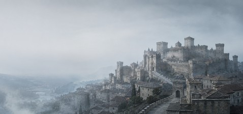
Wieladingen Castle is a notable high medieval hill castle ruin situated approximately 90 metres above the Murg valley near Rickenbach in the Hotzenwald region of Germany. Constructed in the 12th century, the castle was first documented in 1260 and served as a residence for local squires and knights during the 13th and 14th centuries. Although it fell out of historical records by the late 14th century, the castle's remains have been preserved and offer insight into medieval fortification and noble life in this part of the Black Forest.

Historical background and significance

The castle's origins trace back to the high medieval period, a time when hill castles were strategically built to control valleys and trade routes. Wieladingen Castle was likely established to oversee the Murg valley, providing both defense and administrative control. The castle was inhabited by the knights and squires of Wieladingen, a minor noble family whose influence waned by the end of the 14th century, leading to the castle's abandonment.

Architectural features and layout

The castle's remains include a prominent 20-meter tall keep (donjon), which is a central defensive tower typical of medieval fortifications. This keep was structurally secured in recent conservation efforts and made accessible via an external spiral staircase, allowing visitors to reach the observation platform. From this vantage point, one can enjoy a panoramic view of the surrounding landscape, including a detailed panoramic panel of the Alps.

The castle's elevated position on a hilltop provided natural defensive advantages, with steep slopes protecting it on multiple sides. The layout likely included residential quarters, defensive walls, and possibly a courtyard, though much of the superstructure has not survived intact.

Defensive elements

Typical of high medieval hill castles, Wieladingen would have featured thick stone walls and battlements designed to withstand sieges. The keep served as the last refuge in case of attack. The castle's location above the valley allowed for early warning of approaching enemies and control over the surrounding territory.

Conservation and visitor experience

Wieladingen Castle is classified as a well-preserved ruin following careful structural stabilization. The restoration of the keep's accessibility has enhanced its appeal as a cultural and historical site. Visitors can climb the external spiral staircase to the top of the keep, where the observation platform offers sweeping views of the Alps and the Black Forest region.

The castle's accessibility and interpretive elements, such as the panoramic panel, provide educational value and promote heritage tourism in the Hotzenwald area. The site serves as a tangible connection to medieval history and architecture in southwestern Germany.

Wieladingen Castle in the regional context

Located in the Hotzenwald area of the Black Forest, Wieladingen Castle is part of a network of medieval fortifications that once dotted the landscape. These castles played a crucial role in local governance, defense, and the assertion of noble power during the Middle Ages. Wieladingen's position above the Murg valley highlights its strategic importance in controlling movement through this part of the region.

Today, the castle contributes to the cultural heritage and tourism appeal of Rickenbach and the surrounding communities, offering insights into medieval life and architecture.

Architectural style and period

The castle exemplifies high medieval military architecture with Romanesque influences typical of 12th-century construction. The focus on a strong keep and hilltop location aligns with defensive priorities of the period. Although much of the original structure is lost, the surviving keep reflects the robust masonry and functional design characteristic of the era.

Frequently asked questions (FAQ)

How do I reach Wieladingen Castle in Rickenbach?
Wieladingen Castle is located about 90 metres above the Murg valley near Rickenbach. Visitors can access the site via hiking trails from the town center, with signage guiding the way.
What is the historical significance of Wieladingen Castle?
Built in the 12th century, Wieladingen Castle served as a residence for local knights and squires and played a strategic role in controlling the Murg valley during the high medieval period.
Is the castle keep accessible to visitors?
Yes, the 20-meter tall keep has been structurally secured and features an external spiral staircase allowing visitors to reach the observation platform.
When was Wieladingen Castle first documented?
The castle was first documented in 1260, during the high medieval period.
What views can I expect from the castle?
From the observation platform atop the keep, visitors can enjoy panoramic views of the Alps and the surrounding Black Forest landscape.

Information

Hill Castle

Loading map...

Visitor reviews

No reviews yet. Been here? Write the first review and help other travelers!

Write the first review

Visited this castle? Share your experience

Your review helps other travelers and adds first-hand knowledge to our encyclopedia.
Write a review

(5/5)

0/2000 characters

Your review will be visible after admin approval

Nearby castles

5.5 km

Laufenburg Castle

Laufenburg, Switzerland

Laufenburg Castle stands as a remarkable example of a high medieval hill castle situated in the Swiss town of Laufenburg, in the canton of Aargau. Constructed in the 12th century by the influential Habsburg family, this fortress played a significant role in regional defense and governance along the Rhine River. Its strategic position atop a hill overlooking the river allowed control over vital trade and travel routes, making it a focal point of power and conflict for centuries. The castle's origins trace back to around 1180 when the Habsburgs acquired the territory surrounding present-day Laufenburg. They established fortifications on both sides of the Rhine, including an initial castle on the northern bank. Elements of this early structure were likely incorporated into the later southern castle, which evolved into the main stronghold. The castle's design reflects the typical medieval emphasis on defense, featuring a robust bergfried (main tower), thick stone walls, and multiple defensive towers. Historical development and ownership The history of Laufenburg Castle is closely intertwined with the fortunes of the Habsburg dynasty. In the late 12th century, Count Rudolf II of Habsburg sought to found a town adjacent to the castle. However, his ambitions were curtailed by an arbitration ruling favoring the abbess of the nearby Säckingen monastery, which prevented the establishment of the town at that time. Despite this setback, Rudolf's son, Rudolf III, moved his residence to the southern castle and transformed it into a more comfortable residential castle, founding the Habsburg-Laufenburg lineage. Throughout the 13th century, the settlement around the castle gradually expanded and was granted town privileges, officially renewed in 1328. These rights helped the town develop economically and politically, despite ongoing disputes over its status. The castle and its lordship remained under Habsburg control until financial difficulties forced Graf Hans IV to sell the property in 1386 to Duke Leopold III of Austria for 12,000 guilders. The 15th century was marked by military conflicts that impacted the castle's fortunes. During the Old Zürich War in 1443, forces from Basel and Bern attacked Laufenburg, causing significant damage to the fortress. Later, during the Burgundian Wars, the castle briefly came under the control of Duke Charles the Bold. Following his defeat, Kaspar von Schönau took possession and undertook repairs in 1486 to restore the castle's defenses and habitability. Sieges and military significance The castle's military importance continued into the Thirty Years' War, during which it was captured three times by Swedish forces. This turbulent period further strained the castle's structure and defenses. It was not until 1648 that Austrian control was reestablished. At this time, the castle still retained substantial fortifications, including defensive walls with towers nearly as tall as the bergfried. The complex featured numerous rooms, a castle garden, and a chapel, illustrating its dual role as a fortress and noble residence. However, the prolonged warfare left the castle in a deteriorated condition. By 1687, military experts from Italy declared the fortress obsolete, leading to its abandonment as a defensive site. The castle was gradually neglected and eventually deserted in 1787. Subsequently, it was used as a quarry, with stones taken for other building projects. Architectural features and remains Today, the most prominent surviving feature of Laufenburg Castle is the bergfried, an imposing main tower that rises nearly intact. This tower originally had an entrance door positioned about four meters above the courtyard level on its northern side, a defensive measure to prevent easy access. Visitors now reach the bergfried via a modern external spiral staircase made of steel, which leads to an observation platform approximately thirteen meters above ground. The platform offers panoramic views of the historic town on both sides of the Rhine, the river itself, several bridges, nearby railway lines, and a hydroelectric power station along the High Rhine. Inside, a separate internal staircase ascends the full height of the tower, ending at a metal box marking the top of the stairs. The castle's former defensive perimeter included a ring wall reinforced by multiple towers, which in their prime rose to nearly the height of the bergfried. These stone walls exemplify medieval construction techniques designed to withstand sieges and attacks. Although the majority of the castle's residential buildings, garden, and chapel no longer survive above ground, archaeological studies and historical documents attest to their existence and importance. Preservation and modern significance After the castle was purchased by the city of Laufenburg in 1803, efforts to preserve the ruins began slowly. A park was established on the site in 1908, providing public access and enhancing the area's cultural value. More comprehensive restoration work was undertaken in 1986 to stabilize the remaining structures, particularly the bergfried and adjoining walls. Today, Laufenburg Castle stands as a significant historical monument and a testament to the region's medieval heritage. It attracts visitors interested in castle architecture, medieval history, and the legacy of the Habsburg dynasty. The castle's location on a hill overlooking the Rhine continues to offer strategic and scenic importance, linking past and present in the heart of Laufenburg. Visitor experience and accessibility Visitors to Laufenburg Castle can explore the ruins and ascend the bergfried to enjoy sweeping views of the surrounding landscape. The site is accessible via well-maintained paths leading up the hill, and the modern staircases ensure safe access to the tower's observation platform. Informational signage provides historical context, enriching the visitor experience. The castle's proximity to the town center makes it an easily reachable destination for those interested in Swiss medieval architecture and history. Cultural and heritage importance Laufenburg Castle is emblematic of the high medieval fortifications established by the Habsburgs during their territorial expansion. Its history reflects the complex political and military struggles of the region, including conflicts such as the Old Zürich War and the Thirty Years' War. The castle's architectural features, particularly the bergfried and defensive walls, offer valuable insights into medieval construction and defensive strategies. As a preserved ruin, the castle also serves as a cultural landmark, fostering local identity and historical awareness. Conservation efforts have ensured that this heritage site remains a vital part of Laufenburg's landscape, contributing to tourism and education.

High Medieval (11th–13th c.)
Details
8.1 km

Bärenfels Castle

Wehr, Germany

Bärenfels castle, formerly known as Steinegg, is a notable late medieval fortress perched at the entrance to the Wehra valley above the town of Wehr in the Hotzenwald hills of southwestern Germany. Constructed between 1323 and 1330 by the noble Vasolt family, the castle occupies a strategic hilltop position that commands extensive views over the surrounding landscape. Historical background and ownership The castle's origins trace back to the early 14th century when the Vasolt family established it as a fortified residence and defensive stronghold. By the 13th century, ownership likely transferred to the Barons of Schönau, marking the beginning of a series of noble custodians. Subsequently, the castle came under the control of the Margraves of Hachberg, a powerful noble family in the region. These margraves leased the castle to the Barons of Bärenfels, a knightly family from Basel, whose name the castle adopted and retains today. Architectural features and layout Bärenfels castle exemplifies typical hill castle architecture of the late medieval period, designed to leverage its elevated terrain for defense and surveillance. The castle complex includes a prominent tower, which remains visible from great distances and serves as a landmark. This tower offered an advantageous vantage point, providing sweeping views of the Swiss Jura mountains, the Dinkelberg region, and the Wiesental valley. The castle's construction features robust stone walls and fortified gates characteristic of the era, aimed at withstanding sieges and controlling access to the valley below. Although much of the original structure has fallen into ruin, the remaining elements give insight into its defensive design and residential functions. Preservation and modern significance Since the end of the 19th century, the Schwarzwaldverein (Black Forest hiking club) has taken an active role in preserving and renovating the ruins of Bärenfels castle. Their efforts have made the site accessible to visitors, allowing hikers and history enthusiasts to explore the remains and appreciate the castle's historical context. The castle ruins, particularly the tower, continue to attract visitors who seek panoramic views and a connection to the region's medieval heritage. The site serves as a cultural landmark within the Black Forest region, linking natural beauty with historical architecture. Geographical and strategic importance Situated high in the Hotzenwald hills, Bärenfels castle's location was chosen for its commanding oversight of the Wehra valley, an important route through the region. The elevated position allowed its occupants to monitor movements and defend the territory effectively against potential invaders or rival factions during the turbulent late medieval period. The castle's proximity to the borders of Switzerland and the scenic views of the Swiss Jura underscore its strategic and aesthetic significance. Its placement reflects the medieval practice of establishing fortifications at key transit points and natural chokepoints to control trade and military passage. Visitor experience and access Today, visitors to Bärenfels castle can explore the ruins and climb the surviving tower for expansive views of the surrounding landscapes. The site is integrated into hiking routes managed by the Schwarzwaldverein, offering an engaging combination of outdoor activity and historical exploration. The castle's location above Wehr makes it accessible for day trips, with pathways leading through the scenic Black Forest region. Interpretive signage and guided information help contextualize the castle's history and architectural features for visitors.

Late Medieval (14th–15th c.)
Details
10.3 km

Alt-Thierstein Castle

Gipf-Oberfrick, Switzerland

Alt-Thierstein Castle is a significant medieval fortress located on a hillside in the municipality of Gipf-Oberfrick, Switzerland. Constructed in the early 11th century by the noble Counts of Tierstein, later known as the Counts of Homberg, the castle stands as a testament to early medieval fortification practices and noble family heritage in the region. Historical background and noble lineage The castle's earliest documented association is with Count Rudolf I, who referenced the fortress in official documents dated 1082 and 1114. This highlights the castle's role as a family stronghold and seat of power during the high medieval period. In the early 12th century, the Homberg family split into two branches, with one led by Count Rudolf III of Homberg establishing the Tierstein line, which took control of Alt-Thierstein Castle. During the 14th century, the Tierstein family further divided, giving rise to the Farnsburg lineage, which inherited the castle. The construction of Neu-Thierstein Castle near Büsserach in the late 13th century reflected shifts in family holdings and the need for new residences. Despite this, Alt-Thierstein remained inhabited well into the 15th century, with its abandonment closely linked to the extinction of the Tierstein-Farnsburger line. Architectural features and site layout Alt-Thierstein Castle is a classic example of a hill castle, strategically positioned on the southeastern slope of the Tiersteinberg hill, approximately 750 meters high. Rather than occupying the summit, the fortress was built on a large rocky outcrop about 600 meters above sea level. This natural foundation, measuring roughly 55 by 40 meters, provided a robust base for the castle’s structures. The castle's design ingeniously adapted to the steep hillside through the use of terracing. Builders carved multiple terraces into the slope, creating level platforms for construction. This stepped arrangement not only maximized defensive capabilities but also integrated the fortress harmoniously with the natural landscape. Although much of the original masonry has been removed over time—often repurposed by local inhabitants—the remaining ruins still delineate the castle's footprint and its relationship with the terrain. Surrounding fields bear names such as "Burgmatte" and "Burghalde," German terms meaning "castle meadow" and "castle slope," preserving the memory of the fortress in local toponymy. Impact of natural disasters and archaeological efforts The castle endured the 1356 Basel earthquake, a major seismic event that also destroyed nearby Alt-Homburg Castle. Records indicate that Alt-Thierstein sustained damage but was repaired rather than abandoned immediately. This resilience underscores the castle’s importance and the commitment to maintaining its defensive role during the medieval period. In 1934, an archaeological excavation led by Hans Erb sought to uncover more about the site. Unfortunately, the excavation was poorly documented, and artifacts were mixed, complicating modern study. Despite this, the dig contributed valuable insights into the castle’s layout and construction phases. Cultural significance and preservation status Today, Alt-Thierstein Castle stands as a partially preserved hill castle ruin that offers visitors a glimpse into medieval fortification strategies and noble life in Switzerland. Its location on a prominent rocky outcrop provides commanding views of the surrounding landscape, emphasizing its strategic importance. The castle’s ruins, though incomplete, remain a valuable cultural heritage site. They illustrate the interplay between natural topography and human engineering in medieval castle construction. The site is accessible to visitors interested in history, architecture, and archaeology, contributing to the understanding of regional medieval history. Architectural elements and defensive features While detailed architectural plans are lacking, the castle’s terraced design suggests a complex arrangement of defensive walls, residential buildings, and possibly a keep or tower house. The natural rocky foundation would have enhanced the castle’s defensibility, making it difficult for attackers to approach or undermine the walls. The terraces likely supported various functional spaces, including living quarters, storage areas, and defensive battlements. The integration of natural rock formations into the castle’s defenses is characteristic of hill castles built in challenging terrain during the medieval period. Historical context within Swiss medieval fortifications Alt-Thierstein Castle is part of a broader network of medieval fortifications in the Swiss Jura region. Its construction and use reflect the feudal dynamics and territorial disputes typical of the high and late medieval periods. The castle’s endurance through seismic events and family line transitions highlights its strategic and symbolic significance. The transition from Alt-Thierstein to Neu-Thierstein Castle mirrors broader trends in castle development, where newer residences were built to accommodate changing defensive needs and residential preferences among noble families. Visitor information and accessibility Located near Gipf-Oberfrick, the castle ruins are accessible via hiking trails that ascend the Tiersteinberg hillside. Visitors can explore the terraces and enjoy panoramic views of the Swiss landscape. While no formal visitor center exists, informational signage at the site provides historical context. Due to the castle’s ruinous state, visitors should exercise caution when navigating uneven terrain. The site is open year-round, with the best visiting conditions in late spring through early autumn when weather is favorable. Frequently asked questions When was Alt-Thierstein Castle built? The castle was constructed in the early 11th century by the Counts of Tierstein. What type of castle is Alt-Thierstein? It is a hill castle, built on a rocky outcrop with terraced platforms. Is the castle accessible to visitors? Yes, the ruins are accessible via hiking trails near Gipf-Oberfrick and can be visited year-round. What happened during the 1356 earthquake? The castle was damaged but repaired after the major earthquake centered near Basel. Are there any archaeological excavations? A 1934 excavation led by Hans Erb uncovered artifacts, although documentation was limited. Why was the castle abandoned? Its abandonment is linked to the extinction of the Tierstein-Farnsburger noble line in the 15th century.

Early Medieval (5th–10th c.)
Details