Fortress of Ghat — Libya castle

Fortress of Ghat

Fortress of Ghat in Libya

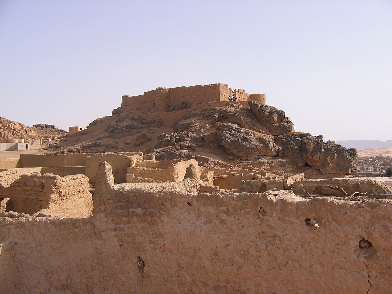
The Fortress of Ghat is a prominent bastioned fortress located on the hill of Koukemen overlooking the town of Ghat in southwestern Libya. This strategic position provided defensive advantages controlling the surrounding desert and trade routes. The fortress was originally constructed by the Ottoman military during their rule in the region, reflecting the empire's efforts to secure its Saharan territories.

Historical background and Ottoman origins

The fortress was established in the late Ottoman period, likely in the 19th century, as part of the empire's military infrastructure to maintain control over the Fezzan region. The Ottomans built the fortress with thick stone walls and bastions designed to withstand artillery attacks, a common feature of bastioned fortresses of that era. Its location on the hill provided commanding views, enabling surveillance and defense against potential invaders or local uprisings.

Architectural features and design

The Fortress of Ghat is characterized by its bastioned design, which includes angular bastions projecting from the main walls. These bastions allowed defenders to cover adjacent walls with gunfire, eliminating blind spots. The fortress walls are constructed from local stone and mortar, exhibiting a robust and utilitarian style typical of military architecture in the Saharan environment.

Inside the fortress, there are remnants of military barracks, storage rooms, and defensive structures such as ramparts and gun embrasures. The layout is compact, optimized for defense rather than comfort, reflecting its primary function as a military stronghold.

Impact of the Italian campaign and 20th-century restoration

During the Italian campaign against Libya in the early 20th century, the fortress suffered partial destruction. The Italians, seeking to consolidate their colonial control, targeted Ottoman military installations including the Fortress of Ghat. Following damage sustained during these conflicts, the fortress underwent significant rebuilding in the 1930s.

The restoration efforts in the 1930s aimed to reinforce the fortress's defensive capabilities and repair war damage. This period of reconstruction introduced some modern building techniques while preserving the original bastioned layout. The fortress continued to serve as a military post under Italian colonial administration.

Current condition and cultural significance

Today, the Fortress of Ghat stands as a partially preserved military structure that offers insight into the Ottoman and colonial military architecture in the Sahara. While some sections remain intact, others show signs of decay due to age and exposure to harsh desert conditions.

The fortress is a significant cultural landmark in Ghat, representing the historical layers of Ottoman and Italian influence in southwestern Libya. It attracts visitors interested in military history, Saharan heritage, and architectural fortifications.

Visiting and accessibility

Visitors to Ghat can access the fortress by climbing the hill of Koukemen, where the structure dominates the skyline. The site provides panoramic views of the surrounding desert landscape and the town below. Due to its remote location and preservation status, visitor facilities are limited, and guided tours may not always be available.

Frequently asked questions (FAQ)

How do I get to the Fortress of Ghat?
The Fortress of Ghat is accessible by road from major cities in Libya. Visitors can reach it by renting a car or taking a taxi or bus service. It is advisable to check local travel advisories and road conditions before your visit.
What is the historical significance of the Fortress of Ghat?
The Fortress of Ghat, built during the medieval period, served as a vital stronghold for trade routes across the Sahara Desert. It showcases the strategic importance of Ghat in connecting various cultures and trade networks. The fortress is a testament to the architectural ingenuity and historical narratives of the region.
When was the Fortress of Ghat constructed?
The construction of the Fortress of Ghat dates back to the 15th century. It was built to provide defense and protection against invasions and to control trade in the area. Its age adds to the allure of the site for history enthusiasts.
Can I take photos inside the Fortress of Ghat?
Yes, visitors are generally allowed to take photos inside the Fortress of Ghat. However, it is important to be respectful of any signs indicating restrictions in certain areas. Capturing the architectural beauty and panoramic views is a must for any visitor.
Why is the architecture of the Fortress of Ghat unique?
The architecture of the Fortress of Ghat is unique due to its blend of Berber and Islamic influences, characterized by intricate designs and robust structures. The use of local materials and traditional building techniques reflects the cultural heritage of the region. This distinct architectural style makes it a fascinating site for visitors interested in historical architecture.
Is it possible to access the Fortress of Ghat year-round?
Yes, the Fortress of Ghat is generally accessible year-round, although visiting during the cooler months, from October to April, is recommended. During the summer, temperatures can be quite high, making exploration less comfortable. Check local conditions before planning your visit.
What are the opening hours of the Fortress of Ghat?
The Fortress of Ghat typically opens daily from 9 AM to 5 PM, but it is advisable to confirm current hours before your visit. Special events or seasonal changes may affect these hours. Arriving early can give you a quieter experience and more time to explore.
Are there any nearby attractions to visit while in Ghat?
Yes, while visiting Ghat, you can explore the stunning landscapes of the Sahara, visit traditional Berber villages, and enjoy local markets. Other historical sites nearby can enrich your experience of the region's culture and history. Make sure to allocate time for these nearby attractions during your visit.
What are the ticket prices for visiting the Fortress of Ghat?
Ticket prices for the Fortress of Ghat are generally affordable, often ranging from a few Libyan dinars for adults to reduced prices for children and students. It's a good idea to check for any guided tour options that might be available, as they can enhance your understanding of the fortress's history. Be prepared for possible changes in pricing, especially during peak tourist seasons.

Photo gallery

Fortress of Ghat
Click to view
1 photo • Click any image to view in full screen

Information

Bastioned Fortress

Loading map...

Visitor reviews

No reviews yet. Been here? Write the first review and help other travelers!

Write the first review

Visited this castle? Share your experience

Your review helps other travelers and adds first-hand knowledge to our encyclopedia.
Write a review

(5/5)

0/2000 characters

Your review will be visible after admin approval

Nearby castles

487.7 km
Madama — Niger castle

Madama

, Niger

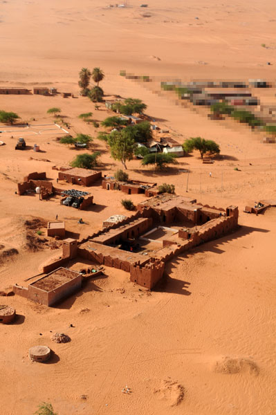
Madama fort is located at a strategic border settlement on the northeast frontier of Niger, near the border with Libya. Originally constructed in 1931 during the French colonial period, the fort served as a key military outpost controlling movement along this remote and harsh desert frontier. Its primary function was to monitor and regulate travel between Niger and Libya, reflecting the geopolitical concerns of the early 20th century in this region. Historical context and construction The fort was built by the French colonial administration as part of their efforts to secure and control their territories in West Africa. Constructed in the early 20th century, it is classified as a bastioned fortress, a style characterized by angular bastions designed to provide defensive fire coverage along the walls. This architectural approach was typical for military forts of the time, intended to withstand attacks and provide a strong defensive position in a remote desert environment. Madama fort's establishment in 1931 came at a time when colonial powers were consolidating their holdings and establishing military outposts to assert control over vast and often sparsely populated regions. The fort's location was chosen for its strategic importance in monitoring cross-border movement and preventing incursions. Architectural features and military significance The fort's design incorporates bastions which allowed defenders to cover all approaches with overlapping fields of fire. The structure was likely built with thick walls and limited openings to resist artillery and small arms fire. Surrounding the fort is a perimeter of barbed wire and a field of landmines, underscoring its continued military role and the security concerns in the region. While the fort itself is modest in size compared to larger colonial fortifications elsewhere, its isolated location and defensive features made it a vital point of control on Niger's northeastern frontier. The harsh desert environment further enhanced its defensive advantages, as supply and reinforcement routes were difficult for potential attackers. Current status and accessibility Today, Madama fort remains primarily a military installation rather than a tourist site. Its surroundings, including the extensive barbed wire and landmine fields, restrict civilian access and reflect ongoing security issues in the border area. The fort stands as a relic of colonial military architecture adapted to desert frontier conditions. Visitors interested in the history of colonial military outposts in Africa will find Madama notable for its strategic location and the persistence of its defensive structures. However, due to security restrictions, access is generally limited and requires official permission. Geopolitical importance of Madama Madama's position on the frontier between Niger and Libya has made it a focal point for border control and military presence, especially given the regional instability in recent decades. The fort symbolizes the legacy of colonial-era border demarcations and the ongoing challenges faced by modern states in managing vast and remote borderlands. Its continued use as a military post highlights the intersection of historical architecture and contemporary security needs in this part of the Sahara desert.

Contemporary (20th–21st c.)
Details
804.9 km
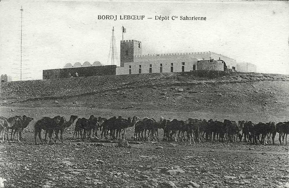
Borj le Bœuf — Tunisia castle

Borj le Bœuf

, Tunisia

Borj le Bœuf is a prominent bastioned fortress located in Tunisia, representing a significant example of military architecture designed to withstand artillery attacks. Its strategic position highlights its historical role in regional defense, particularly during the period when coastal and inland fortifications were crucial for controlling trade routes and protecting against invasions. Historical context and significance The fortress of Borj le Bœuf was constructed during an era when fortifications were evolving to counter new military technologies, especially the widespread use of cannons and gunpowder artillery. This period saw the development of bastioned fortresses, characterized by angular bastions projecting from curtain walls, allowing defenders to cover adjacent walls with overlapping fields of fire. While the exact construction date of Borj le Bœuf is not precisely documented, its architectural features place it within the post-medieval era, likely between the 16th and 18th centuries, when such fortifications were common in North Africa under Ottoman influence and European colonial pressures. Tunisia's strategic location on the Mediterranean made it a focal point for military and trade control, with fortresses like Borj le Bœuf playing vital roles in regional security. Architectural features Borj le Bœuf exemplifies the bastioned fortress design, featuring prominent angular bastions at its corners. These bastions were constructed to eliminate blind spots and provide overlapping defensive fire, a key innovation in fortification design that improved the fortress's ability to resist sieges and artillery bombardment. The fortress walls are thick and robust, built from local stone materials to absorb and deflect cannon fire. The layout typically includes a surrounding ditch or moat, enhancing its defensive capabilities by impeding direct assaults on the walls. The entrance gate would have been fortified with additional defensive structures such as a ravelin or drawbridge, although specific details about Borj le Bœuf's gate complex are not well documented. Inside the fortress, there would have been various functional buildings including barracks, armories, and storage facilities to support the garrison stationed there. The design reflects a balance between defensive strength and practical military needs. Strategic location and military role Situated in Tunisia, Borj le Bœuf was part of a network of fortifications designed to secure key points along the coast and inland routes. Its bastioned design was particularly suited to withstand attacks from both land and sea, providing a stronghold against rival powers and pirates who threatened Mediterranean trade. The fortress's military role extended beyond mere defense; it served as a base for controlling surrounding territories and projecting power in the region. Its presence contributed to the stability and security of the area during periods of conflict and political change. Preservation and current status Today, Borj le Bœuf remains an important cultural and historical monument in Tunisia. Although detailed information about its current condition is limited, bastioned fortresses of this type often survive as well-preserved or partially preserved structures, offering valuable insights into the military architecture of the post-medieval period. Efforts to preserve such fortresses contribute to understanding Tunisia's historical landscape and its role in Mediterranean history. Visitors to the site can appreciate the fortress's imposing walls and bastions, which stand as a testament to the architectural and military ingenuity of the time. Architectural legacy in Tunisia Borj le Bœuf is part of Tunisia's broader heritage of fortifications that reflect diverse influences, including Ottoman and European military engineering. The bastioned fortress style represents a significant phase in the evolution of defensive architecture, marking a transition from medieval castles to modern fortresses designed for gunpowder warfare. This architectural legacy is evident in other Tunisian fortresses and coastal defenses, which collectively illustrate the strategic importance of the region and its adaptation to changing military technologies.

Post-Renaissance (17th–18th c.)
Details
847.1 km
Gasr Banat — Libya castle

Gasr Banat

Bani Walid, Libya

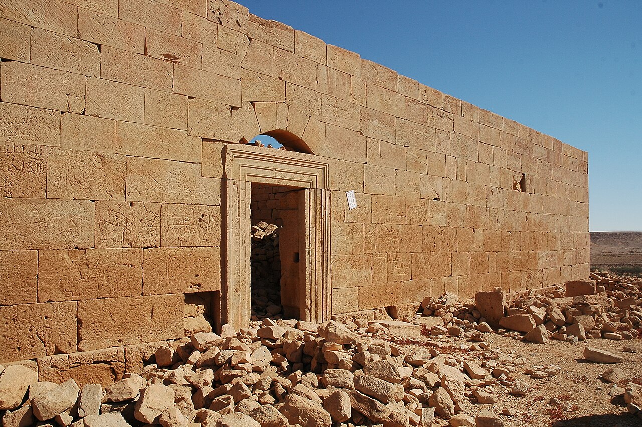
Gasr Banat, also known as Gasr Isawi, is a significant archaeological site located near Bani Walid in Libya. This site is notable for its remains of an Ancient Roman centenarium, a type of fortified farmstead or "perched" oppidum, dating back to the 3rd century CE. The centenarium's strategic position and architectural design reflect Roman rural military and agricultural practices in North Africa during the Early Medieval period. The site was extensively studied by the archaeologist Graeme Barker in 1984, who contributed to understanding its historical context and construction techniques. Pottery fragments found around Gasr Banat confirm the dating to the third century CE, situating the centenarium within the broader framework of Roman imperial frontier settlements. Architectural features of the centenarium The centenarium at Gasr Banat exhibits architectural characteristics typical of Roman fortified farmsteads, designed to protect agricultural resources and serve as a military outpost. It shares a striking resemblance to a similar structure found at Gherait esh-Shergia north of Wadi Nefud, suggesting a regional architectural style or common purpose among these installations. The building likely included robust defensive walls, towers, and internal courtyards, although much of the original structure now lies in ruins. Despite the loss of some surrounding medieval walls—possibly due to natural decay or conflict—the core of the centenarium remains in a fairly good condition, enabling ongoing archaeological study. Associated structures and landscape features Within the nearby valley, there is an ancient temple-type mausoleum dating to the same period as the centenarium. This mausoleum features a burial chamber decorated with fish motifs, which may hold symbolic or religious significance linked to Roman funerary practices in the region. Additional remnants in the vicinity include a Roman quarry and several dams constructed within the nearby wadi (valley). These features illustrate the extensive use of local natural resources and water management techniques employed to support the settlement and its agricultural activities. Historical use and significance The centenarium at Gasr Banat was actively used for several centuries, indicating its importance as a sustained rural and military installation during the Roman and Early Medieval periods. The presence of medieval walls around the centenarium suggests continued occupation or reuse into later historical phases, although these walls no longer stand intact. Today, the site also serves as a semi-permanent camp for nomadic groups, linking its ancient heritage with ongoing human activity in the region. Gasr Banat's combination of military, agricultural, and funerary elements provides valuable insights into the Roman frontier system in North Africa and the adaptation of Roman architecture to local conditions. Archaeological investigations and preservation Since its initial study in the 1980s, Gasr Banat has attracted scholarly attention for its well-preserved centenarium and associated structures. Archaeological efforts have focused on documenting the site's layout, construction methods, and material culture, such as pottery and architectural decoration. Despite its classification as ruins, the site retains considerable archaeological value, offering a rare glimpse into Roman rural fortifications outside the more commonly studied urban centers. Preservation challenges include natural erosion and the impact of modern use by local populations.

Early Medieval (5th–10th c.)
Details