Fort Nassau
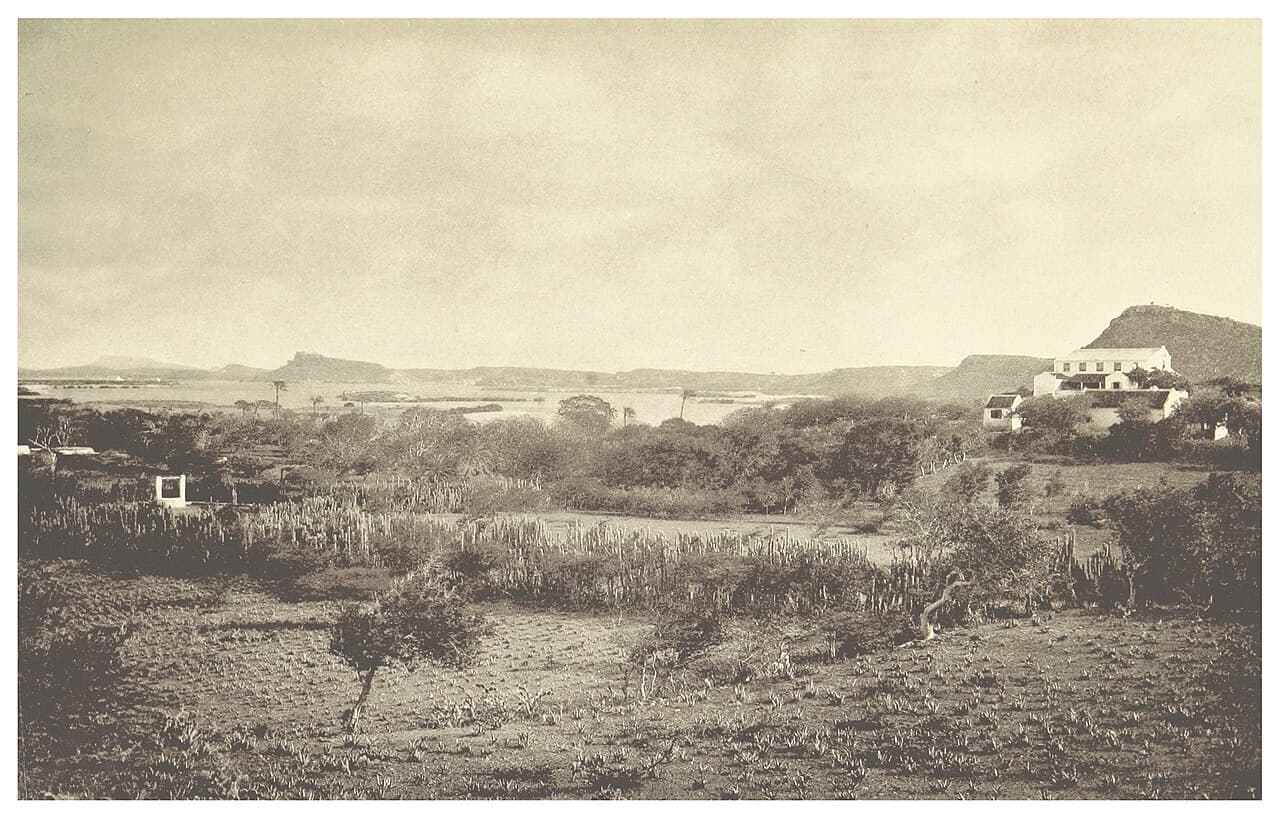
Fort Nassau stands prominently on a 68-meter-high hill overlooking the city of Willemstad and its harbor on the Caribbean island of Curaçao. This bastioned fortress was constructed in 1797 during the post-Renaissance period as a strategic military installation to protect the vital harbor and town from naval threats. Originally named Fort Republiek in honor of the newly established Batavian Republic in the Netherlands, the fort was built by the Military Committee of the Curaçao Council on the site known as Sablica Hill.
Architectural design and military features
The fort exemplifies the bastioned fortress design common in the late 18th century, featuring angled bastions that allowed defenders to cover all approaches with cannon fire. It was originally armed with a formidable array of artillery, including eight iron eighteen-pounder cannons, six iron eight-pounder cannons, and nine metal mortars. These weapons were strategically placed to defend the harbor entrance and the town of Willemstad from enemy ships and potential land assaults.
Constructed at a cost of 60,000 guilders, the funding was sourced from the citizens of Willemstad, reflecting the community's investment in their own defense. The fort's elevated position on Sablica Hill provided a commanding vantage point over the St. Anna Bay, enabling early detection of approaching vessels and a strong defensive posture.
Historical significance and military engagements
Fort Nassau played a critical role during a turbulent period marked by colonial conflicts involving the Dutch, British, French, and Americans. In September 1800, the fort faced a potential threat from 16 French ships anchored in the bay, which led to the arrival and assistance of two American warships, the USS Patapsco and the USS Merrimack. This cooperation was short-lived as the island soon fell under British control.
Following the Treaty of Amiens in 1802, Curaçao was returned to Dutch control, only to be contested again during renewed hostilities with the British. In 1804, despite Fort Nassau's defenses, the town of Willemstad suffered bombardment from British forces led by Captain William Bligh, famed for the Mutiny on the Bounty, who operated from the nearby captured Fort Waakzaamheid.
The fort's artillery was first fired in combat in 1807 against an attacking British naval squadron commanded by the HMS Arethusa. However, the British ultimately captured Curaçao, renaming the fort Fort George after King George III.
After the Treaty of Paris in 1816, Curaçao was returned to Dutch sovereignty. The fort was renamed Fort Orange-Nassau, though it remained popularly known as Fort Nassau. Its military importance declined, transitioning to a lookout post and control tower, with its cannons fired only for ceremonial purposes.
The decline of military use and modern adaptation
The last recorded cannon firing occurred on August 3, 1823, when a false alarm involving French warships prompted a warning shot by the fort's commander. This incident marked the end of Fort Nassau's active military role. Over time, the fort's strategic function diminished, and it was repurposed for non-military uses.
Today, Fort Nassau houses a restaurant and a harbor radar installation, serving as a cultural and historical landmark. Visitors can freely explore the site, enjoying panoramic views of Willemstad and the Caribbean Sea from its elevated position. The fort's well-preserved bastions and walls offer insight into late 18th-century military architecture and the complex colonial history of Curaçao.
Location and cultural significance
Situated on Fort Nassauweg in Willemstad, the fort is a prominent feature of the city's skyline. Its location on a high hill next to St. Anna Bay made it a key defensive point protecting the harbor, which was crucial for trade and naval operations in the Caribbean. The fort's history reflects the shifting control of Curaçao among European powers and the strategic importance of the island in colonial geopolitics.
Since 1959, the fort has been adapted for hospitality purposes, allowing visitors to experience its historic ambiance alongside modern amenities. Its transformation from a military fortress to a public venue illustrates the evolving relationship between heritage preservation and contemporary use.
Frequently asked questions (FAQ)
- What are the opening hours of Fort Nassau?
- Fort Nassau is generally open to visitors during daytime hours, but since it houses a restaurant, opening times may vary. It is recommended to check with the restaurant for current visiting hours.
- Can I visit Fort Nassau for sightseeing without dining?
- Yes, visitors can freely explore Fort Nassau's grounds to enjoy the historic architecture and panoramic views without needing to dine at the restaurant.
- What is the historical significance of Fort Nassau?
- Fort Nassau was built in 1797 to defend Willemstad and its harbor. It played a role in several colonial conflicts involving the Dutch, British, French, and Americans during the early 19th century.
- Is Fort Nassau accessible for people with limited mobility?
- The fort is located on a hill and includes uneven surfaces and steps, which may pose challenges for visitors with limited mobility. It is advisable to contact the site in advance for accessibility information.
- Why was Fort Nassau renamed several times?
- The fort's name changed according to the controlling power: originally Fort Republiek under the Batavian Republic, Fort George under British rule, and Fort Orange-Nassau after returning to Dutch control, reflecting the island's colonial history.
Photo gallery

Public domain
Information
Address
Fort Nassauweg, Curaçao
Loading map...
Visitor reviews
No reviews yet. Been here? Write the first review and help other travelers!
Write the first reviewVisited this castle? Share your experience
Your review helps other travelers and adds first-hand knowledge to our encyclopedia.