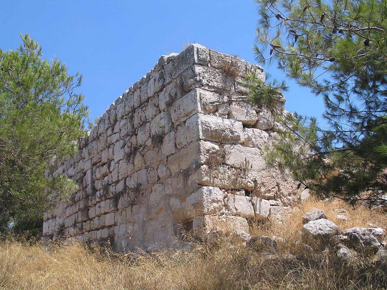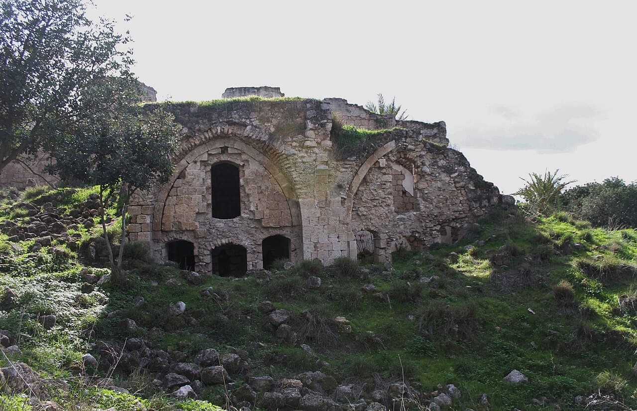
Caco — Israel castle

Caco

Caco castle archaeological ruins in israel
High Medieval (11th–13th c.)
Ruins

Caco Castle is a notable example of a high medieval fortress located in Israel, dating back to the 12th century. Although the exact city of its location remains uncertain, the castle stands as an important archaeological site that provides insight into the military architecture and historical context of the region during the Crusader period.

Historical background and significance

Constructed in the 12th century, during the era of the Crusades, Caco Castle was likely established as part of the network of fortifications built by Crusader forces to secure strategic positions in the Levant. This period, known as the high medieval era, was characterized by frequent conflicts between Crusader states and Muslim powers, necessitating strong defensive structures.

The castle's strategic location would have enabled control over surrounding territories and trade routes, serving both military and administrative purposes. While detailed historical records about Caco Castle are limited, its remains contribute valuable information about the Crusader presence in the region.

Architectural features and layout

As an archaeological ruin, Caco Castle today consists primarily of foundational remains and partial walls that outline its original footprint. The castle likely featured typical high medieval defensive elements such as thick stone walls, battlements, and possibly towers or keeps to enhance its fortification.

The surviving ruins suggest a compact fortress designed to withstand sieges and protect its inhabitants. The use of local stone materials and construction techniques reflect the architectural practices of the time in the Levant.

Defensive structures

The castle's defensive system would have included curtain walls and possibly a moat or ditch, common in Crusader castles to deter attackers. The remains of walls indicate a robust construction aimed at resisting assaults and providing vantage points for defenders.

Internal spaces

While much of the internal layout is lost, typical features of Crusader castles included a central courtyard, living quarters, storage rooms, and a chapel. These elements supported the daily life and military functions within the fortress.

Archaeological importance and preservation

Today, Caco Castle is classified as an archaeological ruin, offering valuable opportunities for research and exploration of medieval military architecture in Israel. The site provides archaeologists with material culture and structural evidence that help reconstruct the history and usage of Crusader fortifications.

Preservation efforts focus on stabilizing the remaining structures to prevent further decay while allowing controlled access for educational and cultural purposes.

Visiting and cultural context

Although not widely known or developed as a tourist destination, Caco Castle attracts visitors interested in the Crusader period and medieval archaeology. Its remote and partly ruined state offers a glimpse into the past, inviting exploration of Israel's diverse historical landscape.

Visitors should prepare for limited facilities and accessibility, as the site is primarily an archaeological area rather than a restored castle.

Frequently asked questions (FAQ)

How do I get to Caco Castle?
Caco Castle is located in Israel, easily accessible by car or public transport. Visitors can take a bus from nearby cities or drive and use the designated parking areas available at the site.
What is the historical significance of Caco Castle?
Caco Castle dates back to the Middle Ages and played a crucial role in the region's defense against various invasions. Its rich history reflects the cultural and military heritage of Israel, making it an important site for understanding the historical context of the area.
When was Caco Castle built?
Caco Castle was constructed in the 12th century during the Crusades, showcasing the architectural styles of that period. Over the years, it has undergone various renovations, preserving its historical essence while adapting to modern tourism.
Can I explore the interior of Caco Castle?
Yes, visitors can explore the interior of Caco Castle, where guided tours are often available. These tours provide insights into the castle's history, architecture, and the life of its inhabitants throughout the centuries.
Why is the architecture of Caco Castle unique?
The architecture of Caco Castle is unique due to its blend of Gothic and Romanesque styles, reflecting the various influences of the cultures that occupied the region. The castle's sturdy stone walls, arched windows, and impressive towers create a dramatic silhouette against the landscape.
Is it possible to visit Caco Castle with children?
Yes, Caco Castle is family-friendly and offers a great opportunity for children to learn about history in an engaging environment. The open spaces and guided tours are suitable for all ages, making it an enjoyable experience for families.
What are the opening hours for Caco Castle?
Caco Castle is typically open to visitors from 9 AM to 5 PM, but hours may vary seasonally. It is advisable to check the official website or contact the visitor center before your visit for the most accurate information.
What are the ticket prices for visiting Caco Castle?
Ticket prices for Caco Castle are generally affordable, with discounts available for students and seniors. Children under a certain age may enter for free, making it an accessible destination for all visitors.
When is the best time to visit Caco Castle?
The best time to visit Caco Castle is during the spring and fall when the weather is mild and pleasant for outdoor exploration. Avoiding the peak summer heat will enhance your experience while touring the castle and enjoying the surrounding grounds.
Are there any nearby attractions to Caco Castle?
Yes, there are several nearby attractions, including beautiful parks and historical sites that complement your visit to Caco Castle. Exploring the surrounding area can provide a fuller understanding of Israel's rich history and natural beauty.

Photo gallery

Caco
Click to view

Photo by IZiv3•CC BY-SA 3.0

1 photo • Click any image to view in full screen

Information

Archaeological Site / Ruins

Loading map...

Visitor reviews

No reviews yet. Been here? Write the first review and help other travelers!

Write the first review

Visited this castle? Share your experience

Your review helps other travelers and adds first-hand knowledge to our encyclopedia.
Write a review

(5/5)

0/2000 characters

Your review will be visible after admin approval

Nearby castles

22.6 km
Arsuf — Israel castle

Arsuf

Herzliya, Israel

Arsuf, historically known as Apollonia in antiquity and later as Arsur during the Crusader period, is a significant archaeological site located on the Mediterranean coast of modern-day Israel, within the municipality of Herzliya. The site, also referred to as Tel Arshaf in Israeli archaeology, offers a rare glimpse into a continuous urban settlement that spans from the Persian period through the Crusader era, encompassing Hellenistic, Roman, Byzantine, Early Islamic, and Mamluk phases of history. Ancient origins and early history The city of Apollonia was originally founded by the Phoenicians during the late 6th century BCE, under the Persian Empire's influence. It was strategically situated on a sandy coastal area featuring a prominent cliff overlooking the Mediterranean Sea, approximately 34 kilometers south of Caesarea. This prime location allowed it to serve as a vital maritime and commercial hub throughout antiquity. During the Hellenistic period, Apollonia flourished as a Greek city, maintaining its coastal prominence. Under Roman rule, it continued to develop, later transitioning into the Byzantine period when it was renamed Sozusa or Sozusa in Palaestina to distinguish it from its Libyan namesake. The city's urban fabric during these eras was marked by typical Mediterranean features such as fortified walls, residential quarters, public buildings, and religious structures. Early islamic and crusader periods Following the Muslim conquest in 640 CE, the city became known as Arsuf. It was fortified extensively to resist Byzantine counterattacks, reflecting its strategic importance on the coastal frontier between the Islamic world and the Byzantine Empire. The fortifications included robust city walls and defensive towers, which were likely enhanced over time. In 1101, during the Crusades, Arsuf was captured by the Kingdom of Jerusalem. It became a crucial stronghold for the Crusaders, controlling access along the coast and serving as a defensive bulwark against Muslim forces. The fortress and city played a pivotal role during the Third Crusade, particularly in the Battle of Arsuf in 1191, where Richard the Lionheart's forces defeated Saladin's army nearby. The Crusader fortress featured typical military architecture of the period, including thick stone walls, battlements, a keep, and a gatehouse. These structures were designed to withstand prolonged sieges and to control the surrounding territory. Decline and destruction under mamluk rule In 1265, the city and its fortress fell to the Mamluks, who decisively destroyed the settlement and fortifications to prevent further Crusader use. This marked the end of Arsuf as a fortified city and its decline into ruins. The ruins today primarily consist of the remains of the Crusader castle and city walls, along with earlier archaeological layers from the Phoenician through Byzantine periods. These ruins provide valuable insights into the military, urban, and cultural history of the eastern Mediterranean coast. Archaeological excavations and modern significance Since intensive excavations began in 1994, the site has been extensively studied, revealing a wealth of artifacts and architectural features spanning over two millennia. The findings include fortification walls, residential buildings, public spaces, and artifacts illustrating the diverse cultural influences that shaped Arsuf. In 2002, the area was designated as Apollonia National Park, opening the site to the public. Visitors can explore the archaeological remains, enjoy panoramic views of the Mediterranean, and learn about the site's layered history through informative displays and guided tours. Architectural features and layout The site of Arsuf includes remnants of a fortified city typical of Mediterranean coastal settlements. The Crusader fortress was constructed with thick stone walls and featured a keep or donjon, which served as the last line of defense. The walls were equipped with battlements and towers at strategic points to provide overlapping fields of fire. Earlier layers reveal a complex urban layout with residential quarters, public buildings, and religious structures from the Byzantine period, including churches and possibly a bishop's residence. The city's location on a cliff provided natural defense, supplemented by man-made fortifications. Cultural and historical importance Arsuf stands as a testament to the region's turbulent history, reflecting the succession of civilizations that dominated the eastern Mediterranean. Its strategic coastal position made it a coveted site for Phoenicians, Greeks, Romans, Byzantines, Muslims, Crusaders, and Mamluks alike. The Battle of Arsuf remains one of the most notable military engagements of the Crusades, symbolizing the intense conflict between Christian and Muslim powers during the 12th century. The site's archaeological richness continues to contribute to understanding medieval warfare, urban development, and intercultural interactions. Visiting arsuf and apollonia national park Today, visitors to Apollonia National Park can walk among the ruins of Arsuf, viewing the remains of the Crusader fortress walls, towers, and gatehouses. The park offers walking trails along the cliff edge with views of the Mediterranean Sea, picnic areas, and educational signage detailing the site's history. The park is accessible year-round, with no entrance fee, making it a popular destination for tourists, history enthusiasts, and locals. Guided tours are occasionally available, providing deeper insights into the archaeological findings and historical context.

Contemporary (20th–21st c.)
Details
28.2 km
Migdal Afek — Israel castle

Migdal Afek

Rosh HaAyin, Israel

Migdal Afek, located near the city of Rosh HaAyin in Israel, is a remarkable historic site that encapsulates a rich tapestry of cultural and architectural heritage spanning several millennia. This hill castle stands on a strategic vantage point overlooking the Afek Pass, an important corridor along the ancient Via Maris trade route, which connected the Mediterranean coast to the inland regions. The site’s history is deeply intertwined with the Second Temple period, the Crusader Kingdom of Jerusalem, and subsequent Byzantine, Mamluk, and Ottoman occupations. Archaeological evidence reveals that human activity at Migdal Afek dates back to the Bronze and Iron Ages, highlighting its long-standing significance. During the Second Temple period, a Jewish settlement thrived here, as demonstrated by burial caves fashioned in the distinctive Jerusalem style and numerous artifacts from the Roman and Byzantine eras. The site was destroyed in 67 CE during the First Jewish–Roman War, when Roman forces quelled the Jewish rebellion, marking a pivotal moment in its early history. The crusader fortress of Mirabel In the early 12th century, the site was transformed by the Crusaders, who built a fortress known as Mirabel atop the ruins of Roman and Byzantine structures. Constructed by the influential Ibelin family, this castle was strategically positioned on the hill to control the Afek Pass. Its design featured a ring wall approximately two meters thick encircling a central donjon or keep, a typical defensive arrangement of hill castles in the Crusader period. Mirabel played a significant role in the political and military struggles of the Crusader Kingdom of Jerusalem. It was notably involved in the rivalry between Queen Melisende and her son Baldwin III, reflecting the castle’s importance as a power center. The fortress fell to Muslim forces under Saladin in 1187 during his campaigns to reclaim the Holy Land. It was destroyed in 1191 during the Third Crusade but later rebuilt by the Mamluks, underscoring its continuing strategic value. Ottoman period and later developments During the Ottoman era, the site saw intermittent use and adaptation. In the 17th century, the local Rayyān family constructed a two-story manor house directly atop the Crusader ruins. This residence incorporated and built upon the medieval masonry, reflecting the evolving architectural styles and habitation patterns of the region. The manor remains today as a testament to the layered history of occupation at Migdal Afek. Adjacent to the castle, an Arab village known as Majdal Yaba or Majdal Ṣādiq developed, thriving from at least the 16th century until its depopulation in 1948 during the conflicts surrounding the establishment of the State of Israel. The site also played a role in World War I battles and was used as a clandestine base for Jewish arms manufacturing in the 1940s. Architectural features and archaeological remains The castle’s layout centers on the preserved Crusader fortress remains, including the thick ring wall and the central donjon. Despite alterations by later Ottoman constructions, much of the original Crusader masonry endures, allowing visitors to appreciate the fortress’s defensive design and commanding hilltop position. This vantage point afforded control over the narrow Afek Pass, a crucial passageway for trade and military movements. A remarkable architectural element is a reused stone lintel with a Greek inscription dating to the 4th or 5th century CE. This lintel, inscribed with a dedication to the "Martyrion of Saint Kyrikos," indicates the presence of a Byzantine-era shrine at the site. The Crusaders incorporated this stone into their castle doorway, exemplifying the practice of reusing earlier building materials and preserving a tangible connection to the site’s Byzantine heritage. The Ottoman manor house remains are integrated with the Crusader ruins, illustrating the continuity of occupation and architectural adaptation. The surrounding landscape features burial caves from the Second Temple period, decorated stones, inscriptions, and pottery fragments from Roman and Byzantine times, providing a comprehensive archaeological record of the site’s diverse cultural phases. Preservation and public access Today, Migdal Afek is designated as a national park covering approximately 1,700 dunams, including the castle ruins and lands formerly associated with the adjacent village of Majdal Yaba. Preservation efforts completed by 2021 have stabilized the fortress remains and Ottoman structures, enabling visitors to explore the site’s layered history. The park offers a unique opportunity to witness the architectural evolution from ancient Jewish settlement through Crusader fortifications to Ottoman habitation. Migdal Afek’s combination of Crusader defensive architecture, Byzantine religious elements, and Ottoman residential construction makes it a significant cultural and historical landmark in Israel. Its commanding hilltop location and rich archaeological finds continue to attract scholars, historians, and tourists interested in the complex history of the Levant.

High Medieval (11th–13th c.)
Details
32.9 km
Qula — Israel castle

Qula

, Israel

Qula (Arabic: قولة), also known as Quliya, is an archaeological site located in Israel, representing the ruins of a former Palestinian village in the Ramle Subdistrict of Mandatory Palestine. Situated approximately 15 kilometers northeast of Ramla, this site preserves the remnants of a village that was depopulated during the 1948 Arab-Israeli War. Historical background and significance The village of Qula had its population primarily composed of residents originally from nearby villages such as Jimzu and Ammuriya. The inhabitants maintained agricultural livelihoods and local traditions typical of Palestinian rural communities in the early 20th century. Qula's historical importance is also marked by its association with prominent Palestinian figures, notably Hasan Salama, a Palestinian commander, and his son Ali Hassan Salameh (1940-1979), who played significant roles in Palestinian nationalist movements. Depopulation and aftermath During the 1948 Arab-Israeli War, Qula was depopulated amid the conflict that reshaped the region's demographic and political landscape. The village's residents were displaced, and the physical structures fell into ruin over time. Today, the site remains as archaeological ruins, offering insights into the village's layout and historical presence in the area. Archaeological features and site condition As an archaeological site, Qula consists primarily of ruins that reflect the village's former residential and agricultural buildings. The remains include foundations of houses, fragments of walls, and other structural elements typical of rural Palestinian architecture from the early to mid-20th century. The site is in a state of ruins, with no significant restoration efforts documented, preserving its authenticity as a historical footprint of the past community. Cultural and heritage context Qula's ruins stand as a testament to the complex history of the region, embodying the narratives of Palestinian displacement and the broader geopolitical changes of the mid-20th century. The site holds cultural significance for descendants of the original inhabitants and serves as a point of interest for historians and archaeologists studying the effects of conflict on rural settlements in Mandatory Palestine. Visiting and accessibility Due to its status as an archaeological ruin, Qula does not function as a conventional tourist castle or fortress. Visitors interested in the historical and cultural aspects of the site should be aware that facilities and interpretive resources may be limited. Access to the site might require special arrangements or permissions, depending on local regulations and land ownership.

Details