Alt-Urach Castle Ruins

Alt-urach castle ruins in lenzkirch, germany
Lenzkirch, Germany
High Medieval (11th–13th c.)
Ruins

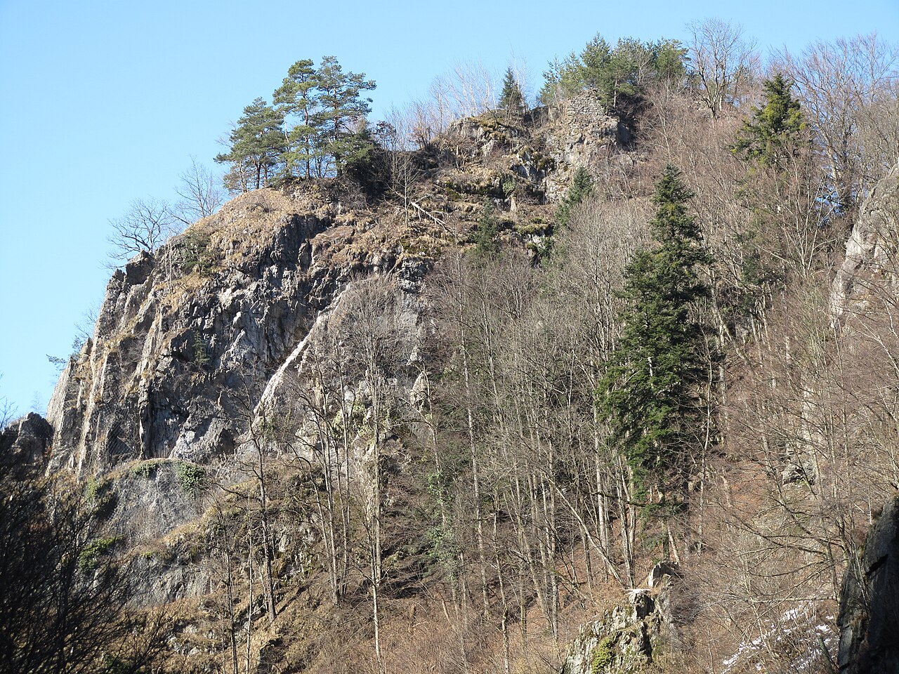
Alt-Urach Castle ruins stand as a significant medieval fortification located in Lenzkirch, Germany. Constructed between 1225 and 1239, this castle was originally built by the lords of Urach, a noble family influential in the region during the High Medieval period. The first documented mention of the castle appears in records from 1316, confirming its early importance as a feudal stronghold.

Historical background and ownership

Throughout the 14th and 15th centuries, Alt-Urach Castle was under the possession of the lords of Blumegg, another aristocratic family who maintained control over the castle and its surrounding lands. The castle's strategic location in the Black Forest region contributed to its role in local governance and defense during turbulent medieval times. Since 1972, the site has been owned and maintained by the municipality of Lenzkirch, ensuring its preservation as a cultural heritage landmark.

Architectural features and layout

Alt-Urach Castle was originally constructed as a hill castle, utilizing the natural elevation to enhance its defensive capabilities. The castle's design included a fortified keep or donjon, which served as the central stronghold and last refuge during attacks. Surrounding the keep were curtain walls and defensive battlements designed to resist sieges and assaults common in the High Medieval period.

The castle complex likely included a gatehouse controlling access, along with residential quarters, storage facilities, and possibly a chapel. Although much of the structure is now in ruins, archaeological investigations have revealed foundations and remnants of walls that outline the castle's original footprint. The use of local stone materials is evident in the surviving masonry, reflecting typical construction techniques of the 13th century.

Significance and preservation

Alt-Urach Castle is an important example of High Medieval fortification architecture in the Baden-Württemberg region. Its ruins provide insight into feudal life, military architecture, and territorial control during the Middle Ages. The castle's preservation under municipal care has allowed for ongoing archaeological study and public access, contributing to local cultural tourism.

Visitors to the site can explore the remains of the castle's walls and enjoy panoramic views of the surrounding Black Forest landscape. Interpretive signage and local guides often provide historical context to enhance the visitor experience. Although the castle is in a ruined state, its enduring presence continues to attract historians, architects, and tourists interested in medieval heritage.

Location and accessibility

Situated near the town of Lenzkirch, Alt-Urach Castle ruins are accessible via hiking trails that connect to other historic sites in the Black Forest area. The castle's elevated position offers scenic vistas and a tangible connection to the region's medieval past. The municipality of Lenzkirch manages the site, providing information for visitors and maintaining the pathways leading to the ruins.

Frequently asked questions (FAQ)

When was Alt-Urach Castle originally built?
Alt-Urach Castle was constructed between 1225 and 1239 during the High Medieval period by the lords of Urach.
What architectural style characterizes Alt-Urach Castle?
The castle features typical High Medieval fortification elements, including a keep, curtain walls, and battlements, built with local stone.
Is Alt-Urach Castle open to visitors?
Yes, the ruins are accessible to the public, with hiking trails and informational signage managed by the municipality of Lenzkirch.
Who owned Alt-Urach Castle after the lords of Urach?
In the 14th and 15th centuries, the castle belonged to the lords of Blumegg, another noble family in the region.
What is the current condition of Alt-Urach Castle?
The castle is in a ruined state, with remaining foundations and walls that outline its original structure.

Information

Hill Castle

Current owner

Municipality of Lenzkirch

Loading map...

Visitor reviews

No reviews yet. Been here? Write the first review and help other travelers!

Write the first review

Visited this castle? Share your experience

Your review helps other travelers and adds first-hand knowledge to our encyclopedia.
Write a review

(5/5)

0/2000 characters

Your review will be visible after admin approval

Nearby castles

15.1 km
Bubenstein Castle — Germany castle

Bubenstein Castle

Buchenbach, Germany

Bubenstein Castle, also known as Neu-Falkenstein, is an important high medieval spur castle located on the northern side of the Höllental valley near the village of Falkensteig in the municipality of Buchenbach, Baden-Württemberg, Germany. Constructed in the 13th century by Walter of Falkenstein, it served as a fortified residence for the lords of Falkenstein, who were first recorded as its occupants in 1266. The castle occupies a strategic position on a rocky spur overlooking the valley, providing commanding views and natural defenses. Historical background and ownership The castle was an important seat for the lords of Falkenstein during the high medieval period. By 1328, the castle had passed to the lords of Staufen, indicating a shift in regional power and ownership. The castle's history reflects the feudal dynamics of southwestern Germany during the Middle Ages, with noble families controlling key defensive positions in the Black Forest region. Architectural features and layout Bubenstein Castle was built as a spur castle, utilizing the natural topography of a rocky promontory to enhance its defenses. The castle's most prominent feature was its bergfried, a large tower measuring approximately 10 by 10 metres. This tower would have served as a last refuge during sieges and a lookout point over the surrounding landscape. The castle was protected by a neck ditch carved into the rock, which was about 5 metres deep and 8 metres wide. This defensive trench separated the castle from the adjacent land, making direct assault difficult. The remaining wall fragments and the neck ditch are key elements that illustrate the castle's defensive design. Defensive structures As with many spur castles, Bubenstein's position on a steep rocky outcrop provided natural protection on several sides. The man-made fortifications, including the bergfried and neck ditch, complemented these natural defenses. The castle's walls, though now mostly ruined, would have enclosed a courtyard and living quarters, typical of medieval fortifications. Later history and current condition In the 19th century, the castle suffered significant damage when part of the castle rock was blasted to make way for a railway line, reflecting the industrial expansion of the era and the changing priorities in land use. By 1960, due to its poor state of repair, the castle was partially dismantled to prevent further collapse. Today, Bubenstein Castle survives only as ruins, with some wall remains and the neck ditch still visible. The site is classified as an archaeological ruin, offering valuable insights into medieval castle construction and feudal history in the Black Forest region. Location and surrounding landscape The castle is situated approximately 500 metres west of Old Falkenstein Castle above the village of Falkensteig, within the municipality of Buchenbach. It lies at an elevation of about 617.6 metres above sea level, perched on a rocky crag that is now difficult to access. This location provided strategic control over the Höllental valley and the nearby Engenbach valley, key routes through the region. The surrounding landscape is characterized by dense forest and steep terrain, typical of the Black Forest area. The castle's position on a spur made it a formidable defensive site in the medieval period. Preservation and archaeological significance Although much of the castle has been lost, the remaining structures and earthworks are important for understanding the high medieval fortification techniques used in southwestern Germany. Archaeological studies of the site contribute to knowledge about the lifestyle, military architecture, and feudal relations of the period. Visitors today can observe the surviving walls and the neck ditch, which highlight the castle's original defensive layout. The ruin is less well preserved compared to other castles in the Breisgau region but remains a significant cultural heritage site.

High Medieval (11th–13th c.)
Details
16.1 km

Roggenbach Castle

Bonndorf im Schwarzwald, Germany

Roggenbach Castle stands as a significant medieval hill castle ruin located near the district of Wittlekofen in Bonndorf im Schwarzwald, Germany. Constructed around 1200 by the Counts of Nellenburg, this fortress was strategically positioned on a ridge approximately 675 meters above sea level, offering commanding views of the surrounding landscape. The castle’s remains today include two prominent bergfrieds (fortified towers) and a well-preserved courtyard, which collectively reflect the architectural and military design typical of high medieval fortifications in the region. Historical background and ownership The earliest documented mention of Roggenbach Castle dates to 1288, linked to a recorded sale, though its origins trace back to before 1100 under the auspices of the medieval Counts of Nellenburg. Over the centuries, the castle changed hands among several noble families, notably the Freiherren von Krenkingen, who used the fortress as a base for raids against the nearby monastery of St. Blasien. These aggressive actions prompted the Basel Council to impose a formal church ban, underscoring the castle’s role in regional conflicts. In the mid-15th century, ownership passed to Wolf von Lichtenstein, who acquired the castle and the surrounding Vogtei of Riedern am Wald through purchase and family ties. However, in 1438, the castle suffered a significant assault by Austrian troops led by Werner von Staufen, resulting in its destruction. A partial reconstruction was undertaken in 1443 by the son of Johann von Krenkingen, aiming to restore some defensive functionality. By 1482, when acquired by the Counts of Lupfen, Roggenbach Castle was already described as a Burgstall, indicating a site largely in ruins. The remaining economic buildings were destroyed during the 1525 Peasants’ War, an uprising that also devastated the nearby Burg Steinegg. Following the extinction of the Lupfen family’s male line in 1582, the property passed to the Pappenheim family, who held it until selling it in 1609 to the monastery of St. Blasien. The monastery retained ownership until secularization in 1806, when church properties were transferred to state control. Local tradition sometimes groups Roggenbach Castle with nearby Burg Steinegg under the collective name "Rogèbacher Schlösser" or "Roggebach." Earlier assumptions linking the castle to the Freiherren von Roggenbach have been disproved by research, which suggests the Roggenbach family’s ancestral seat was a different, now-lost castle in Unterkirnach. Architectural features and layout The ruins of Roggenbach Castle reveal a complex primarily built of stone masonry, arranged along a hill ridge to maximize natural defenses. The site comprises two main enclosures, each dominated by a bergfried—a tall, square fortified tower characteristic of medieval German castles. These towers served as both defensive lookout points and refuges during attacks. The bergfrieds Both bergfrieds share a similar design, with square bases approximately nine meters across and walls about 2.5 meters thick, rising to roughly ten meters in height. The northern bergfried is the taller and better-preserved of the two, retaining its outer walls up to the former battlements. It features an internal spiral staircase that historically allowed defenders to move between floors and access the tower’s summit. The southern bergfried is smaller and was originally accessed via an external wooden staircase, a feature now considered unsafe for visitors. Historical modifications appear to have sealed off the upper section of this tower, though the exact reasons for this alteration remain unclear. Courtyard and defensive structures Between the two towers lies a well-preserved courtyard area, where stone foundations mark the locations of former residential buildings and essential castle structures. A dividing wall separates the two main sections of the fortress, reinforcing the castle’s layered defensive design. The castle’s thick stone walls and elevated position exemplify typical high medieval hill castle architecture, designed to withstand sieges and provide strategic control over the surrounding territory. Although the wooden roofing and interior wooden structures have not survived, the remaining stonework offers valuable insight into the castle’s original form and function. Destruction and legacy Roggenbach Castle’s history is marked by conflict and destruction. Its initial destruction by Austrian forces in 1438 and subsequent partial rebuild illustrate the turbulent political landscape of the region during the late medieval period. The final devastation occurred during the Peasants’ War of 1525, when the castle’s economic buildings were destroyed alongside neighboring fortifications. Despite its ruined state, Roggenbach Castle remains an important cultural and historical landmark within the Black Forest region. The ruins provide a tangible connection to the feudal past and the complex interplay of noble families, military conflicts, and ecclesiastical power that shaped the area. Archaeological research and preservation Ongoing archaeological investigations at Roggenbach Castle continue to shed light on its construction phases, defensive features, and the daily life of its medieval inhabitants. Preservation efforts focus on maintaining the structural integrity of the surviving bergfrieds and courtyard walls to ensure the site remains accessible and informative for visitors and scholars alike. Local interest in the castle’s history is reflected in the collective naming of Roggenbach and Burg Steinegg as the "Rogèbacher Schlösser". This highlights the intertwined histories and geographical proximity of these two medieval sites, enriching the cultural heritage of Bonndorf im Schwarzwald.

High Medieval (11th–13th c.)
Details
24.9 km

Burgstelle Kybfelsen

Freiburg im Breisgau, Germany

Burgstelle Kybfelsen is a significant medieval castle site located within the city of Freiburg im Breisgau, Germany. Nestled atop two prominent rocky outcrops connected by a narrow ridge, this hill castle exemplifies the strategic use of natural terrain combined with medieval defensive architecture. Though now in ruins, the site offers valuable insights into the fortification methods and regional politics of southwestern Germany during the late 11th and early 12th centuries. The castle's origins are closely tied to the period of Zähringer rule in the Breisgau region, a time when the Zähringer family exerted considerable influence over southwestern Germany. Archaeological evidence places the castle's active occupation primarily in the High Medieval period, with ceramic finds indicating continued use through the 12th century and into the early 13th century. Although the name "Kyburg" appears in later legal records, no direct connection to the Swiss Counts of Kyburg has been established, and such a link is regarded as unlikely. Historical context and significance During the High Medieval era, the Breisgau region was a contested area of strategic importance. The Zähringer dynasty played a crucial role in consolidating power through the construction of castles like Burgstelle Kybfelsen. These fortifications served both military and administrative functions, controlling trade routes and asserting territorial dominance. References to the castle appear in a mid-14th-century chronicle by Matthias von Neuenburg, indicating its recognized status in regional history. The castle was likely abandoned in the first half of the 13th century, a period marked by shifting political landscapes and the decline of certain feudal holdings. Architectural features and defensive design Site layout and natural fortifications Burgstelle Kybfelsen is uniquely positioned on two rocky summits connected by a narrow ridge approximately 70 meters long. The southern rock, about 30 meters wide, formed the main area of the castle complex. The builders skillfully incorporated the natural rock formations into the defensive scheme, minimizing the need for extensive masonry while maximizing natural barriers. Masonry walls and fortifications The southern approach was once secured by a broad defensive wall, now largely reduced to small remnants. At the southern tip of the southern rock, archaeological excavations uncovered an artificially leveled platform, interpreted as the base of a south tower. This tower would have provided a commanding view of the surrounding landscape and served as a strongpoint against attackers. The eastern side of the castle was bounded by a structure referred to as the "East building," though no above-ground remains survive. To the southwest, the site is naturally protected by a steep rock face, eliminating the need for man-made defenses on that side. Northern summit and neck ditch The northern summit preserves the most substantial ruins, including the base of a large tower approximately eight meters in diameter. The walls here are up to two meters thick, indicating a robust defensive construction designed to withstand siege warfare. Just before the tower base lies a deep, roughly twelve-meter-long fissure in the rock, artificially smoothed to create a neck ditch (Halsgraben). This defensive trench separated the two rocky summits and enhanced the castle's protection by preventing direct access along the connecting ridge. Archaeological findings and site usage In addition to medieval artifacts, surface finds suggest that the site was occupied during the Bronze Age, pointing to a long history of human presence prior to the castle's construction. The ceramic and structural remains primarily date to the High Medieval period, confirming the castle's role during the zenith of Zähringer influence. Excavations conducted in the early 20th century revealed important structural details, including the layout of the defensive walls and the tower foundations. Although much of the masonry has collapsed or eroded, the integration of natural rock and human-made fortifications remains evident. Current condition and preservation Today, Burgstelle Kybfelsen exists as ruins, with many original structures reduced to foundations and low wall fragments. The natural rock formations continue to dominate the site, providing visitors with a tangible sense of the castle's original defensive advantages. Preservation efforts focus on maintaining the visible ruins and preventing further deterioration. The site is accessible to the public and offers a unique glimpse into medieval castle construction adapted to challenging terrain. Its historical significance and archaeological value make it an important cultural heritage site within the Freiburg region. Visiting burgstelle kybfelsen Visitors to Burgstelle Kybfelsen can explore the rugged terrain and observe the remains of the castle's defensive features. The site provides educational opportunities related to medieval fortifications and the history of the Zähringer dynasty in southwestern Germany. While no formal visitor center exists on site, informational signage may be available nearby. Due to the natural rocky environment, caution is advised when navigating the ruins, especially along the narrow ridge connecting the two summits. How do I get to Burgstelle Kybfelsen? The castle site is located within Freiburg im Breisgau and can be reached by local hiking trails. It is advisable to consult local maps or tourist information centers for the best access routes. What is the historical significance of Burgstelle Kybfelsen? The castle is an important example of a High Medieval hill castle associated with the Zähringer dynasty, illustrating medieval defensive architecture and regional power dynamics. Is the castle suitable for families and children? Due to the rocky terrain and ruins, caution is recommended for families with young children. The site is best suited for visitors comfortable with uneven ground and some climbing. When is the best time to visit? Spring through early autumn offers the most favorable weather for exploring the ruins and surrounding natural landscape. Are there guided tours available? No formal guided tours are typically offered at the site, but local historical societies or visitor centers in Freiburg may provide additional information or organized excursions.

High Medieval (11th–13th c.)
Details