Österburg Castle Ruins

Österburg castle ruins in Bischofsheim in der Rhön
Bischofsheim in der Rhön, Germany
High Medieval (11th–13th c.)
Ruins

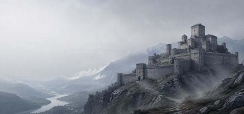
Österburg Castle stands as a significant medieval ruin located on a prominent hilltop near Bischofsheim in der Rhön, Germany. Constructed probably in the 12th century, this hill castle was a strategic fortification during the High Medieval period, guarding important territories in a region marked by ecclesiastical rivalries and feudal power struggles. Although it was destroyed around the 13th century, the castle's remains reveal valuable insights into Romanesque castle architecture and the political landscape of medieval Franconia.

Historical context and origins

The origins of Österburg Castle trace back to the early medieval era when the Franks dominated this part of Europe. Local tradition holds that the site initially hosted a Frankish royal hunting lodge in the 6th century, reflecting the area's early importance as a royal domain. This lodge likely served as a seasonal retreat for Frankish nobility, capitalizing on the abundant natural resources and strategic vantage points offered by the hill.

By the 12th century, the castle was established as a fortified stronghold to protect the valuable salt forest holdings, which belonged to the Würzburg prince-bishops. The castle's primary function was to defend these lands from incursions by the Fulda prince-abbots, who governed a neighboring ecclesiastical principality. This defensive role highlights the complex political tensions between ecclesiastical authorities during the medieval period in Germany.

Medieval feudal significance

The earliest documentary evidence of the castle dates from around the year 1200. Notable figures such as Reinhold von der Osterburg and Engelhard von Osterburg appear in records, with Engelhard serving as a witness in legal documents in 1217 and 1230. Additionally, Boto von Eberstein is recorded as holding a fief at the castle in 1231, confirming its integration into the feudal system of the time.

Despite its early prominence, the rise of the nearby fortified town of Bischofsheim in the 12th century gradually diminished the castle's strategic importance. The castle likely became less central as Bischofsheim developed into a significant urban and defensive center.

Destruction and decline

Österburg Castle met its demise around 1270, reportedly destroyed during an assault linked to the broader conflict involving the destruction of Bischofsheim by forces under the Fulda abbot. This event marked the end of the castle's active use, and it subsequently vanished from historical records.

By the early 17th century, the castle was mentioned only as a ruin in territorial disputes concerning hunting and wood rights among local communities. By the late 19th century, very little of the original structure remained, with stones from the ruins repurposed in nearby constructions such as the Kreuzberg monastery.

Archaeological rediscovery and preservation efforts

A significant rediscovery occurred in 1897 during the construction of a timber transport path. Excavations led by forest master Fuchs uncovered extensive remains of the castle walls, revealing a complex with an entirely Romanesque architectural style. The castle measured approximately 114 meters long by 70 meters wide, indicating a substantial fortified complex for the period.

The excavations yielded artifacts now preserved in a local collection in Bischofsheim, providing tangible evidence of the castle's historical occupation and architectural character.

In the early 20th century, the castle's main tower, or bergfried, was adapted into a lookout tower in 1909. However, due to structural instability, it was dismantled in 1928. Since 2005, local associations and Bavarian heritage authorities have undertaken efforts to clear and consolidate the ruins, aiming to protect and better understand this important medieval site.

Architectural features and layout

The Österburg castle ruins occupy the summit of a 714-meter-high hill, commanding expansive views over the surrounding landscape and the nearby town of Bischofsheim. The remaining foundations outline a large rectangular complex measuring roughly 114 by 70 meters.

The castle's design is characterized by Romanesque architectural elements, including thick stone walls, rounded arches, and a robust, fortress-like construction. The walls were built from local stone, forming a strong defensive perimeter around the castle grounds.

Within the enclosure, the layout suggests multiple courtyards designed to accommodate several knights simultaneously, each likely housed in separate buildings surrounded by the castle's ring wall. This arrangement reflects the castle's role as a small but active military and administrative center.

A key feature was the bergfried, a tall main tower serving as both a lookout and a final defensive refuge. Although converted into a viewing platform in the early 20th century, the tower no longer stands due to its dismantling in 1928 for safety reasons.

Today, visitors encounter fragments of walls, sections of staircases, and other structural remnants partially reclaimed by forest growth. The site offers a compelling glimpse into medieval fortification techniques and the strategic importance of hill castles in the region.

Cultural significance and modern conservation

Österburg Castle holds cultural and historical significance as a testament to the medieval power struggles between ecclesiastical territories in Franconia. Its ruins are a valuable heritage site that illustrates the evolution of castle architecture and feudal society in the High Middle Ages.

Modern conservation efforts, initiated in the early 21st century, focus on stabilizing the ruins and enhancing public understanding of the site. These endeavors are supported by local heritage organizations and the Bavarian state, ensuring that Österburg Castle remains an accessible and educational landmark for future generations.

Frequently asked questions (FAQ)

How do I get to Österburg Castle ruins?
Österburg Castle ruins are located on a hill near Bischofsheim in der Rhön, Bavaria. Visitors can reach the site by car or local transport to Bischofsheim, followed by a hike up the hill to the ruins.
What is the historical significance of Österburg Castle?
Österburg Castle was a strategic medieval hill castle built in the 12th century to guard important territories and resources. It reflects the political tensions between the Würzburg prince-bishops and the Fulda prince-abbots during the High Middle Ages.
Can I visit the bergfried tower?
The original bergfried tower was dismantled in 1928 due to structural instability. Today, only the ruins of the tower remain and no access to a viewing platform is available.
When is the best time to visit the castle ruins?
The best time to visit Österburg Castle ruins is during late spring to early autumn when weather conditions are favorable for hiking and outdoor exploration.
Are there guided tours available at Österburg Castle ruins?
Currently, there are no regular guided tours at Österburg Castle ruins, but local heritage groups occasionally organize events and informational sessions about the site.

Information

Hill Castle

Current owner

Municipality

Sources & official resources

Verify the information above using these authoritative references.

Loading map...

Visitor reviews

No reviews yet. Been here? Write the first review and help other travelers!

Write the first review

Visited this castle? Share your experience

Your review helps other travelers and adds first-hand knowledge to our encyclopedia.
Write a review

(5/5)

0/2000 characters

Your review will be visible after admin approval

Nearby castles

12.4 km

Ebersburg Castle

Ebersburg, Germany

Ebersburg Castle stands prominently atop the Ebersberg hill in the municipality of Ebersburg, located in the German state of Hesse. This medieval hill castle was constructed during the High Middle Ages, with origins tracing back to around the year 1100. It is closely associated with the noble lords of Ebersberg and their connections to the powerful Staufer dynasty and nearby imperial palaces. The castle’s strategic location on a wooded ridge rising to 689 meters above sea level between the Fulda and Lütter valleys provided natural defensive advantages that were enhanced by man-made fortifications. Historical origins and medieval significance The earliest phases of Ebersburg Castle likely date to the late 12th or early 13th century, with some scholars suggesting its foundation during the reigns of Emperor Frederick Barbarossa or his son Heinrich VI. The first surviving written record appears in 1396, documenting a petition by noble families including descendants of the Ebersbergs and the Weyhers to the Prince-Abbot of Fulda. This petition sought permission to erect a fortress on the Ebersberg mountain, revealing prior conflicts involving the destruction of an earlier castle by Fulda troops after a noble’s killing. Throughout the 15th and early 16th centuries, the castle served as a Ganerbenburg, a joint residence shared among several branches of the Ebersberg and Steinau families. The Burgfrieden agreements from 1430 to 1516 regulated co-ownership, occupancy, and defense responsibilities, reflecting the complex feudal arrangements of the time. Architectural features and castle layout Fortress structure and natural defenses Ebersburg Castle occupies nearly the entire plateau of the hilltop in a roughly polygonal shape. The steep slopes on the south and west sides provide natural protection, while the east side is secured by a ring-shaped moat and an earth rampart. The castle’s walls are primarily constructed from local anthracite-colored phonolite stone using rubble masonry, accented with gray sandstone for windows, door frames, and corners. Early construction phases employed sandstone blocks with rough bossage, replaced around 1400 by finely cut ashlar sandstone blocks. Towers and defensive elements The oldest surviving elements include the base of the south tower and the western tower wall, both measuring approximately seven meters per side. The south tower’s basement features a barrel-vaulted dungeon with no entrance except a trapdoor in the ceiling and a narrow slit for light and ventilation. After its destruction circa 1396, the south tower was rebuilt with a cylindrical upper section, accessed originally by a door seven meters above ground level via wooden corbels supporting a walkway. Historical depictions show a conical roof replaced later by battlements with a timber-covered roof. Today, the tower stands 16.5 meters tall and includes a visitor-accessible wooden staircase installed during 19th-century restoration efforts, offering panoramic views of the surrounding landscape. The north tower, constructed in the late 14th century, is a circular structure about 5.8 meters in diameter, rising from a two-meter-thick curtain wall. Its original entrance was six meters above ground, framed by a pointed arch for defensive purposes. The tower includes observation slits and a battlement walk with a projecting gargoyle spout for water drainage. Restoration in the 1920s helped consolidate this tower’s structure. Curtain walls connect the two towers, following the irregular polygonal shape of the hilltop. The eastern curtain wall meets the north tower’s western wall and incorporates remnants of older masonry. These walls were heightened and repaired during the 19th century to maintain the fortress’s defensive integrity. Residential and auxiliary buildings Excavations have uncovered foundations near the west wall believed to be the original main gate, later blocked and replaced by a northern entrance. Adjacent to this are the remains of two vaulted residential buildings with substantial footprints, measuring at least 11 meters square and 9 meters square, connected by a narrow passage under 1.5 meters high. The castle’s chapel, first recorded in 1446, had a chaplain by 1456 who was obligated to celebrate weekly mass, indicating the site’s religious importance during its occupation. The outer bailey extends eastward on a terrace and features a south wall approximately 35 meters long and 1.5 meters thick, dating from the castle’s later medieval expansion. Near the entrance stands the "Eselstall" or donkey stable, a 19th-century half-timbered structure built on older foundations with irregular masonry and a low ceiling. Historical records suggest it served as a beer cellar in the early 20th century rather than housing animals. Within the ruins, the foundations of a 1664 half-timbered house remain visible. This timber-framed building was divided into two living quarters, each equipped with multiple windows, doors, and stoves. Although plans included a cistern to provide water, it was never completed, contributing to the castle’s eventual abandonment. Decline, abandonment, and later use By the 16th century, Ebersburg Castle was largely abandoned due to the lack of a reliable water source, specifically a well, and because it no longer met the evolving military requirements of the period. The castle’s defensive structures were outdated in the face of new fortification techniques. After the Thirty Years’ War, the ruins found temporary use beginning in 1646 by local farmers who sought refuge and pasture for livestock, paying rent in exchange for maintenance. In 1664, the Ebersberg family constructed the half-timbered house within the ruins to provide better shelter. Despite its division into two living units with multiple windows and stoves, the building deteriorated quickly due to rain damage and insufficient repairs over the centuries. Ownership passed through various hands, including the Kingdom of Bavaria’s Weyhers district court in the 18th and 19th centuries. During the 19th century, one of the castle’s towers was adapted into a viewing platform, and restoration efforts aimed to preserve the remaining structures. Archaeological excavations and modern preservation Between 1956 and 1959, archaeological excavations led by Fritz Luckhard and Gotthold Wagner uncovered significant structural details and clarified the castle’s layout and history. These efforts revealed the original construction phases, defensive features, and residential areas, contributing valuable knowledge to medieval castle studies in the region. Today, Ebersburg Castle is protected as a cultural monument by the State of Hesse and managed by Hessen-Forst. It remains freely accessible to visitors and offers facilities such as a sheltered resting area with tables, benches, and a fire pit within the castle courtyard. Since 2009, civil wedding ceremonies have been permitted on site, highlighting the castle’s continued cultural significance. The castle’s ruins provide a tangible connection to the medieval past, with exposed phonolite rock outcrops, enduring stone walls, and restored towers that offer panoramic views of the surrounding valleys and forests. Restoration efforts have focused on masonry repair, protective roofing, and visitor access improvements, preserving the site as a valuable heritage landmark.

High Medieval (11th–13th c.)
Details
17.7 km

Burg Milseburg

Germany, Germany

Burg Milseburg stands as a testament to medieval fortification on a steep hill spur near Kleinsassen in the municipality of Hofbieber, Germany. This medieval hill castle was constructed by the Frankish civilization and played a vital role as a strategic fortification during the Middle Ages. Its commanding position allowed control over important territorial borders and routes, reflecting its military and political significance in the region. The earliest documentary evidence of the site dates back to July 25, 980, when Emperor Otto II mentioned "Milsiburg" as a boundary marker between the lands of the Fulda monastery and the neighboring territories of Hünfeld. This early reference implies the existence of a fortified structure overseeing a crucial border zone at that time. By 1119, the castle is explicitly recorded as "Burg Milseburg" in medieval documents, confirming its established presence and importance. Historical context and ownership The castle was closely associated with the noble Frankish family von Milz, who appear prominently in early documents related to Fulda Abbey. This family also held the nearby Haselstein castle, underscoring their regional influence. Burg Milseburg's military significance is further emphasized by its location opposite the fortification of Bieberstein above the old Ortesweg route, highlighting its role in controlling movement and defending territorial boundaries. Historical records suggest different phases of construction and renovation. Between 1114 and 1122, Abbot Erlolf von Bergholz of Fulda may have seized and rebuilt the fortress to strengthen the abbey’s defenses. Another phase of building activity is proposed between 1150 and 1165 under Abbot Markward, who is known for fortifying Bieberstein and Haselstein castles as well. Due to limited documentary clarity, these interpretations remain cautious but indicate the castle's ongoing strategic importance during the High Middle Ages. Burg Milseburg was abandoned during the 13th century, and by 1450 it was already recorded as a ruin. Its abandonment likely reflects changing military tactics and political circumstances. Despite this, the site remained a landmark, with its ruins attracting local interest and archaeological attention over the centuries. Architectural features and layout The surviving remains of Burg Milseburg reveal a compact yet well-planned hilltop fortification, measuring approximately 21 by 24 meters. The castle's primary defensive structure is a complete ring wall built entirely from fieldstones. The inner face of this wall features carefully smoothed and tightly fitted stones, demonstrating skilled masonry intended to ensure the wall's solidity and durability against attacks. One section of the southwest wall remains preserved to a height of about 50 centimeters, with a thickness of approximately 1.20 meters. This section shows a breach, which may have functioned as an entrance or resulted from later damage. The castle's location on the narrow, steep spur called Liedenküppel provided natural defensive advantages. The southeastern approach to the castle was protected by a neck ditch, a defensive trench cut across the spur to impede attackers. Although the ditch itself is no longer fully visible, a circular depression marks its former position. Adjacent to this, evidence of a terrace suggests the presence of an additional half-enclosing defensive wall running from southwest to northeast, reinforcing the castle's defenses on the more accessible side. At the heart of the site lies the remains of the main residential tower or keep. While now largely reduced to earthworks and fragmentary walls, the depression marking its position and adjoining sections of the ring wall remain visible. This central tower would have served as the stronghold and living quarters for the castle's occupants. The castle's core plateau surrounds the tower site and includes remnants of the inner face of the western ring wall. The overall layout reflects a typical medieval hill castle design focused on maximizing natural topography for defense while incorporating man-made fortifications. A modern boundary stone stands weathered near the tower area atop the plateau, marking the historical site's limits. Although not part of the medieval structure, this stone reflects later land ownership and surveying traditions, linking the site to its continued cultural significance. Archaeological research and preservation The ruins of Burg Milseburg have attracted scholarly and local interest for over a century. In 1899, archaeologist Eduard Breitung documented the legendary remains, highlighting the site's historical importance. More recent investigations, including detailed plans by Rudolf Knappe, have helped clarify the castle's development, layout, and strategic role in the region. These archaeological efforts have provided valuable insights into the castle's construction techniques, defensive features, and historical context. The site today offers a tangible connection to medieval fortification practices and the political landscape of the Frankish territories. Significance and visitor experience Burg Milseburg exemplifies the strategic use of natural terrain combined with skilled masonry to create a defensible hill castle during the medieval period. Its association with notable historical figures and families, such as the von Milz and the abbots of Fulda, underscores its importance in regional power dynamics. Visitors to the site can explore the remains of the ring wall, the depression marking the former keep, and the traces of defensive ditches and terraces. The castle's elevated position offers panoramic views of the surrounding landscape, enhancing its appeal as a historical and cultural landmark. While only ruins remain, the site’s preservation allows for appreciation of medieval military architecture and the historical narrative of border control in central Germany. Interpretive signage and local guides often provide context to enrich the visitor experience.

Details
19.5 km

Ruine Lichtenburg

Ostheim, Germany

Ruine Lichtenburg is a remarkable example of a medieval hill castle strategically perched on the Schlossberg hill overlooking the town of Ostheim in the Rhön region of Germany. Constructed originally in the 12th century, this fortress was built by a branch of the Counts of Henneberg, a prominent noble family influential in the region during the High Middle Ages. The castle's earliest documented mention dates to 1161, marking it as a significant military and administrative site for centuries. The castle initially served as a fortified noble residence, described as a "Castrum" in 1230, indicating its role as a military stronghold. Its importance grew in the early 14th century when Abbot Heinrich VI of Fulda enhanced its defenses by constructing the imposing bergfried, a tall, tower-like keep typical of German castles. This bergfried, rising to over 31 meters including a modern viewing platform, remains the tallest in the Rhön area and exemplifies medieval defensive architecture. Historical significance and ownership transitions Throughout its history, Ruine Lichtenburg played a pivotal role as the administrative center of the Amt Lichtenberg, a regional district under the ecclesiastical authority of Fulda Abbey. Ownership shifted several times, returning to the Henneberg family through the Römhild line in the mid-14th century before passing to Saxon control. The castle endured significant damage during the 16th-century Peasants' War, a major uprising against feudal lords, but was swiftly repaired to continue its function. By the late 17th century, the castle's strategic and administrative importance waned, particularly after the departure of the last local overseer, Friedrich Sebastian von Stein, in 1680. Although briefly refortified during the conflicts between the Holy Roman Empire and France in the early 1670s, the castle was eventually abandoned and slated for demolition by 1719. Subsequent ownership by Carl August of Weimar and restoration attempts by Ernst August of Sachsen-Weimar-Eisenach in the mid-18th century were only partially successful, and the castle fell into ruin. Architectural features and layout The castle complex is defined by extensive defensive ramparts encircling the precinct, reflecting its military purpose. Visitors today approach via a paved path leading to a Renaissance-era gatehouse, which replaced an earlier drawbridge. This gatehouse features thick walls and a robust gate designed to withstand assaults, illustrating the evolution of castle defenses over time. The centerpiece of Ruine Lichtenburg is its bergfried, constructed under Abbot Heinrich VI in the early 14th century. This tower, originally built for defense and surveillance, stands as a testament to medieval masonry techniques with its well-preserved stonework reaching 28 meters in height. The bergfried has been adapted with a modern viewing platform and protective roof, preserving its commanding presence and offering panoramic views of the surrounding landscape. Within the castle grounds, a forecourt leads to the main castle area, which was separately fortified. This inner enclosure contains the remains of key residential and functional buildings including the palas, the great hall serving as the lord's principal living quarters, and the kemenate, or women's chamber, which provided private quarters for noblewomen. The presence of stables and a chapel further highlight the castle's dual military and domestic functions, typical of knightly residences. The chapel ruins remain visible as fragmentary walls, underscoring the spiritual dimension of the castle complex. The spatial arrangement reflects a clear hierarchy, with the bergfried positioned near the entrance for maximum defensive advantage, surrounded by interconnected buildings enclosed by walls and earthworks. This design exemplifies the integration of fortification and habitation in medieval castle architecture. Preservation and modern significance Today, Ruine Lichtenburg is recognized as a valuable cultural heritage site. The substantial survival of original stonework in the bergfried and palas provides rare insight into medieval construction methods. The castle's ruins have been carefully preserved since the 19th century, following periods of neglect and partial quarrying. A dedicated preservation society now oversees the site, ensuring ongoing maintenance and public accessibility. The castle’s location on Schlossberg hill not only offers historical context but also spectacular views of Ostheim and the surrounding Rhön landscape, making it a popular destination for visitors interested in medieval history and architecture. Ruine Lichtenburg stands as a compelling example of a hill castle that evolved through centuries of military, administrative, and domestic use. Its architectural features, from the towering bergfried to the Renaissance gatehouse, provide a tangible link to the region's High and Late Medieval periods. The castle's layered history and well-preserved ruins contribute significantly to our understanding of German medieval fortifications and noble residences.

High Medieval (11th–13th c.)
Details