Middle Head Fortifications — Australia castle

Middle Head Fortifications

Middle Head Fortifications, Sydney Harbour
Mosman, New South Wales, Australia
Post-Renaissance (17th–18th c.)
Partially Preserved

Middle Head Fortifications are a significant heritage-listed military complex located in Middle Head, Mosman, within the New South Wales region of Australia. These fortifications form an integral part of the historic Sydney Harbour defences, constructed to protect the vital harbour from naval attacks. The site is also known as the Middle Head Military Fortifications or simply The Old Fort. Its strategic position on the headland provided commanding views over the harbour entrance, making it a critical component in Australia's coastal defence network during the late 19th and early 20th centuries.

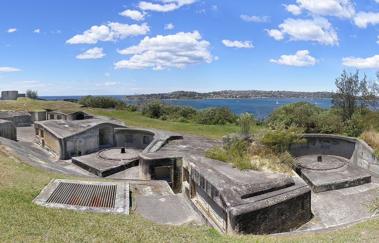
The fortifications comprise several key elements: the Outer Middle Head Battery situated at the end of Old Fort Road, the Inner Middle Head Battery located at the end of Governors Road, and the Obelisk Batteries, which can be accessed via a path from the corner of Middle Head Road and Chowder Bay Road. These batteries were designed to house heavy artillery pieces, including large-caliber coastal guns, to deter and defend against enemy ships attempting to enter Sydney Harbour.

Historical context and military significance

The construction of the Middle Head Fortifications began in the late 19th century, during a period when the Australian colonies were fortifying their coastlines in response to growing concerns about potential naval threats from foreign powers. The fortifications were part of a broader system of defences around Sydney Harbour, which included other fortresses such as Georges Head and Bradleys Head.

Middle Head's location was chosen for its elevated terrain and commanding views, allowing defenders to monitor and control maritime traffic effectively. The fortifications played a defensive role during both World War I and World War II, although their active military use diminished after the mid-20th century as advances in naval technology and changes in military strategy rendered coastal artillery less critical.

Architectural features and design

The fortifications at Middle Head are classified as a bastioned fortress, a style characterized by angular bastions projecting from the walls to provide defensive enfilading fire. The complex includes extensive stone and concrete gun emplacements, underground tunnels, magazines for storing ammunition, and observation posts.

The Outer Middle Head Battery was equipped with heavy coastal artillery, including disappearing guns mounted on concrete platforms designed to retract after firing to protect the crew. The Inner Middle Head Battery served as a secondary line of defence with smaller caliber guns and supporting facilities. The Obelisk Batteries are notable for their distinctive stone obelisks that served as range-finding markers for the artillery.

The fortress complex also includes remnants of barracks, command posts, and other military infrastructure necessary to support the garrison stationed there. The defensive walls and earthworks demonstrate the military engineering techniques of the period, combining natural terrain with man-made fortifications to maximize defensive capabilities.

Preservation and public access

Today, the Middle Head Fortifications are managed by the Department of Planning and Environment and are open to the public as a historic site and recreational area. The site is recognized on the New South Wales State Heritage Register since 2 April 1999, reflecting its cultural and historical importance.

Visitors can explore the remains of the batteries, tunnels, and gun emplacements, gaining insight into Australia's military history and coastal defence strategies. The site also offers scenic walking trails with panoramic views of Sydney Harbour, making it a popular destination for both history enthusiasts and nature lovers.

Legacy and cultural significance

The Middle Head Fortifications stand as a testament to Australia's efforts to defend its shores during a period of imperial rivalry and global conflict. They illustrate the evolution of military architecture from traditional bastioned designs to more modern coastal artillery installations.

The preservation of this site allows contemporary audiences to engage with Australia's colonial and military heritage, providing educational opportunities and fostering appreciation for the strategic importance of Sydney Harbour throughout history.

Frequently asked questions (FAQ)

How do I visit the Middle Head Fortifications?
The Middle Head Fortifications are open to the public and accessible via walking trails from Mosman. There is no admission fee, and visitors can explore the historic batteries and tunnels at their own pace.
What is the historical significance of the Middle Head Fortifications?
The fortifications were built in the late 19th century as part of Sydney Harbour's coastal defence system to protect against naval threats during periods including World War I and World War II.
Can I explore the underground tunnels and gun emplacements?
Yes, visitors can access some of the underground tunnels and gun emplacements, which have been preserved to showcase the military architecture and defensive strategies of the era.
When is the best time to visit Middle Head Fortifications?
The site is open year-round, but visiting during daylight hours is recommended to fully appreciate the views and explore the fortifications safely.
Are there guided tours available at Middle Head Fortifications?
While the site is primarily self-guided, occasional guided tours may be offered by local historical societies or park services. It is advisable to check with the Department of Planning and Environment or local visitor centres for tour availability.

Photo gallery

Middle Head Fortifications
Click to view

Photo by :--Adam (talk)•CC BY-SA 2.5

1 photo • Click any image to view in full screen

Information

Bastioned Fortress

Current owner

Department of Planning and Environment

Address

Middle Head Road, Middle Head, Mosman, NSW, Australia

Loading map...

Visitor reviews

No reviews yet. Been here? Write the first review and help other travelers!

Write the first review

Visited this castle? Share your experience

Your review helps other travelers and adds first-hand knowledge to our encyclopedia.
Write a review

(5/5)

0/2000 characters

Your review will be visible after admin approval

Nearby castles

5 km
Fort Denison — Australia castle

Fort Denison

Sydney, Australia

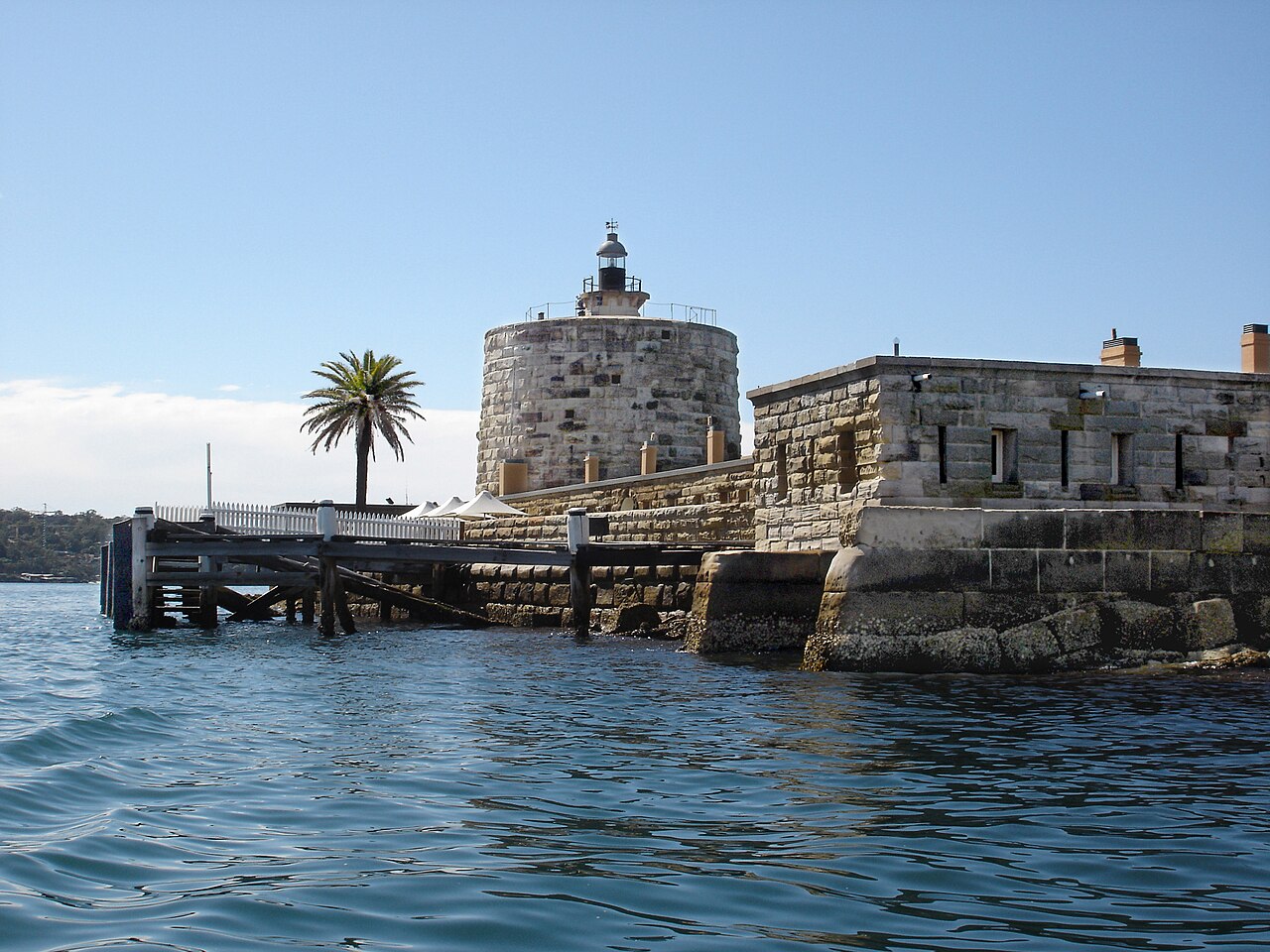
Fort Denison is a prominent bastioned fortress located on a small island in Sydney Harbour, New South Wales, Australia. The fortress occupies an island situated northeast of the Royal Botanic Garden and approximately 1 kilometre east of the iconic Sydney Opera House. Known historically by the indigenous Eora people as Mattewanye or Muddawahnyuh, and later referred to as Pinchgut Island, the site has a layered history as both a penal settlement and a military defensive facility.The island's strategic position in Sydney Harbour made it an ideal location for fortification to protect the city from naval threats. The original construction of Fort Denison began in the mid-19th century, between 1840 and 1862, under the design direction of Colonel George Barney, a key military engineer of the time. The construction was carried out by builder William Randle. The fortress was built during the post-Renaissance period, reflecting military architectural principles suited to the evolving technology of artillery and coastal defense.Architectural features and military designFort Denison is classified as a bastioned fortress, a style characterized by angular bastions that allowed defenders to cover adjacent walls with cannon fire, eliminating blind spots. The fortress features thick sandstone walls quarried locally, designed to withstand bombardment from enemy ships. The island itself is surrounded by a defensive wall and includes a moat-like channel, enhancing its defensive capabilities.One of the fortress's most distinctive features is its Martello tower, a circular stone tower typical of coastal defenses in the 19th century. This tower was equipped with heavy artillery and served as the primary defensive stronghold on the island. The tower's compact, robust design was intended to resist naval bombardment and provide a secure platform for the fortress's guns.Additional facilities and later modificationsBesides its military function, Fort Denison also housed a penal settlement during its early years, serving as a place of incarceration for convicts. Over time, the fortress's role shifted towards navigation and communication support, incorporating facilities such as a time gun used for maritime time signals, navigational aids, and a tide gauge to monitor harbour conditions.These adaptations reflect the fortress's evolving function from a purely military installation to a multifaceted maritime facility. The site today includes remnants of these installations, which contribute to its historical significance.Historical context and significanceFort Denison was constructed in response to perceived threats from foreign naval powers during the 19th century, particularly concerns about Russian expansion in the Pacific. Its construction was part of a broader effort to fortify Sydney Harbour, which was a critical port and naval base for the British colony of New South Wales.The island's use as a penal site also connects it to Australia's colonial history of convict transportation and imprisonment. The fortress was never directly engaged in battle, but it played an important deterrent role in the defence of Sydney.Current status and public accessToday, Fort Denison is part of the Sydney Harbour National Park and is managed by the Office of Environment & Heritage. It is recognized as a heritage-listed site on the New South Wales State Heritage Register since April 2, 1999, and was previously listed on the now-defunct Register of the National Estate in 1978.The fortress is well preserved and serves as a popular tourist destination, offering guided tours that explore its military architecture, history, and panoramic views of Sydney Harbour. It also functions as a nature reserve and event venue, integrating cultural heritage with public recreation.Visiting Fort DenisonVisitors can reach Fort Denison by ferry from Circular Quay, with tours providing detailed insights into the fortress's history and features. The site includes interpretive signage and exhibits explaining its military and penal past as well as its role in maritime navigation.Fort Denison remains a unique example of a bastioned fortress adapted to an island setting, reflecting the military engineering and colonial history of Australia in the 19th century.

Post-Renaissance (17th–18th c.)
Details
5.9 km
Fort Macquarie — Australia castle

Fort Macquarie

Sydney, Australia

Fort Macquarie was a significant bastioned fortress constructed in the 19th century at Bennelong Point in Sydney, New South Wales, Australia. This fortification was built in 1817, replacing an earlier fortification from 1798, and served as a key defensive structure guarding the entrance to Sydney Harbour. It was designed as a square castellated battlement fort, featuring bastions at each corner to provide overlapping fields of fire, a common defensive architectural feature of the period. Architectural design and features The design of Fort Macquarie reflected the bastioned fortress style, which was prevalent in military architecture from the Renaissance through to the 19th century. The fort's stone walls were thick and robust, intended to withstand naval bombardment and protect the city from potential seaborne attacks. Its castellated battlements gave it a medieval appearance, with crenellations allowing defenders to fire while being shielded. The fort included gun emplacements on its ramparts, capable of mounting several cannons to command the approaches to Sydney Harbour. The bastions allowed enfilading fire along the walls, enhancing the fort's defensive capabilities. Inside, the fort contained barracks and for storing gunpowder and ammunition, as well as facilities for the garrison stationed there. Historical context and significance Originally, a smaller fortification was established at Bennelong Point in 1798, shortly after the founding of the Sydney colony. However, as threats to the colony grew, particularly from foreign naval powers, the need for a more substantial defensive structure led to the construction of Fort Macquarie in 1817. It played a crucial role in the defense of Sydney during the 19th century, although it never saw active combat. Fort Macquarie was part of a broader network of coastal defenses built to protect Sydney Harbour and the growing city. Its location at Bennelong Point was strategic, commanding views over the water and controlling access to the harbor's inner areas. Demolition and legacy In the early 20th century, Sydney's urban development and changing transportation needs led to the fort's demolition in 1901. The site was cleared to construct the Fort Macquarie Tram Depot, reflecting the shift from military to civilian infrastructure. The tram depot itself was later demolished, and the iconic Sydney Opera House was built on the same site, becoming one of the world's most recognizable landmarks. Although Fort Macquarie no longer exists, its historical importance as part of Sydney's early colonial defense system is recognized. The fort represents an era of military architecture adapted to the unique needs of a growing colonial port city in the 19th century. Cultural and heritage significance Today, the legacy of Fort Macquarie is preserved through historical records, maps, and archaeological studies. It holds a place in Sydney's heritage as an example of early colonial fortifications and their role in shaping the city's development. The site at Bennelong Point continues to be a focal point of Sydney's cultural landscape, linking the city's past military history with its present as a global cultural destination.

Modern (19th–20th c.)
Details
18.6 km
Bare Island Fort — Australia castle

Bare Island Fort

La Perouse, Australia

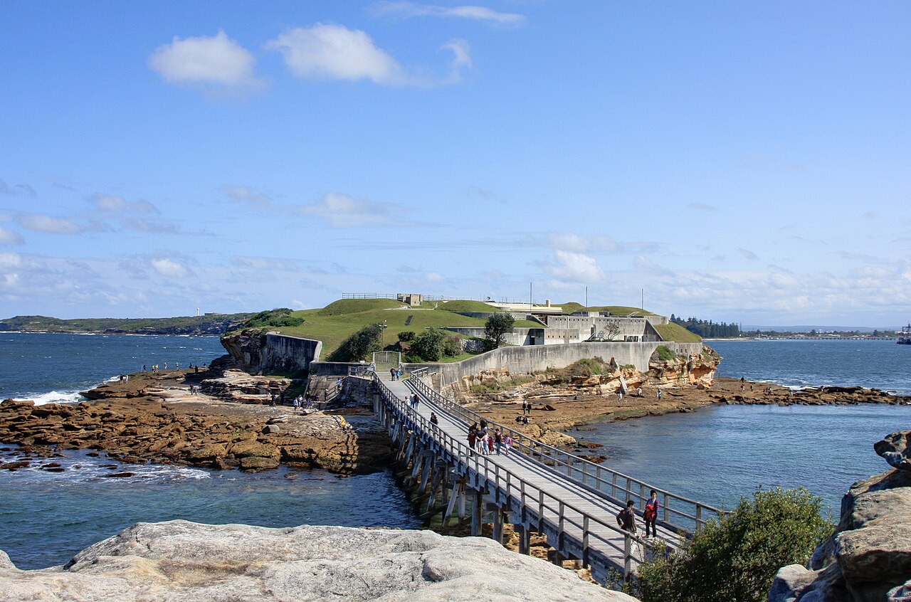
Bare Island Fort is a historically significant bastioned fortress located on a small islet at La Perouse, New South Wales, within the Eastern Suburbs of Sydney, Australia. Positioned approximately 16 kilometres southeast of Sydney's central business district, the fort stands on the northern headland of Botany Bay. This strategic location was chosen to protect the bay and the city from potential naval attacks during the late 19th century. Historical context and construction The construction of Bare Island Fort took place between 1881 and 1889, during a period when Australia was enhancing its coastal defences in response to growing concerns about naval threats. The fort was designed by prominent military engineers Sir Peter Scratchley and Gustave Morell, with architectural oversight by James Barnet, the New South Wales Colonial Architect. The construction was carried out by John McLeod under the direction of the New South Wales Department of Public Works. The fort is an almost completely intact example of late nineteenth-century coastal defence technology. It was built to protect the approaches to Botany Bay, which was an important harbour and potential landing site for enemy forces. Bare Island's fortifications were part of a network of coastal defences designed to safeguard Sydney and its surroundings. Architectural features and design Bare Island Fort is classified as a bastioned fortress, a style characterized by angular bastions projecting outward from the main walls, allowing defenders to cover adjacent walls with gunfire and eliminate blind spots. The fort features thick stone walls constructed from local sandstone, which provided strong resistance against artillery fire. The fortress includes a series of interconnected tunnels and chambers beneath the surface, used for ammunition storage, troop movement, and shelter during attacks. The design incorporates gun emplacements positioned to cover the bay's entrance, with firing positions for cannons and later artillery pieces. The fort is connected to the mainland by a footbridge, providing controlled access to the island. This connection facilitates guided tours, which are currently the only way visitors can explore the military fort and its tunnels. Military use and later history Although Bare Island Fort was built for military purposes, it never saw active combat. Its role was primarily deterrence, serving as a visible symbol of Sydney's coastal defence capabilities. During the 20th century, the fort was repurposed as a war veterans' home and later a museum, preserving its historical significance and making it accessible to the public. Today, the fort is a protected heritage site listed on the New South Wales State Heritage Register since 2 April 1999. It remains a rare and well-preserved example of coastal defence architecture from the modern period of fortification development in Australia. Current status and visitor information Bare Island Fort is currently a historic site open to visitors by guided tour only, ensuring the preservation of its delicate structures. The surrounding waters are popular with scuba divers due to the rich marine life and underwater features near the island. The fort's cultural impact extends beyond its military history; the Bare Island anglerfish, a species named after the island, highlights the ecological importance of the area. Visitors can experience both the historical and natural aspects of Bare Island during their visit. Significance and heritage value The fort is significant as an almost completely intact example of 19th-century bastioned fortress design adapted to coastal defence needs. Its preservation offers valuable insight into the military engineering practices of the time and the strategic considerations for protecting Sydney's harbour. As a heritage-listed site, Bare Island Fort contributes to the understanding of Australia's colonial defence history and the evolution of fortification architecture during the modern period. It stands as a tangible link to the past and a resource for education and tourism in New South Wales.

Modern (19th–20th c.)
Details