Limes Germanicus
Limes Germanicus, known as the "Germanic Limes," represents a significant Roman frontier system that demarcated the boundaries between the Roman Empire and the Germanic tribes from approximately 83 AD to 260 AD. This extensive network of fortifications was constructed primarily during the 1st century AD to protect the Roman provinces of Germania Inferior, Germania Superior, and Raetia. The frontier combined natural geographical features with man-made defenses, including earth banks, ditches, wooden palisades, and watchtowers positioned at regular intervals. Behind these defenses lay a series of linked forts that formed a comprehensive military barrier.
Geographical scope and structure of the limes
The Limes Germanicus stretched from the North Sea outlet of the Rhine to near Regensburg (Castra Regina) on the Danube, covering a total length of about 568 km (353 miles). This frontier was strategically placed between two major rivers, the Rhine and the Danube, which provided natural defense lines against large-scale incursions. However, a notable gap existed between Mogontiacum (modern Mainz) on the Rhine and Castra Regina on the Danube, a corridor approximately 300 kilometers wide that required particularly heavy fortification due to its vulnerability.
Divisions of the limes
- The Lower Germanic Limes: Extended from the North Sea at Katwijk in the Netherlands along the Lower Rhine branches, including the Oude Rijn, Leidse Rijn, Kromme Rijn, and Nederrijn.
- The Upper Germanic Limes: Began at the Rhine near Rheinbrohl, crossing the Taunus mountains to the river Main east of Hanau, then following the Main to Miltenberg, and continuing south from Osterburken to Lorch in a straight line of over 70 km.
- The Rhaetian Limes: Extended eastward from Lorch to Eining near Kelheim on the Danube.
Architectural and military features
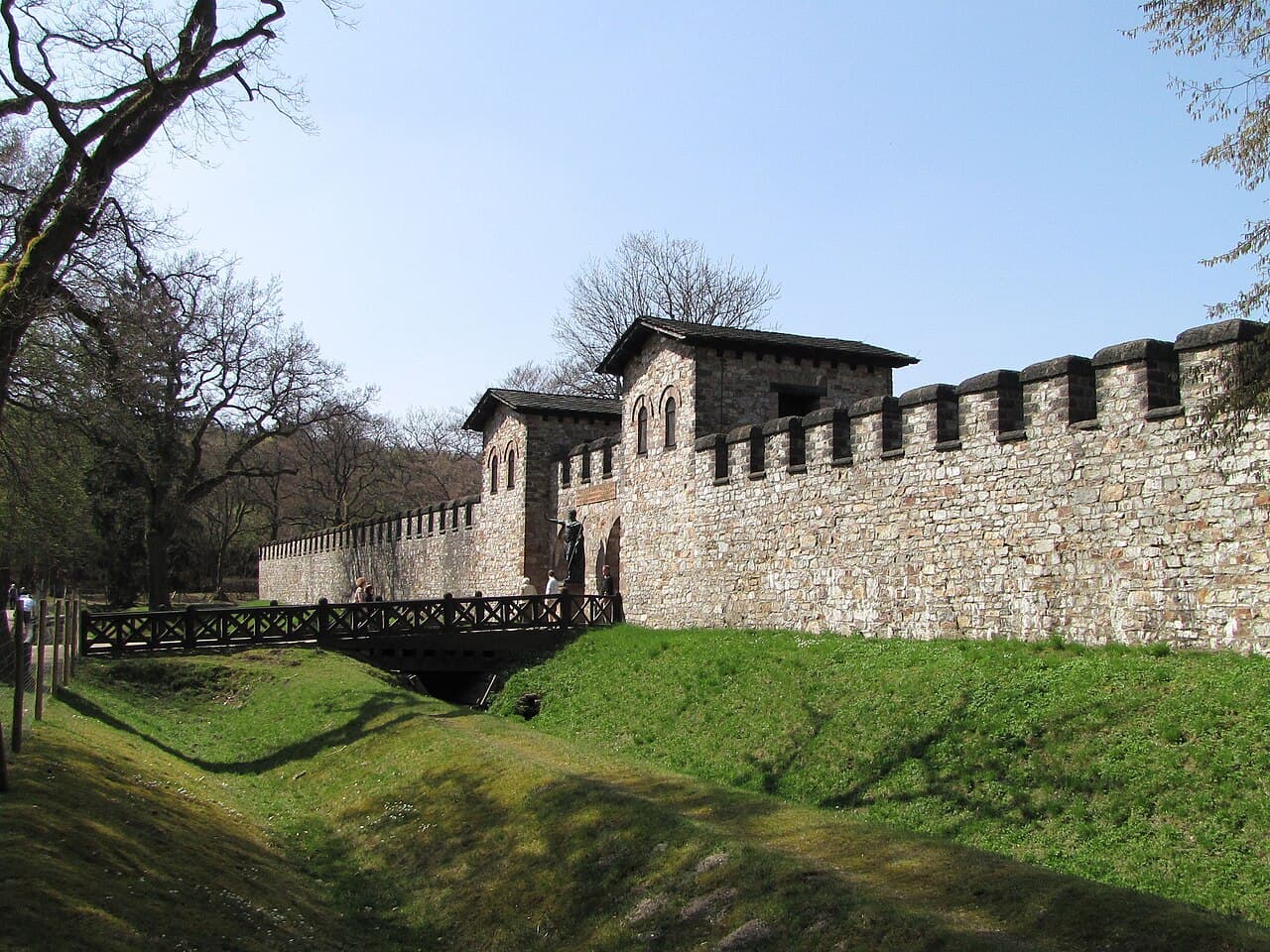
The frontier system was characterized by a combination of natural boundaries and constructed defenses. In many places, the Romans built an earthen rampart accompanied by a ditch and topped with a wooden palisade. Watchtowers were spaced at intervals to allow for surveillance and rapid communication across the frontier. Behind these linear defenses, a chain of at least 60 forts was established, serving as bases for the Roman legions and auxiliary troops.
These forts varied in size but typically included barracks, granaries, workshops, headquarters buildings, and defensive walls. The forts were connected by a network of roads, facilitating troop movements and supply logistics. The watchtowers and forts formed a layered defense system that allowed the Romans to monitor and control movement across the frontier effectively.
Historical context and significance
The Limes Germanicus was constructed during the height of the Roman Empire's expansion into the Germanic territories. It marked the boundary between the Romanized provinces and the territories controlled by various Germanic tribes, who were often hostile and posed a continuous threat to imperial security.
The frontier line was not static; it shifted in response to military campaigns, political changes, and external pressures. At times, the Romans advanced beyond the limes, while at other times, they retreated to more defensible positions. The system was maintained until around 260 AD, when increasing pressure from Germanic invasions and internal instability led to the Roman withdrawal from these territories.
Archaeological legacy and modern importance
Today, the remains of the Limes Germanicus are recognized as a valuable archaeological and cultural heritage site. The line of forts, watchtowers, and earthworks provide important insights into Roman military engineering and frontier policy. Parts of the limes have been excavated and preserved, with some sections visible as earthworks or reconstructed wooden palisades and towers.
The site is part of the UNESCO World Heritage list, highlighting its significance in illustrating the Roman Empire's northern boundary and its interaction with the Germanic world. Visitors to the region can explore museums, reconstructed forts, and walking trails that trace the ancient frontier's course.
Frequently asked questions (FAQ)
- What is the Limes Germanicus?
- The Limes Germanicus was a Roman frontier system of fortifications separating the Roman Empire from Germanic tribes from about 83 AD to 260 AD.
- Where did the Limes Germanicus stretch?
- It extended from the North Sea outlet of the Rhine to near Regensburg on the Danube, covering about 568 km.
- What were the main components of the Limes Germanicus?
- The frontier consisted of natural boundaries, earth banks, ditches, wooden palisades, watchtowers, and a chain of forts.
- Why was there a gap between Mainz and Regensburg?
- This 300 km corridor was a vulnerable area without natural river boundaries, requiring heavy fortification with multiple layers of forts and towers.
- Can visitors see the Limes Germanicus today?
- Yes, many sections have been excavated and preserved, with some reconstructed parts accessible to visitors as archaeological sites and museums.
Photo gallery

Information
Loading map...
Visitor reviews
No reviews yet. Been here? Write the first review and help other travelers!
Write the first reviewVisited this castle? Share your experience
Your review helps other travelers and adds first-hand knowledge to our encyclopedia.