Gurzuf Fortress — Ukraine castle

Gurzuf Fortress

Gurzuf Fortress: early medieval bastioned fortress in Crimea, Ukraine
Early Medieval (5th–10th c.)
Partially Preserved

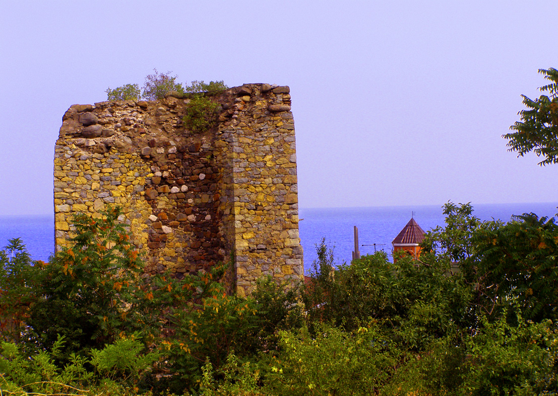
Gurzuf Fortress is a significant early medieval bastioned fortress situated on the southern coast of the Crimean Peninsula in Ukraine. Constructed in the 6th century, this fortress occupies a commanding position overlooking the Black Sea, which was crucial for controlling maritime routes and defending the coastline from invasions. Its strategic location near the modern settlement of Gurzuf allowed it to serve as a military stronghold and a protective barrier against seaborne threats.

Historical context and significance

The fortress was built during a period marked by frequent conflicts and territorial disputes in the Black Sea region. The 6th century was a time when the Byzantine Empire sought to secure its northern borders and maintain control over vital trade routes. Gurzuf Fortress was part of a network of fortifications designed to protect the empire's interests and to monitor movements along the coast.

Throughout its history, the fortress witnessed various phases of occupation and reconstruction, reflecting the changing political and military dynamics of the region. It played a role in local defense against nomadic tribes, pirates, and later, during the medieval period, against invading forces seeking control over Crimea.

Architectural features and design

Gurzuf Fortress is classified as a bastioned fortress, a type of fortification characterized by projecting bastions that allowed defenders to cover adjacent walls with defensive fire, eliminating blind spots. Although the fortress dates back to the early medieval period, its bastion design indicates adaptations and enhancements over time to meet evolving military needs.

The fortress walls were constructed using local stone, providing robust protection against siege weaponry. The layout typically included thick curtain walls, bastions at key points, and a fortified gatehouse to control access. The elevated position of the fortress on rocky terrain enhanced its defensive capabilities, making direct assaults difficult.

Within the fortress, there would have been essential structures such as barracks, storage facilities, and possibly a chapel, although much of the internal architecture has not survived intact. The fortress's design reflects the military engineering principles of the period, combining natural topography with man-made defenses.

Preservation and current condition

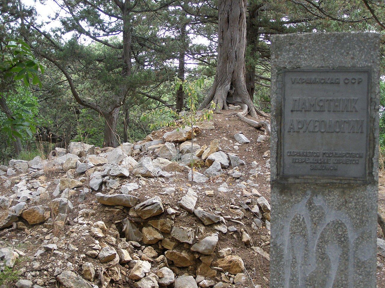
Today, Gurzuf Fortress is considered partially preserved. While substantial sections of the walls and bastions remain visible, much of the internal structures have succumbed to time and natural decay. The fortress ruins offer valuable insights into early medieval military architecture and the strategic importance of Crimean coastal defenses.

Conservation efforts have aimed at stabilizing the existing structures and making the site accessible to visitors interested in the region's history and heritage. The fortress is a notable archaeological site attracting both tourists and researchers.

Visiting Gurzuf Fortress

Visitors to Gurzuf Fortress can explore the remains of the bastioned walls and enjoy panoramic views of the Black Sea and surrounding landscape. The site provides an opportunity to appreciate early medieval fortification techniques and the historical significance of Crimea's coastal defenses.

Access to the fortress is generally open to the public, although facilities and guided tours may vary. The best time to visit is during the warmer months when weather conditions are favorable for outdoor exploration.

Frequently asked questions (FAQ)

How do I get to Gurzuf Fortress?
Gurzuf Fortress is located in the picturesque village of Gurzuf, Ukraine, near the southern coast of Crimea. You can reach it by car or public transport from nearby cities such as Yalta or Simferopol. The fortress is a short walk from the nearest bus stop, making it accessible for visitors.
What is the historical significance of Gurzuf Fortress?
Gurzuf Fortress dates back to the 14th century and was built to protect the region from invaders. It holds significant historical value as it reflects the military architecture of its time and the various cultures that inhabited the area. Today, it stands as a testament to the rich history of Crimea.
When was Gurzuf Fortress constructed?
The construction of Gurzuf Fortress began in the 14th century during the reign of the Genoese in the region. Over the centuries, it underwent several modifications, each contributing to its unique architectural style. The fortress has witnessed numerous historical events, adding layers to its storied past.
Can I enter the fortress grounds?
Yes, visitors can enter the grounds of Gurzuf Fortress and explore its ruins. However, it is essential to follow any guidelines provided by local authorities to ensure safety while exploring the ancient structure. Guided tours may also be available for a more in-depth experience.
Why is Gurzuf Fortress a popular tourist attraction?
Gurzuf Fortress is popular among tourists for its breathtaking views of the Black Sea and surrounding landscapes. Its historical significance and unique architecture draw history enthusiasts and photographers alike. Additionally, its proximity to other attractions in the region makes it a convenient stop for visitors.
Is it possible to visit Gurzuf Fortress year-round?
Yes, Gurzuf Fortress is open for visitors year-round, although the best time to visit is during the spring and early autumn months when the weather is pleasant. Keep in mind that winter conditions may affect accessibility, so it's advisable to check local weather forecasts before planning your visit.
What are the opening hours for Gurzuf Fortress?
Gurzuf Fortress typically opens daily from 9 AM to 6 PM, but hours may vary seasonally. It is recommended to check the official website or local tourist information for the most current opening hours before your visit. Arriving early can also help you avoid crowds and enjoy a more peaceful experience.
Are there any nearby attractions to visit?
Yes, Gurzuf Fortress is close to several other attractions, including the stunning Ai-Petri Mountain and the charming village of Gurzuf itself. Visitors can also explore the nearby Swallow's Nest castle and the beautiful beaches along the coastline. These attractions make it easy to create a full day of sightseeing in the area.
What are the ticket prices for Gurzuf Fortress?
Admission to Gurzuf Fortress is generally affordable, with ticket prices aimed at making it accessible to all visitors. Discounts may be available for students, seniors, or group tours. Always check for any updates on pricing as it may change seasonally or during special events.

Photo gallery

Gurzuf Fortress
Click to view

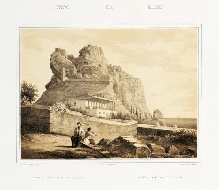
Photo by Unknown authorUnknown author (Роки життя: До 1926 р.)•Public domain

1 photo • Click any image to view in full screen

Information

Bastioned Fortress

Loading map...

Visitor reviews

No reviews yet. Been here? Write the first review and help other travelers!

Write the first review

Visited this castle? Share your experience

Your review helps other travelers and adds first-hand knowledge to our encyclopedia.
Write a review

(5/5)

0/2000 characters

Your review will be visible after admin approval

Nearby castles

17.5 km

Yalta Castle

Gaspra, Ukraine

Swallow's Nest Castle, located on the dramatic Aurora cliff near the town of Gaspra in Crimea, stands as one of the most iconic and picturesque examples of Neo-Gothic architecture in the region. Despite its modest size, this castle has captured the imagination of visitors and writers alike, becoming a symbol of the Crimean coastline and a popular subject in literature related to mystery and intrigue. Constructed between 1911 and 1912, Swallow's Nest is perched precariously on a 40-meter-high cliff overlooking the Black Sea. Its location offers breathtaking panoramic views of the sea and the surrounding landscape, making it a unique architectural landmark. The castle's design features characteristic turrets, battlements, and pointed arches typical of the Neo-Gothic style, yet these elements serve primarily decorative purposes rather than defensive ones. Historical background and ownership The site originally hosted a small wooden cottage built around 1895 at the request of a Russian general. This modest structure was later acquired by A.K. Tobin, a physician to the Russian Imperial Court and the Tsar, who used it as a summer residence. The property changed hands again when Baron von Stiegl purchased it and decided to demolish the wooden cottage to build the present-day castle. Baron von Stiegl commissioned the construction of the castle in the Neo-Gothic style, reflecting the romantic architectural trends of the early 20th century. The castle was never intended as a fortress for defense; instead, it was designed as a decorative manor to showcase the owner's status and to complement the stunning natural surroundings. Architectural features and style Swallow's Nest is a small castle featuring a compact footprint that fits the narrow cliff edge. Its most striking features include pointed towers and turrets that evoke medieval castles but are purely ornamental. The castle's façade is adorned with decorative battlements and gothic arches, emphasizing verticality and romantic aesthetics. The structure's stone construction and intricate detailing contrast vividly with the rugged cliff and the expansive sea below. The castle's interior, though modest in scale, includes several chambers and halls that were used as living quarters and reception rooms, designed to provide comfort rather than fortification. Location and setting Situated on the Aurora cliff, the castle's dramatic position on the edge of the Crimean coastline provides spectacular views and a sense of isolation. Its proximity to the town of Gaspra places it within reach of visitors while maintaining an aura of mystery and romance. Cultural significance and tourism Swallow's Nest has become one of the best-known landmarks in Crimea and Ukraine, frequently appearing in postcards, films, and travel literature. Its fairy-tale appearance and unique location have made it a magnet for tourists, photographers, and artists. Despite its relatively recent construction, the castle embodies the romantic spirit of the early 20th century and serves as a reminder of the region's rich cultural history during the era of Imperial Russia. It continues to be a popular destination, drawing visitors who seek to experience its enchanting atmosphere and stunning views. Preservation and current condition The castle has undergone several restorations to maintain its structural integrity, especially given its precarious cliffside location. Today, it is well-preserved and accessible to the public, with facilities for visitors to explore its interiors and enjoy the surrounding scenery.

Post-Renaissance (17th–18th c.)
Details
17.6 km
Aluston Fortress — Ukraine castle

Aluston Fortress

, Ukraine

The Aluston Fortress is a historically significant bastioned fortress located in the Crimean Peninsula, Ukraine. Constructed in the 6th century, it represents an important example of early medieval military architecture in the region. The fortress was strategically built to protect the surrounding territory and control key routes along the Black Sea coast. Historical context and significance The fortress was established during a period of frequent conflicts and shifting powers in the Black Sea region. It was part of a network of fortifications designed to defend against invasions by various nomadic tribes and rival states. The 6th century marked a time when the Byzantine Empire exerted influence over Crimea, and Aluston Fortress likely served as a military stronghold in this context. Its location allowed control over maritime and land routes, making it a crucial defensive position. The fortress played a role in regional defense strategies throughout the early medieval period, although detailed records of specific battles or sieges involving Aluston are limited. Architectural features and design Aluston Fortress is classified as a bastioned fortress, a type of fortification characterized by projecting bastions that allow defensive fire in multiple directions. This design was advanced for its time and indicates an understanding of evolving military tactics. The fortress's walls were constructed using local stone, with thick ramparts designed to withstand attacks. The bastions provided overlapping fields of fire, reducing blind spots and enhancing the defenders' ability to repel assaults. The layout likely included a central courtyard, residential quarters, storage facilities, and a chapel or place of worship, common features in fortresses of this period. Defensive structures The bastions themselves were angular projections from the main walls, allowing defenders to cover adjacent walls with crossfire. The walls were likely surrounded by a moat or ditch, adding another layer of defense. Gatehouses would have controlled access, possibly reinforced with towers or barbicans. Archaeological findings and preservation Excavations at the site have revealed remnants of the fortress walls and foundation structures, providing insight into construction techniques of the early medieval period in Crimea. Artifacts such as pottery shards, weapons, and coins have been uncovered, contributing to understanding the daily life and military activities of its inhabitants. The fortress today is in a state of ruins, reflecting centuries of exposure to natural elements and historical conflicts. Preservation efforts have been limited, but the site remains an important cultural and historical landmark in Crimea. Visitor information and cultural importance Although not as widely known as some other European castles, Aluston Fortress attracts visitors interested in early medieval history and military architecture. The site offers a glimpse into the strategic defensive systems of the Byzantine era in the Black Sea region. Visitors can explore the ruins and appreciate the fortress's layout and construction, gaining an understanding of the challenges faced by its defenders. The fortress also holds cultural significance for the local population, symbolizing historical resilience and regional heritage.

Early Medieval (5th–10th c.)
Details
18.1 km
Charax — Ukraine castle

Charax

, Ukraine

Charax (Ancient Greek: Χάραξ, gen.: Χάρακος) represents the largest Roman military settlement uncovered in the Crimea, situated on a four-hectare site at the western ridge of Ai-Todor, near the famed Swallow's Nest tourist attraction. This extensive site provides invaluable insight into Roman military architecture and strategic deployments on the northern Black Sea coast during the 2nd century AD. The establishment of Charax traces back to the reign of Emperor Vespasian, who founded the camp as a defensive measure to protect the important Greek city of Chersonesus and the surrounding Bosporean trade emporiums from incursions by the Scythians. The camp was strategically placed to control access and safeguard Roman interests in the region. By the end of the 1st century AD, however, the Roman military presence was withdrawn from the Crimean Peninsula. After a period of abandonment, Charax was reoccupied and restored by a vexillatio (detachment) of the Legio I Italica, and later hosted a detachment of the Legio XI Claudia towards the end of the 2nd century AD. The military camp functioned until the mid-3rd century AD, when it was finally abandoned amidst the broader Roman military retreat from the area. Archaeological discovery and excavations The ruins of Charax were first discovered in 1837 by Peter Keppen, who measured the defensive walls at approximately 395 metres in length. Keppen identified the site with the name "Charax," derived from the Greek term for "fortification," the only Roman camp recorded in Crimea. Despite no direct historical evidence linking the camp to Ai-Todor, the name has remained associated with this location. In 1849, Count Shuvalov sponsored initial excavations, though these early efforts were somewhat rudimentary. More systematic and extensive excavations began in 1896 under the patronage of Grand Duke Alexander Mikhailovich of Russia, who had a summer residence nearby. These excavations continued for fifteen years, uncovering a wealth of Roman coins, bronze artifacts, and structural remains. Michael Rostovtzeff, representing St. Petersburg University, directed the archaeological work and reclassified Charax as an "entire Roman city" rather than merely a military fortification, highlighting its urban characteristics and complex infrastructure. In 1907, a museum dedicated to the archaeological finds was established on-site, preserving and displaying the artifacts for scholarly study and public education. Architectural features and urban layout The excavations in the early 20th century revealed that Charax was more than a simple military camp; it contained features typical of Roman urban settlements. Remains of public water basins, thermae (baths), and an aqueduct indicate advanced water management infrastructure. The presence of a gymnasium and a sanctuary outside the defensive walls further suggest a community with social and religious functions beyond purely military purposes. The defensive structures included cyclopean walls—massive stone fortifications whose origins have been debated. Early hypotheses proposed that these walls were constructed by the indigenous Tauri before Roman occupation, though this theory has lost favor in recent scholarship. The camp's walls formed a bastioned fortress, a style adapted to the military needs of the time, designed to withstand sieges and raids. Defensive architecture The layout of Charax reflects Roman military engineering principles, with thick stone walls and bastions providing vantage points for defense. The camp's position on a ridge offered strategic control over the surrounding terrain and sea approaches. The fortifications included gates and towers, facilitating surveillance and troop movements. Urban amenities and infrastructure The discovery of thermae and public water basins illustrates the Roman emphasis on hygiene and public welfare even in frontier settlements. The aqueduct system supplied fresh water, crucial for sustaining the garrison and any civilian inhabitants. The gymnasium served as a center for physical training and social interaction, reflecting the cultural integration of Roman and local practices. Historical significance and military role Charax played a key role in the Roman defensive network guarding the northern Black Sea coast. Its foundation under Vespasian was part of a broader strategy to secure trade routes and protect allied cities from nomadic tribes like the Scythians. The camp's occupation by elite legions such as Legio I Italica and Legio XI Claudia underscores its military importance. The eventual abandonment of Charax in the mid-3rd century corresponds with the wider Roman military withdrawal from Crimea due to increasing pressure from external threats and internal instability within the empire. The site thus marks a significant chapter in the Roman Empire's frontier history. Later research and interpretations Further excavations led by Vladimir Blavatsky in the 1930s expanded understanding of the site's complexity. His team uncovered additional public buildings and supported theories about the site's pre-Roman origins and its deliberate slighting by retreating Roman forces to prevent enemy use. Modern archaeological methods have refined the chronology and function of Charax, situating it firmly within the Roman military and urban tradition of the Early Medieval period. It remains a vital archaeological site for studying Roman frontier life and military architecture in Eastern Europe. Visiting Charax today While the precise city location remains uncertain, the ruins near Ai-Todor are accessible to visitors interested in Roman history and archaeology. The site offers a glimpse into Roman military engineering and settlement patterns on the Black Sea coast, complemented by nearby attractions such as the Swallow's Nest castle and the historic lighthouse built in the 19th century.

Early Medieval (5th–10th c.)
Details