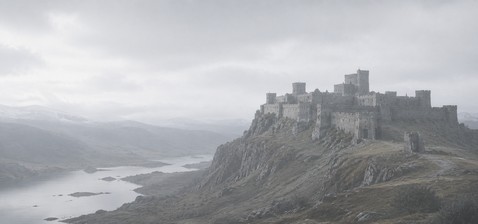
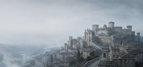
Gaztelu Zahar castle stands as a remarkable example of early 16th-century military architecture in the Basque region of Spain. Situated in Irún, this hill castle was strategically positioned to oversee the critical Behobia pass, a key border crossing between Spain and France. Commissioned in 1518 by King Ferdinand II of Aragon, the fortress was constructed by the Kingdom of Castile to secure the frontier during a period of intense territorial conflict. Its role was pivotal in controlling movement and defending against incursions, especially following the Franco-Navarrese invasion of Gipuzkoa in 1512.
The castle's triangular floor plan is a distinctive architectural feature, attributed to the military engineer Diego de Vera. Each side of the triangle measures approximately 22 meters, with a consistent wall width of about 5 meters, designed to optimize defense. This geometric design was unusual for the period and region, reflecting advanced military thinking to maximize coverage and reduce blind spots. The fortress's elevated position on a hill provided commanding views over the Behobia pass and the surrounding landscape, crucial for monitoring enemy troop movements and artillery deployment.
Historical significance and military role
Gaztelu Zahar was built during a turbulent era marked by the struggle for control over the Basque territories between Castile, Navarre, and France. After the Battle of San Marcial (1521-1522), the castle endured conflict and was temporarily occupied by hostile forces, suffering significant damage. Recognizing its strategic importance, Emperor Charles I ordered its demolition in 1539 to prevent its use by Navarrese troops attempting to reclaim their kingdom. The demolition was completed by 1542, with much of the stone repurposed for the fortifications of the nearby town of Fuenterrabía (Hondarribia).
Despite its destruction, the castle remained a symbol of military heritage in the region. It was referred to as Gaztelu Zahar, meaning "old castle," reflecting its ruined state. Restoration efforts were considered in the 17th century, and some fortification work was undertaken in 1719 during the War of Succession, highlighting its ongoing strategic relevance. In modern times, the Basque Government recognized its archaeological value, granting it protection in 1997. The castle was further acknowledged in 2010 when it was included in the Monument Ensemble list associated with the Basque section of the Way of St. James pilgrimage route, underscoring its cultural and historical significance.
Architectural features and construction details
Unique triangular design and bastions
The castle's triangular layout is rare among fortifications of its time. Each corner of the triangle featured a large circular bastion, or "cube," approximately 21 meters in diameter. These bastions were equipped with gunports (troneras) at two levels: at ground level and on an upper floor about six meters high. This arrangement allowed defenders to fire artillery and small arms effectively, covering all approaches to the fortress.
Materials and construction techniques
Constructed primarily from limestone blocks bonded with lime mortar, the castle's walls were finished externally with finely cut ashlar stones. The walls were thick and robust, designed to withstand artillery fire and sieges. The main entrance faced south, serving as the principal access point, and was likely fortified with defensive features such as a gatehouse or drawbridge, typical of military architecture of the period.
Surviving remains and archaeological insights
Today, two sides of the triangular castle survive intact, standing about nine meters tall. Remnants of the bastions remain visible, with one corner bastion particularly well-preserved. The interior structures have largely vanished, but the outlines of internal walls and one bastion can still be discerned, providing valuable insights into the castle's defensive layout. Stones from the demolished fortress were reused in local fortifications, linking the site to the broader military history of the region.
Gaztelu Zahar's role in regional defense and heritage
The castle's location on a hill overlooking the Behobia pass was critical for controlling one of the most important passages between Spain and France. Its construction reflects the military and political tensions of the early 16th century, particularly the efforts of Castile to secure its northern borders. The fortress exemplifies the transition in castle design responding to the advent of gunpowder artillery, with its thick walls and bastioned corners designed to resist cannon fire.
Although Gaztelu Zahar was demolished in the mid-16th century, its remains continue to tell the story of border conflicts and military innovation in the Basque Country. The castle's inclusion in the Way of St. James pilgrimage route's Monument Ensemble highlights its enduring cultural importance, attracting visitors interested in both history and architecture.
Visiting Gaztelu Zahar today
Visitors to Gaztelu Zahar can explore the ruins set amidst the natural landscape of the Basque hills. The site offers panoramic views of the Behobia pass and the surrounding region, allowing a tangible connection to the castle's strategic purpose. Interpretive signage and archaeological markers help contextualize the remains, making it a valuable destination for those interested in military history, medieval architecture, and Basque heritage.
While the castle is in a ruined state, its surviving walls and bastions provide a compelling glimpse into early modern fortification techniques. The site is accessible to the public and contributes to the broader understanding of the region's historical landscape.
Frequently asked questions (FAQ)
- When was Gaztelu Zahar castle built and by whom?
- Gaztelu Zahar castle was built in 1518 by the Kingdom of Castile, commissioned by King Ferdinand II of Aragon to secure the border with France and Navarre.
- What is unique about the architectural design of Gaztelu Zahar?
- The castle features a rare triangular floor plan with large circular bastions at each corner, designed to optimize defense and artillery coverage.
- Why was the castle demolished in the 16th century?
- Emperor Charles I ordered the demolition in 1539 to prevent the castle's use by Navarrese troops during regional conflicts; demolition was completed by 1542.
- What remains of Gaztelu Zahar castle can be seen today?
- Today, two sides of the castle's triangular walls survive up to nine meters high, along with remnants of the circular bastions, offering insight into its defensive structure.
- Can visitors access Gaztelu Zahar castle ruins?
- Yes, the ruins are accessible to the public, with interpretive signage providing historical context, making it a popular site for history and architecture enthusiasts.
Information
Loading map...
Visitor reviews
No reviews yet. Been here? Write the first review and help other travelers!
Write the first reviewVisited this castle? Share your experience
Your review helps other travelers and adds first-hand knowledge to our encyclopedia.