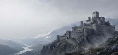
Château de la Briantais

Château de la briantais in saint-malo
Saint-Malo, France
Modern (19th–20th c.)
Partially Preserved

The Château de la Briantais is a notable historic estate located in Saint-Malo, France, distinguished by its blend of architectural heritage and scenic parkland. The site originally hosted a manor constructed in 1666 by the Pointel family. Though the original manor no longer stands intact, its ruins remain visible on the grounds, providing a tangible connection to the estate's 17th-century origins.

The present-day château was constructed between 1850 and 1864 by Eugene Sully-Brunet, reflecting the architectural tastes and ambitions of the mid-19th century. This period is often characterized by a revival and reinterpretation of earlier styles, and while the château is classified as modern due to its construction date, it incorporates elements that harmonize with the site's historical context.

Architecture and design of the château

The château exhibits features typical of 19th-century French country estates, with an emphasis on elegance and integration with the surrounding landscape. While specific architectural style details are less documented, the building's design aligns with the modern period classification, emphasizing functionality alongside aesthetic appeal.

The estate includes several ancillary structures and features that contribute to its historic ambiance. Among these is a chapel dating from 1778, which predates the current château and adds a layer of religious and cultural significance to the property. The chapel's presence enriches the narrative of the estate, linking it to the spiritual practices of the region's past inhabitants.

The park and grounds

One of the château's most remarkable features is its extensive 27-hectare park, which offers visitors a blend of natural beauty and historical interest. The park is laid out to complement the château, featuring mature trees, landscaped gardens, and walking paths that invite exploration and leisure. This large green space serves as a vital element of the estate, enhancing its appeal as a destination for cultural and recreational activities.

Historical significance and current use

Owned today by the city of Saint-Malo, the château has been repurposed as a venue for concerts and various cultural events. This adaptive reuse ensures the preservation of the estate while making it accessible to the public. The château's role as a cultural hub highlights its ongoing relevance and the community's commitment to maintaining its heritage.

The visible ruins of the original 17th-century manor offer visitors a glimpse into the site's layered history, contrasting with the 19th-century château and the historic chapel. Together, these elements create a multifaceted heritage site that reflects several centuries of architectural and social evolution in the Saint-Malo region.

Visiting château de la briantais

Visitors to the château can enjoy the combination of historical architecture and natural surroundings. The park's extensive area makes it ideal for walking and outdoor activities, while the château itself hosts events that showcase its cultural importance. The presence of the chapel adds an additional point of interest for those intrigued by religious architecture and history.

Frequently asked questions (FAQ)

How do I get to Château de la Briantais?
Château de la Briantais is located in Saint-Malo, France, and can be easily accessed by car, public transport, or on foot from the city center. If traveling by train, the Saint-Malo train station is a short taxi ride away. There are also several bus routes that connect to the castle.
What is the historical significance of Château de la Briantais?
Château de la Briantais dates back to the 18th century and is a fine example of French neoclassical architecture. It played an important role in the local history of Saint-Malo, serving as a residence for prominent families. The castle is also noted for its beautiful gardens and picturesque setting along the Rance River.
When was Château de la Briantais built?
Construction of Château de la Briantais began in 1752 and was completed in 1755. The castle was designed to be a summer residence, showcasing the elegance of the era. Over the years, it has been well-preserved, allowing visitors to appreciate its historical architecture.
Can I visit Château de la Briantais?
Yes, Château de la Briantais is open to visitors, allowing them to explore its stunning gardens and enjoy guided tours of the castle. It's advisable to check the official website for any seasonal events or special exhibitions. Keep in mind that access may be limited during certain periods, so planning ahead is recommended.
Why is Château de la Briantais a popular tourist attraction?
Château de la Briantais attracts visitors for its rich history, architectural beauty, and serene gardens. The castle offers breathtaking views of the surrounding landscape, making it a perfect spot for photography and relaxation. Its proximity to the historic walled city of Saint-Malo also adds to its appeal.
Is it possible to have events at Château de la Briantais?
Yes, Château de la Briantais can be rented for private events such as weddings, receptions, and corporate gatherings. The picturesque setting and elegant interiors provide a memorable backdrop for any occasion. It’s recommended to contact the castle's management for details on availability and arrangements.
What are the opening hours of Château de la Briantais?
Château de la Briantais typically opens to the public from April to October, with varying hours. During peak tourist season, the castle may operate longer hours to accommodate visitors. Always check the official website for the most accurate and current opening times before planning your visit.
What are the ticket prices for Château de la Briantais?
Ticket prices for Château de la Briantais vary depending on the season and the type of tour chosen. Generally, admission is affordable, with discounts available for students and seniors. It's best to purchase tickets in advance online or check at the entrance for the latest pricing information.
When is the best time to visit Château de la Briantais?
The best time to visit Château de la Briantais is during the late spring and early autumn months when the weather is pleasant, and the gardens are in full bloom. These seasons also see fewer tourists compared to the peak summer months. Visiting during weekdays can provide a more tranquil experience.
Are there any nearby attractions to Château de la Briantais?
Yes, visitors to Château de la Briantais can also explore the historic walled city of Saint-Malo, just a short distance away. Other attractions include the Grand Aquarium and the nearby beaches, which offer a variety of outdoor activities. The area's rich maritime history adds to the overall experience for tourists.

Information

Lowland Castle

Current owner

City of Saint-Malo

Loading map...

Visitor reviews

No reviews yet. Been here? Write the first review and help other travelers!

Write the first review

Visited this castle? Share your experience

Your review helps other travelers and adds first-hand knowledge to our encyclopedia.
Write a review

(5/5)

0/2000 characters

Your review will be visible after admin approval

Nearby castles

2 km
Solidor Tower — France castle

Solidor Tower

Saint-Malo, France

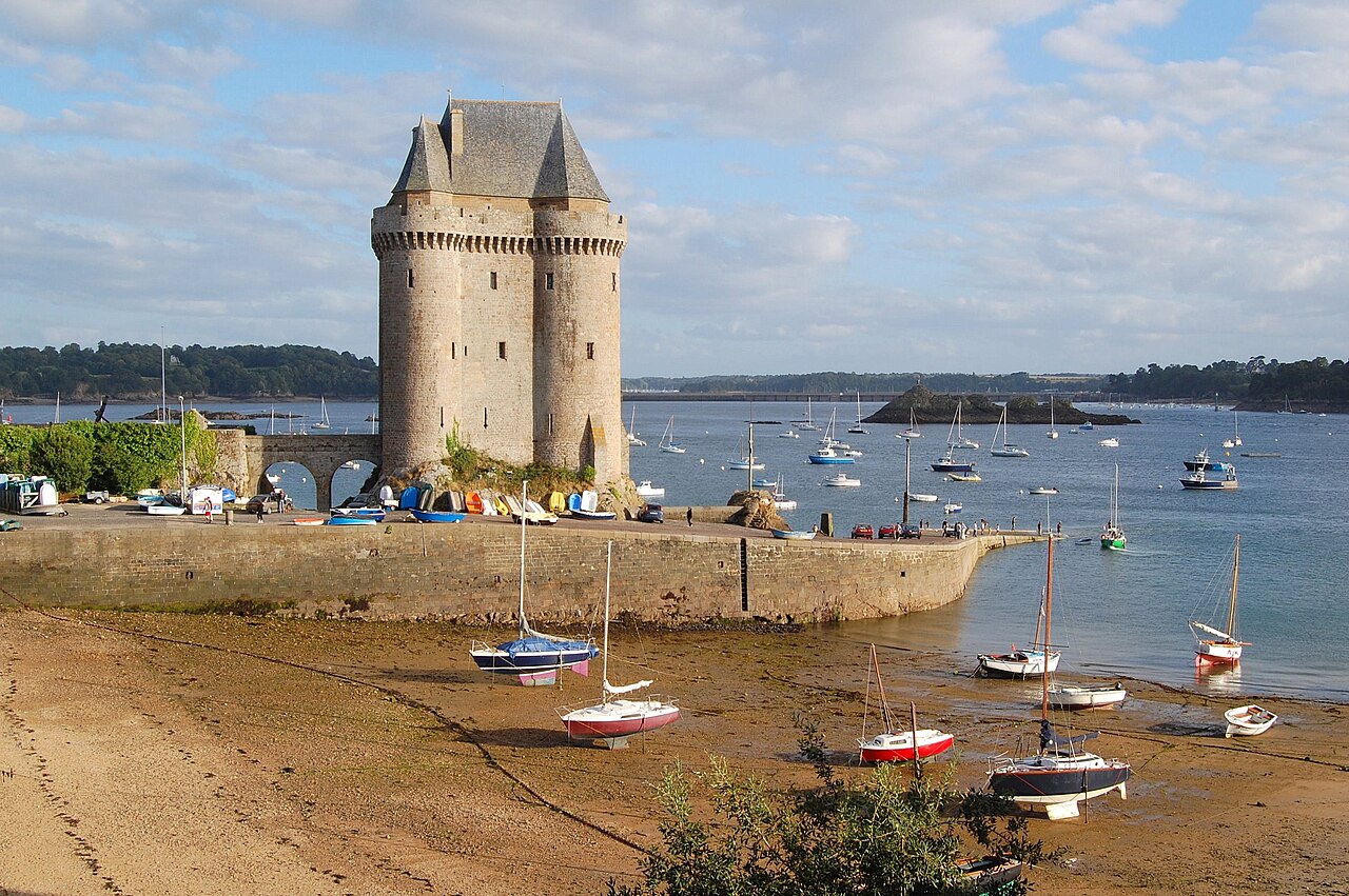
Solidor Tower, locally known as Tour Solidor, is a remarkable medieval fortress located in the Saint-Servan neighborhood of Saint-Malo, in the Ille-et-Vilaine department of Brittany, France. This imposing structure stands on a rocky promontory overlooking the estuary of the river Rance, a strategic location that has been fortified since Roman times. The tower’s primary historical function was to control access to the Rance estuary and assert ducal authority over the rebellious city of Saint-Malo during the late 14th century. The construction of Solidor Tower was commissioned by John IV, Duke of Brittany, between 1369 and 1382. This period, part of the High to Late Medieval era, saw the development of strong defensive keeps to secure important waterways and trade routes. The tower was designed as a fortified donjon featuring three round towers connected by short curtain walls, forming a triangular layout. Each tower rises approximately 18 meters high, and the interior comprises three floors linked by a spiral staircase with 104 steps. The original entrance was protected by a drawbridge, later replaced in 1756 by a stone bridge, reflecting evolving military architectural practices. Historical significance and military role Solidor Tower was built during a time of political tension between the Duke of Brittany and the city of Saint-Malo, which was known for its rebellious stance. The tower served as a critical point for controlling river traffic on the Rance estuary, enabling the Duke to monitor and tax goods transported by boat. This control was vital for maintaining ducal authority and securing economic interests in the region. In 1588, during the conflicts involving the Breton League, the tower was seized by supporters of Philippe Emmanuel, Duke of Mercœur, with minimal resistance due to the small garrison of only a few men. By 1590, the tower was lightly manned by a captain, three soldiers, a servant, and two watchdogs, indicating a reduced but ongoing military presence. King Louis XIII ordered repairs in 1636, underscoring the tower’s continued strategic importance. In 1694, responsibility for the tower’s upkeep was transferred to the inhabitants of Saint-Servan, and engineer Siméon Garangeau developed plans to strengthen its defenses. However, advances in artillery and changes in warfare gradually diminished the tower’s military relevance. Transformation and later uses By the 18th century, Solidor Tower had lost its military importance and was repurposed during the French Revolution and the subsequent French First Republic as a prison. It housed priests, nuns, and soldiers, many of whom left graffiti on the interior walls, providing a poignant historical record of its use as a place of incarceration. In 1804, the tower was assigned to the French Navy, reflecting its continued strategic maritime significance. Later, in 1886, it was designated a historic monument and underwent restoration under the direction of architect Albert Ballu. The restoration included the addition of the distinctive slate roof that remains today, enhancing the tower’s silhouette and protecting its medieval stonework. Architectural features and layout Solidor Tower is an excellent example of a fortified medieval keep with a unique triangular plan formed by its three interconnected round towers. The structure is built primarily of stone, featuring thick walls designed to withstand siege weaponry. The towers’ height and the connecting curtain walls provided a formidable defense against attackers. The interior contains three floors accessible by an internal spiral staircase comprising 104 steps. The original entrance, once defended by a drawbridge, was later replaced by a stone bridge in the 18th century, reflecting changes in defensive architecture and access requirements. The small gatehouse, or châtelet, was incorporated from earlier fortifications and converted into a guardhouse. Remnants of Gallo-Roman fortifications survive in the entrance bastion, preserving parts of the earlier defensive works. Nearby, the remains of a Roman stone causeway are visible at low tide, indicating the historical importance of this site as a port and military installation. This causeway once connected the tower area to the ancient port of Aleth, illustrating the region’s long-standing maritime significance. Modern significance and museum use Since 1970, Solidor Tower has housed a museum dedicated to the maritime heritage of Brittany, particularly celebrating Breton sailors and explorers of Cape Horn. The museum features exhibits on the region’s seafaring history and the daring voyages undertaken by local navigators. A notable addition in 2003 was a wooden albatross-shaped weather vane, donated by the Chilean section of the International Cape Horners Association, symbolizing the tower’s connection to global maritime exploration. A cross erected at the tower’s base in 1985 commemorates Jacques Cartier’s departure from this site in 1534 on his historic voyage to Canada, linking the tower to significant events in the history of European exploration. Before the construction of the Rance dam in 1967, a ferry operated from the Solidor quay across the river to Dinard, highlighting the tower’s ongoing role in local river traffic and transportation. The tower’s location near other historic sites, such as Fort Aleth and the walled city of Saint-Malo with its castle and forts like Fort National and Fort Petit-Bé, makes it a key part of the region’s rich cultural heritage. Preservation and current status Solidor Tower has been protected as a classified historic monument since 1886, ensuring the preservation of its medieval architecture and Roman-era remnants. Its well-preserved condition allows visitors to appreciate the defensive design and historical layers embedded in the structure. Although the museum housed within the tower was closed for renovation as of 2022, plans to reopen it aim to enhance the visitor experience and further celebrate the tower’s maritime and military history. The tower itself remains an iconic landmark, symbolizing the complex history of Brittany’s coastal defenses and its enduring connection to the sea.

Late Medieval (14th–15th c.)
Details
2.3 km

Château de Montmarin

Pleurtuit, France

Château de Montmarin stands as a distinctive example of an 18th-century Malouinière, a summer residence typical of wealthy ship-owners and merchants from Saint-Malo, located uniquely on the left bank of the Rance estuary in Pleurtuit, France. Constructed in 1760 by Aaron Magon, Squire of the Château du Bosq, this estate combines elements of restrained classicism with the elegant charm of the Louis XV architectural style. Architectural features and design The château's entrance is marked by an imposing classic gateway that opens onto the court of honor, which is decorated with a splendid 18th-century fountain crafted from white Carrara marble. This gateway and entrance exhibit a restrained classicism that contrasts strikingly with the main façade facing the Rance. The main façade is noted for its fanciful Louis XV elegance, featuring pavilions with roofs shaped like open upturned boats, a distinctive architectural detail that enhances the building's maritime connection and aesthetic appeal. Layout and grounds The château is set within a 6-hectare park that gently slopes down to the Rance River through a series of terraces. The park was highly praised by contemporary writers such as Madame de Genlis and Chateaubriand, who admired its harmonious integration with the natural landscape. Directly in front of the house lies a French formal garden, which has remained practically unchanged since its original design. This garden overlooks the rest of the park, which was laid out in 1885 in the English landscape style, featuring historic trees, wide lawns, thickets, rock gardens, and flowering borders. Historical context and significance The château represents the lifestyle and social status of the Malouinières, which were country homes built by the prosperous maritime merchants of Saint-Malo during the 18th century. These residences were designed not only as retreats but also as symbols of wealth and maritime heritage. The location of Château de Montmarin on the left bank of the Rance estuary is unique among Malouinières, most of which are situated on the right bank, giving it a commanding view of the estuary and surrounding countryside. Architectural style and period The château embodies the post-Renaissance period with its blend of classical architectural elements and Louis XV stylistic details. The restrained classicism of the entrance contrasts with the more decorative and elegant main façade, illustrating a transition in architectural tastes during the mid-18th century. The use of white Carrara marble for the fountain and the carefully designed gardens reflect the refined aesthetic sensibilities of the period. Gardens and landscaping The French formal garden in front of the château is a key feature, maintaining its original design and layout since the 18th century. Beyond this, the park's transformation in 1885 introduced an English landscape garden style, which emphasizes naturalistic elements such as sweeping lawns and informal planting. This combination of formal and informal garden styles offers visitors a rich experience of historical landscape design. Botanical collection The park and gardens of Château de Montmarin are notable for their diverse and evolving collection of plants and trees. Each year, new varieties are added to the existing collection, which already includes a range of historic trees and flowering plants. The gardens serve both as a living museum of horticultural heritage and a serene environment for visitors and residents alike. Visiting Château de Montmarin While primarily a private residence, Château de Montmarin's architectural and historical significance make it a point of interest in the region of Brittany. Its panoramic views over the Rance estuary and well-preserved gardens attract visitors interested in 18th-century French architecture and garden design. The château's location near the town of Pleurtuit offers access to other cultural and natural attractions in the area. Accessibility and tourism Visitors to Château de Montmarin can appreciate the estate's classic gateway, the court of honor, and the French formal garden. The park's terraces provide scenic walks with views of the estuary. The château's proximity to Saint-Malo and the Rance River makes it a valuable stop for those exploring Brittany's maritime heritage.

Post-Renaissance (17th–18th c.)
Details
2.5 km

Fort Aleth

Saint-Malo, France

Fort Aleth, also known locally as Fort d'Aleth or Fort du Cité d'Aleth, is a prominent historic fortification located in the Saint-Servan neighborhood of Saint-Malo in the Ille-et-Vilaine department of France. This coastal fort stands on a strategic promontory at the mouth of the Rance river, directly opposite the island that would later develop into the city of Saint-Malo. The site’s history spans over two millennia, reflecting its importance in regional defense and maritime control. Ancient origins and early fortifications The earliest known inhabitants of the site were the Coriosolites, a Celtic tribe documented in Roman writings from the 1st century. This area was a key settlement due to its vantage over the river and sea routes. By the late 4th century, the location had evolved into a significant Saxon Shore promontory fort, part of a network of coastal defenses built by the Romans to repel Saxon raids along the northern coast of Gaul and Britain. The fort’s position allowed control over maritime traffic entering the Rance estuary, crucial for trade and military movements. From this early fortification grew a settlement that eventually became the neighborhood known as Saint-Servan. This town flourished for centuries but was later overshadowed by the rise of Saint-Malo, which absorbed Saint-Servan as it expanded. 17th and 18th century fortifications and Vauban’s influence By the end of the 17th century, the site, then called Cité d'Aleth, was defended mainly by a series of batteries guarding the entrance to the Rance river. The renowned military engineer Sébastien Le Prestre de Vauban inspected the fortifications of Saint-Malo and warned that without strengthening Fort Aleth, the city’s defenses would be vulnerable. Despite his advice, significant fortification work only began after multiple English incursions. In 1759, under the direction of Saint-Malo’s chief engineer, the current artillery fort was constructed. This fort was designed to provide a robust defense against naval attacks and to secure the river entrance, reflecting the military architectural principles of the period, emphasizing heavy artillery placement and thick defensive walls. 19th century modernization and abandonment During the late 19th century, Fort Aleth underwent substantial upgrades as part of a comprehensive modernization of Saint-Malo’s coastal defenses. These improvements included reinforced walls, updated artillery emplacements, and enhanced barracks to accommodate a larger garrison. However, with the decline of hostilities between France and England, the fort’s strategic importance diminished. By 1914, the fort was largely abandoned as military technology and strategic priorities evolved, rendering static coastal forts less critical in modern warfare. World War II occupation and fortification During World War II, Fort Aleth was occupied by the German army and transformed into a heavily fortified stronghold. The Germans installed a powerful artillery battery and multiple anti-aircraft batteries, alongside barracks and defensive structures. The fort was reinforced with 32 bunkers and 8 cast iron cloches, which are small armored firing positions barely rising above ground level and accessible only via tunnels. These fortifications were interconnected by an extensive network of over 1300 meters of tunnels, allowing secure movement of troops and supplies. Fort Aleth became the command center of Festung Saint-Malo, from which Colonel Andreas von Aulock directed the defense of the city against the advancing Allied forces. The battle for Saint-Malo Following the Normandy landings in June 1944, the Allies initially underestimated the strength of German defenses at Saint-Malo. Two infantry assaults were repelled with heavy Allied casualties. Subsequently, the Allies resorted to sustained bombing raids and intense artillery bombardment from both land and sea. After eight days of relentless shelling, the German garrison at Fort Aleth surrendered, marking a significant moment in the liberation of Brittany. Current status and visitor experience Today, Fort Aleth is open to the public and serves as a historical site that offers visitors a glimpse into centuries of military architecture and coastal defense. One of the German bunkers houses the '39-'45 Memorial museum, which provides detailed exhibits on the fort’s role during World War II. The fort’s elevated position affords panoramic views over the surrounding coastline and the city of Saint-Malo, making it a popular destination for history enthusiasts and tourists alike. Nearby landmarks include the Solidor Tower, a medieval tower guarding the Rance river, and the walled city of Saint-Malo itself, which boasts its own castle and several other forts such as Fort National and Fort Petit-Bé. Architectural features Fort Aleth’s architecture reflects its evolution from a Roman-era promontory fort to a modern artillery fortification. The current structure includes thick stone walls designed to withstand cannon fire, bastions for artillery placement, and extensive underground tunnels connecting defensive positions. The German modifications added reinforced concrete bunkers and cloches, showcasing 20th-century military engineering adaptations to aerial and artillery threats. Significance in regional defense history Fort Aleth’s long history illustrates the strategic importance of the Rance river estuary and the northern coast of Brittany. From ancient Celtic and Roman times through to the Second World War, the site has been continuously adapted to meet changing military needs. Its layered fortifications provide a tangible record of the evolution of coastal defense technology and strategy over nearly two thousand years.

Early Medieval (5th–10th c.)
Details