Cezayirli Hasan Paşa House

Cezayirli Hasan Paşa House: 18th-century Ottoman fortified tower house
East of Yeniköy, Turkey
Post-Renaissance (17th–18th c.)
Ruins

Cezayirli Hasan Paşa House, locally known as Cezayirli Hasan Paşa Köşkü, is a notable example of an 18th-century Ottoman fortified tower house situated north of the village of Üvecik in the province of Çanakkale, Turkey. This historic structure is linked to Hasan Paşa, an influential Ottoman Grand Admiral of the 18th century, whose epithet "Cezayirli" means "from Algiers" in Turkish, reflecting his time spent with the Barbary Pirates during his military career.

Historical background and significance

Hasan Paşa rose through the ranks of the Ottoman military hierarchy and was stationed in Algiers for a period, which shaped his title and reputation. In the 1770s, he commissioned the construction of a mansion complex in the village of Yerkesik, overlooking the Batak Plain. The fortified tower house that remains today was part of this mansion and served as a hunting lodge for Hasan Paşa.

Aside from the architectural legacy, Hasan Paşa undertook significant environmental modifications, including the digging of a canal from the village to Beşik Bay. This canal was intended to drain the marsh waters surrounding the village, aiming to revive the area and improve its habitability. The village of Yerkesik itself was a relatively new settlement, founded in the early 18th century, but it has since disappeared with no visible remains today.

Architectural features and location

The tower house is a fortified structure characteristic of Ottoman residential architecture of the period, combining defensive and domestic functions. It stands isolated in the landscape north of Üvecik, surrounded by the plains rather than coastal features.

Contrary to some local claims that the tower served as a watchtower to monitor shipping traffic in the Dardanelles Strait and the nearby Beşik Bay, its actual location is more than 2 kilometers from the sea and at a relatively low elevation. This makes its use as a maritime observation post unlikely.

Decline and current status

The reasons behind the disappearance of the village of Yerkesik and the abandonment of Hasan Paşa's mansion remain unclear. Over time, the mansion fell into ruin, leaving the tower house as the primary surviving element.

Today, the Cezayirli Hasan Paşa House is accessible to visitors without restrictions. There are plans to restore the tower and develop it as a tourist attraction, but some prefer that it remains a consolidated ruin, preserving its atmosphere of historical mystery and solitude.

Context within Ottoman architecture and heritage

This tower house represents a blend of residential comfort and fortification typical of Ottoman provincial architecture in the post-Renaissance period. It reflects the lifestyle of high-ranking Ottoman officials who combined military duties with leisure pursuits such as hunting. The environmental engineering efforts by Hasan Paşa also illustrate the interaction between architecture and landscape management in Ottoman times.

As an architectural relic, the tower offers insights into the 18th-century Ottoman military elite's country estates and their strategic yet leisurely use of rural properties. Its preservation contributes to understanding regional history in the Çanakkale area, close to the historically strategic Dardanelles.

Frequently asked questions (FAQ)

How do I visit Cezayirli Hasan Paşa House?
Cezayirli Hasan Paşa House is freely accessible to visitors. It is located north of Üvecik village in the Çanakkale province. Visitors should plan transportation accordingly as the site is in a rural area without public transport connections.
What is the historical significance of Cezayirli Hasan Paşa House?
The house was built in the 18th century by Hasan Paşa, an Ottoman Grand Admiral known for his time with the Barbary Pirates in Algiers. It served as a hunting lodge and a fortified residence, reflecting the lifestyle of Ottoman military elites.
Is Cezayirli Hasan Paşa House open year-round?
There are no official opening hours as the site is currently a ruin accessible at any time. Visitors should consider weather conditions and daylight hours when planning their visit.
Can I learn about Ottoman architecture at the site?
Yes, the tower house is a good example of a fortified Ottoman residential structure from the post-Renaissance period, showing how military and domestic functions were combined in provincial estates.
Why did the village of Yerkesik disappear?
The exact reasons for the disappearance of Yerkesik village are unknown. It was founded in the early 18th century but has left no visible remains today, possibly due to environmental changes or abandonment over time.

Information

Tower House

Loading map...

Visitor reviews

No reviews yet. Been here? Write the first review and help other travelers!

Write the first review

Visited this castle? Share your experience

Your review helps other travelers and adds first-hand knowledge to our encyclopedia.
Write a review

(5/5)

0/2000 characters

Your review will be visible after admin approval

Nearby castles

13.4 km

Seddülbahir Castle

Seddülbahir Köyü İç Yolu, Turkey

Seddülbahir Castle, also known as Seddülbahir Kalesi, is a historic fortress located on the European shore of the Dardanelles Strait in the village of Seddülbahir, within the province of Çanakkale, Turkey. This castle holds significant strategic importance due to its position guarding the narrow entrance to the Dardanelles, a vital maritime route linking the Aegean Sea to the Sea of Marmara and Istanbul beyond. The castle's origins trace back to the aftermath of the Cretan War (1645-1669), during which the Venetian navy frequently blockaded and raided the Dardanelles Strait. The Ottomans recognized that the existing fortifications at Kilitbahir and Çimenlik castles were insufficient to secure the passage. Consequently, in 1659, they commissioned the construction of two new fortresses: Seddülbahir Castle on the European side and Kumkale Castle on the Asian shore. Historical context and construction The construction of Seddülbahir Castle was reportedly ordered by Turhan Hatice Sultan, the Valide Sultan and mother of Sultan Mehmed IV. The castle was designed with an irregular ground plan to adapt to the contours of the shoreline and to maximize its defensive capabilities. Its architecture reflects the military engineering principles of the mid-17th century Ottoman Empire, focusing on artillery defense to control naval access through the strait. In 1885, the castle underwent restoration to maintain its defensive readiness as military technology and strategic requirements evolved. Role during World War I Seddülbahir Castle played a notable role during the Gallipoli Campaign of World War I. Armed with a battery of 12 cannons, it was one of the key defensive positions protecting the Dardanelles from the Allied naval forces. The castle was first bombarded by British naval forces in November 1914, marking the beginning of intense military engagements in the area. In February 1915, the castle faced a massive assault from the combined Anglo-French fleet, which inflicted severe damage, nearly reducing the fortress to ruins. The Allies designated the castle as "Fort 3" during their operations. Nearby, the Ertuğrul Bastion was known as "Fort 1," and the area between these fortifications was the landing site known as "V Beach" where Allied troops attempted amphibious landings. Despite heavy bombardment, the castle was eventually captured by French forces in April 1915. The fierce battles around Seddülbahir Castle were part of the larger Gallipoli struggle that shaped the course of the war in the region. Architectural features and layout The castle's irregular ground plan is a distinctive feature, shaped by the rocky coastline and designed to provide overlapping fields of fire for its artillery. The fortress included thick stone walls, bastions, and embrasures for cannons, enabling it to withstand naval bombardments and repel amphibious assaults. The location on a promontory allowed defenders to monitor and control naval traffic entering the strait effectively. The castle's design incorporated elements typical of mid-17th century Ottoman military architecture, balancing stone masonry with artillery platforms. Post-war condition and restoration efforts Following World War I, Seddülbahir Castle was left in a state of significant disrepair due to the extensive damage sustained during the conflict. For many decades, it remained a deteriorating ruin, exposed to natural weathering and neglect. In 2015, a comprehensive restoration project was initiated to preserve and rehabilitate the castle. This large-scale effort aims to stabilize the structure, reconstruct damaged sections, and restore the fortress's historical appearance while respecting its original materials and architectural character. The restoration has focused initially on the west front, with substantial rebuilding already completed. However, the castle remains closed to visitors during this ongoing conservation work. The project is expected to continue for several more years to ensure the castle's long-term preservation. Visiting Seddülbahir Castle Currently, Seddülbahir Castle is not open to the public due to the ongoing restoration. Visitors interested in the castle and the Gallipoli campaign can explore the surrounding areas, including the nearby Kilitbahir and Çimenlik castles, as well as the Gallipoli battlefields and memorials. Once restoration is complete, the castle will offer valuable insights into Ottoman military architecture and the strategic history of the Dardanelles Strait. Its location and historical significance make it an important cultural heritage site in Turkey.

Late Medieval (14th–15th c.)
Details
13.7 km

Ertuğrul Bastion

East of Seddülbahir, Turkey

Ertuğrul Bastion, locally known as Ertuğrul Tabyası, is a coastal fortress located west of the village of Seddülbahir in the Çanakkale province of Turkey. It stands on the strategic Gözcü Baba Hill at Cape Helles, overlooking the entrance to the Dardanelles Strait from the European side. This bastion was constructed in the late 19th century during the reign of Sultan Abdülhamid II as part of the Ottoman Empire's efforts to strengthen coastal defenses along this vital maritime corridor. The bastion was designed as a small but robust fortification featuring three gun emplacements (bonnets) equipped with platforms for two long-barreled Krupp cannons positioned between them. These artillery pieces were state-of-the-art at the time, reflecting the empire's adoption of modern European military technology. The placement of these guns allowed for effective coverage of the sea approaches to the Dardanelles, complementing the nearby 17th-century Seddülbahir Castle to the east, which also played a key role in coastal defense. Strategic importance and military history Ertuğrul Bastion was a critical component of the Ottoman defensive network guarding the Dardanelles Strait, a waterway of immense strategic importance linking the Aegean Sea to the Sea of Marmara and ultimately to Istanbul. The fortress was part of a broader system of fortifications designed to prevent enemy naval forces from penetrating this narrow strait. During World War I, the bastion gained historical significance as a target during the Gallipoli Campaign. On February 17, 1915, it was subjected to a prolonged naval bombardment by an Anglo-French fleet aiming to neutralize Ottoman coastal artillery defenses. This bombardment successfully suppressed the bastion's guns, allowing allied naval forces to attempt passage through the strait. Despite this, the overall campaign eventually failed due to fierce Ottoman resistance on land. Architectural features and design The bastion’s design reflects the military architectural principles of the late 19th century, emphasizing artillery defense with reinforced platforms and protective earthworks. The three gun emplacements were carefully spaced to maximize the field of fire over the sea while providing mutual support. The use of Krupp artillery represented a significant technological upgrade, as these cannons were known for their long range and accuracy. The fortifications included thick masonry walls and earth embankments designed to absorb and deflect incoming fire. Although smaller and less elaborate than many earlier castles or forts, Ertuğrul Bastion’s compact and functional layout was well-suited for its role as a coastal artillery position. Relationship with nearby fortifications Ertuğrul Bastion worked in concert with the older Seddülbahir Castle, located just east of the village of Seddülbahir. While Seddülbahir Castle dates back to the 17th century and features traditional Ottoman fortress architecture, Ertuğrul Bastion exemplifies the modernization of coastal defenses in the modern period. Together, these fortifications created overlapping fields of fire that guarded the narrow entrance to the Dardanelles from the European side, deterring enemy ships and protecting Ottoman naval interests. Current condition and visitor information Today, Ertuğrul Bastion remains accessible to visitors and is open for free exploration. Although it is a relatively small and modest fortification compared to larger castles, it offers visitors panoramic views of the Dardanelles Strait and the adjacent Seddülbahir Castle. The site’s elevated position on Gözcü Baba Hill provides a commanding vantage point over the surrounding landscape and seascape. The bastion’s preservation state is partially preserved, with visible remnants of the gun platforms and defensive walls. Visitors interested in military history and Ottoman coastal defenses will find the site informative, particularly in the context of the Gallipoli Campaign and late Ottoman military architecture. Historical context of late Ottoman coastal defenses The construction of Ertuğrul Bastion during Sultan Abdülhamid II’s reign reflects broader military reforms and modernization efforts within the Ottoman Empire in the late 19th century. Facing increasing threats from European powers and the strategic importance of the Dardanelles, the empire invested in upgrading its fortifications with modern artillery and improved defensive designs. This period saw the integration of European military technology, such as the German-made Krupp cannons, into Ottoman defenses. These upgrades were intended to protect key maritime routes and maintain control over vital straits that connected the Mediterranean and Black Seas. Legacy and cultural significance While Ertuğrul Bastion may not be as grand or well-known as other historic castles, its role in the defense of the Dardanelles during a pivotal moment in World War I grants it a distinct place in military history. The site serves as a reminder of the Ottoman Empire’s strategic challenges and its efforts to adapt to modern warfare. Today, it contributes to the cultural heritage of the Çanakkale region and the broader narrative of the Gallipoli Campaign, attracting historians, military enthusiasts, and tourists interested in the complex history of this critical maritime corridor.

Modern (19th–20th c.)
Details
14.3 km
Bozcaada Castle — Turkey castle

Bozcaada Castle

Bozcaada, Turkey

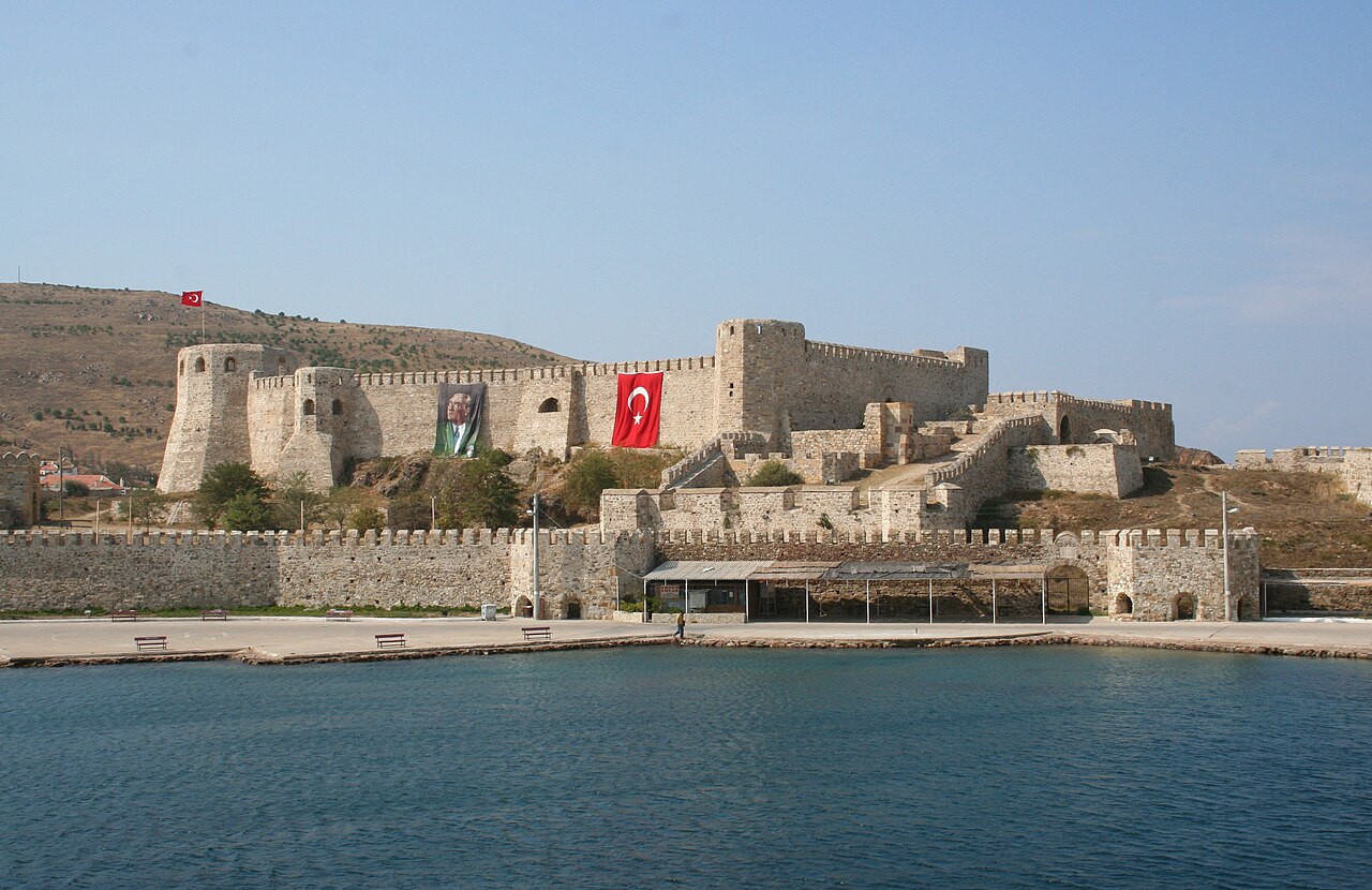
Bozcaada Castle, locally known as Bozcaada Kalesi, is a prominent hill castle located on the island of Bozcaada in the Çanakkale province of Turkey. The castle occupies a strategic position in the village of Alabey, commanding views over the surrounding sea and the village itself. Its location on the island has made it a key fortification throughout history, guarding the entrance to the Dardanelles Strait. The island of Bozcaada was historically known as Tenedos in antiquity and was mentioned in the "Iliad," an ancient Greek epic poem dating back to the 8th century BC. Despite its modest size, the island held significant strategic importance due to its position controlling naval access to the Dardanelles, a vital waterway linking the Aegean Sea to the Sea of Marmara and ultimately the Black Sea. This strategic value made the island a contested site through various historical periods. Early fortifications and medieval history Before the current castle's construction, the island had fortifications dating back potentially to Roman times, though the exact origins are undocumented. These early defenses were certainly used and modified by the Byzantines. In the late 14th century, the island's control shifted when the Venetians received permission from the Byzantine Emperor Andronikos IV Palaiologos in 1377 to occupy the island. This occupation contributed to the War of Chioggia (1378-1381) between Venice and Genoa, a major conflict in the Mediterranean maritime power struggle. The Treaty of Turin in 1381 ended the war and mandated the demolition of the castle and Venetian evacuation from Tenedos. The island was largely depopulated, with many inhabitants relocated to Crete. For several decades, the castle lay in ruins and the island remained mostly uninhabited. Ottoman reconstruction and military significance In the mid-15th century, around 1455, the island came under the control of the Ottoman Empire during the reign of Mehmed the Conqueror. Recognizing the island's strategic importance, the Ottomans undertook a comprehensive reconstruction of the ruined castle, transforming it into a strong defensive fortification. This rebuilding marked the beginning of the castle's current form, designed to withstand the artillery and siege tactics of the late medieval period. During the Cretan War (1645-1669) between the Ottomans and Venetians, the castle was briefly captured by Venetian forces in 1656. However, the Ottomans retook the fortification in 1657, after which they repaired and expanded the castle's defenses. The outer castle, or bailey, was added during this period to enhance its defensive capabilities. 18th and 19th century restorations and expansions The castle underwent several restorations throughout the 18th century to maintain its military readiness. In 1815, during the reign of Sultan Mahmud II, further fortifications were added to the castle complex. This period also saw the construction of the Bozcaada New Castle, a newer fortification built on a ridge overlooking the village and the original castle. This addition reflected evolving military architecture and the ongoing importance of the island's defense. Architectural features and layout Bozcaada Castle features a polygonal inner castle surrounded by an outer castle or bailey, which was added after the 1657 reconquest. The design incorporates thick defensive walls with battlements, towers for surveillance and defense, and a moat in some sections. Inside the castle walls, visitors can find the remains of important functional structures such as arsenals for weapons storage, a cistern for collecting and storing water, and a mosque reflecting the Ottoman period's cultural and religious presence. Modern history and preservation In the early 20th century, the castle was largely abandoned and fell into disrepair. By the 1960s, efforts were made to consolidate and preserve the remaining structures to prevent further deterioration. Today, the castle is partially preserved and open to visitors for a fee. It remains a significant cultural and historical landmark on Bozcaada island, attracting tourists interested in its layered history and commanding views. Visitors to Bozcaada Castle can explore its extensive walls and towers, learn about its role in the military history of the region, and enjoy the scenic surroundings of the village and sea. The castle's combination of Byzantine, Venetian, and Ottoman influences makes it a unique site reflecting the complex history of the Aegean and the strategic importance of the Dardanelles throughout the centuries.

Late Medieval (14th–15th c.)
Details