Erkek Castle

Erkek castle near D060, Erzurum, Turkey
Near D060, Erzurum, Turkey
Late Medieval (14th–15th c.)
Partially Preserved

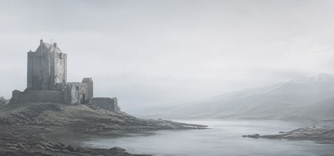
Erkek Castle, locally known as Erkek Kalesi, is a medieval fortress located on a hill in a valley between the villages of Dağdibi and Iriağaç (also called Pernek) in the Erzurum province of Turkey. It occupies a strategic position on the western bank of a river flowing from south to north, forming a defensive pair with the nearby Kizkalesi Castle on the eastern bank. These two castles guard the confluence of two rivers, one flowing from the south and the other joining from the east, creating a natural defensive corridor in the valley.

Location and strategic importance

Erkek Castle stands approximately 500 meters north of Kizkalesi Castle, together forming a defensive system that controlled river traffic and local routes during the medieval period. The castle's placement on a hill overlooking the river valley provided a commanding view of the surrounding landscape, essential for monitoring movements and defending the area. This strategic location highlights its role in regional defense, particularly during the Byzantine period, when controlling river valleys was critical for maintaining territorial integrity.

Architectural features and layout

The castle has an elongated rectangular plan, adapted to the contours of the hill. Its western walls feature the main entrance, positioned roughly in the middle, allowing controlled access to the interior. The southern section contains the ruins of a building believed to have been a chapel, indicating the presence of religious functions within the castle complex. The rest of the interior is largely empty, suggesting that much of the original structures have not survived or were modest in scale.

Construction materials and techniques

While detailed studies are lacking, typical construction in the region during the medieval period involved the use of local stone and mortar, with defensive walls built to withstand sieges and natural erosion. The castle's hilltop position also served as a natural fortification, reducing the need for extensive outer walls.

Historical context and naming

Erkek Castle was active primarily during the Middle Ages, with significant use during the Byzantine era. Its exact origins and detailed history remain obscure due to limited archaeological investigation and historical documentation. The castle's name, Erkek, translates to "boy" or "man" in Turkish, and it is sometimes referred to as Oğlan Kalesi, another term meaning "boy" or "man." Its counterpart, Kizkalesi, means "girl's castle," suggesting a traditional pairing in local folklore or naming conventions. However, there is some confusion in sources, with the names occasionally swapped between the two castles.

Current condition and access

Today, Erkek Castle is in a state of partially preserved ruins. The chapel ruins remain one of the few identifiable structures. Unfortunately, the site suffers from illegal treasure digging, which threatens the preservation of its archaeological and historical value. Despite this, the castle is freely accessible to visitors, offering a quiet glimpse into medieval fortifications in the Erzurum region.

Visitor experience

While not a spectacular or extensively restored site, Erkek Castle is worth visiting for those interested in medieval military architecture and regional history, especially in conjunction with a visit to Kizkalesi Castle nearby. The natural setting and the castle's hilltop vantage point provide scenic views of the river valley and surrounding countryside.

Cultural and heritage significance

Erkek Castle, together with Kizkalesi, represents an example of medieval river valley defense systems in eastern Anatolia. These castles illustrate the strategic importance of controlling waterways and trade routes during the Byzantine and medieval periods. Their continued existence, even as ruins, contributes valuable insights into the military and social history of the Erzurum region.

Frequently asked questions (FAQ)

How do I get to Erkek Castle near D060 in Erzurum?
Erkek Castle is located near the D060 road in Erzurum province, Turkey. Visitors can reach the site by car or local transport heading towards the villages of Dağdibi and Iriağaç, then follow local paths to the hilltop castle.
What is the historical significance of Erkek Castle?
Erkek Castle played a key role in medieval defense, especially during the Byzantine period, guarding a strategic river valley alongside Kizkalesi Castle.
Can I visit Erkek Castle freely?
Yes, Erkek Castle is freely accessible to visitors. However, facilities are minimal, and visitors should be prepared for a modest site with ruins and natural terrain.
What remains can be seen at Erkek Castle?
Visitors can see the elongated rectangular layout, the main entrance on the western wall, and the ruins of a probable chapel in the southern part of the castle.
Why are Erkek Castle and Kizkalesi Castle often confused?
The names Erkek and Kizkalesi are sometimes swapped in sources. Erkek means "boy" or "man" and Kizkalesi means "girl's castle," reflecting local naming traditions but causing confusion.

Information

Hill Castle

Loading map...

Visitor reviews

No reviews yet. Been here? Write the first review and help other travelers!

Write the first review

Visited this castle? Share your experience

Your review helps other travelers and adds first-hand knowledge to our encyclopedia.
Write a review

(5/5)

0/2000 characters

Your review will be visible after admin approval

Nearby castles

0.6 km

Kızkalesi Castle

Kızkalesi, Turkey

Kızkalesi Castle, also known as Maiden's Castle, is a remarkable medieval fortress located on a small island approximately 400 meters off the coast of the town of Kızkalesi in the province of Mersin, Turkey. This sea castle stands as a prominent example of Byzantine and Armenian military architecture, strategically positioned in the bay to protect the ancient harbor city of Korykos (modern Kızkalesi) and its vital maritime routes. The castle's origins trace back to the early 12th century, likely constructed during the reign of the Byzantine emperor Alexios I Komnenos. Historical accounts, notably from the emperor's daughter Anna Komnene in her work the Alexiad, describe the deployment of the royal eunuch Eustathius as admiral tasked with fortifying Korykos against potential Crusader incursions, particularly from Bohemund I de Guiscard. The fortress was part of a broader defensive network, including the mainland Korykos Castle, to secure the port and surrounding region. Architectural features and construction Kızkalesi Castle is built on a naturally fortified island, surrounded by water and protected by shoals, which diminished the need for extensive defensive walls. The castle features a single geometrical circuit wall with square towers constructed primarily from smooth ashlar stone, much of which was repurposed from the nearby abandoned late antique city of Korykos. This original Byzantine masonry is particularly evident on the south and east sides of the fortress. The Armenian period brought significant reconstruction in the late 12th century, introducing rounded salients on the northwest side of the castle. The castle's layout conforms closely to the island's topography, maximizing defensive capabilities while accommodating the natural terrain. The combination of Byzantine and Armenian architectural elements reflects the castle's complex history of occupation and military significance. Historical context and significance The region of Cilicia, where Kızkalesi Castle is located, was a contested frontier between the Byzantine Empire, Armenian Cilicia, Crusader states, and later the Mamluks and Karamanids. By the late 12th century, the castle came under the control of the Armenian Kingdom of Cilicia, evidenced by the attendance of Simon, Baron of Korykos, at King Leo I's coronation in 1198/99. Throughout the 13th century, the castle was governed by Armenian lords such as Vahram and Oshin, members of the Hethumid dynasty, who maintained its strategic and military importance. The fortress served as a base for military operations, including battles against Turkish forces and the Mamluks. In 1318, Oshin, son of Hethum, led a garrison of 300 troops to temporarily expel Turkish raiders from the area. In the mid-14th century, the castle passed under the control of the Kingdom of Cyprus, with King Peter I taking possession in 1360 as the Mamluk threat intensified. Cypriot forces helped defend the castle against a Karamanid attack in 1367. Despite these efforts, the castle eventually fell to the Karamanids in 1448, marking the end of its medieval military prominence. The castle and its surroundings today Today, Kızkalesi is a small holiday resort town, and the castle is a popular tourist attraction. Visitors can explore the castle for a modest entrance fee, though access is limited to daylight hours. The castle's picturesque location on the island, surrounded by turquoise waters, makes it a favored subject for photography and historical interest. The nearby mainland Korykos Castle complements the island fortress, together illustrating the medieval defensive system protecting the ancient harbor. While the castle has undergone various reconstructions, much of its original Byzantine and Armenian stonework remains visible, offering valuable insights into medieval military architecture in the eastern Mediterranean. Preservation and challenges Despite its historical significance, Kızkalesi Castle faces challenges related to preservation. Natural erosion, tourism pressures, and the risk of unauthorized excavations threaten its structural integrity. Conservation efforts aim to maintain the castle's fabric and promote sustainable tourism to ensure its survival for future generations. How to visit Visitors to Kızkalesi can reach the castle by boat from the mainland town, with regular tours available during the tourist season. The castle is accessible for exploration on foot once on the island, but visitors should be prepared for uneven terrain and limited facilities.

High Medieval (11th–13th c.)
Details
20.9 km

Oltu Castle

Oltu, Turkey

Oltu Castle, known locally as Oltu Kalesi, is a significant historical fortress located in the town of Oltu within the Erzurum province of Turkey. This castle occupies a commanding position on a steep rock overlooking the Oltu River, a strategic location that has been fortified since ancient times. The site's earliest fortifications likely date back to the Urartian period during the Iron Age, indicating its long-standing military and strategic importance in the region. The historical development of oltu castle The castle as it stands today reflects a complex history of construction, destruction, and restoration by various ruling powers over the centuries. The initial structure was established by the Urartians, an ancient kingdom known for their advanced fortification techniques. Following this early phase, the site underwent significant rebuilding and modifications during the High Medieval period, particularly under the Byzantine Empire and later the Seljuk Turks in the 11th century. These rulers enhanced the castle's defensive capabilities to suit the military technologies and threats of their respective eras. From the mid-16th century onwards, the Ottoman Empire took control of the castle. During this period, Oltu Castle was adapted for additional uses beyond purely military functions. It served as a caravanserai, providing lodging and protection for travelers and merchants along important trade routes. This multifunctional use highlights the castle's role not only as a fortress but also as a hub of commerce and travel in the region. Architectural features and layout The castle is constructed primarily from ashlar masonry, a technique involving finely cut and dressed stone blocks laid in regular courses. This method provided both strength and aesthetic appeal to the structure. What remains of Oltu Castle today is mainly the inner bailey, the central fortified courtyard that would have housed essential buildings and served as the last line of defense. The original castle complex was much larger, including an outer bailey that enclosed the old town of Oltu. This outer defensive wall was equipped with thick walls and multiple towers, designed to protect the settlement and control access. Unfortunately, this outer bailey has been completely destroyed over time, leaving only the inner core visible. One notable feature of the castle is a northern bastion that was repurposed as a tomb, indicating the site's use for funerary purposes at some point in its history. This adds a layer of cultural significance to the fortress beyond its military and commercial roles. Strategic importance and location Oltu Castle's position on a steep rock next to the Oltu River was a deliberate choice to maximize defensive advantage. The elevation provided clear sightlines over the surrounding landscape, making it difficult for attackers to approach unnoticed. The river itself served as a natural barrier on one side, enhancing the castle's defensive capabilities. This strategic location also placed the castle along important trade and military routes in eastern Anatolia, contributing to its role as a caravanserai during the Ottoman era. Control of Oltu Castle meant control over movement and commerce in this part of the region. Visiting oltu castle today Today, Oltu Castle is accessible to visitors, although access is limited to Fridays. The castle's current condition is primarily that of a partially preserved medieval fortress, with much of the outer fortifications lost but the inner bailey still standing. Visitors can explore the surviving structure and appreciate its historical layers, architectural features, and commanding views of the surrounding Erzurum province. While the castle may not have extensive visitor facilities, its rich history and dramatic setting make it a worthwhile destination for those interested in medieval architecture and Anatolian history. Preservation and cultural significance Oltu Castle represents an important cultural heritage site that reflects the diverse history of eastern Anatolia. Its layers of construction and use by different empires showcase the region's complex past. Efforts to preserve the castle focus on maintaining the integrity of the surviving inner bailey and promoting awareness of its historical significance. As a monument that spans from the Iron Age through the medieval period and into the Ottoman era, Oltu Castle offers valuable insights into the architectural and military developments over centuries in this part of Turkey.

High Medieval (11th–13th c.)
Details
30.4 km

Iğdeli Castle

Near İğdeli Köyü Yolu, Turkey

Iğdeli Castle, locally known as Iğdeli Kalesi, is a historic fortress situated on a mountain northeast of the village of İğdeli in the Erzurum province of Turkey. This castle is notable for its strategic location atop a ridge, providing commanding views of the surrounding landscape, which was essential for defense in its time. The castle's construction primarily uses rubble masonry, a common building technique in the region that involves rough stones set in mortar, indicative of a practical approach to fortification during its era. Architectural layout and structural features The castle is divided into two main parts: an upper castle and a lower castle, which are connected by a defensive wall running over the ridge. The upper castle remains accessible to visitors today, allowing exploration of its defensive walls and remnants of internal structures. However, the lower castle is currently inaccessible, possibly due to deterioration or safety concerns. To the northwest of the castle lies a relatively flat area on the mountain, which is believed to have functioned as an outer bailey. This space includes the ruins of a small chapel and fragments of additional walls, suggesting a complex that supported both military and possibly religious activities. The presence of the chapel ruins points to the castle's role not only as a military stronghold but also as a center of community or religious significance. Historical context and significance Unfortunately, there is a scarcity of detailed historical records or documentation about Iğdeli Castle. Its precise date of construction and the identities of its builders remain unknown, which is not uncommon for many regional fortifications in Eastern Anatolia. The castle's design and materials suggest it could date back to the medieval period, possibly serving as a local defensive site during times of regional conflict or as a watchpoint overseeing important routes. The strategic location in Erzurum province, a historically significant area that has seen various empires and cultures, indicates that Iğdeli Castle may have played a role in local defense networks. Erzurum itself has been a crossroads of civilizations, including Byzantine, Seljuk, and Ottoman influences, which might have affected the castle's use and modifications over time. Access and preservation status Iğdeli Castle is freely accessible to visitors, although there is no clearly marked path leading to the site, which may require some effort to reach. The castle's condition is best described as partially preserved, with significant portions of the walls and structures still standing, especially in the upper castle area. However, the lower castle and some outer structures are in ruins or inaccessible. One notable modern impact on the site is the presence of a cement factory at the foot of the mountain, which affects the surrounding environment and detracts somewhat from the castle's natural setting. Despite this, the castle remains a valuable cultural and historical landmark, offering insight into the region's medieval fortifications and architectural practices. Architectural characteristics and construction techniques The use of rubble masonry in the castle's construction reflects a pragmatic approach to building with locally available materials. This technique involves using irregularly shaped stones bonded with mortar, which was effective for creating thick defensive walls capable of withstanding attacks and the elements. The defensive wall connecting the upper and lower castles follows the natural ridge line, maximizing the defensive advantage provided by the terrain. The layout suggests careful planning to utilize the mountain's topography for protection and surveillance. Religious and auxiliary structures The chapel ruins in the outer bailey area indicate the presence of religious facilities within the castle complex. Such chapels were common in medieval castles, serving the spiritual needs of the garrison and local inhabitants. The small size of the chapel ruins suggests it was likely a modest structure, typical of rural or frontier fortifications. Visiting information and tourism potential Visitors to Iğdeli Castle should be prepared for a somewhat rugged journey, as the lack of a marked path requires navigation skills and physical effort. The castle offers a unique opportunity to explore a less-visited historical site in Erzurum, providing panoramic views and a tangible connection to the area's medieval past. While there are no formal visitor facilities or guided tours currently available, the castle's open access allows for independent exploration. The nearby village and the natural surroundings contribute to the experience, although visitors should be mindful of the industrial activity nearby.

Details