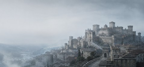
Dunworley Castle

Dunworley Castle near Butlerstown, County Cork
Butlerstown, United Kingdom
Late Medieval (14th–15th c.)
Partially Preserved

Dunworley Castle is located south of the village of Butlerstown in County Cork, Ireland. This site holds historical significance as the former stronghold of the O'Cowig clan, built upon the foundations of an earlier fortification. The castle's strategic position on a small headland provided natural defenses, with the narrow land connection to the mainland measuring only 8 to 9 meters wide.

Historical background and ownership

The original stronghold at Dunworley was constructed by the O'Cowig family, an Irish clan with local influence during the medieval period. Over time, the castle and its surrounding lands were appropriated by the Barry Roe clan, reflecting the shifting power dynamics in the region. Unfortunately, detailed historical records about the castle's role in local conflicts or its architectural evolution are scarce.

Architectural features and site layout

Today, the physical remains of Dunworley Castle are minimal. The main castle structure and its bawn (a defensive enclosure common in Irish castles) have disappeared over the centuries. The only surviving element is a rectangular guard tower measuring approximately 4 by 5 meters and standing one story high. This tower likely served as a gatehouse or defensive lookout guarding the narrow isthmus connecting the headland to the mainland.

It is probable that defensive walls extended from this tower on either side, effectively closing off the peninsula to potential attackers. The western wall may have included a gate, though no physical remains of such a gate or additional buildings have been detected on the site. The absence of other structural remnants suggests the castle was relatively small or that other buildings have been lost to time and natural erosion.

Geographical setting and current condition

Dunworley Castle occupies a remote and elevated position on a headland, offering commanding views of the surrounding landscape. The narrow land bridge leading to the peninsula would have made the site easier to defend in medieval times. Presently, the headland is used as a field for horses, and the castle remains are freely accessible to visitors willing to undertake a 20-minute walk from the nearest road.

Despite its limited remains, Dunworley Castle's location and surviving guard tower provide valuable insight into medieval Irish defensive architecture and clan territorial control. The site exemplifies the use of natural landscape features for fortification purposes in Ireland.

Visiting Dunworley Castle

Access to Dunworley Castle requires a moderate walk through rural terrain, making it suitable for visitors interested in off-the-beaten-path historical sites. There are no visitor facilities or interpretive signage on site, so preparation and research beforehand are recommended. The castle's remote setting offers a quiet environment for reflection on Ireland's medieval past.

Preservation and archaeological potential

As only a single guard tower remains visible, Dunworley Castle is classified as partially preserved. The site has not undergone extensive archaeological excavation or restoration, leaving potential for future discoveries about its construction phases and historical use. Preservation efforts would benefit from detailed surveys and archaeological studies to better understand and protect this piece of Irish heritage.

Frequently asked questions (FAQ)

How do I get to Dunworley Castle?
Dunworley Castle is accessible by a 20-minute walk from the nearest road near Butlerstown, County Cork. Visitors should prepare for a rural walk through fields to reach the site.
What remains of Dunworley Castle can I see today?
Today, only a rectangular guard tower of about 4 by 5 meters remains visible. The main castle and bawn have vanished, with no other buildings detectable on the site.
Is Dunworley Castle open to the public?
Yes, the castle grounds are freely accessible. However, there are no visitor facilities or guided tours, so visitors should plan accordingly.
What is the historical significance of Dunworley Castle?
Dunworley Castle was originally an O'Cowig clan stronghold and later held by the Barry Roe clan. It reflects medieval Irish clan territorial control and defensive architecture.
Can I visit Dunworley Castle year-round?
There are no official visiting hours, and the site is outdoors and accessible year-round. Weather conditions should be considered when planning a visit due to the rural location.

Information

Hill Castle

Loading map...

Visitor reviews

No reviews yet. Been here? Write the first review and help other travelers!

Write the first review

Visited this castle? Share your experience

Your review helps other travelers and adds first-hand knowledge to our encyclopedia.
Write a review

(5/5)

0/2000 characters

Your review will be visible after admin approval

Nearby castles

2.4 km

Seven Heads Signal Tower

Ballymacshoneen, United Kingdom

Seven Heads Signal Tower, also known locally as Travarra Signal Tower, is a historic coastal defense structure located on a prominent headland south of the village of Butlerstown in County Cork, Ireland. This tower is part of a network of signal towers built during the early 19th century as a strategic response to the threat of a French invasion during the Napoleonic Wars. In 1803, amid fears of a French naval attack, the British government commissioned the construction of a series of coastal signal towers around Ireland. These towers were designed to provide early warning of an approaching enemy fleet by relaying signals along the coast to the government authorities in Dublin. Between 1804 and 1805, a total of 81 such towers were erected at strategically high and exposed locations along the Irish coastline, enabling rapid communication through visual signals. Architectural design and features The Seven Heads Signal Tower exemplifies the typical architectural style and defensive features common to these structures. Most towers were square in plan and rose to two or sometimes three stories. They featured a flat roof with a parapet, providing a vantage point for observation and signaling. The entrance was positioned on the first floor, usually on the seaward side, accessible by ladder or removable steps to enhance security. Defensive elements included machicolations—openings in the parapet or walls allowing defenders to drop projectiles on attackers—located above the entrance and on the landward side. Inside, the towers were equipped with fireplaces to provide warmth for the signaling crew, who typically numbered between eight and twelve men. The exterior walls were often rendered or clad with weather-slates to protect against the harsh coastal weather. Many towers were surrounded by a stone wall or earthen bank to provide additional defense. Some sites included ancillary buildings or spaces for the crew to cultivate food, reflecting the need for sustained occupancy during heightened alert periods. Function and historical context The primary function of the Seven Heads Signal Tower was to serve as a relay point in a chain of visual communication. Signals were transmitted using flags and balls mounted on a mast in front of the tower, allowing messages to be sent swiftly along the coast. This early warning system was critical during the Napoleonic Wars, when the threat of invasion was taken seriously by the British administration in Ireland. Following the decisive defeat of Napoleon at the Battle of Waterloo in 1815, the perceived threat of a French invasion diminished considerably. Consequently, the upkeep of these towers was no longer justified, and most were gradually abandoned due to the high maintenance costs and their exposed, weather-beaten locations. Current condition and accessibility Today, the Seven Heads Signal Tower remains as a ruinous but striking landmark on the rugged coastline of County Cork. Its weathered stone walls and silhouette against the often stormy skies create a dramatic scene, particularly on rainy days. The tower stands on private farmland, and public access is restricted, preserving its fragile state. Despite its ruinous condition, the tower is an important cultural and architectural relic, illustrating the coastal defense strategies employed in early 19th-century Ireland. It provides valuable insight into the military engineering and communication technologies of the period. Legacy of the Irish signal towers The network of signal towers, including the Seven Heads Signal Tower, represents a unique chapter in Irish military history. These towers were among the earliest examples of a nationwide visual communication system, predating modern electronic methods. Their construction reflects the geopolitical tensions of the era and the strategic importance of Ireland's coastline. Architecturally, the towers blend functional military design with adaptations to the harsh coastal environment. Their robust construction and defensive features highlight the dual role of these towers as both lookout posts and small forts capable of resisting minor attacks. Today, the surviving towers are studied by historians and conservationists interested in early 19th-century military architecture and coastal defense systems. They also attract interest from visitors who appreciate their historical significance and dramatic coastal settings.

Modern (19th–20th c.)
Details
2.5 km

Lissycrimeen Castle

Timoleague, United Kingdom

Lissycrimeen Castle is a modest historic structure located in the townland of Lissycrimeen, just south of the town of Timoleague in County Cork, Ireland. This castle is positioned on a small hill overlooking a bend in a cove that leads out to the Celtic Sea, offering strategic views of the surrounding coastal landscape. The castle is believed to have been a small tower house, a common type of fortified residence in Ireland during the late medieval period. Tower houses were typically constructed between the 15th and 17th centuries as defensive homes for local lords and chieftains. Although detailed historical records on Lissycrimeen Castle are scarce, it is thought to have had connections with the MacCarthy clan, a prominent Gaelic Irish family influential in Munster during the medieval and early modern periods. Currently, only two stories of the original structure remain, reflecting its status as a partially preserved ruin. The surviving walls hint at the castle's original verticality and defensive purpose. The location on a small hill would have provided a natural defensive advantage, while proximity to the sea allowed for monitoring maritime activity and access to coastal routes. Lissycrimeen Castle is situated on private farmland and is not open to the public. However, it is visible from a nearby road across the cove, making it accessible for viewing from a distance. Its setting amidst rural and coastal surroundings adds to the castle's quiet historical presence in the region. Architectural features and structure The castle's design as a tower house typically included a rectangular or square footprint with thick stone walls to withstand attacks. Defensive features likely included narrow slit windows for archers and a fortified entrance. The remaining two stories suggest it was a modestly sized building, possibly with a vaulted ground floor used for storage or a kitchen, and upper floors serving as living quarters. Given the castle's coastal location, it may have also played a role in local maritime defense or acted as a lookout point to guard against seaborne threats during turbulent periods in Irish history. Historical context and ownership While specific historical events tied to Lissycrimeen Castle are not well documented, its association with the MacCarthy dynasty places it within the broader context of Gaelic lordship in Munster. The MacCarthys were known for their network of castles and tower houses throughout southwestern Ireland, which served as centers of power, administration, and defense. The castle's modest size suggests it was likely a residence for a lesser branch of the clan or a local chieftain under MacCarthy influence. Such castles were common in rural Ireland during the late medieval and early modern periods, reflecting the fragmented political landscape and the need for fortified homes. Current condition and accessibility Today, Lissycrimeen Castle exists as a partially preserved ruin, with only two stories remaining intact. The structure is integrated into a private farm, limiting visitor access. Despite this, the castle remains a visible landmark in the area and contributes to the cultural heritage of County Cork. Visitors interested in viewing the castle can do so from a nearby public road across the cove, where the ruins can be seen against the backdrop of the sea and rural landscape. Its location offers a picturesque glimpse into Ireland's medieval past, even if physical access is restricted. Significance and heritage Lissycrimeen Castle, though small and less documented than other Irish castles, represents the widespread tradition of tower house construction in Ireland. These castles illustrate the social and military organization of Gaelic Ireland and the importance of fortified residences for local power holders. The castle's coastal position and connection to the MacCarthys add layers of historical interest, linking it to the maritime environment and the complex clan dynamics of County Cork. It stands as a testament to the region's medieval architecture and the enduring legacy of Ireland's Gaelic families.

Late Medieval (14th–15th c.)
Details
10.2 km

Ballinoroher Castle

West of Timoleague, United Kingdom

Ballinoroher Castle is a historic Renaissance-era castle ruin located in the townland of Ballinoroher, west of Timoleague in County Cork, Ireland. This small but significant castle was constructed in the early 17th century, likely between 1590 and 1610, by the Sliocht Inghine Ui Chruimin sept of the MacCarthys Reaghs, a branch of the powerful MacCarthy dynasty. Its primary purpose was to guard a strategic ford across the Argideen River, a vital crossing point that connected Bandon with the southwest region of Ireland. Historical context and ownership The first documentary mention of Ballinoroher Castle dates to 1611, when it was recorded among the possessions of Donal MacCarthy of Kildee. The MacCarthys were a dominant Gaelic family in Munster, and the castle played a role in securing their territorial interests during a turbulent period marked by shifting allegiances and conflicts between Gaelic lords, English settlers, and later, Cromwellian forces. During the mid-17th century, Ireland was engulfed in the Cromwellian conquest, which led to widespread dispossession of native Irish landowners. According to local legend, as Cromwell's troops advanced, the MacCarthy family concealed their valuables within a secret compartment in the castle walls or possibly in a tunnel extending about 250 meters south to an ancient fortification. This tunnel, if it existed, would have been a tactical feature for escape or safeguarding treasures. Architectural features and layout Ballinoroher Castle exemplifies a small-scale Renaissance castle typical of rural Munster in the early 1600s. While now a ruin, the remains suggest a fortified residence rather than a large military fortress. The castle was built primarily of local stone and likely featured thick defensive walls, narrow slit windows for archers, and a simple rectangular or L-shaped plan common in tower houses of the period. Its position overlooking the Argideen River ford was strategic, controlling movement and trade routes between Bandon and the southwest. Defensive features would have included battlements and possibly a bawn (walled courtyard) to protect livestock and inhabitants during raids. Defensive significance The castle’s location was not accidental. The Argideen River ford was the only viable passage in the area, making Ballinoroher a key point to monitor and defend. Control of such a crossing was crucial for both military and economic reasons, allowing the MacCarthys to regulate travel and collect tolls or taxes. Current condition and accessibility Today, Ballinoroher Castle stands as a ruin, with portions of its walls still visible amidst the surrounding countryside. It is freely accessible to the public, offering visitors a glimpse into early 17th-century Irish castle architecture and the historical landscape of County Cork. Though modest in scale, the castle’s remains provide valuable insight into the defensive strategies and domestic arrangements of Gaelic lords during the Renaissance period in Ireland. Ballinoroher Castle in cultural memory The castle is a point of local heritage and folklore, particularly due to the tales of hidden treasure and secret tunnels. Such stories reflect the turbulent history of Ireland in the 1600s, when families like the MacCarthys faced displacement and conflict during the Cromwellian conquest. Its preservation as a ruin allows it to serve as a tangible link to this past, contributing to the understanding of regional history and architecture.

Renaissance (15th–17th c.)
Details